Report of the SAFE Workshop in APRSAF-23,
Manila, Philippines
< Last Update: Nov. 30, 2016 >
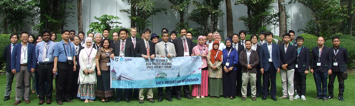
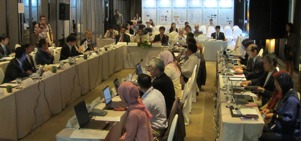
The SAFE Workshop at APRSAF23 was successfully and fruitfully completed at the Sofitel Philippine Plaza Manila on November 14, 2016. After the workshop, the result was reported to the Space Applications Working Group (SAWG) and the plenary session which was held continuously from November 15 to 18.


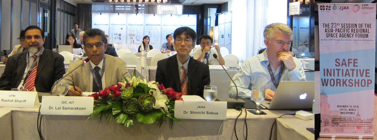
The workshop was led by co-chairs, Dr. Shinichi Sobue, JAXA and Dr. Lal Samarakoon, Geoinformatics Center (GIC), Asian Institute of Technology (AIT). The total number of participants was 60 from several countries and international organizations including ADB, ICHARM, and MRC.
In the workshop, one new SAFE prototype proposal was reviewed and the status of six on-going prototypes and two follow-up activities were reported. At the same time, several reports from ADB and JICA were presented in the development aid agency cooperative session.
The summary recommendations of SAFE initiative are given below;
RECOMMENDATIONS
[SAFE (Space Applications For Environment)]
The following recommendations were made by SAFE:
- A) To encourage users and providers of the space technology to pursue the best practices demonstrated in SAFE accomplishments to solve social issues efficiently and effectively in Asia-Pacific region to meet user demands;
- B) To implement SAFE prototyping to the users through dialogue and communicating the SAFE accomplishments in the region;
- C) To cooperate with development aid agencies to promote successful practical applications of space technology in the Asia-Pacific region.
Workshop Report from Secretariat
- One new prototype proposal reviewed:
- Smoke Haze Monitoring and burned area estimation in Indonesia (LAPAN, Indonesia)
- Progress reports from on-going prototypes:
- Efficient Oil Palm Management Prototyping Using 3D GIS (FGV R&D, Malaysia)
- Deploying GSMaP for Decision Support in Transboundary Catchments in the Lower Mekong Basin (MRC)
- Mapping and Monitoring Oil Palm Plantations Using Optical and SAR Space borne Data (LAPAN, Indonesia)
- Promote rice planted area and production estimation using space based technologies (MAFF, Cambodia)
- Promote a Department of Agricultural Land Management and Statistics (DALMS) system through using Innovative rice crop area mapping and yield monitoring with space based technologies ( MOALI, Myanmar)
- Developing and Implementing an Operational Prototype for Advanced Flood Forecasting, Early Warning, and Data Sharing System in the Kalu Ganga Basin, Sri Lanka (Irrigation Department, Sri Lanka)
- Reports from follow-up activities:
- Rice Crop Monitoring in the Mekong Delta, Vietnam (HCMIRG, Vietnam)
- SAR Technology Application for Paddy Crop Monitoring in Central Area of Paddy Production, in Indonesia (ICALRD, Indonesia)
Result of Reviewing New Proposal
- Smoke Haze Monitoring and burned area estimation in Indonesia (LAPAN, Indonesia)
Decision: Approved with conditions;
- Suggest to clarify the benefit of haze and hotspot information for end-user's agencies.
- Stuggest to refine the validation method and algorithm development.
Results of progress reports
On-going prototyping
1. Malaysia (Oil Palm)
- Confirmed good progress of activities (in particular 2nd UAV measurement activity). How to integrate the methodologies, how to show the advantages of this method (outcome) are next steps.
2. MRC (GSMaP)
- Recognized the necessity of re-planning of the project due to the reformation of MRC. SAFE secretariat will be in charge of the coordination.
3. Indonesia (Oil Palm Monitoring)
- Confirmed the preliminary results including the comparison of Malaysia Oil Palm project and the dialogues with future end users.
4. Cambodia (Rice Production Estimation)
- Confirmed successful completion of 1st field survey and training using ALOS-2 data and JAXAs software INAHOR. Look forward to having validation result with field survey.
5. Myanmar (Agricultural Land Management)
- Confirmed successful completion of 1st field survey and training using ALOS-2 data and JAXAs software INAHOR. Look forward to having validation result with field survey.
6. Sri Lanka (Advanced Flood Forecasting)
- Confirmed good progress as scheduled. How to calibrate GSMaP data in case of overestimated is a challenge. Suggest to collaborate with other GSMaP correction study and have a chance to discuss at GPM Asia.
SAFE follow up
1. Vietnam (Mekong Rice Crop)
- Good result of the follow up activity. Captured the degradation of paddy field due to soil salinity (drought).
- How to connect to the operational system is a challenge with convincing end users (MARD).
2. Indonesia (Paddy Crop Monitoring)
- Good result of the follow up prototype to expand other areas
3. Common (Paddy Crop Monitoring)
- Localization of the output with standardizing simple field survey method is to key for the future.
- Design the data stream with suitable data archive and data processing platform is also the key.
As a result of the workshop, prototyping line-up was updated: