Lao PDR -200905
< Last Update: 19 Feb. 2013 >
SAFE Prototyping Status: May 2008 - June 2010 <Completed>
Forest monitoring and management
Period
June 2009 ~ June 2011
Forest is one of the very important natural resource of Lao PDR. The forest starts to dwindle due to various reasons including forest fires, logging and for use as domestic energy source. It is said that an estimated 300,000ha of forest lands are lost every year. WREA is mandated to study the forest/water management system in Lao and it is essential to identify areas that are under pressure threatening loss of forest resources that could lead to water related problems including floods and drought. Therefore, it is very much important to establish clear methods and technology for monitoring forest resources of the country. The objective of this prototype is the followings;
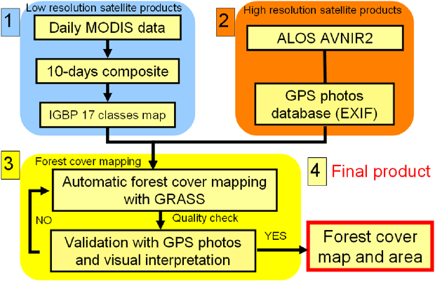
1. To generate the land cover map of 2008 at national level.
2. To generate 100 meter or better resolution forest cover map in a demonstration river basin for water resources management.
3. To build capacities of WREA and MAF technical staff in using Space Technology for environment monitoring.
Participants
(1) Prototyping Executor
Ms. Virany Sengtianthr
Remote Sensing Center (RSC), Water Resources and Environment Research Institute (WERI), Water Resources and Environment Administration (WREA)
(2) Technical Supporter
- University of Tokyo
- Geo-informatics Center (GIC)/Asian Institute of Technology (AIT)
(3) Data & Application Provider
University of Tokyo (MODIS image for Forest cover at national level)
Japan Aerospace Exploration Agency (ALOS/AVNIR-2)
Study Area
(1) Mapping: Whole land of Lao PDR
(2) Field Survey for Validation:
a) Dongphousoy protected area, Khammouane province (Dec. 2009)
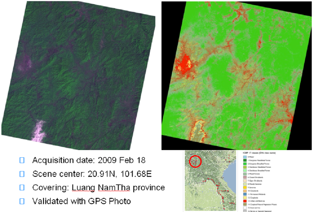
b) Luang Nam Tha province (Nov. 2010)
(3) Some other areas
Developed System / Application
Final Results
(1) Products
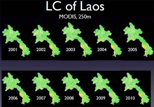
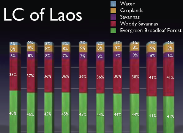
MODIS Map (250m) at National Level
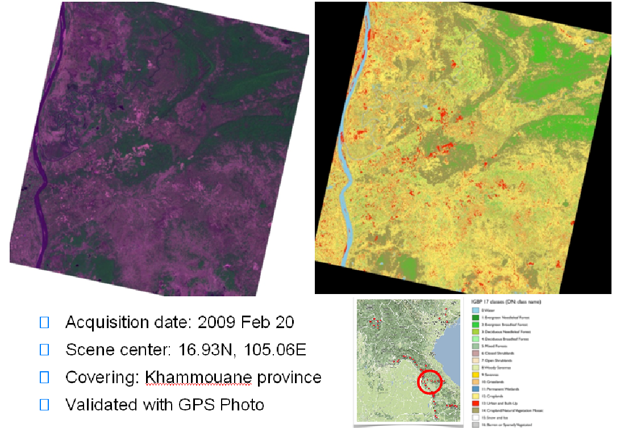
ALOS AVNIR2 Land Cover Classification Map at Province Level
(2) Method
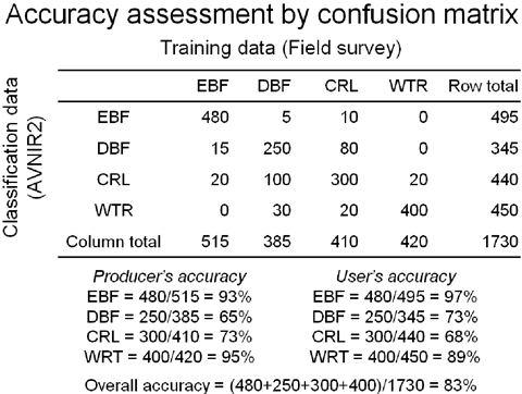
Accuracy Assessment Method by Comparing to Ground Data
(3) Capacity Building
On-the-job trainings:
a) On-the-job training on MODIS classification (Dec. 2009)
b) On-the-job training on ALOS AVNIR2 classification (May 2010)
Training Material
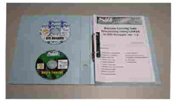
- DVD and USB Live-system on Linux and Windows
- DVD of data and tutorial
- Hardcopy of tutorial
In-situ / Validation Data
(1) Place and Date Acquired Data
a) Dongphousoy protected area, Khammouane province (Dec. 2009)
b) Luang Nam Tha province (Nov. 2010)
(2) Type of Parameter
a) Location Information (Latitude, Longitude, Altitude)
b) Acquired Time
c) Land Cover Type
d) Description of the Field
Status of Utilization
The result and training tool have been operationally utilized by Forest Inventory and Planning Division (FIPD).