Vietnam -201011
< Last Update: 23 Jan. 2013 >
SAFE Prototyping Status: November 2010 - November 2012 <Completed>
Mangrove Forest Mapping and Carbon Stock Estimation
Forest Resources and Environment Center, Forest Inventory and Planning Institute (FIPI)
Vietnam is the house for quite large mangrove forest along its coastal belts. Mangrove forest is an important wildlife sanctuary in Vietnam as it is characterized by a wetland bio-system dominated by mangrove and many rare species.
The mangrove forest performs many valuable ecological functions, including coastal stabilization, protection against coastal erosion, oil spills and storm surges. The mangrove forest is a source of fuel wood and construction materials.
The objective of this prototype is the followings:
1) To produce and provide data on mangrove forest at the period of 1990, 2000 and 2010
2) To assess mangrove forest changes from 1990
3) To determine the method for Carbon Stock calculating for mangrove forest types in Vietnam
4) To provide the basic data on Carbon stock volume of mangrove forest and its change which will be used as the input data for REL calculation in Vietnam
Final Results
1) Products
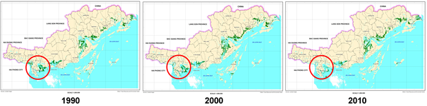
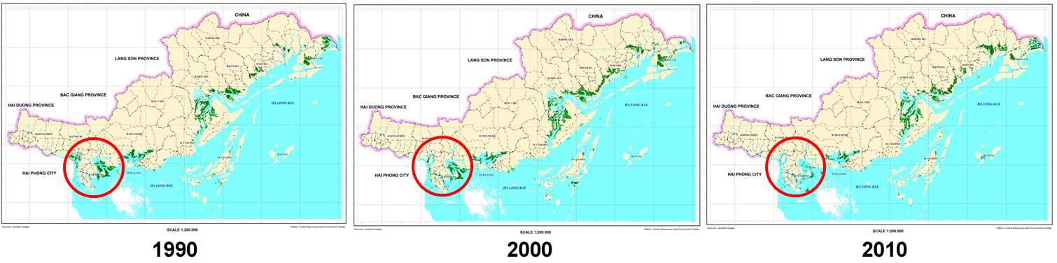
Mangrove Forest Map on Landsat data of Quang Ninh province
Mangrove Change in Quang Ninh
| Year | 1990 | 2000 | 2010 |
|---|---|---|---|
| Area (in ha) |
28876 | 21506 | 23283 |
Above ground biomass estimates across Quang Ninh province
| Year | 1990 | 2000 | 2010 |
|---|---|---|---|
| Area (in ha) |
28876 | 21506 | 23283 |
| Method | Average AGB/ha in 2000 and 2010 |
TH - AGB by SRTM3 |
HV - AGB by PALSAR |
| Above ground biomass (tC) |
633,725 | 476,635 | 506,030 |
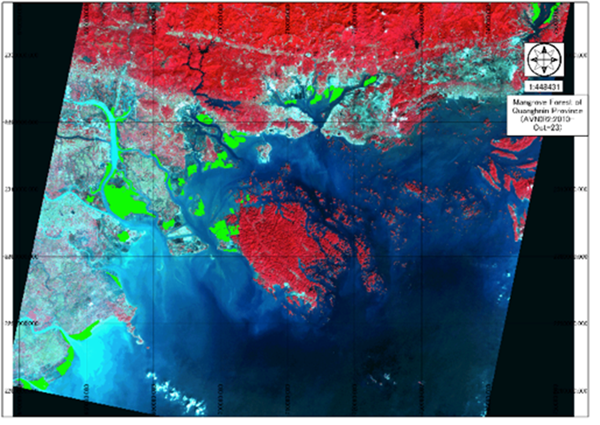
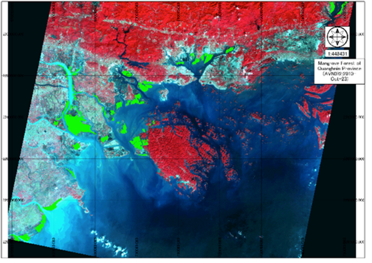
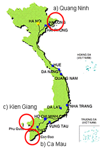
Mangrove Forest of Quang Ninh province on ALOS AVNIR-2 in 2010
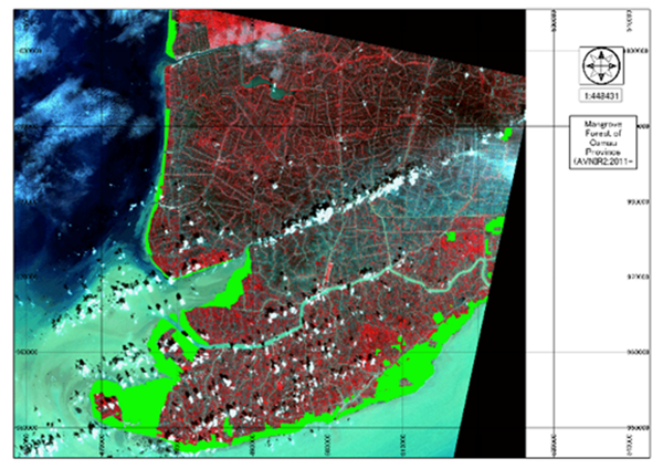
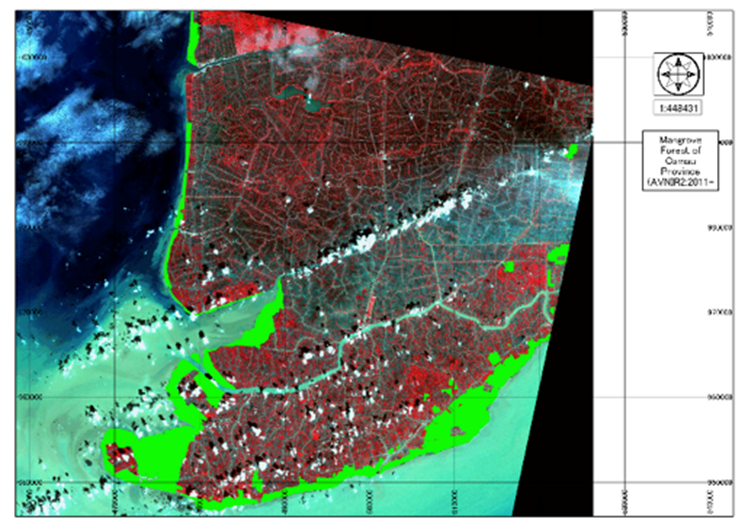
Mangrove Forest of Ca Mau province on ALOS AVNIR-2 in 2010
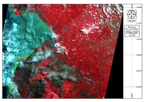
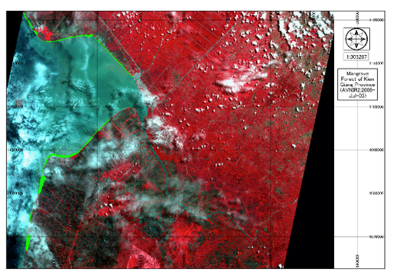
Mangrove Forest of Kien Giang province on ALOS AVNIR-2 in 2010
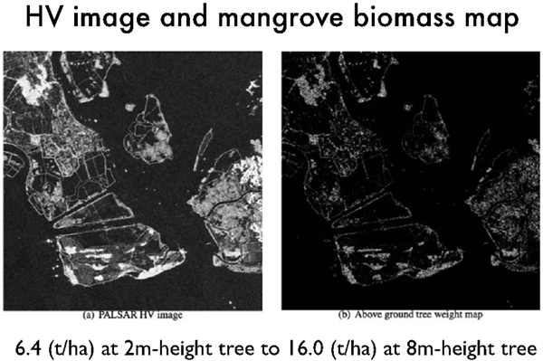
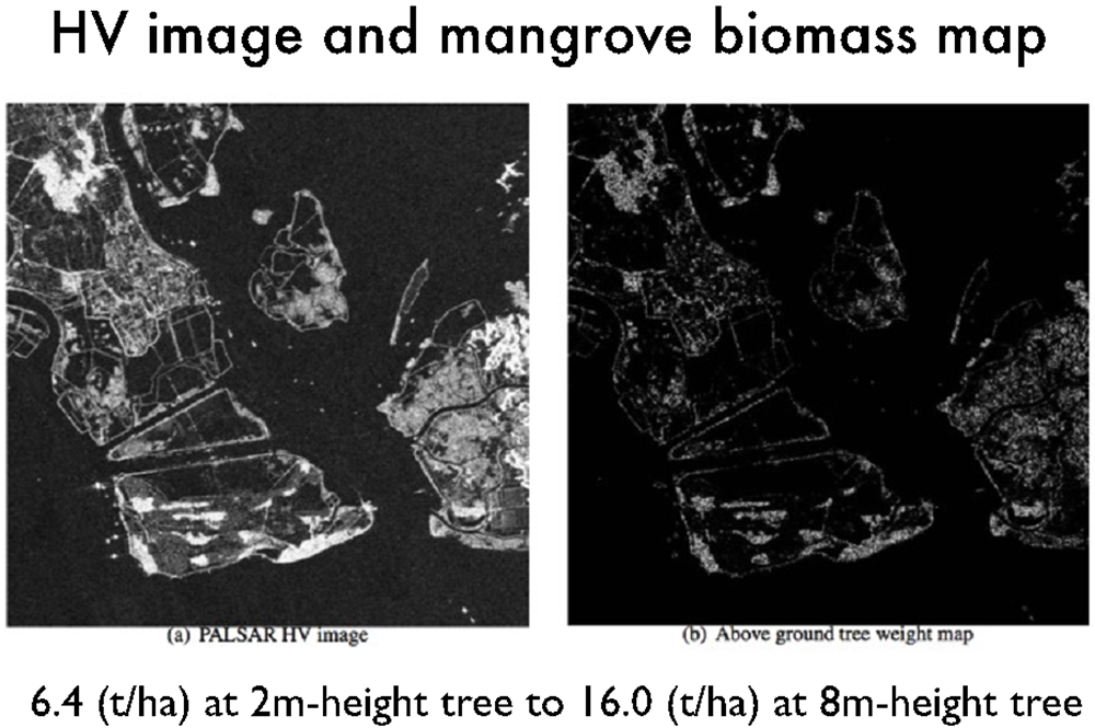
Mangrove Biomass Map (Part of Quang Ninh province)
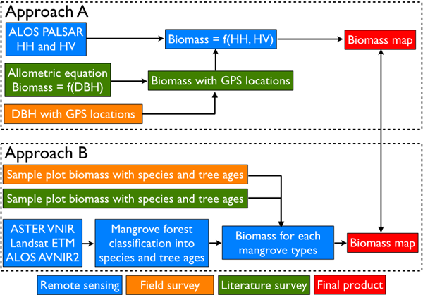
2) Method
Approaches of biomass calculating
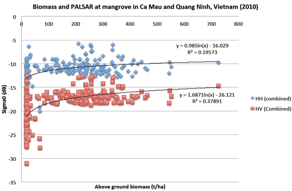
Biomass and ALOS PALSAR
3) Capacity Building
On-the-job training on ALOS PALSAR data processing (Jun. 2011)
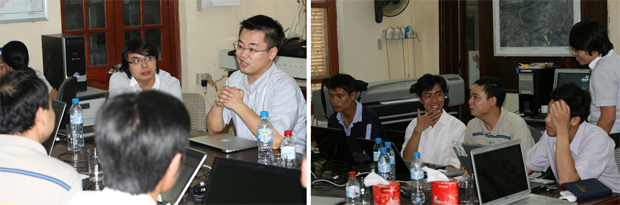
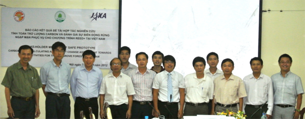
4) Stake-holder Meeting
on Sep. 7, 2012 at FIPI
Study Area
Formation
(1) Prototyping Executor
Mr. Dien Tien Vu, Director
Forest Resources and Environment Center (FREC),
Forest Inventory and Planning Institute (FIPI), Vietnam
(2) Technical Supporter
- University of Tokyo, Japan
- Geo-informatics Center (GIC)
- Asian Institute of Technology (AIT)
(3) Data & Application Provider
- NASA (Landsat ETM)
- Japan Aerospace Exploration Agency (ALOS PALSAR/AVNIR-2)