Vietnam (Forest) -200805
< Last Update: 19 Feb. 2013 >
SAFE Prototyping Status: May 2008 - June 2010 <Completed>
Forest monitoring
Period
May 2008 ~ June 2010
The Vietnamese Forest Protection Department of the Ministry of Agriculture and Rural Development (FPD/MARD) is responsible for forest management in Vietnam. The FPD has a Moderate Resolution Imaging Spectroradiometer (MODIS) receiving station and provides wildfire hotspot information to its rural branches. The goal of the FPD is to strengthen forest management by using MODIS. To achieve the goal, the objective of this prototype is the followings;
1. To generate the forest cover map 2008 at national level
2. To generate 100 meter or batter forest cover map in a demonstration river basin for water resources management
Participants
(1) Prototyping Executor
Forest Protection Department, Ministry of Agriculture and Rural Development (FPD/MARD), Vietnam
(2) Technical Supporter
- University of Tokyo
- Geo-informatics Center (GIC)/Asian Institute of Technology (AIT)
- VAST/STI
- Remote Sensing Centre, MONRE
(3) Data & Application Provider
University of Tokyo (Analyzing tools and MODIS)
Japan Aerospace Exploration Agency (ALOS/PALSAR, AVNIR-2)
Remote Sensing Centre, MONRE (SPOT)
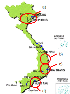
Study Area
(1) Mapping: Whole land of Vietnam
(2) Field Survey for Validation:
a) Bag Giang and Lang Song province (Sep. 2009)
b) Yok Don national park in Dak Lak province (Dec. 2009)
c) Dak Nong province (Apr. 2010)
d) Cangio province (Mar. 2010)
Developed System / Application
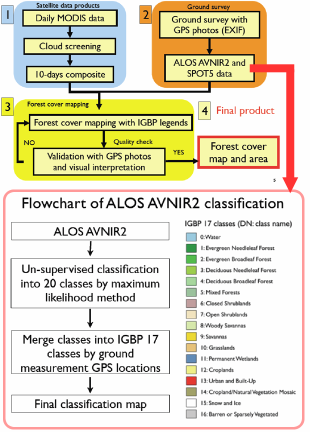
Final Results
(1) Products
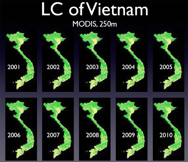
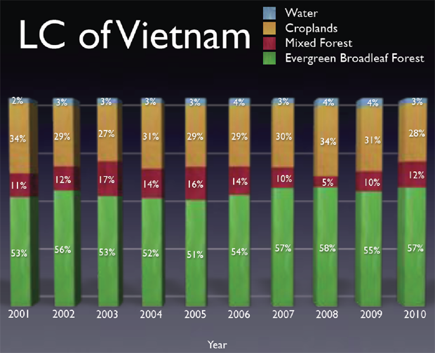
MODIS Map (250m) at National Level
ALOS AVNIR-2 Land Cover Classification Map at Province Level
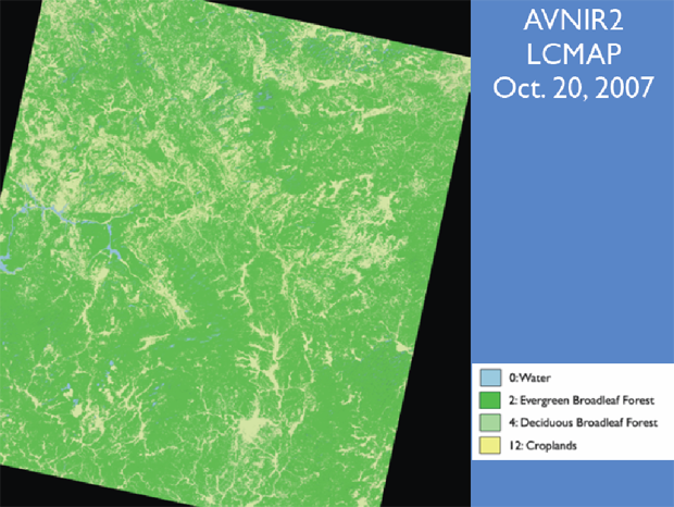
(Bac Giang and Lang Son province, Vietnam)
(2) Method
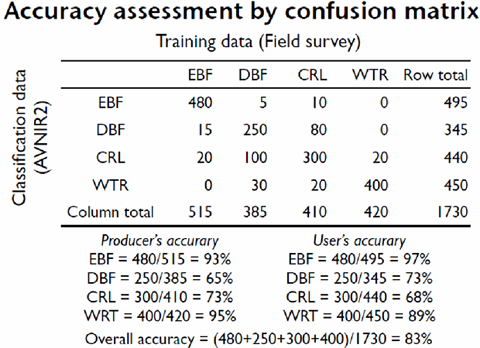
Accuracy Assessment Method by Comparing to Ground Data
(3) Capacity Building
Processing and validation training for FPD and VAST/STI
a) On-the-job training to map forest cover of Vietnam (Hanoi, 16-18 Jul. 2008)
b) On-the-job training to map forest cover of Vietnam (Tokyo, 24-31 Jul. 2008)
Training Material

- DVD and USB Live-system on Linux and Windows
- DVD of data and tutorial
- Hardcopy of tutorial
In-situ / Validation Data
(1) Place and Date Acquired Data
a) Bag Giang and Lang Song province (Sep. 2009)
b) Yok Don national park in Dak Lak province (Dec. 2009)
c) Dak Nong province (Apr. 2010)
d) Cangio province (Mar. 2010)
(2) Type of Parameter
a) Location Information (Latitude, Longitude, Altitude)
b) Acquired Time
c) Land Cover Type
d) Description of the Field
Status of Utilization
The result has been taken over via Vietnamese self-funding members which are responsible for government action plan on forest mapping from 2010-2015.