About SAFE Rice Monitoring Project
Objectives
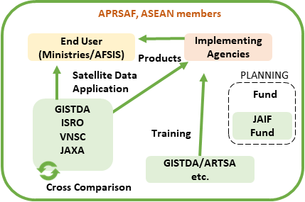
The SAFE Rice Monitoring project aims to contribute national agricultural (rice) statistics and decision-making in agricultural policy. This project focuses on improving national agricultural statistics, focusing on rice production, while also providing decision-makers with the information needed to make agriculture policy decisions. The project also enhances regional and global food security related activities, such as AFSIS Rice Growing Outlook, FAO AMIS, GEOGLAM and Asia-RiCE. The project's ongoing activities include cross-comparison and validation studies of rice maps, data/tool/knowledge sharing and capacity building, and dialog with stakeholders/end-users.

Project Leader: Geo-Informatics and Space Technology Development Agency (GISTDA)
Activities
- Cross-comparison related study of rice map for algorithm improvement.
- Data and tool sharing for facilitating rice monitoring study and capacity building.
- Promote dialogue with stakeholders for applications.
Cross-comparison Study of Rice Maps for Algorithm Improvement
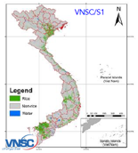
Lower Mekong River, BIMSTEC (Bay of Bengal Initiative for Multi-Sectoral Technical and Economic Cooperation)
As CEOS Chair in 2020, ISRO funded a study for BIMSTEC countries. This followed VNSC’s year as CEOS Chair in 2019, where they funded a similar initiative for the Lower Mekong River. The cross-comparison study involves continuing and expanding on this work, with the aim of improving algorithms by comparing rice maps from different regions and sources, and also by comparing and contrasting various datasets.
India (ISRO-JAXA)
A rice mapping algorithm comparison and development study is ongoing, using shared ALOS-2 ScanSAR data for test sites located in India. The study has found that the Random Forest (RF) algorithm with automatic Hyperparameter Optimization method performed the best among the three algorithms tested. The study also tested transfer learning and found that the algorithm is more efficient when trained with well distributed and balanced ground truth data.
The next step is to expand the study to other regions and seasons, assess and compare the efficacy of C-band SAR from RISAT-1A, Sentinel-1 and ALOS-2 PALSAR-2, and all SAR combinations to improve the algorithm further.
Thailand (GISTDA-JAXA)
The study compared the rice maps developed by GISTDA (Landsat 8 and Sentinel-2 based maps) and JAXA (ALOS-2 based map) and identified cropping pattern change areas from both maps. The plan is to investigate the factors that contributed to these changes.

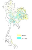
Cross-comparison studies conducted by GISTDA, ISRO, VNSC and JAXA
Data/Tool Sharing for Facilitating Rice Monitoring Study and Capacity Building
ALOS-2 Archive with ISRO’s Data Platform (Visualisation of Earth Observation Data and Archival System, VEDAS)
ISRO’s data platform VEDAS enables users to visualize and process many archived satellite datasets. A huge amount of ALOS-2 ScanSAR data have been ingested into VEDAS, covering India, Bangladesh, and the Lower Mekong River region from 2018 to 2021, to facilitate rice monitoring related activities in the Asian region.
ALOS-2 ScanSAR data on ISRO’s VEDAS
VEDAS: https://vedas.sac.gov.in/en/
Rice Mapping Tool with ALOS-2 Data on Google Earth Engine
ALOS-2 ScanSAR L2.2 data, which has been ortho-slope corrected, has been ingested into Google Earth Engine (GEE) as open access data to aid rice monitoring in the Asian region. Tutorial materials are also available to help agricultural statisticians, who may not have remote sensing expertise, use the data.
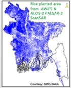
Rice area identified by Random Forest using ALOS-2 HH and HV time-series metrics (min/max/mean)
Promote Dialog with Stakeholders for Applications
Dialogue with AFSIS
Co-organized tutorial session and trainings were conducted with AFSIS and ASEAN for the use of project results in AFSIS’s monthly report (RGO: Rice Growing Report) and improvement of rice statistics in each country.
MAFF/Cambodia-JAXA
Demonstration projects related to the framework of checking rice planted area statistics in collaboration with the Ministry of Agriculture, Forestry and Fisheries (MAFF) in Cambodia are ongoing.
http://www.aptfsis.org/news-events/news50
Capacity Building
1) Training Program on “Satellite-Derived Rice Planed Area Data for AFSIS’s Rice Growing Outlook (RGO)” (2022)
Training Program on “Satellite-Derived Rice Planed Area Data for AFSIS’s Rice Growing Outlook (RGO)”for Agriculture Management in the ASEAN was completed in November 2022. This activity was organized by hybrid with online participation during the APRSAF-28 held in Hanoi, Vietnam.
Organizers:
SAFE, JAXA, VNSC and AFSIS
Date and Venue:
November 14th, 2022 at Vietnam National Space Center (VNSC) and online
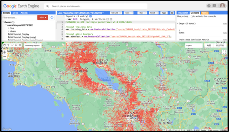
Main activities:
The training demonstrates the use of INAHOR on the Google Earth Engine (GEE). This allows users to use the software over the internet simplifying software and hardware requirements. Specifically, the use of INAHOR using PALSAR-2 data for rice planted area estimation with machine learning technology will be demonstrated. Main trainees for this training will be agricultural statistician in Ministry of Agriculture in ASEAN countries.
- Improvement of agricultural statistics using INAHOR
- INAHOR on GEE training
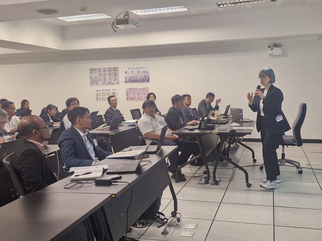
2) APRSAF-29/SAFE Training Program “Rice Planted Area Mapping using Earth Observation Satellite” (2023)
Training Program on “Rice Planted Area Mapping using Earth Observation Satellite” for ASEAN countries was conducted in September 2023. This training was a follow-up of the training “Satellite-Derived Rice Planted Area Data as reference information for generating Rice Growing Outlook (RGO) reports” held in November 2022 jointly with AFSIS. The training program was organized as a part of “Rice Monitoring Project” under the APRSAF/Space Applications for Environment (SAFE) initiative by hybrid with online participation from space and agriculture related agencies in Indonesia and Ministry of Agriculture in ASEAN. 90 participants joined this training.
Organizers:
SAFE, JAXA, BRIN and AFSIS
Date and Venue:
September 18th, 2023 at Indonesia National Research and Innovation Agency (BRIN) and online
Main activities:
The training program aims to use space technology to contribute to the production of accurate and timely rice acreage statistics. This training utilizes a software package “INAHOR” which has developed to identify and estimate rice-planted area using machine learning technology with Synthetic Aperture Radar (SAR) data. This software is available on the Google Earth Engine, a cloud-based geospatial analysis platform that enables users to easily visualize and analyze satellite images.
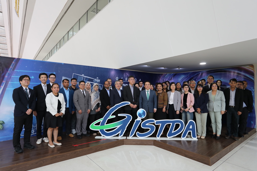
3) JAIF funded Project: Inception Meeting and Training for “Improvement of Rice Paddy Area Statistics and Damage Assessment using Earth Observation Satellites for ASEAN” (2025)
Training of improvement of rice paddy area statistics and damage assessment funded by Japan-ASEAN Integration Fund (JAIF) was conducted during 22-24 January 2015. The main objective of the trainings is to validate and demonstrate innovative analytical methods to enhance rice crop statistics - specifically on planted rice areas - by leveraging earth observation satellite data and the "INAHOR" (INternational Asian Harvest mOnitoring system for Rice) software developed by the Japan Aerospace Exploration Agency (JAXA). Furthermore, the localisation knowledge gained through the project will definitely contribute to enhancing the ASEAN Food Security Information System (AFSIS). More than 30 participants from ASEAN Ministries on Agriculture and Forestry (AMAF) and Sub-Committee on Space Technology and Application (SCOSA) in ASEAN.
Organizers:
JAIF
Supporters:
GISTDA (proponent/training facility), JSF (Implementing Agency), JAXA (project supporter), RESTEC, SEAA Research Limited Liability Company, AFSIS and Ministry of Agriculture Forestry and Fisheries, Japan (MAFF/Japan)
Date and Venue:
- 1st Inception Workshop/Seminar: 22 January 2025 at GISTDA HQs, Thailand
- 1st Training: 23-24 January 2015 at ARTSA Facility, GISDTA, Thailand
For more details:
https://www.aptfsis.org/news-events/news186