Sri Lanka -201006
< Last Update: 15 May 2013 >
SAFE Prototyping Status: January 2010 - November 2012 <Completed>
Modeling ocean frontal zones using satellite and float data to locate tune fish aggregations
National Aquatic Resources Research and Development Agency (NARA), Ministry of Fisheries
The National Aquatic Resources Research and Development Agency, the research arm of the Ministry of fisheries in Sri Lanka has been working on developing a fishery forecasting system for Yellowfin tuna fishery for Sri Lankan long-liners.
Sea surface temperature (SST), sea surface chlorophyll (SSC) and sea surface heights (SSH) derived from satellite data and fishery data were used to determine favorable environmental parameters for Yellowfin tuna. However, the limiting factor of the forecast was the accurate boundaries of frontal zones on the vertical temperature profile where the most fish aggregates can be found.
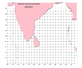
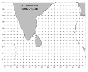
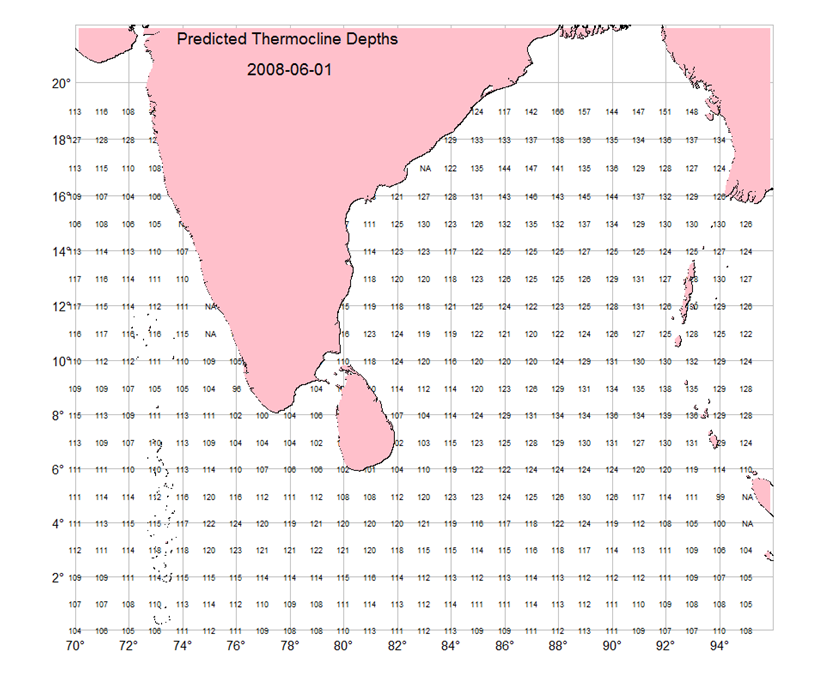
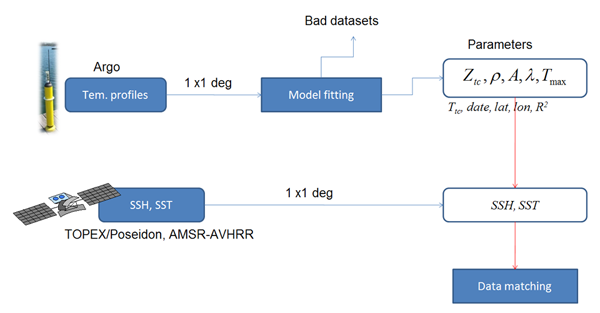
SST, SSH and vertical temperature profiles (Satellite and Argo data) have been used to model thermal fronts in 3D space. Temperature Depth Recorders (TDRs) data from Sri Lankan long-liners can be incorporated to investigate the fishing potential in thermal fronts. The objective of this prototype is to;
1) Develop a predictive model for thermal fronts using satellite (SST,SSH) and float (temperature profiles) data
2) Study the potential occurrence of fish aggregation on thermal fronts and use the model to predict the particular isotherm depths in space and time using satellite data
3) Use the frontal information on the existing fishery forecasting system to increase the fishing efficiency of Sri Lankan tuna fishery
Final Results
1) Products
2) Method
Analysis Methodology
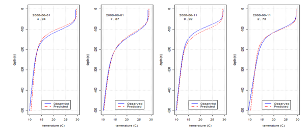
Validation of predictions
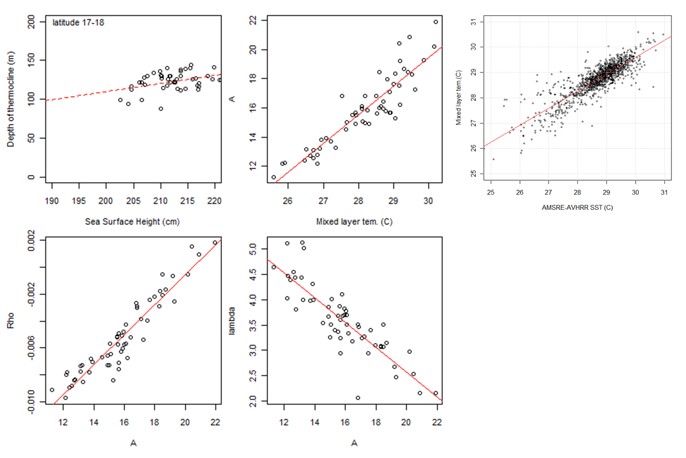
Temperature profile from satellite data
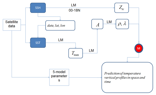
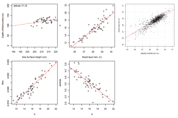
Relationship between 5-Model parameters, SSH and SST
Formation
1) Prototyping Executor
Mr. Jagath Rajapaksha
National Aquatic Resources Research and Development Agency (NARA), Ministry of Fisheries, Sri Lanka
2) Technical Supporter
- National Research Institute of Far Seas Fisheries, Japan (NRIFSS)
- Geo-informatics Center (GIC)/Asian Institute of Technology (AIT)
3) Data & Application Provider
- Japan Aerospace Exploration Agency: AMSR-E SST
- GIC/AIT http://www.geoinfo.ait.ac.th/modis/: MODIS SSC
- NCDC-NOAA ftp://eclipse.ncdc.noaa.gov: TOPEX/Poseidon SSH
- GODAE at ftp://usgodae.org/: Argo Temperature profiles
- NARA: Fishery data from Sri Lankan tuna long-liners