About SAFE Agromet Project(Completed)
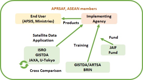
Agromet project in APRSAF/SAFE aims to provide high-quality space-based agrometeorological (agromet) information including extreme events such as flood or drought for end-users to evaluate rice crop growth. To implement this SAFE Agromet project, it is crucial to have various space based agromet information from Asian space organizations.
ISRO: Indian Space Research Organisation
GISTDA: Geo-Infomatics and Space Technology Development Agency
JAXA: Japan Aerospace Exploration Agency
BRIN: National Research and Innovation Agency
JAIF: Japan-ASEAN Integration Fund
Project Leader:ISRO
Activities
Following activities have been completed:
- Application of validated products to Rice Growing Outlooks (RGOs) of AFSIS;
- Contribution to practical usage of data through APRSAF/SAFE website and related services;
- Capacity building and training of data usage provided to Agricultural Statisticians in the ASEAN region funded by the Japan-ASEAN Integration Fund (JAIF).
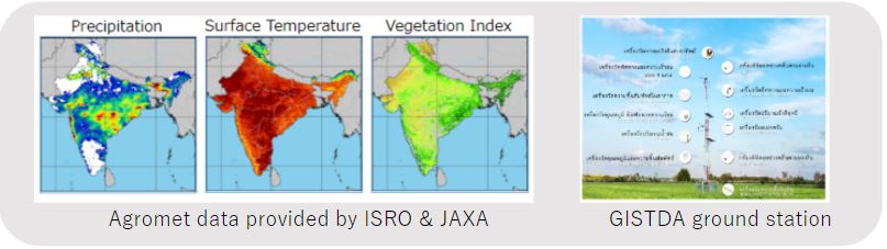
Data comparison between organizations
Inter-comparison or validation of space-based agromet information is imperative for accuracy improvements, interoperability or complementary use. Thus far, satellite derived Agromet data comparison between ISRO and JAXA with GISTDA’s in-situ data have been completed;
Agromet Data and Reports for comparison activities are available.
Future plan
- Actively search for agencies/frameworks to extend the use of agromet information, especially in South Asia and compare agromet data with in-situ data in other regions.
- Integrate project results into the AFSIS monthly RGO report through collaborative efforts to achieve project objectives.
- Maintain coordination with AFSIS for sustainable use of project results.
- The Agromet project is anticipated to conclude in 2024 at the SAFE Executive Board Meeting and APRSAF/SAWG, and APRSAF/SAWG with a commitment to continue supporting AFSIS’s RGO activities beyond project completion and dissemination of project achievement.
Capacity building
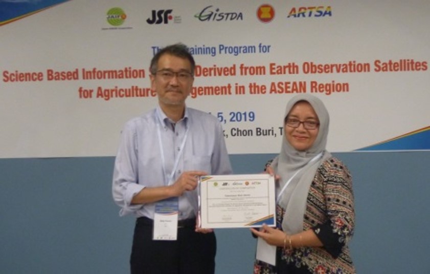
1) Training for Science based information sharing derived from Earth Observation Satellites for agriculture management in the ASEAN Region (2019 and 2021)
Training of data usage of Agromet products funded by Japan-ASEAN Integration Fund (JAIF) was conducted in 2019 and 2021 respectively. The main objective of the trainings is to improve the national capacities on the use of satellite data products developed by many agencies including Japan Aerospace Exploration Agency (JAXA), NASA, NOAA, Japan Meteorological Agency (JMA) of agriculture agencies of the ASEAN member states. It was expected that the knowledge gain through this project would help member states to use satellite data products for their national agriculture information management in practices. Furthermore, the knowledge gained through the project definitely contribute to the ASEAN food security information system (AFSIS), being an ASEAN initiative helping the region.
Organizers:
JAIF
Supporters:
LAPAN/MoA (proponent, currently BRIN), JSF (Implementing Agency), JAXA (project supporter), GISTDA (Training Facility), RESTEC and AFSIS
Date and Venue:
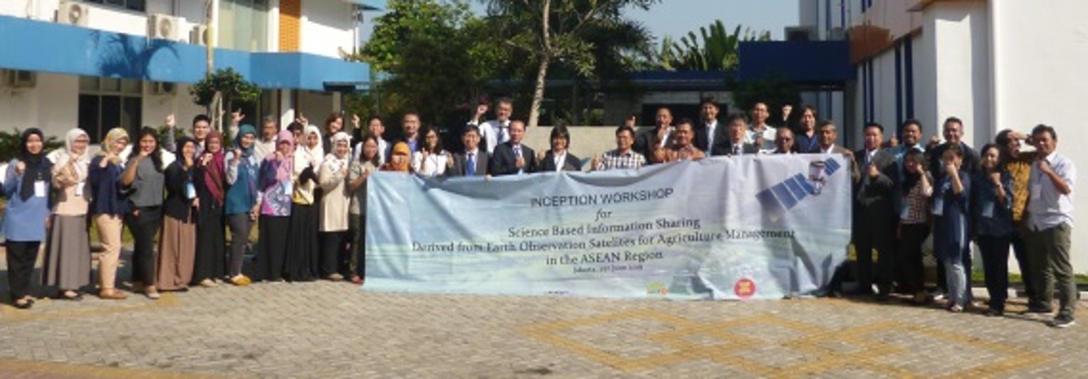
- 1st Inception Workshop: June 27, 2019 at LAPAN, Indonesia
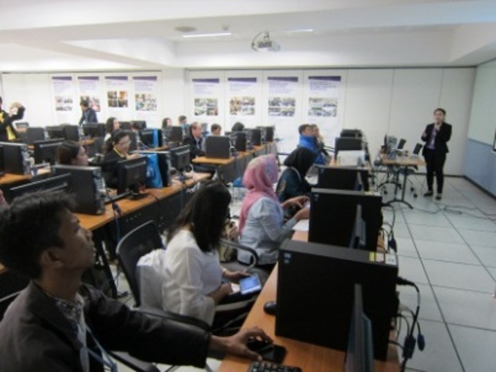
- 1st Training: 4-5 July 2019 at ARTSA Facility, GISDTA, Thailand
- 2nd Training: 24 November 2021, Online
Main activities:
- Develop User Guideline Document for use of agromet information from JASMIN system
- Share implementation strategy and achievements in the Inception and Final Workshop
- Conduct training courses for ASEAN-SCOSA and AFSIS
- User Survey to evaluate the effectiveness of JASMIN system
User Guidebook:
How to interpret JASMIN in Rice Growing Outlook, December 2021 (PDF Download: 2MB)
2) Training Program on “Satellite-Derived Agrometeorological Data for AFSIS’s Rice Growing Outlook (RGO)” for Agriculture Management in the ASEAN (2022)
Under the Space Application on Environment (SAFE) project in cooperation with Indian Space Research Organization (ISRO) of India, Geo-Informatics and Space Technology Development Agency (GISTDA) of Thailand, and Japan Aerospace Exploration Agency (JAXA) Japan, the training was arranged as a virtual program on the 11th July 2022.
Organizers:
SAFE/ISRO, JAXA, GISTDA and AFSIS
Date and Venue:
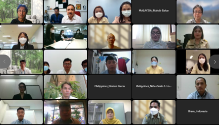
11 July 2022, Online
Main activities:
Participants from ASEAN learned the use of Indian Satellite derived agrometeorological information through the Meteorological & Oceanographic Satellite Data Archival Centre (MOSDAC) and Visualization of Earth Observation Data and Archival System (VEDAS) systems to improve the capabilities of satellite based products to solve the common problems in agriculture information system in each member state.
- SAFE Overview, Agromet and Rice Mapping Projec
- Demonstration of MOSDAC, Python and QGIS
- Demonstration of VEDAS (including wide-area precipitation data)
- Hands-on training for VEDAS
Presentation Materials:
3) Training on JAXA’s JASMIN (JAIF funded project) and ISRO’s VEDAS
Training programmes were conducted for JAXA’s JASMIN (JAIF funded project) and ISRO's VEDAS platform, co-organized by AFSIS for agricultural statisticians in ASEAN. These capacity-building activities were also featured as a good practice in the GEOGLAM document titled “Guidance Document On Good Practices For Designing, Implementing, And Evaluating Capacity Development Interventions In GEOGLAM,” published in June 2023.
Agromet Project Completion Ceremony at APRSAF-30/SAWG
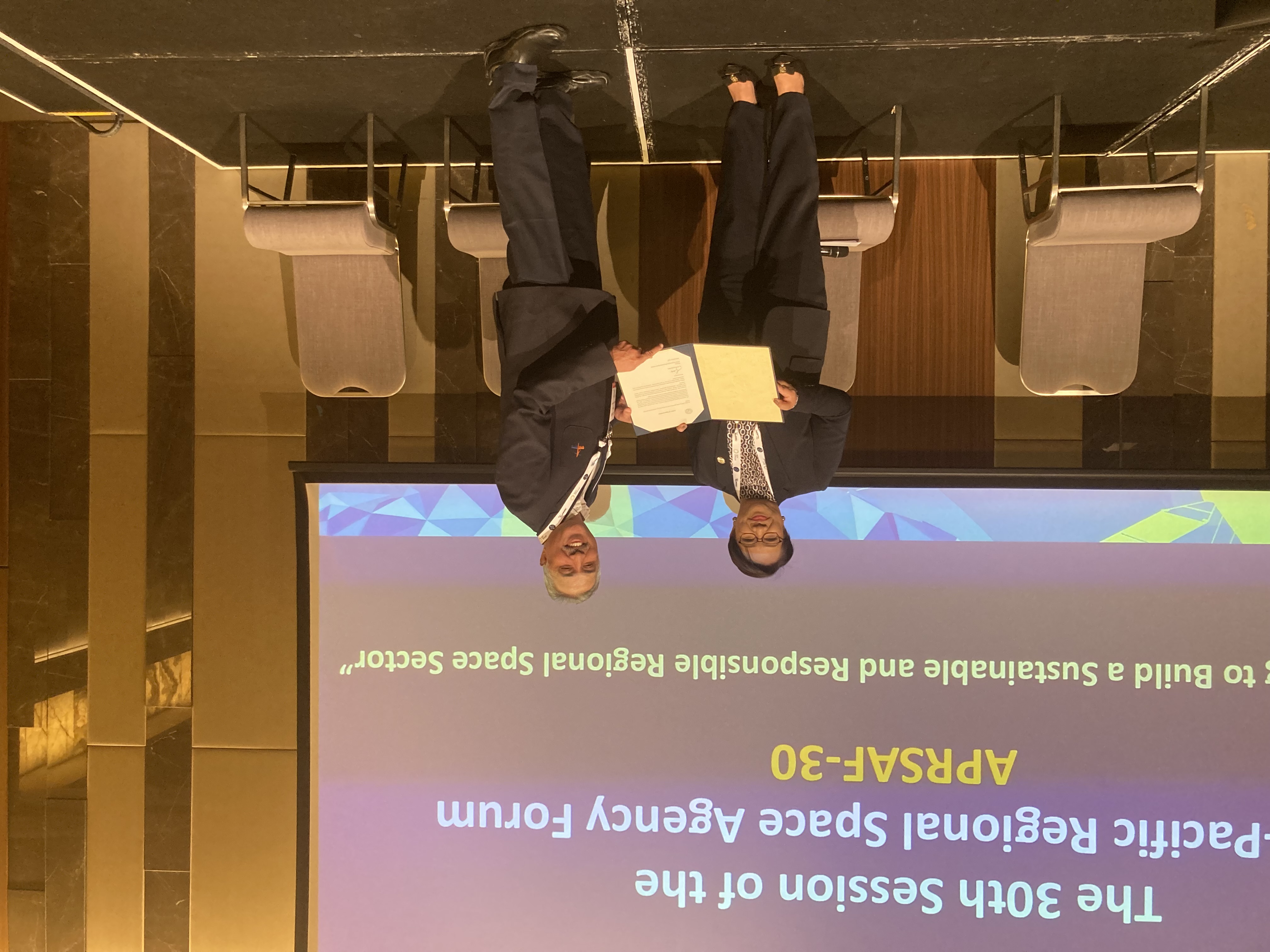
At the APRSAF-30 meeting hosted in Perth, Australia, 26-29 November 2024, the pplications for Environment (SAFE) Agromet project delivered its final report as the activity was concluded. The SAFE Agromet activity sought to provide validated space-based agrometeorological (Agromet) information to support monthly Rice Growing Outlooks (RGO, https://www.aptfsis.org/publication/rgo) in Asia through ASEAN Food Security Information System (AFSIS), the ASEAN Food Security Information System, and contribute to regional food security.
The project combined Land Surface Temperature, Precipitation, and NDVI satellite datasets from ISRO (India) and JAXA (Japan), as well as in situ data from GISTDA (Thailand). This was a successful collaboration and demonstration of product creation and interoperability.
The work of the SAFE Agromet project has been highlighted in the “Guidance Document on Good Practices for Designing, Implementing, and Evaluating Capacity Development Interventions in GEOGLAM (GEO Global Agricultural monitoring)” and “Geospatial Practices for Sustainable Development in East and North-East Asia 2024 (UN ESCAP)”.
The work was recognized in a letter of appreciation received from AFSIS. This letter was presented in a ceremony of recognition during the Satellite Applications for Societal Benefit Working Group (SAWG) session at APRSAF-30.
Related Organizations
ASEAN-SCOSA: ASEAN Sub-Committee on Space Technology and Applications
AFSIS: ASEAN Food Security Information System
GISTDA: Geo-Infomatics and Space Technology Development Agency
ISRO: Indian Space Research Organisation
JAIF: Japan-ASEAN Integration Fund
JAXA: Japan Aerospace Exploration Agency
JSF: Japan Space Forum
BRIN: National Research and Innovation Agency
RESTEC: Remote Sensing Technology Center of Japan