Bangladesh -201205
< Last Update: 20 Aug. 2014 >
SAFE Prototyping Status: May 2012 - April 2014 <Completed>
Investigation of sedimentation process and stability of the area around the cross-dams in Meghna estuary
Local Government Engineering Department (LGED)
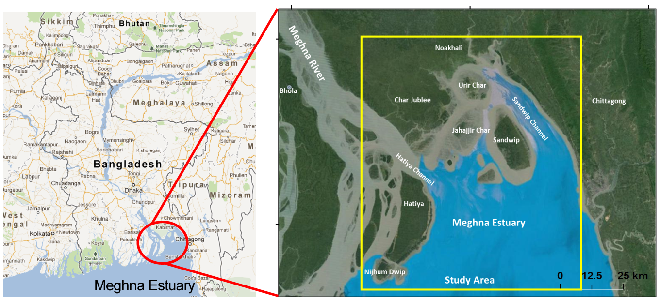
The Meghna Deltaic Plain in Bangladesh lies between Tetulia River in the west to Sandwip channel in the east and has the mouth of the Meghna River. This area has experienced most dynamic morphology changes such as formation of islands and bank erosion under significant sediment supply from the upstream. The Meghna Estuary Study (MES) was conducted by Bangladesh Water Development Board (BWDB) respectively in two phases: MES (from 1995 to 1998) and MES-II (from 1998 to 2001). A total of 19 potential cross-dam sites, which connects multiple small islands, were identified by the BWDB Task Force. Although constructions of some cross-dams have been completed, impacts of these constructions were not yet monitored. This research focuses on monitoring and investigation of impacts of human activities on the dynamic morphology changes around the MES area. The overall objective of the research work is to develop a monitoring system for large scale morphology change especially focusing in sedimentation function of cross dams. The specific objectives of this prototype are the followings;
- Identify the historic and recent morphology changes in the MES area as well as to distinguish the impact of cross dams using optical and PALSAR (SAR) satellite data
- To investigate the relationship between hydrodynamic events and observed morphology changes
- To apply numerical models to analyze morphological changes, considering sediment discharge
- Investigate the reasons for morphological changes including climate related variables and other possible causes

Final Results
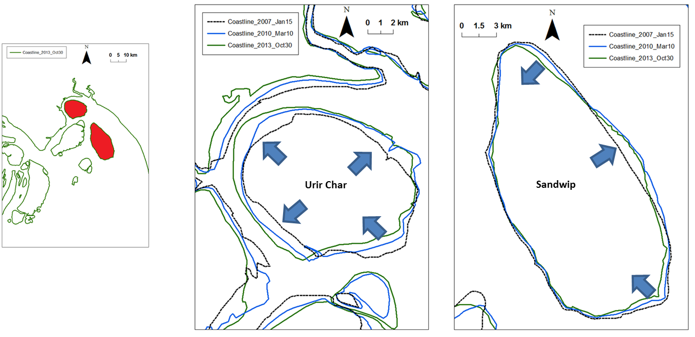
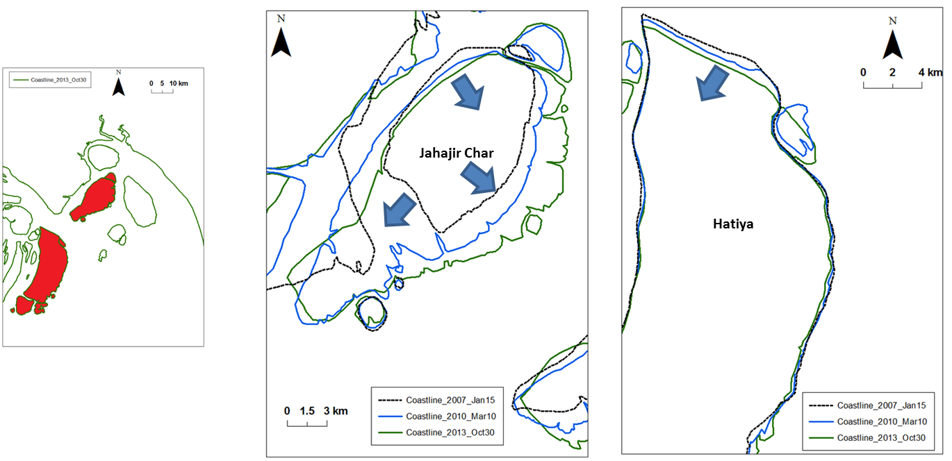
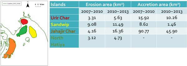
1) Results from satellite images: Historical Coast Line, Erosion and accretion rates
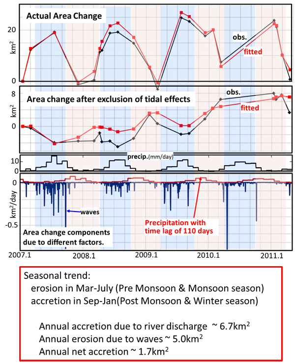
2) Seasonal variation of erosion-accretion around Urir Char Island using PALSAR images
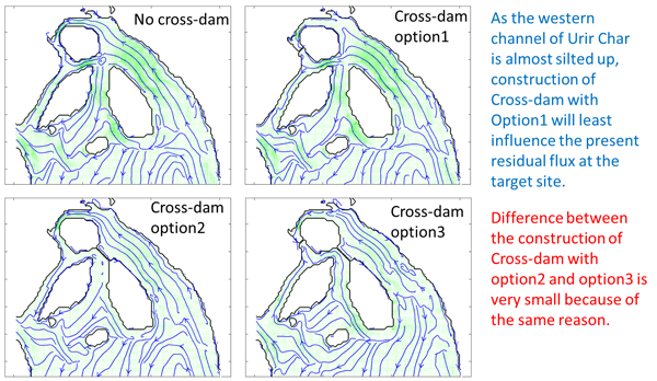
3) Simulation of residual flux after cross dam construction
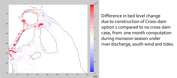
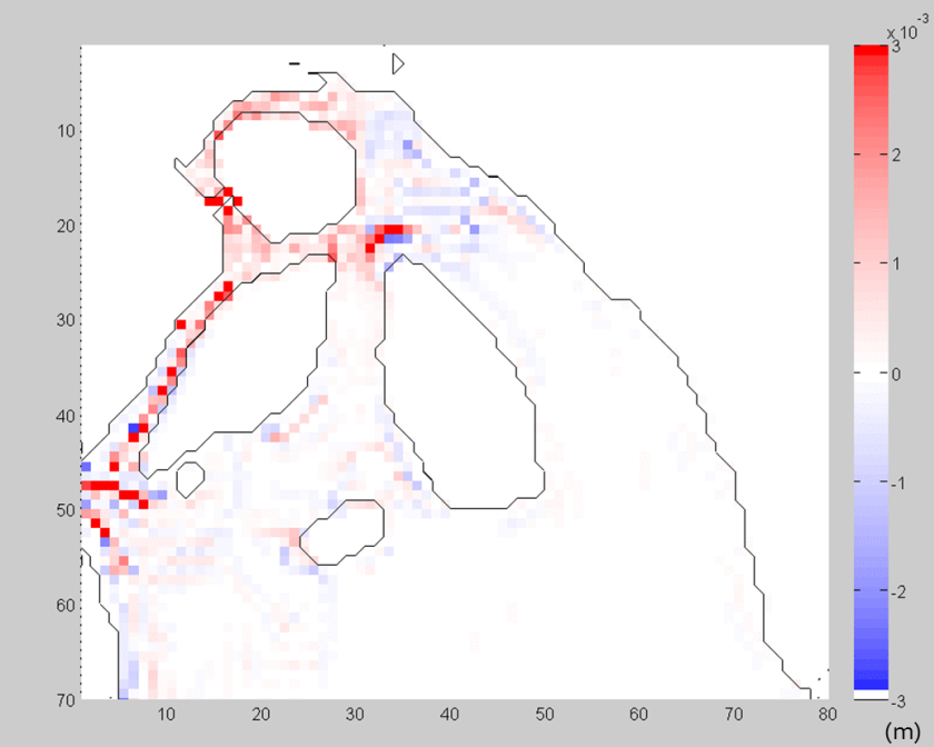
4) Net bed level change due to cross-dam construction
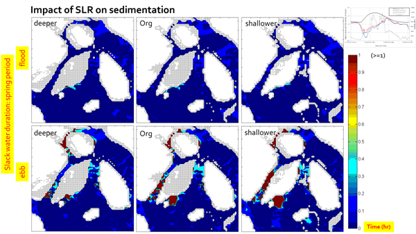
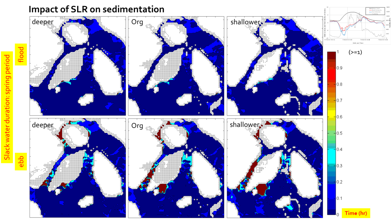
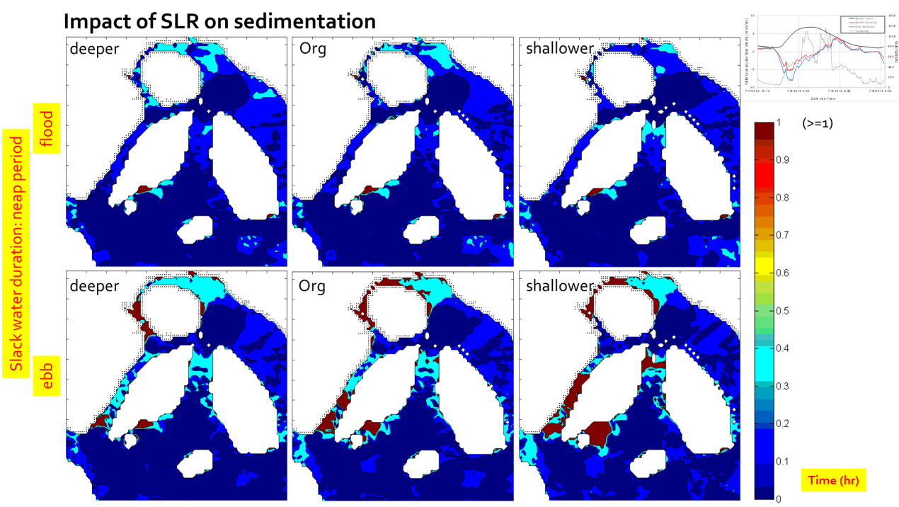
5) Result due to Climate Change (Sea Level Rise: SLR)

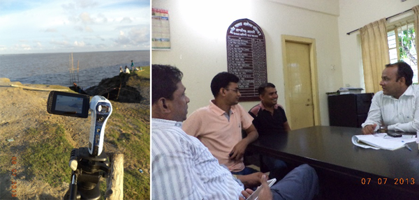
Field Survey
1) Field Survey July 2012: Noakhali Area
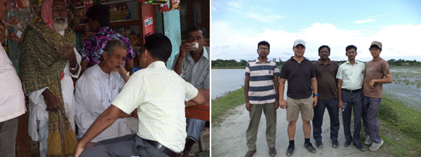
2) Field Survey December 2012: Urir Char
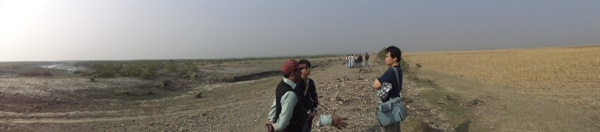
3) Field Survey July 2013: Northern Channel of Urir Char
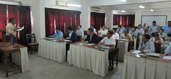
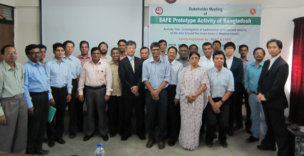
Stakeholder Meeting
1) Date and Place:
August 6, 2014
Institute of Water and Flood Management (IWFM), Bangladesh University of Engineering and Technology (BUET), Dhaka, Bangladesh
2) Participants
- LGED
- IWFM, BUET
- WARPO
- GSB
- SPARRSO
- Survey of Bangladesh
- BWDB
- BMD
- DAE
- Bangladesh Office, JICA
- Ministry of Defense, GoB
- Agricultural Statistics and ICT (ASICT) Division, Bangladesh Agricultural Research Institute (BARI)
- BARI
- CEGIS
- IWM
Formation
1) Prototyping Executor
Local Government Engineering Department (LGED)
a) Md. Sohel Rana (Principal Investigator)
Senior Assistant Engineer, Remote Sensing and GIS Unit, LGED, Dhaka.
b) Mohammad Rezaul Karim
Unit In-charge, RS & GIS Unit, LGED, Dhaka
2) Technical Supporter
- Coastal Engineering Laboratory, The University of Tokyo
- Geo-informatics Center (GIC) / Asian Institute of Technology (AIT)
- Bangladesh University of Engineering and Technology (BUET)
3) Data & Application Provider
- JAXA: ALOS AVNIR-2 / PRISM
- Bangladesh Water Development Board (BWDB) and WARPO: historic data of MES