Indonesia -201205
< Last Update: 5 Aug. 2014 >
SAFE Prototyping Status: May 2012 - April 2014 <Completed>
Assessment of drought impact on rice production in Indonesia by satellite remote sensing and dissemination with web-GIS
ICALRD of IAARD - Ministry of Agriculture (MoA)
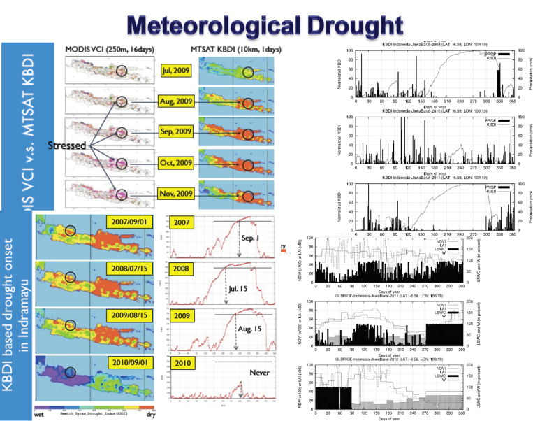
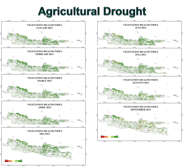
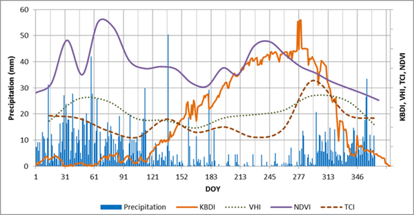
In Indonesia, drought disasters have been occurring frequently in recent years as possibly as impact of climate change. Though drought is a gradual disaster, drought can have devastating effects on agriculture and water supplies, but monitoring and forecasts can allow people to take necessary action to avert the destruction. Effect on agriculture, specifically rice production in Asia can take large toll due to drought impact if appropriate and timely actions are not planned. This regard, an early warning of onset of a drought would be very useful in the planning stage of agricultural development settings. To this point, agricultural monitoring techniques using appropriate tools to find out actual ground surface information in the relatively short time are very important. Further analysis on such data and information would be incorporated in the current agricultural development planning. The objective of this prototype is the followings;
- To assess the use of satellite data for monitoring the drought condition of rice field in a near real time
- To validate the satellite based model on drought with ground observation data
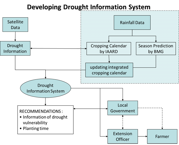
- To develop a system based on Web-GIS integrating satellite based system with existing crop calendar
- To disseminate the drought information to decision makers (BPS, Local Govt, etc.) and the farmer through extension worker
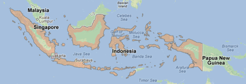
Study Area
(1) Drought Condition of Rice Field: Whole Indonesia
(2) Field Survey for Validation: Subang and Karawang District, West Java, Klaten, Central Java, Pasuruan and Ngawi, East Java, South Sulawesi, and South Kalimantan
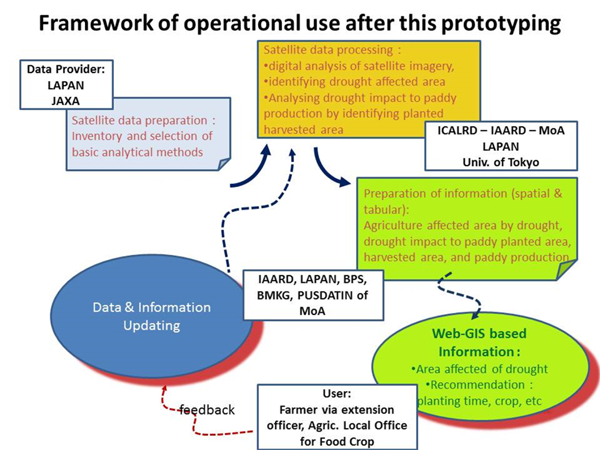
Final Results
1) Products
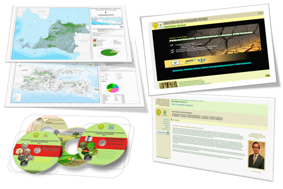
2) Dissemination of Information
Web-GIS on Agricultural Drought (in Indonesian)
http://geostech.org/aram/kekeringan/
3) Method
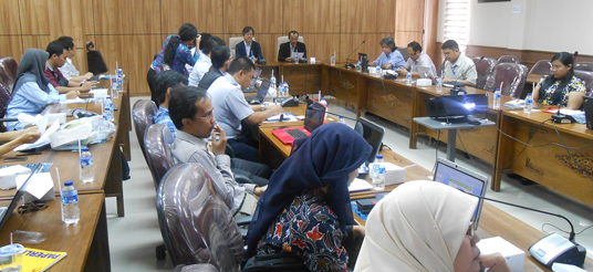
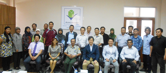
Stakeholder Meeting
1) Date and Place:
March 3, 2014
Meeting Room, ICALRD-IAARD-MoA, Indonesia
2) Participants
- LAPAN
- Center of Technology for Natural Resources Inventory (PTISDA) - BPPT
- Agric. Local Office (DIPERTA) West Java Province
- Indonesian Agency for Meteorological, Climatological and Geophysics (BMKG)
- Indonesian Center for Paddy Research (BB Padi)
- Indonesian Agroclimate and Hydrology Research Center (IAHRI) - IAARD - MoA.
Formation
(1) Prototyping Executor
Indonesian Center for Agricultural Land Resources Research and Development (ICALRD) of Indonesian Agency for Agricultural Research and Development (IAARD) - Ministry of Agriculture (MoA), Indonesia
Coordinator: Dr. Rizatus Shofiyati and Dr. Muhrizal Sarwani (Director of ICALRD)
(2) Technical Supporter
- University of Tokyo
- Geoinformatics Center (GIC) / Asian Institute of Technology (AIT)
(3) Data & Application Provider
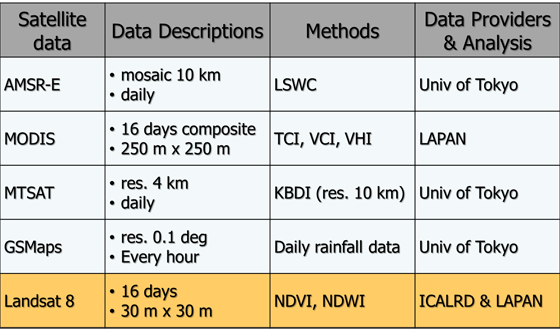
- JAXA: MODIS, MTSAT, AMSR-E and ALOS
- University of Tokyo: Drought index from MODIS, MTSAT and AMSR-E, Future - AMSR-2
- GIC / AIT: MODIS
- LAPAN: Agricultural drought index
- ICALRD: Cropping calendar data and rainfall data