Indonesia -201001
< Last Update: 24 Jan. 2013 >
SAFE Prototyping Status: January 2010 - December 2011 <Completed>
Potential Drought Monitoring over Agriculture Area in Java Island, Indonesia
Indonesian National Institute of Aeronautics and Space (LAPAN)
Drought monitoring and early warning are major components of drought risk management. The goal of drought risk management is to increase society's coping capacity, leading to greater resilience and a reduced need for government or donor interventions in the form of disaster assistance. The second major disaster in Indonesia since 1815 is drought. In the agricultural area, drought is the major disaster besides flood and landslide. The objective of this prototype is the followings;
1) To enhance the understanding on climate change-related drought in Indonesia
2) To develop the methods/techniques of drought monitoring over the agriculture areas in Java island accessible for users and public
Final Results
1) Products
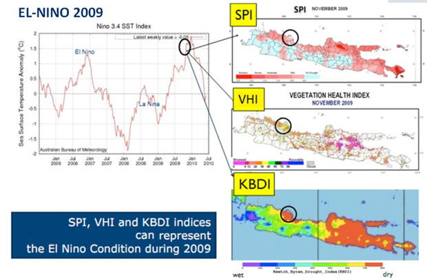
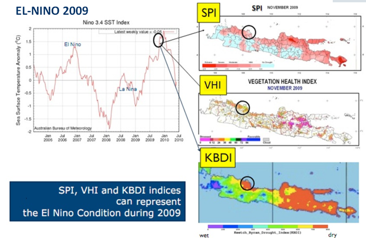
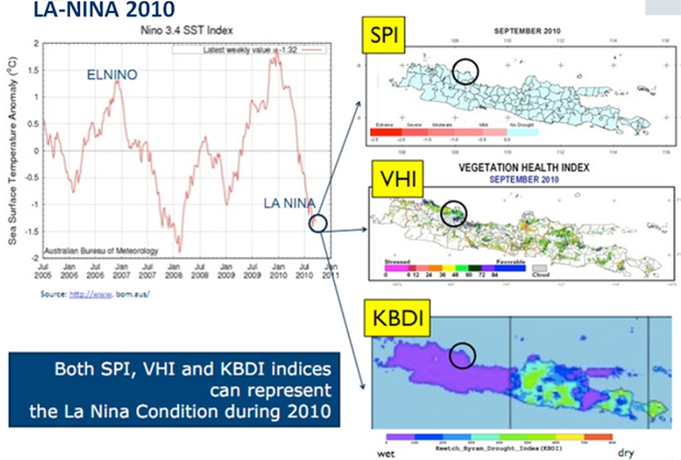
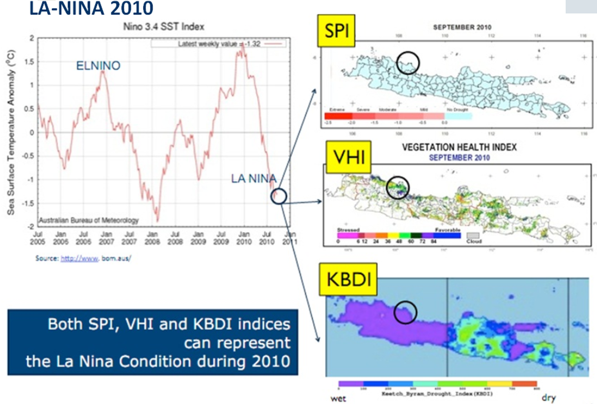
Proving the Effectiveness of Draught Indices
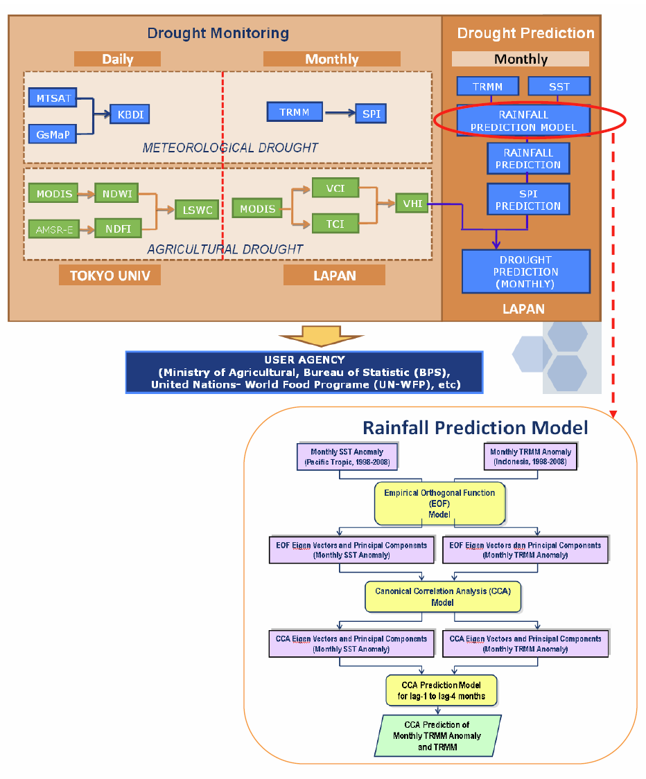
Development of Prediction Model (To be confirmed)


2) Method
Flow Chart of Product

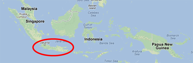
Study Area
1) Draught Monitoring: Whole Java Island
2) Field Survey for Validation: Indramayu district (Aug. 2010)
Formation
(1) Prototyping Executor
Indonesian National Institute of Aeronautics and Space (LAPAN), Indonesia
(2) Technical Supporter
- The University of Tokyo
- Geo-informatics Center (GIC)/Asian Institute of Technology (AIT)
(3) Data & Application Provider
- LAPAN: MODIS, Landsat
- JAXA: TRMM 3B43.6
- AIT: MODIS data
- UT : AMSR-E, GSMaP and MTSAT
- Paddy Area Map (Irrigated and non-irrigated)
In-situ / Validation Data
(1) Place and Date Acquired Data
Indramayu district (Aug. 2010)
(2) Type of Parameter
In-situ Validation (checking drought condition of agricultural area)
Status of Utilization
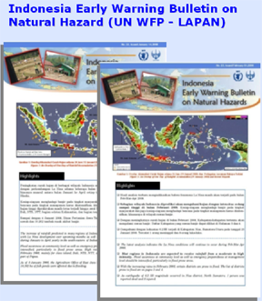
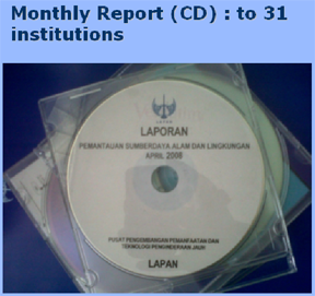
The drought information and prediction is delivered every month to the end user through routine meeting activities, monthly bulletin, website and monthly report.
1) Monthly Bulletin
2) Monthly Report
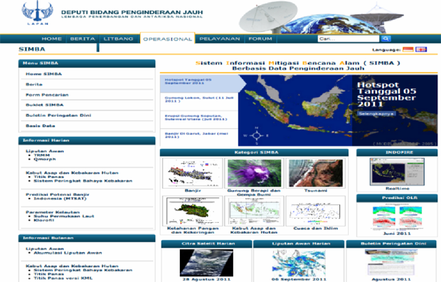
3) Website