Indonesia -201212
< Last Update: 18 Jan. 2016 >
SAFE Prototyping Status: December 2012 - December 2014 <Completed>
The assessment of Mangrove Forest Carbon Stock Monitoring of Indonesia using Remote Sensing Approach
National Institute of Aeronautics and Space (LAPAN)
The largest areas of mangrove in Southeast Asia are found in Indonesia (almost 60% of Southeast Asia's total) which comprises about 19% of world's mangroves (FAO 2007). Recent research found that mangroves are among the most carbon-rich forests in the tropics which containing on average 1,023 Mg carbon per Hectare (Donato et al., 2012). Ironically, mangrove forests are threatened by land use/land cover change as well as global climate change. Rates of deforestation/conversion are among the highest of all tropical forests, far exceeding rates in upland forests (Valiela et al. 2001; Langner et al. 2007). In this study, estimation models will be created from mangrove forest vegetation biomass using several indices using differences reflectance from several bands such as red, Near Infrared and Shortwave Infrared. If the RADAR data is available subsequently it will be analyzed using a combination of optical and RADAR satellite data. The objectives of this prototype are;
1) To evaluate of several existing methods as the most appropriate method for monitoring mangrove stock in Indonesia using RS
2) Mapping mangrove forest of Indonesia using RS
3) To determine model for mangrove forest biomass and carbon stock in Indonesia using RS
4) Assessment of mangrove forest changes using RS
Study Area
1) Assessment of mangrove forest carbon stock monitoring: whole Indonesia.
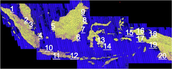
2) Training sample: 20 site spreading in the Indonesian region
3) Field survey for validation: Segara Anakan, Banyuwangi, and Subang, Java.
Formation
(1) Prototyping Executor
Ms. Yenni Vetrita
National Institute of Aeronautics and Space (LAPAN), Indonesia
(2) Technical Supporter
- University of Tokyo
(3) Data & Application Provider
a) Satellite Data
- LAPAN: Low to high resolution optical satellite data
- Japan Aerospace Exploration Agency (JAXA): High resolution satellite data (ALOS PALSAR, AVNIR)
b) Field Data
- Ministry of Marine and Fisheries, Wetland International Indonesia, and other international organizations
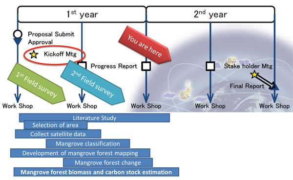
Work Plan
Developed System / Application
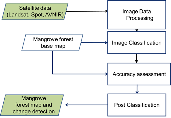
(1) Mangrove forest mapping
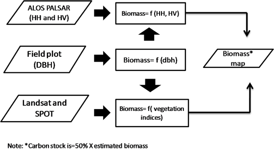
(2) Mangrove forest biomass and carbon stock estimation
Results to Date
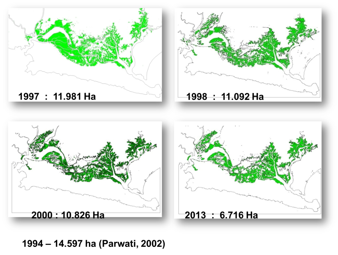
(1) Mangrove change 1994-2013

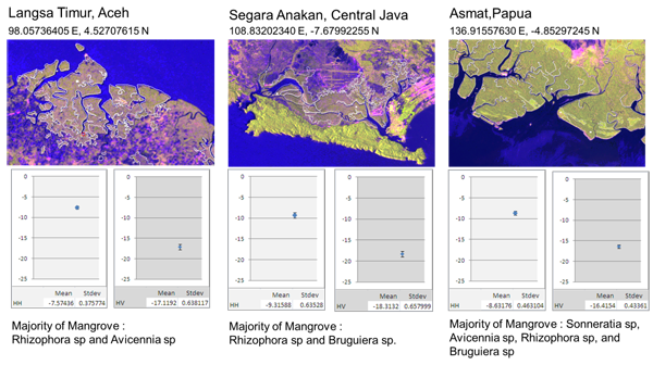
(2) Spectral Signature of Mangrove Based on ALOS PALSAR K&C Mosaic (db)
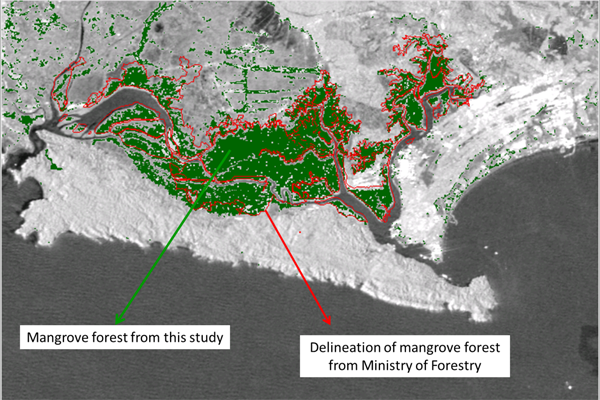
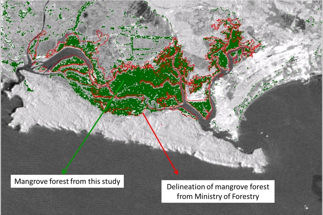
(3) Accuracy assessment
Expected Operational Usage
Cost effective system for monitoring mangrove forest carbon stocks which are rapidly and spatially mapped will be developed. The results can be used for monitoring carbon stocks of mangrove vegetation for rapidly and spatially assessment by Ministry of Forestry and/or Ministry of Marine and Fisheries.