Report of the SAFE Workshop in APRSAF-21,
Tokyo, Japan
< Last Update: Dec. 17, 2014 >
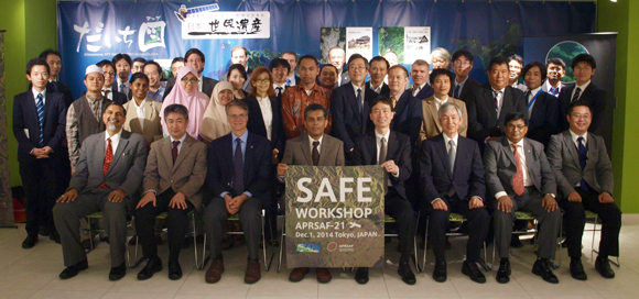
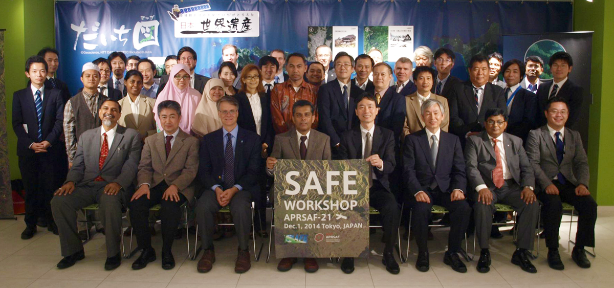
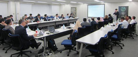
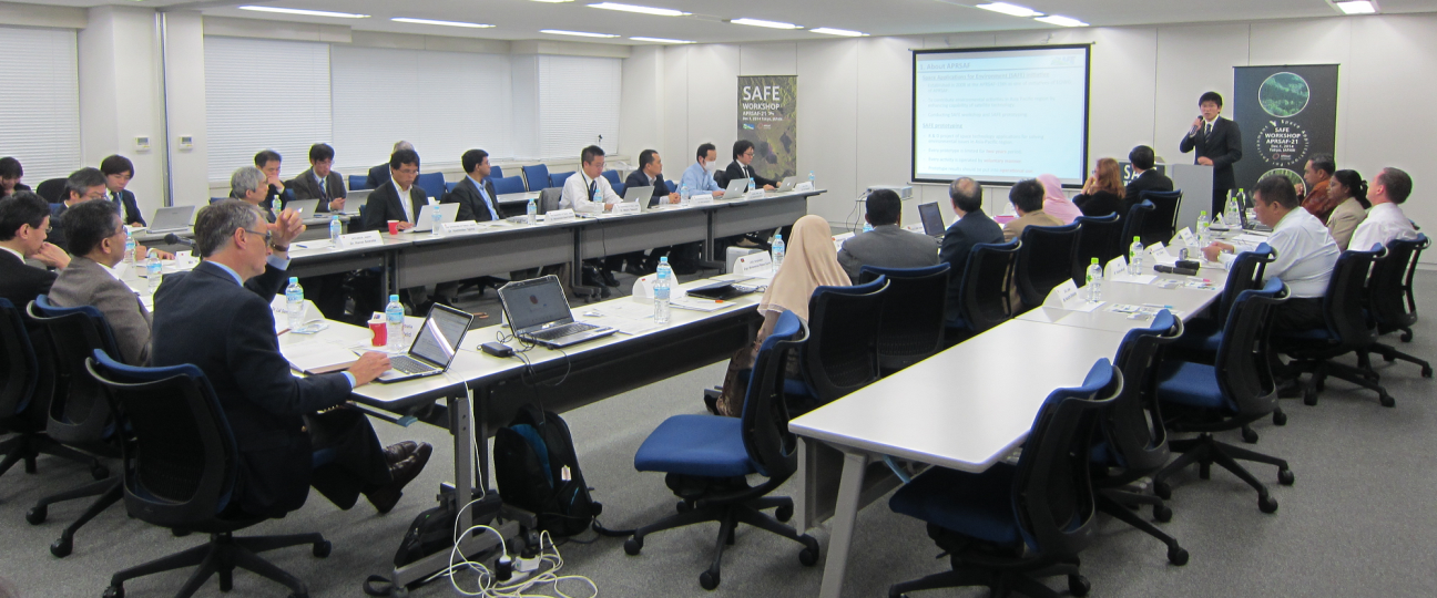
The SAFE Workshop in APRSAF21 was successfully and fruitfully completed at the Remote Sensing Technology Center of Japan (RESTEC) in Tokyo, Japan on Dec 1, 2014. After the workshop, the result was reported to the Space Applications Working Group (SAWG) and the plenary session which was held continuously from Dec 2 to 5.
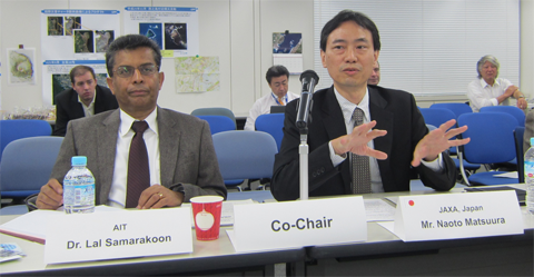
The workshop was led by co-chairs, Mr. Naoto Matsuura, Director of Earth Observation Research Center (EORC), JAXA and Dr. Lal Samarakoon, Director of Geoinformatics Center (GIC), Asian Institute of Technology (AIT). The total number of participants was 51 from several countries and international organizations including ADB.
In the workshop, 3 new SAFE prototype proposals were reviewed and the status of 5 on-going prototypes was reported. At the same time, final report of LAPAN, Indonesia (Mangrove Forest Carbon Stock Monitoring) and stakeholder meeting report of LGED, Bangladesh were presented.
The summary recommendations for the SAFE initiative arrived at the workshop is given below;
RECOMMENDATIONS
[SAFE (Space Applications For Environment)]
- To encourage making prototyping activities sustainable at local levels after the completion of their two-year activities, while expanding cooperation with relevant user organizations and development aid agencies.
- To encourage preliminary study of synergistic use of Earth observation, positioning, and communication technologies, and request to report the study results at the next APRSAF.
Workshop Report from Secretariat
- 3 new prototype proposals reviewed:
- Utilization of Remote Sensing Satellite Data for Monitoring Quality Change of Lake Ecosystem in Indonesia (LAPAN, Indonesia)
- Land Use Changes of "Trees Outside Forests" Sources in Upper Mahaweli Catchment in Sri Lanka: Using Agent Based Moadeling (University of Sri Jayewardhenapura, Sri Lanka)
- Deploying GSMaP for Decision Support in Transboundary Catchments in the Lower Mekong Basin (IKMP, MRC)
- Progress reports from on-going and completing prototypes:
- The assessment of Mangrove Forest Carbon Stock Monitoring of Indonesia using Remote Sensing Approach (LAPAN, Indonesia)
- SAR Technology Application for Paddy Crop Monitoring in Center of Paddy Area, in Indonesia (ICALRD, Indonesia)
- Monitoring of Agricultural Land Abandonment Using Remote Sensing (Universiti Putra Malaysia, Malaysia)
- Rice Crop Monitoring in the Mekong Delta, Vietnam (HCMIRG/VAST, Vietnam)
- Assessment and evaluation of erosion and sedimentation on the coast from Hai Phong to Thanh Hoa province, in Vietnam (KLORCE, VAWR, Vietnam)
- Utilizing satellite data, numerical rainfall forecasts, combining with ground observations in flood forecasting for the Thai Binh river system (NHMS/MONRE, NCHMF, Vietnam)
- Stakeholder meeting report:
- Investigation of sedimentation process and stability of the area around the cross-dams in Meghna estuary (LGED, Bangladesh)
Result of Reviewing New Proposals
-
Utilization of Remote Sensing Satellite Data for Monitoring Quality Change of Lake Ecosystem in Indonesia (LAPAN, Indonesia)
Reviving Results: Requested to Revise and submit for next opportunity.
-
Land Use Changes of "Trees Outside Forests" Sources in Upper Mahaweli Catchment in Sri Lanka: Using Agent Based Moadeling (University of Sri Jayewardhenapura, Sri Lanka)
Reviving Results: Requested to Revise and submit for next opportunity.
-
Deploying GSMaP for Decision Support in Transboundary Catchments in the Lower Mekong Basin (IKMP, MRC)
Reviving Results: Approved.
Reviewer's comments
1. Indonesia (Lake ecosystem)
- Show the role and responsibility of LAPAN in the National Lake Ecosystem of the Indonesian governmental and clearly identify the role of LAPAN in the proposed prototyping
- Need to find a strong technical support expert
2. Sri Lanka (Trees Outside Forest)
- Need to break down and explain technical aspect of using remote sensing data clearly with respect to objectives and expected outcome
- Narrow down target scope and target area with a specific end user to implement LULC changes and its interpretation by socio-economical study more integration
3. Mekong River Commission (GSMaP)
- Governments needs to be addressed so as not to hinder implementation
- Challenge to finish within two years
- Too many works for the two year period: Limit the calibration of GSMaP would be the best within 2 year
- KBDI data set and Himawari are available at U Tokyo as a drought monitoring system to cover GMS countries supported by ADB. This is spin out from Indonesia SAFE prototype
- Information exchange among other activities will be beneficial to establish correction method
- Need listing of end user agencies in each country in the Mekong river, suggest using Himawari data for surface temp measurement
Progress report and results on Ongoing Prototypes
Completing prototyping
Indonesia (Carbon stock mangroves)
- Confirmed evaluation of existing method and development of mangrove forest mapping model; biomass and carbon stock estimation model by using remote sensing.
- Future work in LAPAN including accuracy improve etc. with adding more field survey after completing SAFE prototyping
- Finished validation need to be done elsewhere before becoming a standard method of mangrove mapping for entire
- Need further investigation using more data and diverse
- Spectral analysis will continue to support the biomass estimation models for each mangrove species
- Develop the standard method for use in the mangrove biomass extraction information using RS data (based on space act No.21/2013; LAPAN has a responsible to standardize a method to deliver to line agencies)
- Capacity building for potential users
On-goings
1. Vietnam (Mekong Rice Crop)
- Confirm good progress
- Cosmo-Skymed, Radarsat-2, and RISAT data has all been requested
- Cultivated area maps have been developed
- JAXA rice crop estimation tool INAHOR training was held
- It is hoped to use SCANSAR from ALOS-2 and Sentinel-1 to cover the whole delta
- Stakeholder meeting: PLANNING
- Look forward to having C/L/X comparison study and correlation study between NDVI and backscattering for phenology
- Comment / Suggestion: Propose to extend the research until the end of 2015 (APRSAF22) to finish C/L/X comparison using CSK, Radarsat-2 and ALOS-2, Sentinel-1
2. Indonesia (Paddy Crop Monitoring)
- Confirm good progress
- Selected Satellite based model of estimating planted, harvested area, and production of paddy in the center of paddy area validated using ground truth data
- Paddy area information at district and sub-district level of acreage, area harvested, and production of paddy derived from remote sensing data analysis in Subang with empirical model
- JAXA rice crop estimation tool INAHOR training was held
- Field verification have been ongoing with radarsat-2 observation
- Growing stage classification is done with ENVI/IPB
- SDMS from Bogor test is ongoing but there is still problem of Internet connection
- Comment / Suggestion;
- Propose to extend the research with Java, south Kalimantan until the end of 2015 (APRSAF22) to finish X/C/L comparison using Radarsat-2 and ALOS-2, Sentinel-1.
- Need to consider about how to handle huge data to be in operation with cloud computing.
3. Malaysia (Abandoned Lands)
- Confirm good progress
- Phenology matrix for differentiation: Completed
- Identification and automated mapping of abandoned agricultural field: Completed
- Capacity for identifying & mapping abandoned agricultural: Completed
- Fields by RS data: Ongoing
- Training: PLANNING (February, 2015)
- Stakeholder meeting: PLANNING (April, 2015)
- Rule based classification vs. conventional classification
- Need the latest SAR data - PALSAR2 usage
- Need to improve accuracy more than 80% to invite line agencies such as Department of Agriculture, FELCRA, in operational use
- Comment / Suggestion: Coordinate PALSAR2 usage with SAFE secretariat
4. Vietnam (Erosion and sedimentation)
- Confirm good progress
- Reflection of the comments on SAFE WS@KL was done
- Kick off meeting followed by the 1st field survey (Feb. 2014)
- 2nd Field survey (July 2014) with installation of pressure sensor and collection of past tidal data, sample sand and interview
- Analyze satellite data to identify the historic and recent morphology changes ONGOING using Landsat and ALOS/PALSAR 5 years data set
- Obtain hydrodynamic data and investigate the relationship between hydrodynamic events and observed morphology change
- Apply numerical models, Propose measured bank planning and stakeholder meeting; planning
- Need the latest SAR data to estimate the latest 5 years - PALSAR2 usage, more detailed analysis of sand samples, understanding of wave climates
- Requested to conduct training program for VAWR satffs
- Comment / Suggestion: Coordinate PALSAR2 usage and training of RS with SAFE secretariat
5. Vietnam (Flood forecasting)
- Confirm good progress
- Implementation structure was established
- First meeting and field trip was held on 28 February, 2014
- Kick off meeting and first progress report was done
- IFAS deployment with GSMaP_NRT and ASTER DEM in the Thai Binh river basin and 35 stations with 6 hours interval ground observation: ONGOING
- Inflow or lateral flow by IFAS to downstream (Mike11 hydrodynamic model); ONGOING
- Set up, calibrate and verify the flood forecasting system by combining IFAS and Mike 11 for 2 regional centers
- Combining all types of rainfall in forecasting scheme
- Make supporting software programs for operational forecasting work
- Final / capacity building next April
- Comment / Suggestion: JAXA plans to improve GSMaP_NRT with data latecy from 4 hours to 1.5 hours elased within 1.5 hours delay
Stakeholder meeting report
Bangladesh (Estuarine Studies)
- Confirmed to complete sediment transport models in Meghna Estuary; evaluate performance of cross dams; evaluate impact of climate change in terms of sea level rise and amplified storm surges; carry out training/technology transfer of LGED staff; and carry out stakeholder meeting at BUET on August 6, 2014
- Integrating the results of the present research project with other ongoing research projects in the coastal region of Bangladesh for holistic planning for the future
Future collaboration of EO and QZSS
Oil Palm Precision Farming Prototyping - Malaysia
- Introduce Malaysian oil palm prototyping in SE Asia using EO and GNSS. The suggested use of EO+GNSS in oil palm planation in Malaysia in following activities;
- Develop a system to use GNSS in lining plants
- Develop a procedure and identify suitable satellite data for identifying missing trees.
- Monitor health of planed trees using EO and GNSS for better management practice.
SAFE follow up survey
- Survey 14 SAFE completed prototyping
- Propose a mechanism to promote SAFE activities with alumni and SAFE community
As a result of the workshop, prototyping line-up was updated: