Topics
New Arrival
- Jul. 6, 2026
- "ALOS-2 observations of earthquakes in Venezuela" was released.
- Jul. 3, 2026
- ALOS-2/PALSAR-2 ScanSAR data for the Earthquake in Venezuela released for free.
- May 27, 2026
- PALSAR-3 Standard Product Information (Ver May 2026) was updated.
- Apr. 30, 2026
- PALSAR global mosaic datasets from 2007 to 2010 were updated to Ver.2.6.0
- Apr. 21, 2026
- PALSAR-2 global mosaic datasets from 2015 to 2019 were updated to Ver.2.6.0
- Apr. 9, 2026
-
• PALSAR-3 Standard Product Information (Ver Apr. 2026) was updated.
• PALSAR-2 global mosaic datasets from 2020 to 2024 were updated to Ver.2.6.0 - Mar. 27, 2026
- Kyoto & Carbon Initiative, and The K&C Global Mangrove Watch was updated.
What's NEW!
- Jul. 15, 2026
- ALOS-4/PALSAR-3 Sample Products were updated.
- Jul. 14, 2026
- ALOS-2/PALSAR-2 Sample Products were updated.
- May 26, 2026
- PALSAR-3 Thematic Observation Map was uploaded.
- Apr. 7, 2026
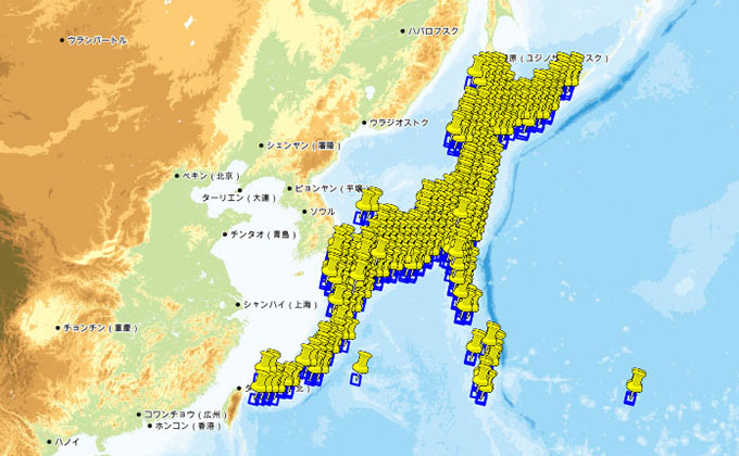
- ALOS-2 / "PALSAR-2 Observation Plan/User Guideline" was updated.(CYCLE286 ~ CYCLE302)
- Mar. 25, 2026
- ALOS-2 Weekly Observation Plan KML download service page has been closed. Could you please use AUIG4 page.
- Mar. 23, 2026
-
• PALSAR-3 map/kml of basic and thematic observation plans were updated.(Cycle44 ~ Cycle57)
• PALSAR-3 Basic Observation Mode per cycle (World/Japan) were updated. - Mar. 19, 2026
-
• ALOS-2 / "PALSAR-2 Observation Plan/User Guideline" was updated.(CYCLE307 ~ CYCLE319)
• PALSAR-2 Basic Observation Mode per cycle (World/Japan) was updated.
• ALOS-2 Basic Observation Scenario (4th Edition, Ver.A) was uploaded.
Project
-
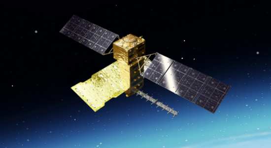
An L-band SAR mission achieving wide swath observation with high resolution, as successor of "DAICHI-2" (ALOS-2). In operation since 2024.
-
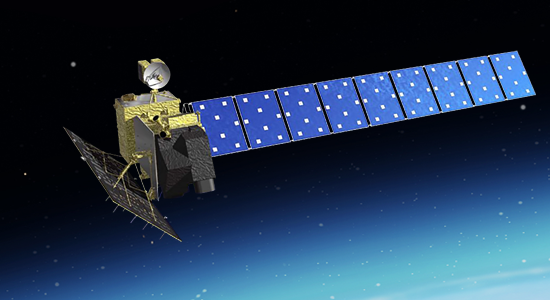
An optical mission achieving high resolution observation with wide swath, as successor of optical mission of "DAICHI" (ALOS). The launch failed on Mar. 7, 2023.
-
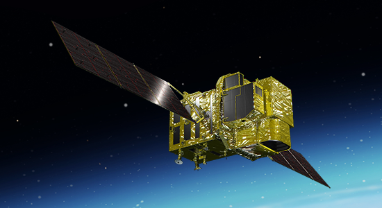
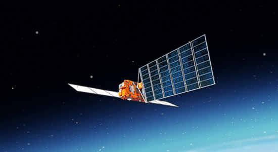
Follow-on mission of L-band SAR from "DAICHI" (ALOS), which contributes for a variety of purposes, including disaster monitoring, forest distribution, and analysis of crustal movement. In operation since 2014.
-
This project aimed to contribute various earth observation field as mapping, disaster monitoring, and resource surveying in global.
-
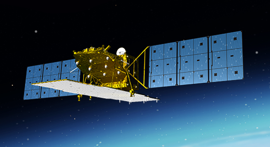
The first satellite in Japan equipped with L-band synthetic aperture radar (SAR) and stereoscopic optical instrument and observed global land area for various purposes.
Dataset
-
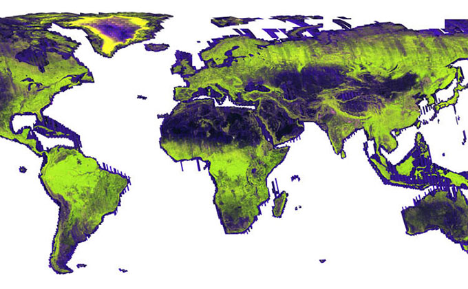
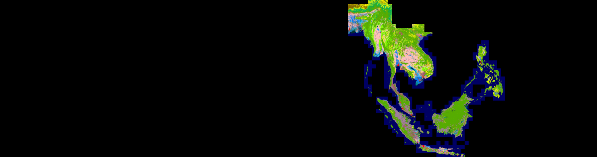
Global 25m-resolution mosaics using ALOS-2 PALSAR-2, ALOS PALSAR, and JERS-1 SAR images and global forest/non-forest maps.
-
The reference dataset for the "ALOS Kyoto and Carbon Initiative Project".
-
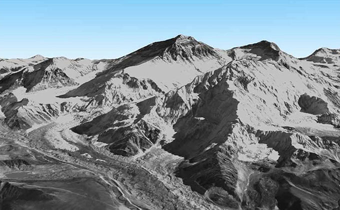
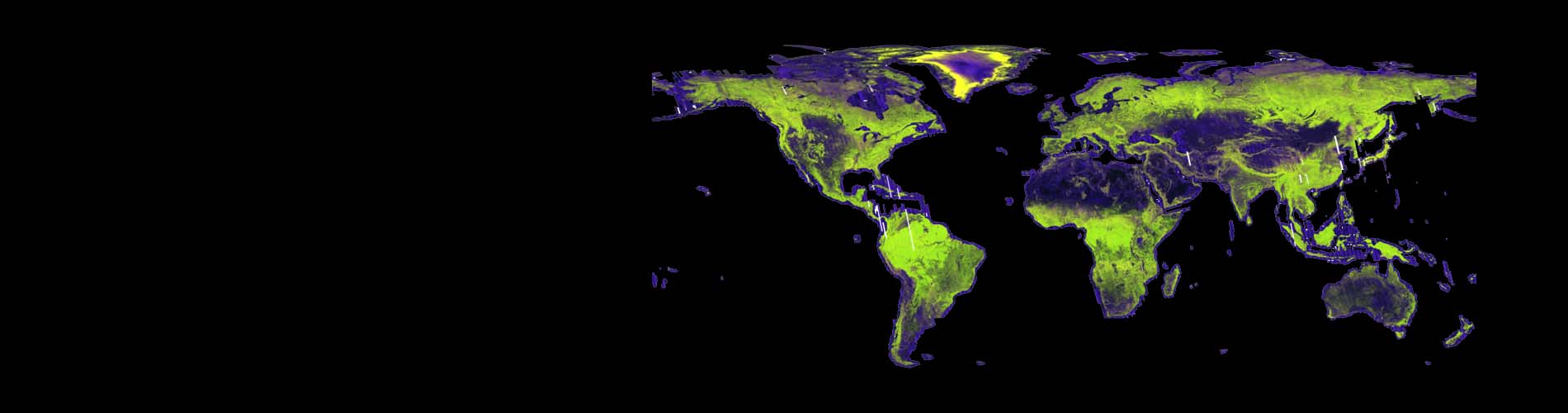
The precise global digital 3D map using ALOS PRISM. Version 3.2 of the global 30m-mesh digital surface model (DSM) is freely available.
-
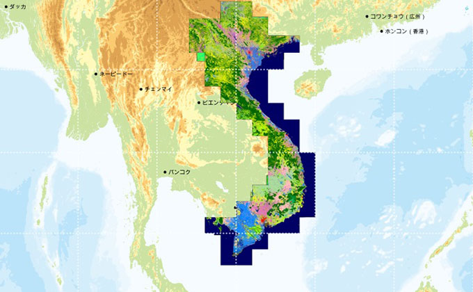
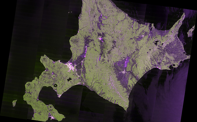
High-resolution land cover classification map dataset for Japan and Vietnam. Three temporal datasets are available for the Japan region.
-
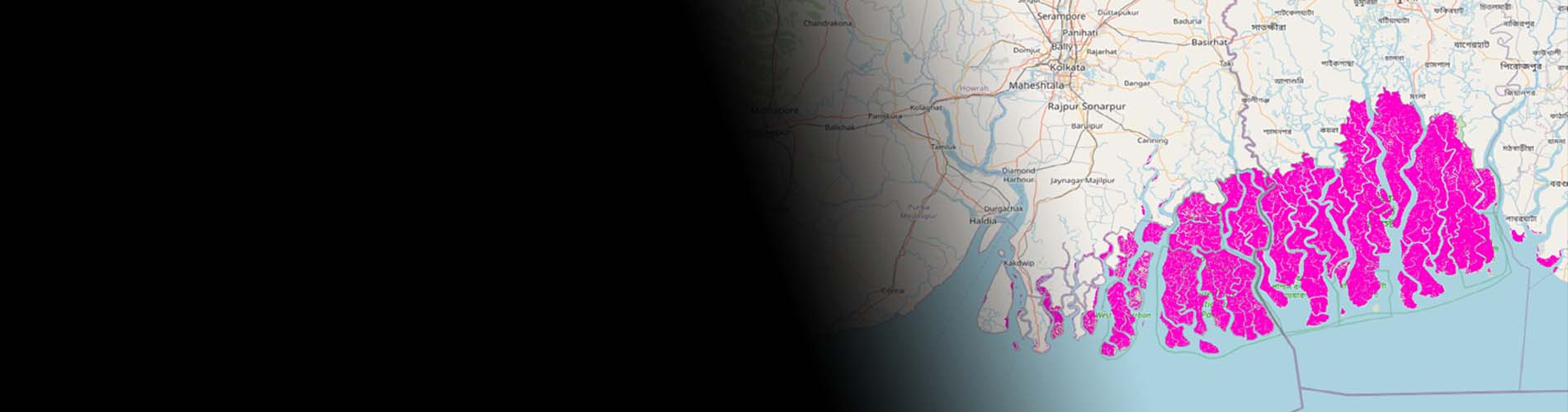
The Global Mangrove Watch (GMW) was established in 2011 under JAXA's Kyoto & Carbon Initiative.
-

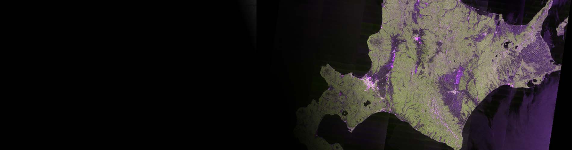
JJ-FAST is a web-based system using JAXA’s ALOS-2 to monitor tropical forests every 1.5 months and release deforestation data, even in the rainy season.
-
Ortho-rectified image products of ALOS/AVNIR-2 for the Japan region.
-
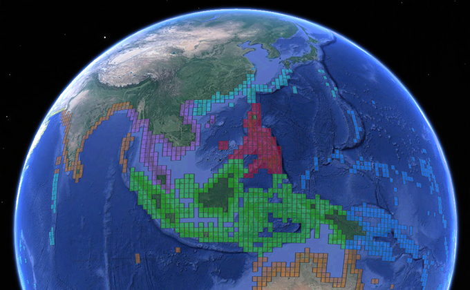
Monitoring the north and south polar regions using PALSAR for contributing "International Polar Year".
-
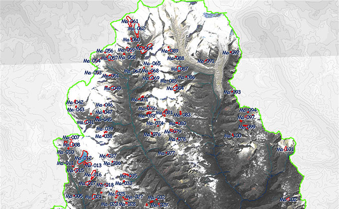
Glacial lake inventory dataset of Bhutan using AVNIR-2 and PRISM.
-
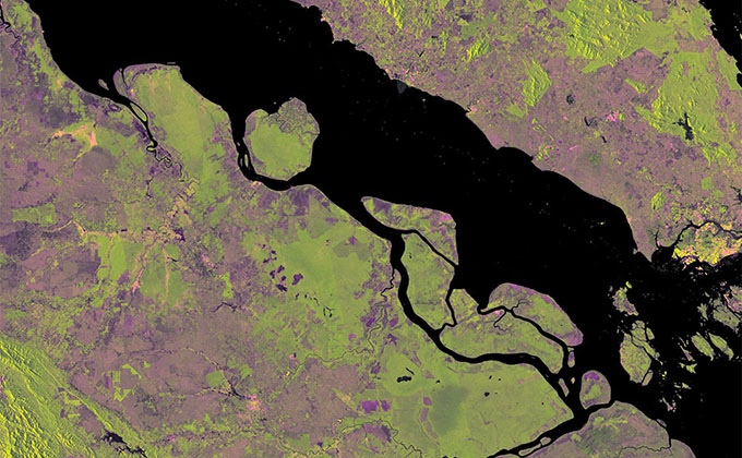
ALOS-2/PALSAR-2 scene-by-scene product with ortho-rectification and radiometric terrain correction.
-
High-resolution biomass map was generated by constructing a model using machine learning based on satellite data from ALOS-2 , the European Space Agency's Sentinel-2 optical satellite, and other data
-
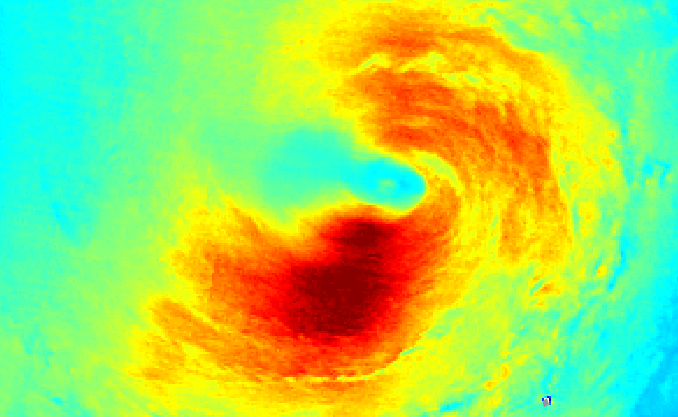 The experimental products of wind speed of past typhoons/hurricanes derived from ALOS-2 data