Image Library
Observation Result for Eruption of Semeru Volcano in Indonesia by ALOS-2
Overview
- Since December 4, 2021, Semeru Volcano in Indonesia has been erupting.
- JAXA performed an emergency observation by ALOS-2 and provided the data to organizations concerned.
- The data captured the extent of lava flow, pyroclastic flow, or lahar.
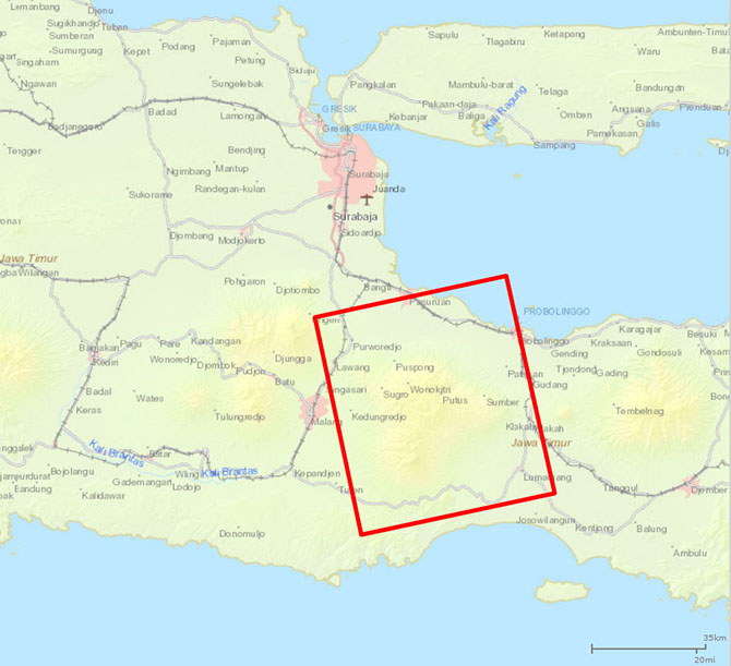
Since December 4, 2021, Semeru Volcano in Indonesia has been erupting. JAXA performed an emergency observation with the Phased Array type L-band Synthetic Aperture Radar-2 (PALSAR-2) aboard the Advanced Land Observing Satellite-2 (ALOS-2, "DAICHI-2") at 16:51 on December 5, 2021 (UT) and provided the data to organizations concerned. Figure 1 shows the observation area.

Fig.1 Observation area by ALOS-2.
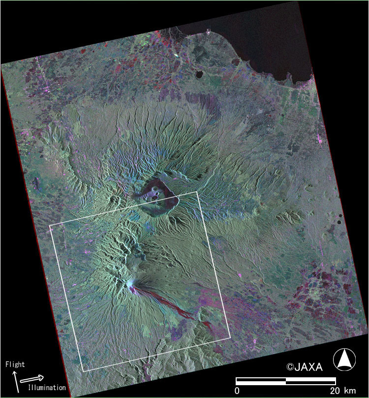
Figure 2 shows a color-composite image with HH polarization on pre-event observation (October 27, 2019) assigned to red, and with HV and HH polarizations of the emergency observation assigned to green and blue, respectively. The lava flow, pyroclastic flow, and lahar can be seen as red color in the image.
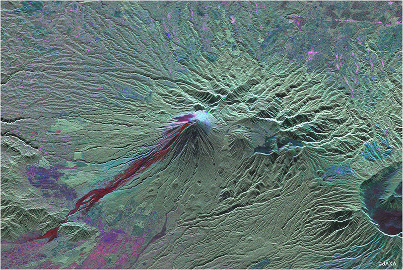
Figure 3 is a close-up image of the white rectangle area (30 kilometers square) in Figure 2. The upward direction of the image is the same direction of the satellite at the time of observation (approximately west-southwest). Based on the principle of synthetic aperture radar, this direction of the image is suitable for interpreting landform three-dimensionally.
Fig.2 Color-composite image by the data acquired before (October 27, 2019) and after (December 5, 2021) the eruption.
JAXA EORC
