Dataset
ALOS-2 Typhoon/Hurricane Sea Surface Wind Products (test release)
1. Overview
Based on the joint research with Meteorological Research Institute, Japan Meteorological Agency, JAXA aims to estimate high-resolution sea surface wind of typhoons/hurricanes, contributing to forecast accuracy improvements. This page provides experimental products of wind speed of past typhoons/hurricanes derived from ALOS-2 data. This product is under development and is experimentally released to improve its accuracy through users’ feedback and to expand its utilization.
2. About the data
This product is under development and validation and is not yet intended for operational use. The wind speed may include various errors due to sensor characteristics, ionospheric effects, and radio interference. The accuracy of this product was validated by comparing the maximum wind speed from the Japan Meteorological Agency (JMA) and the Joint Typhoon Warning Center (JTWC) [1][2] (derived from the interpolation of the best-track data at the time of ALOS-2 observation) with the maximum wind speed of this product (the maximum value from the wind speed profiles calculated at 15-degrees intervals radially from the eye of the typhoon). As a result, the root mean square error (RMSE) is found to be 7 to 10 meters (see the figures below). This validation used 11 observation cases from 2022 to 2024. Only the data observed under ALOS-2 observation conditions suitable for sea wind estimation (beam W2 and W3, with low ionospheric effects) are available, and not all typhoons/hurricanes are covered. Updates and additions to the dataset may be made irregularly.
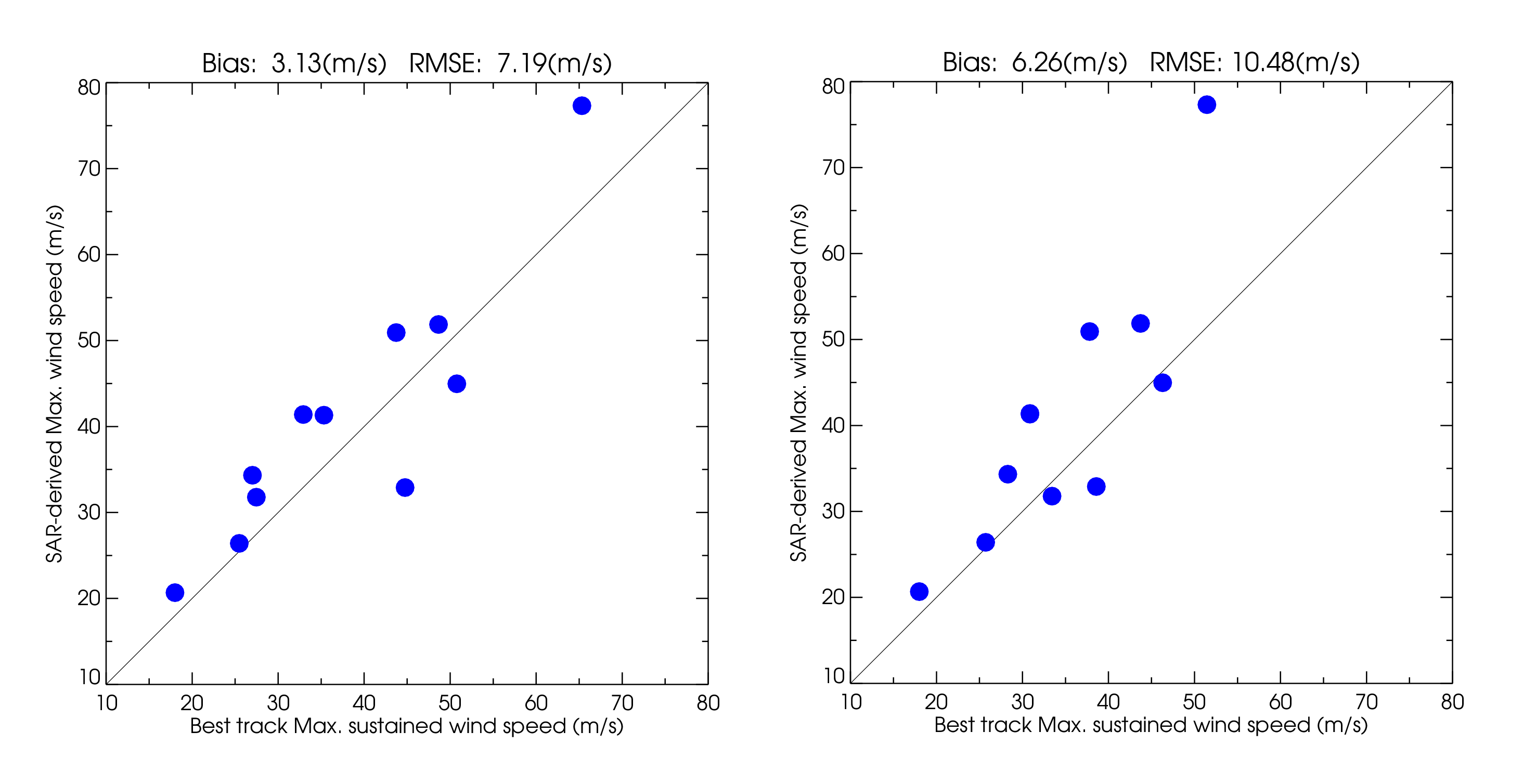
Figure: the accuracy evaluation of this product by comparing with best-track data.
Left: comparison with the best-track data by JTWC (1-minute average wind speed)
right: comparison with the best-track data by JMA (10-minute average wind speed).
3. Download
2024
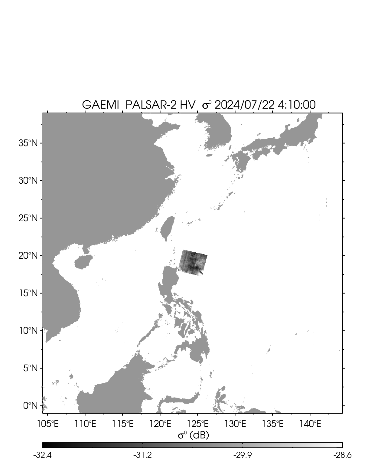
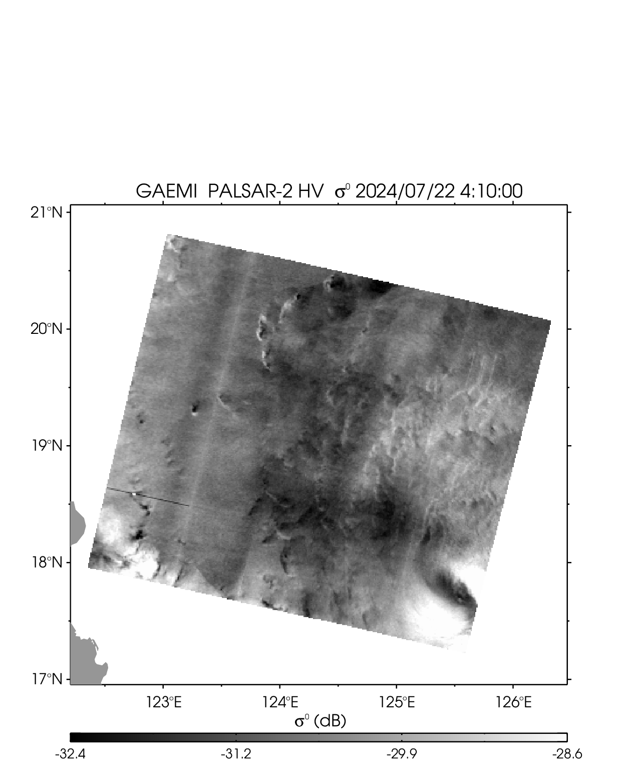
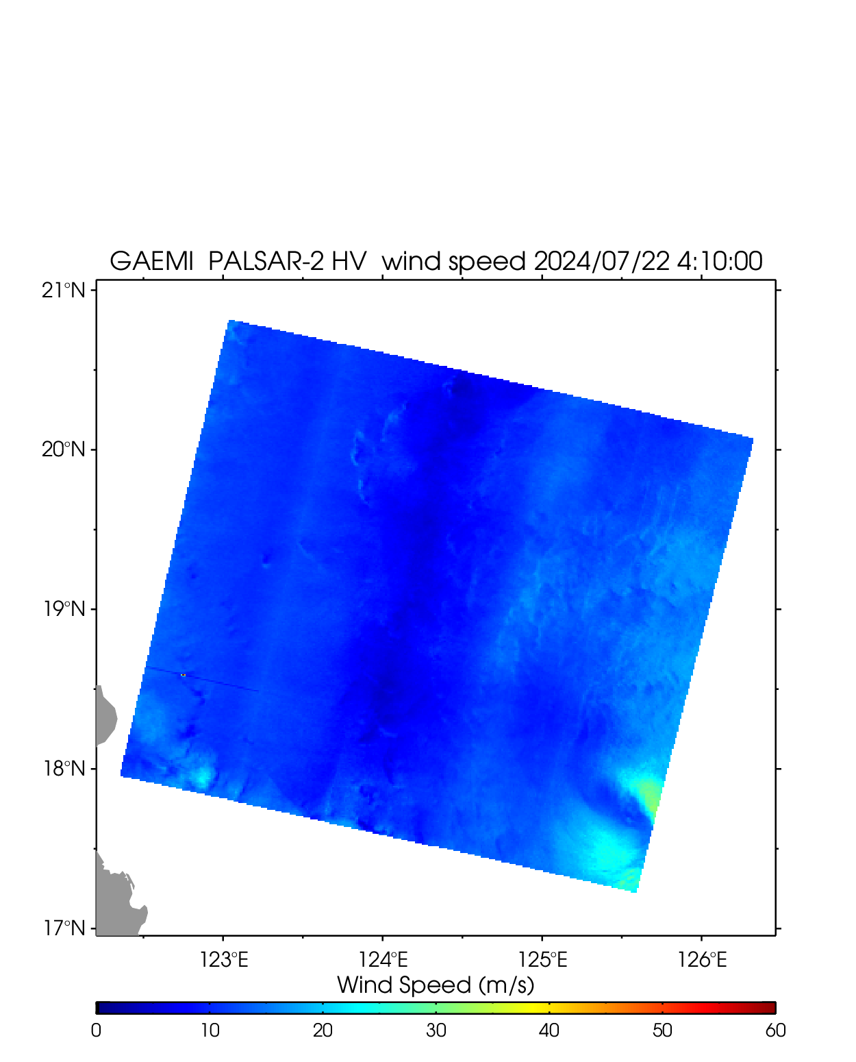
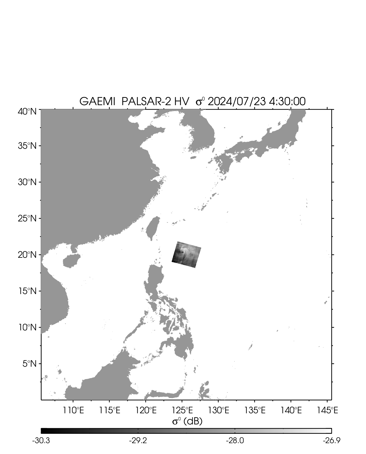
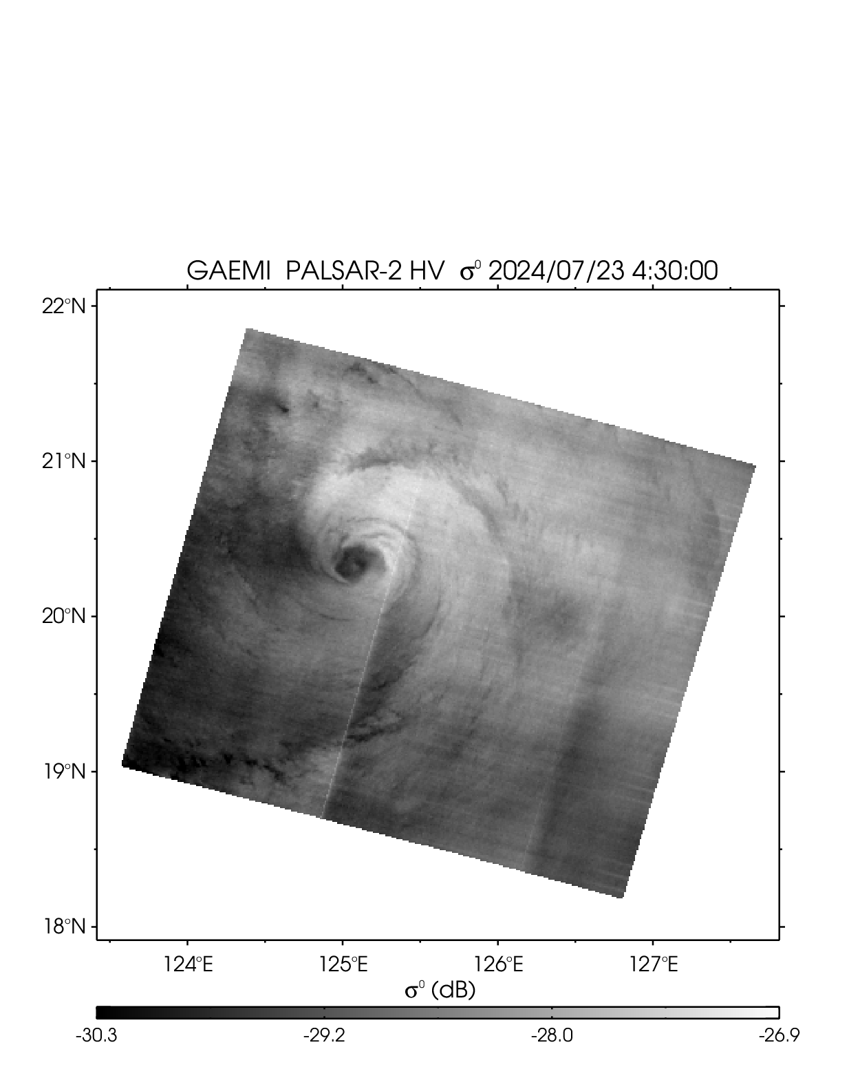
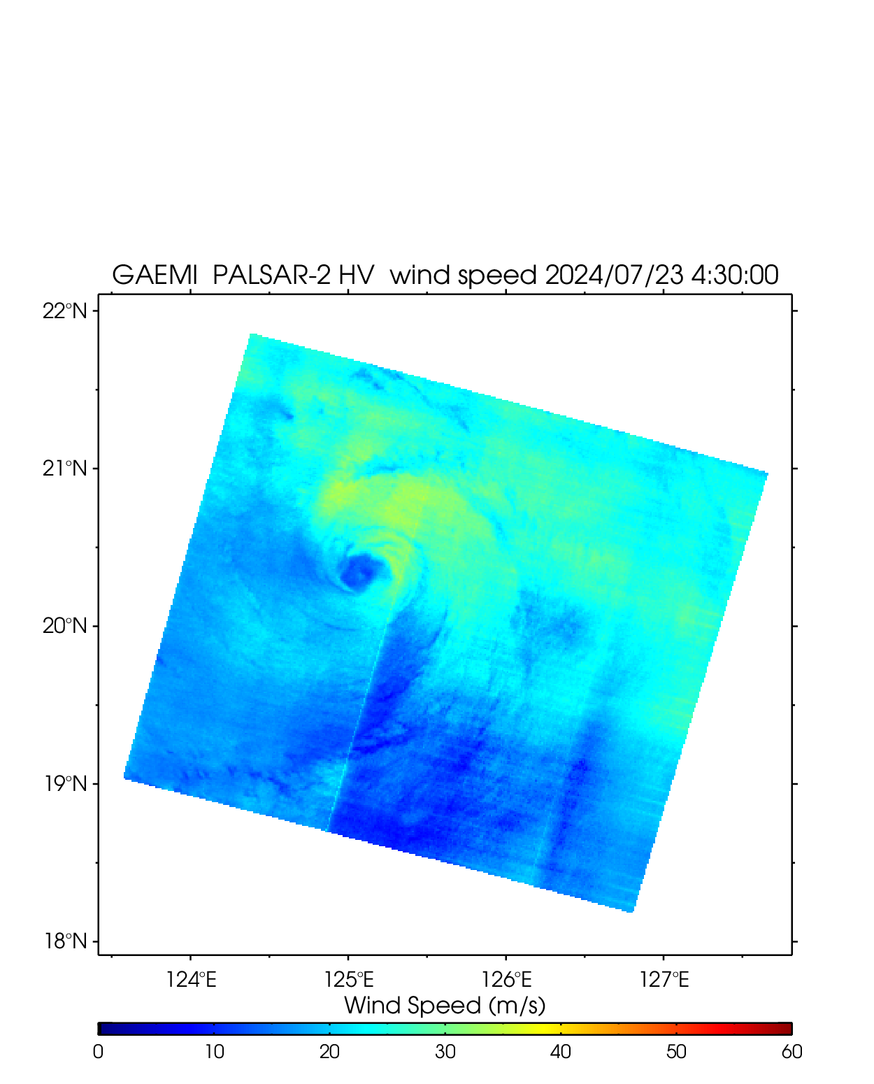
| 2403 GAEMI | ||||||||
|---|---|---|---|---|---|---|---|---|
| PALSAR-2 HV 2024-7-22 04:10 UTC | PALSAR-2 HV 2024-7-23 04:30 UTC | |||||||
 |
 |
 |
 |
 |
 |
|||
| NetCDF | NetCDF | |||||||
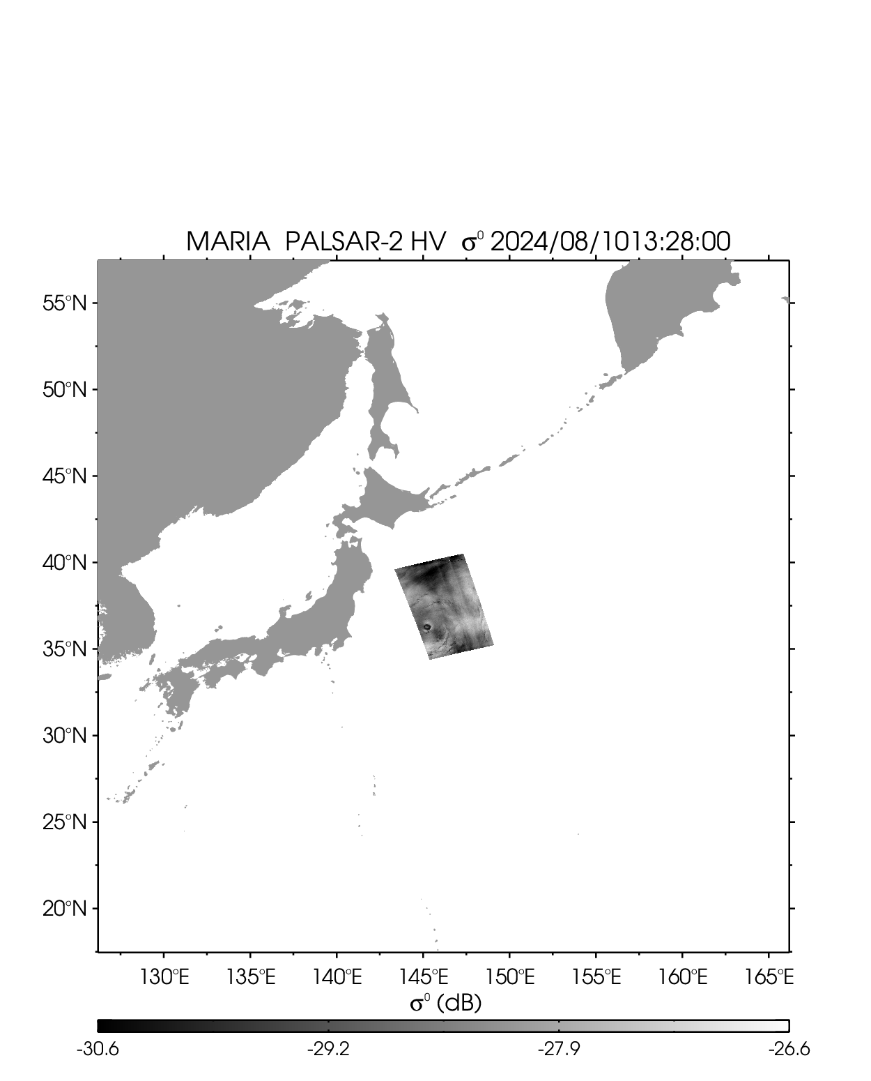
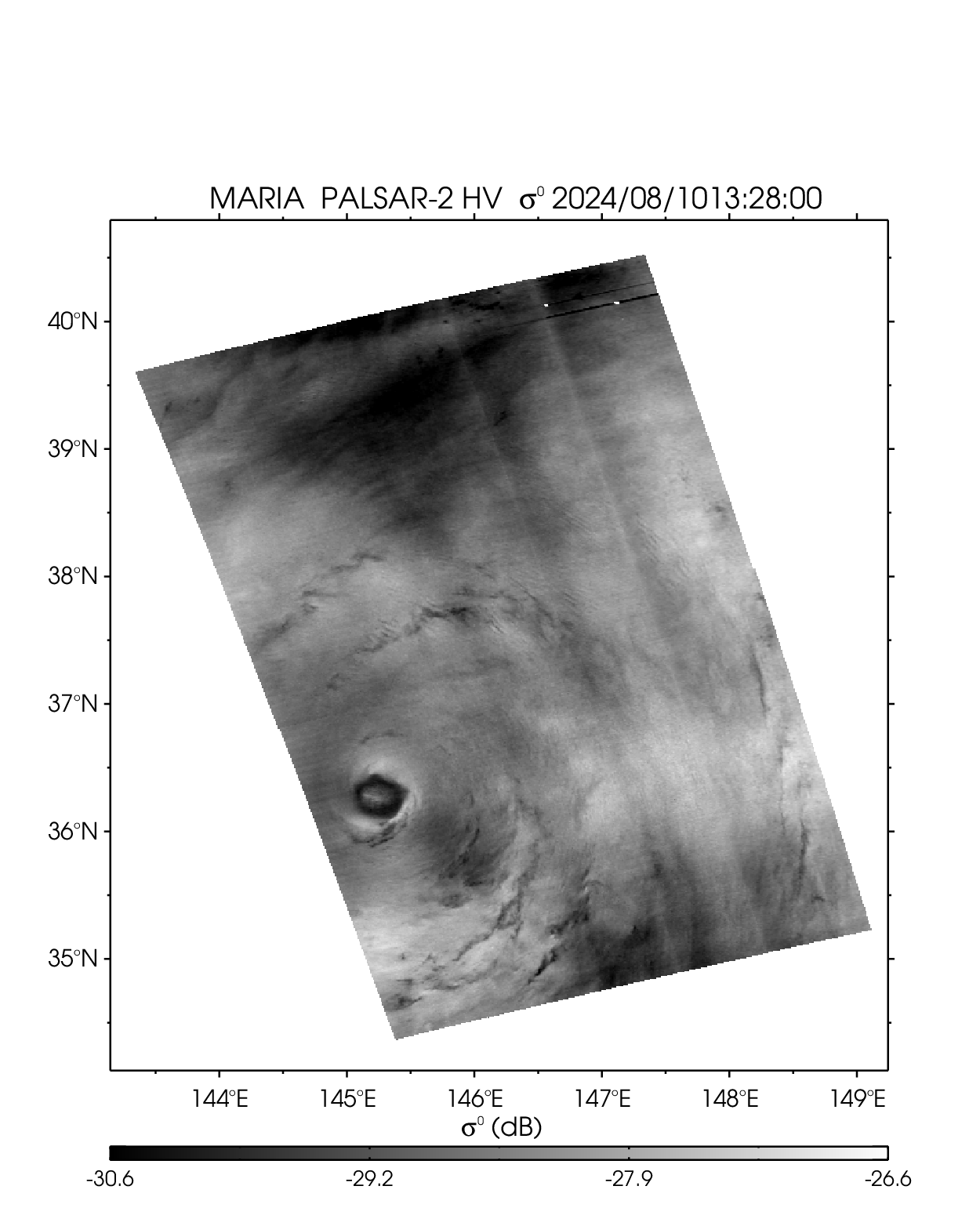
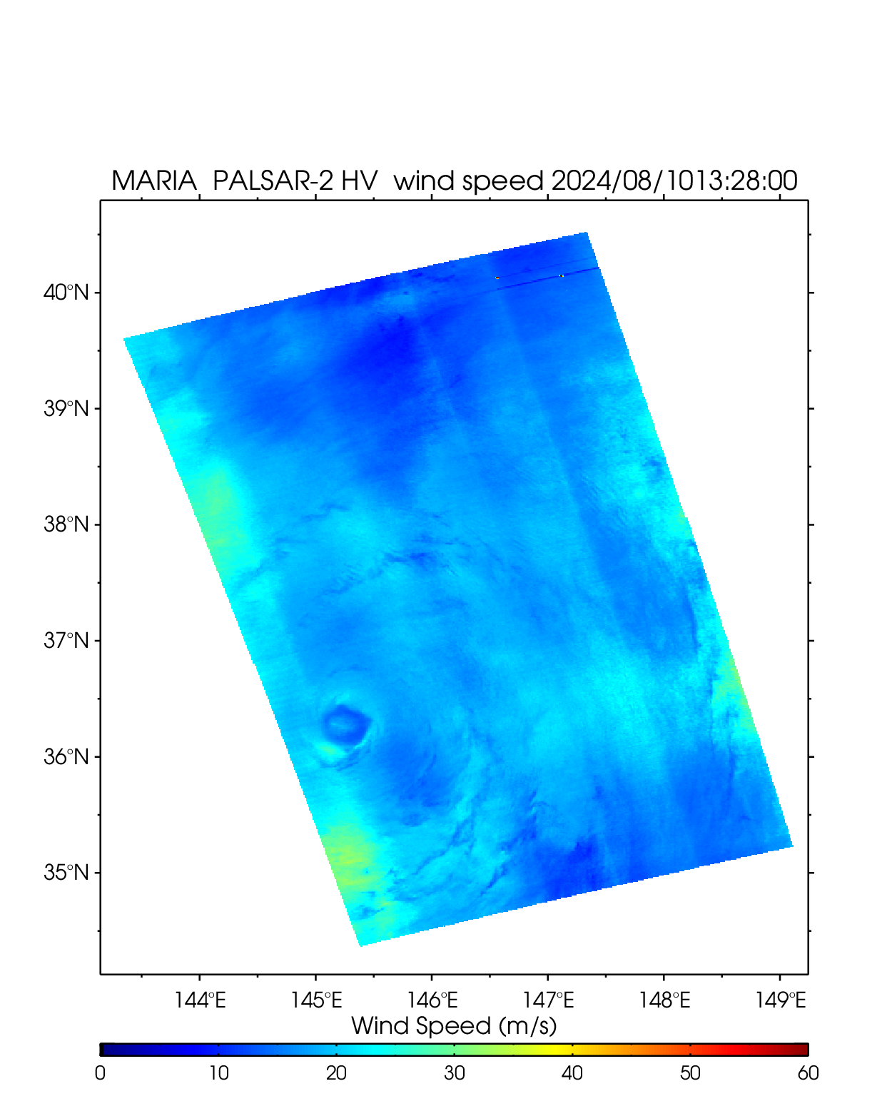
| 2405 MARIA | ||||||||
| PALSAR-2 HV 2024-8-10 04:10 UTC | ||||||||
 |
 |
 |
||||||
| NetCDF | ||||||||
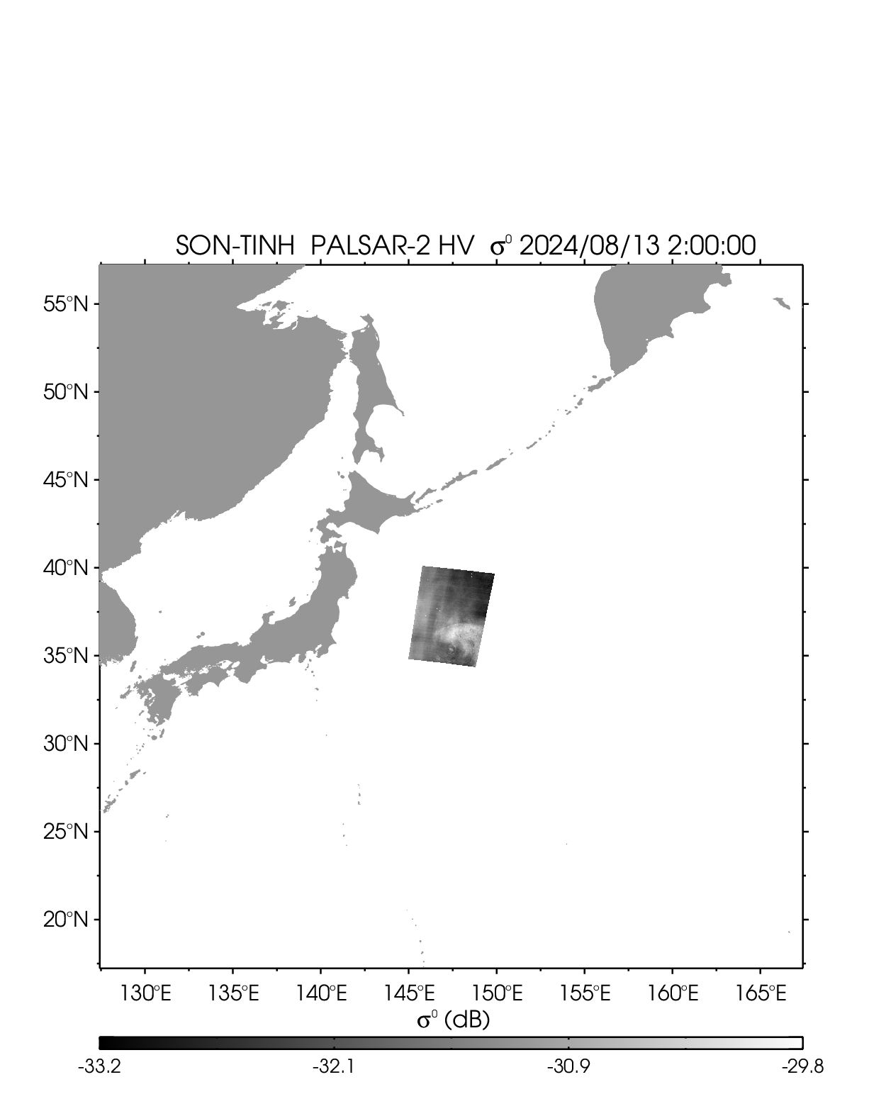
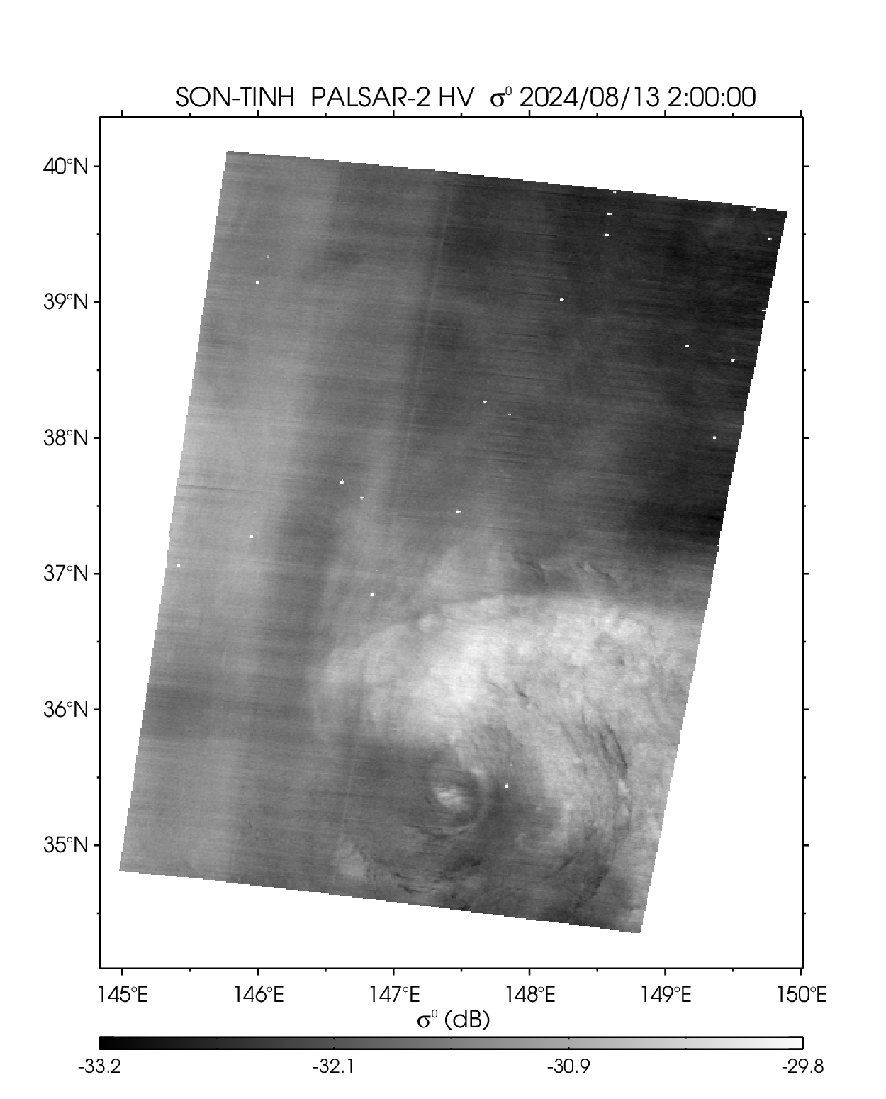
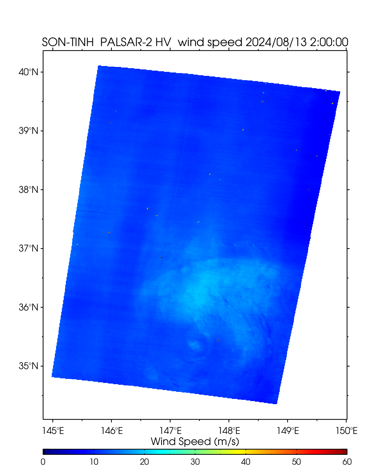
| 2406 SON-TINH | ||||||||
| PALSAR-2 HV 2024-8-13 02:00 UTC | ||||||||
 |
 |
 |
||||||
| NetCDF | ||||||||
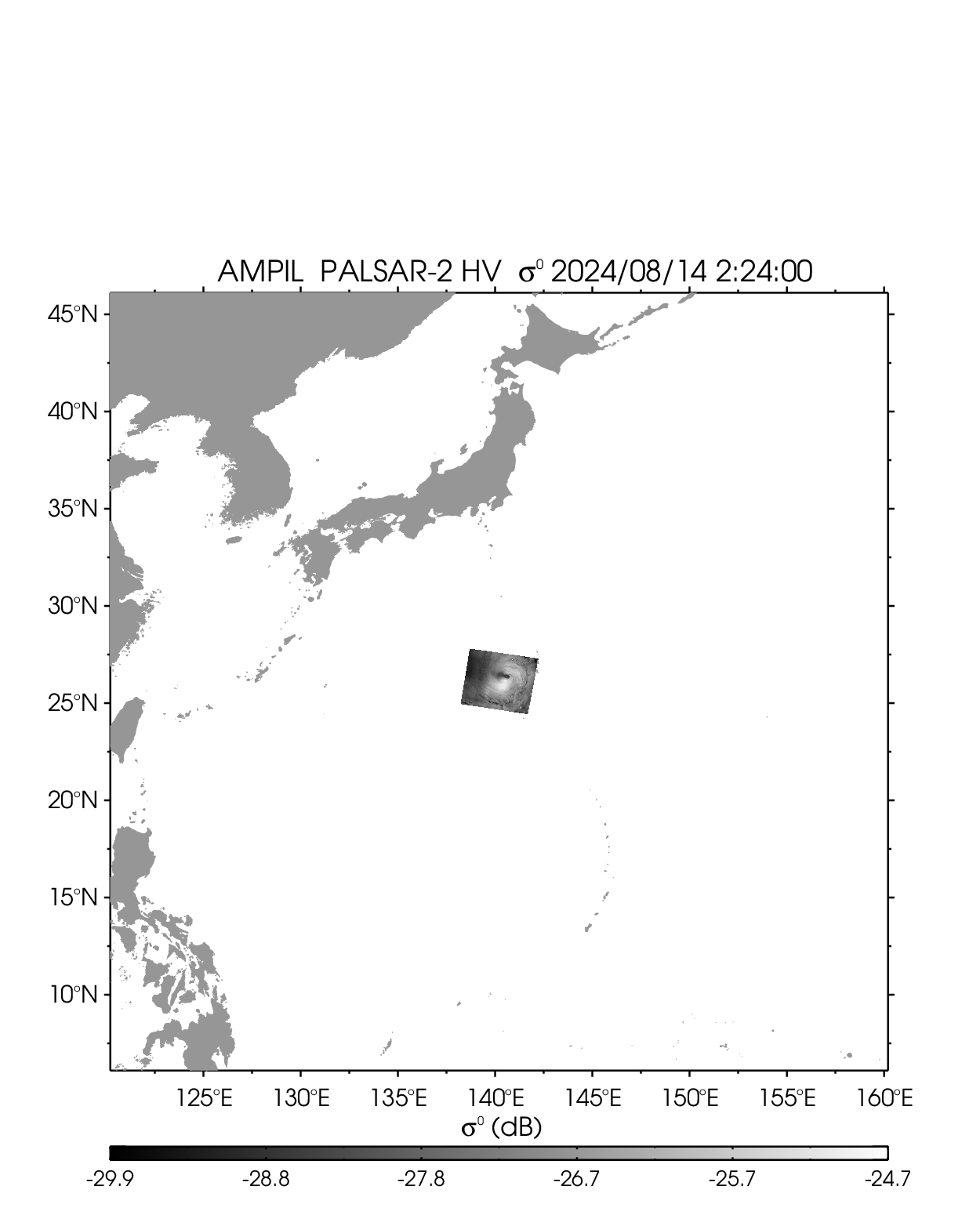
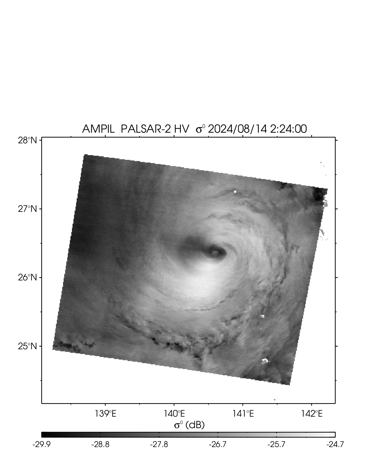
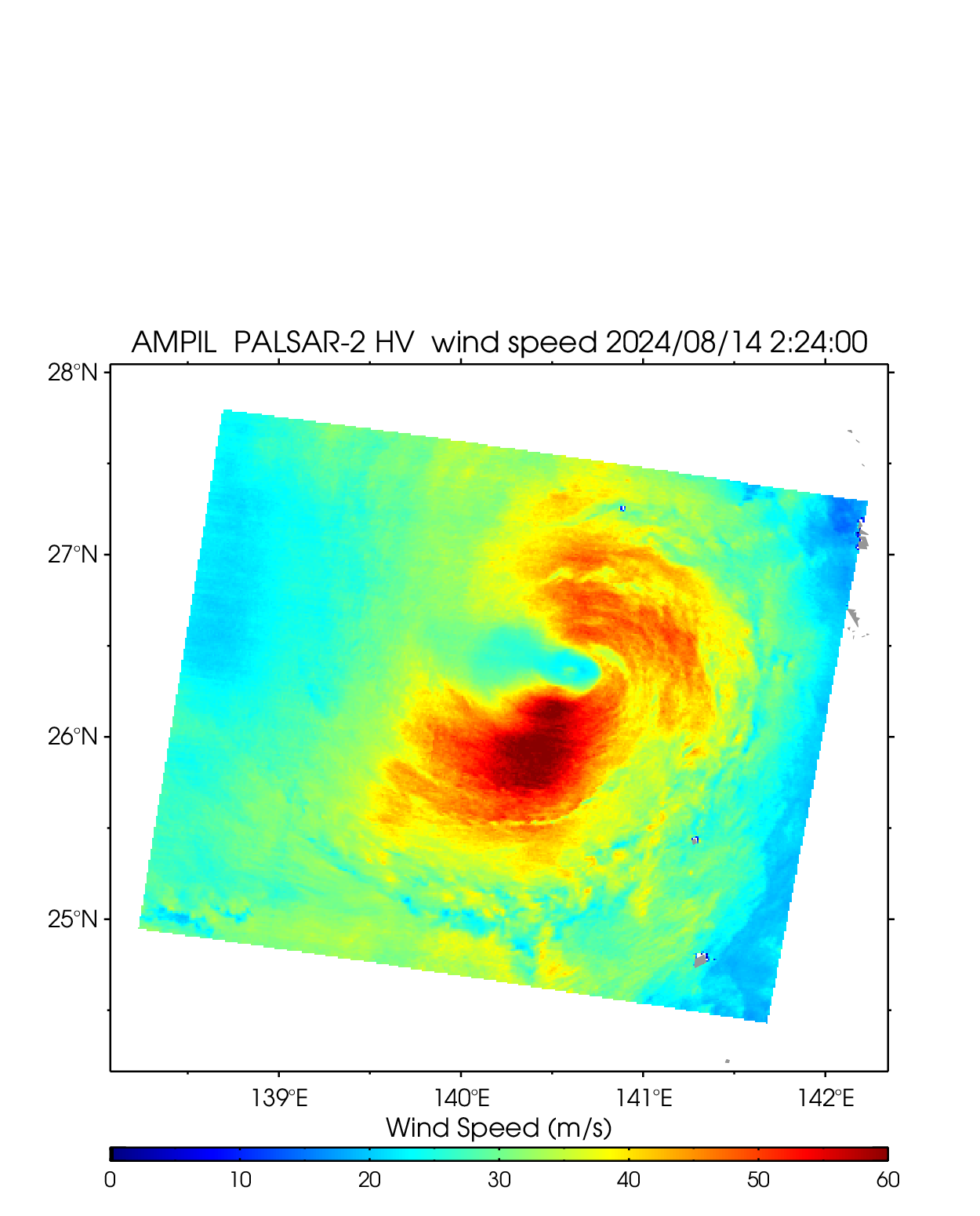
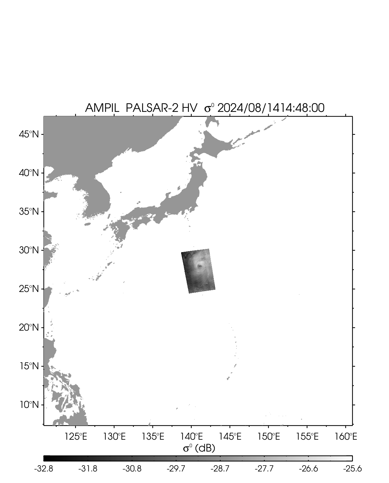
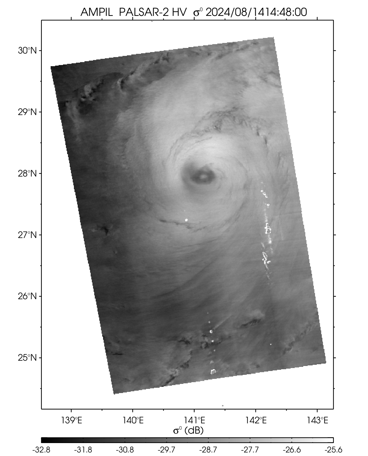
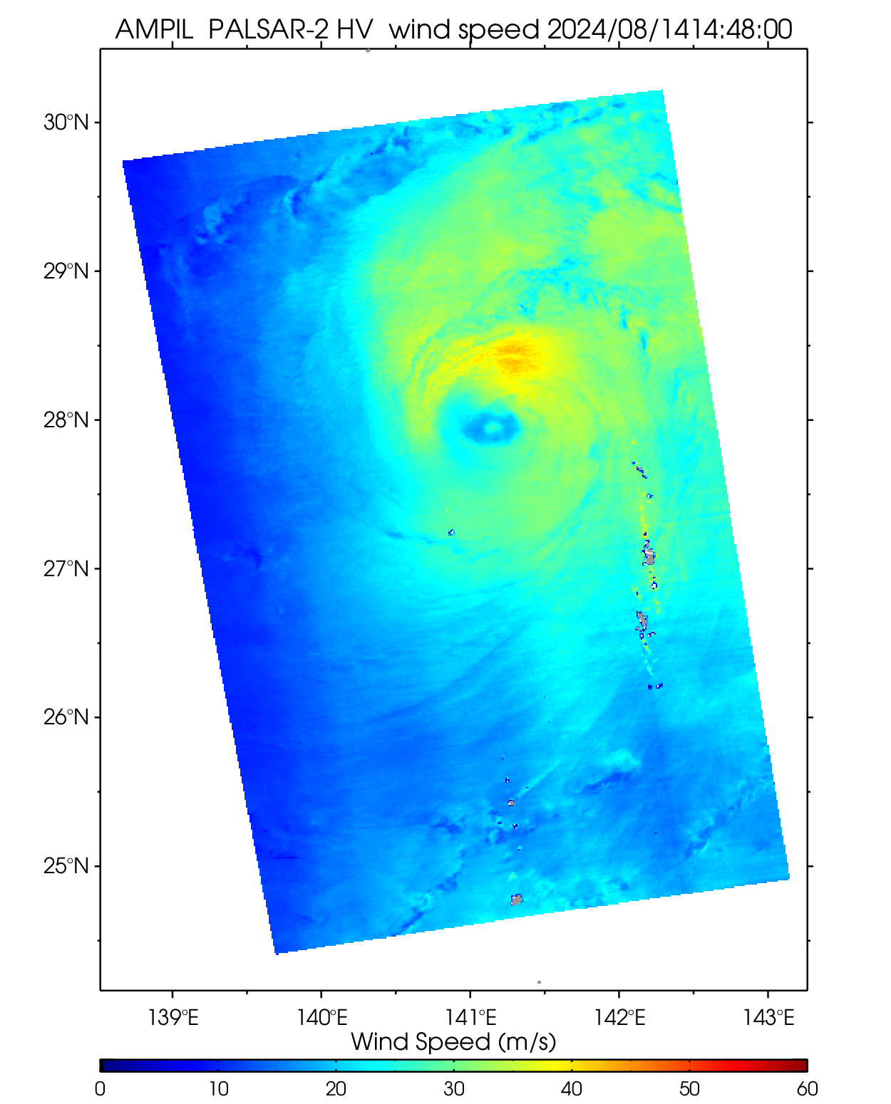
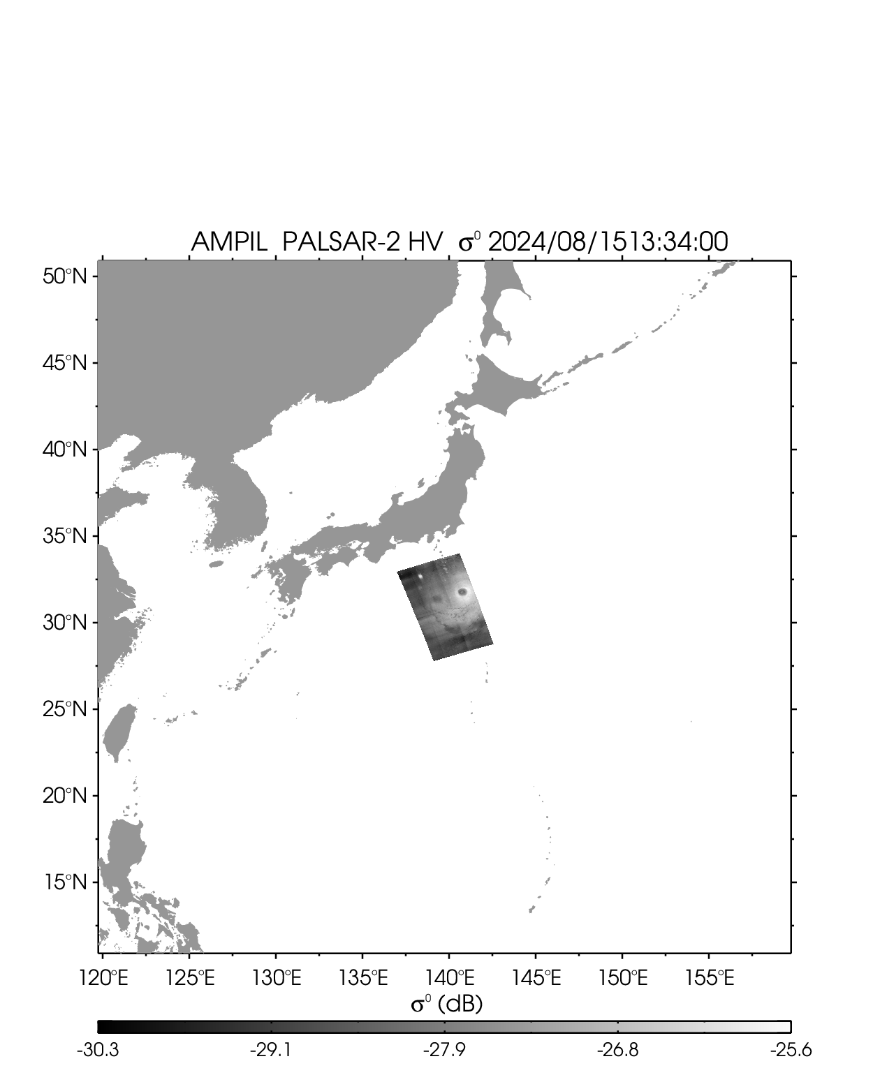
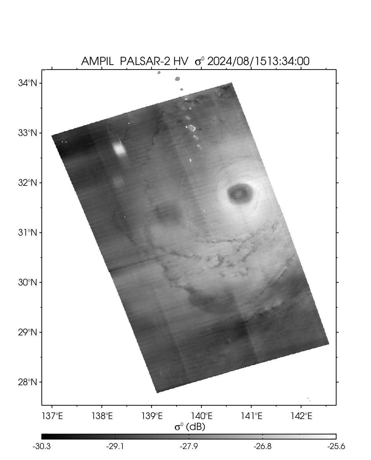
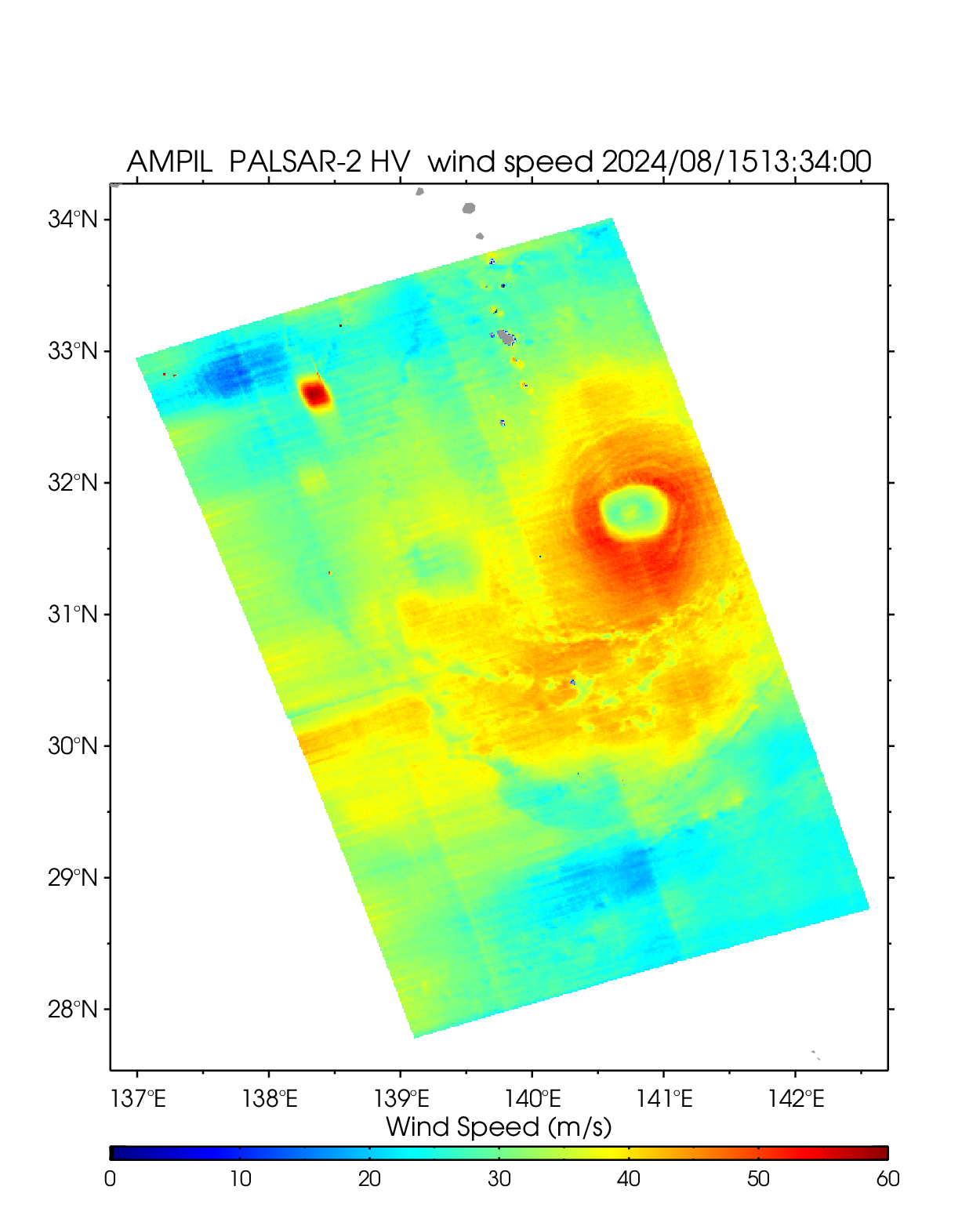
| 2407 AMPIL | ||||||||
| PALSAR-2 HV 2024-8-14 02:24 UTC | PALSAR-2 HV 2024-8-14 14:48 UTC | PALSAR-2 HV 2024-8-15 13:34 UTC | ||||||
 |
 |
 |
 |
 |
 |
 |
 |
 |
| NetCDF | NetCDF | NetCDF | ||||||
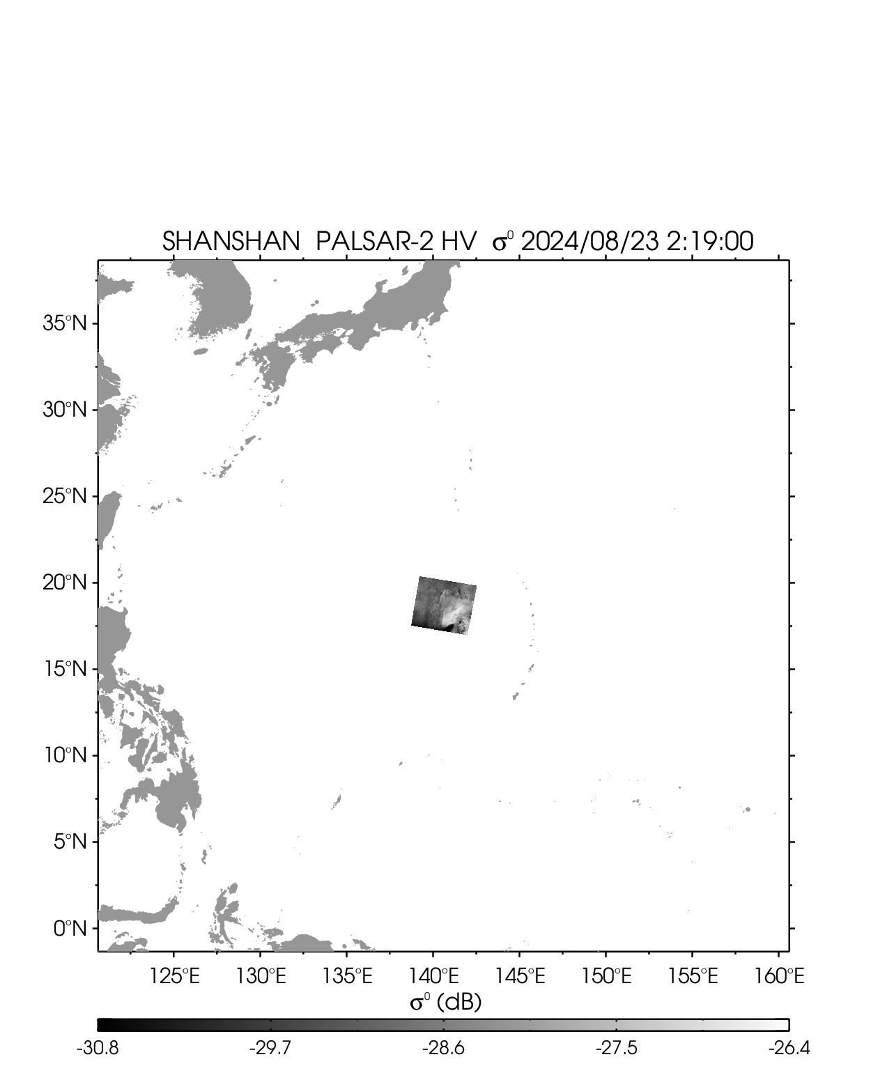
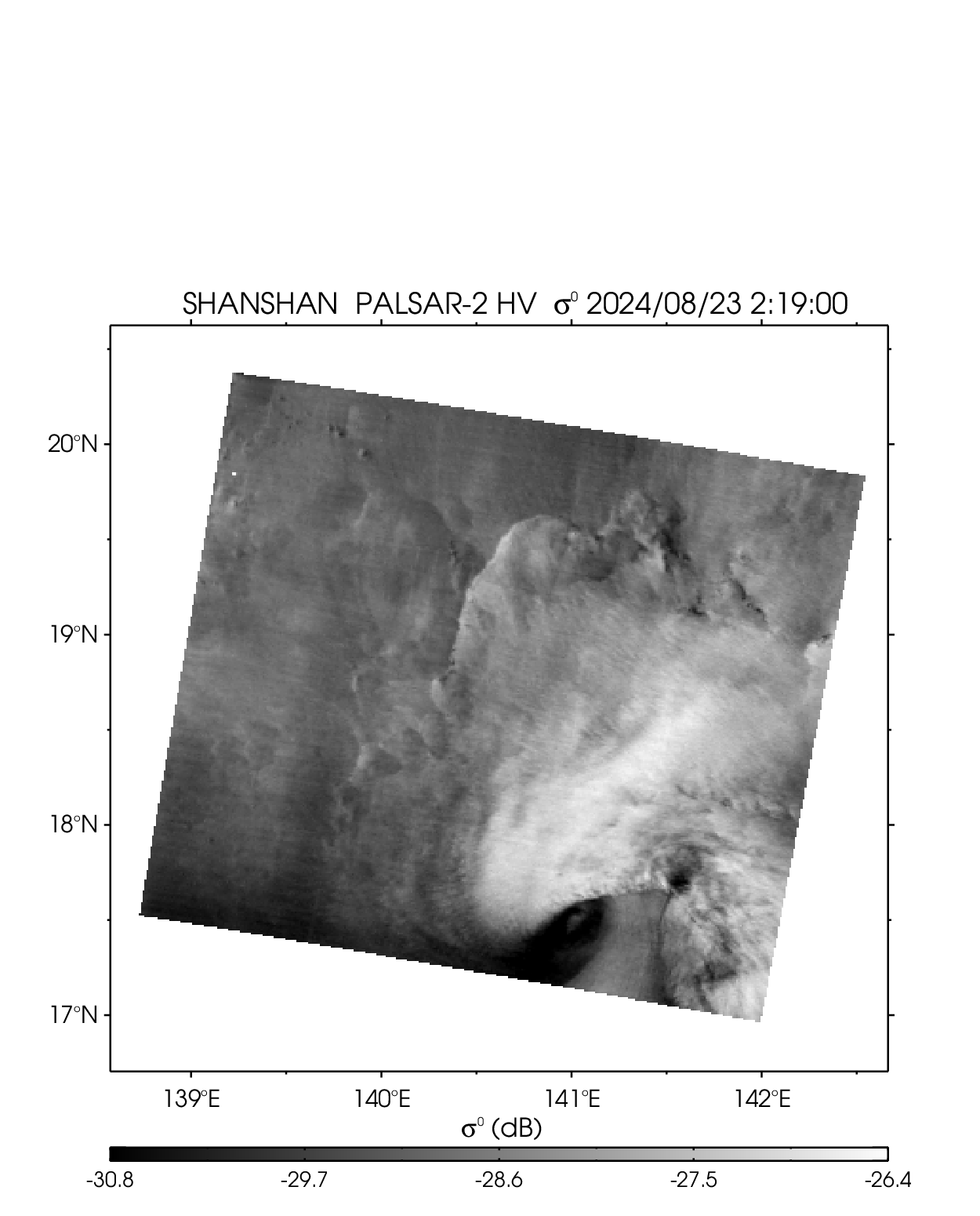
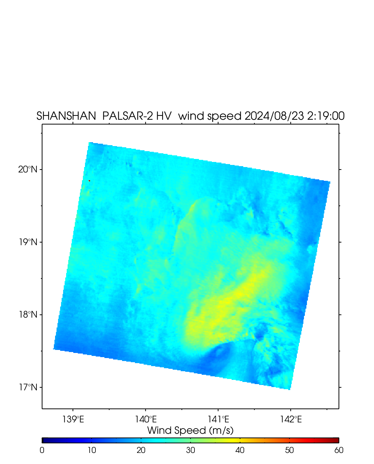
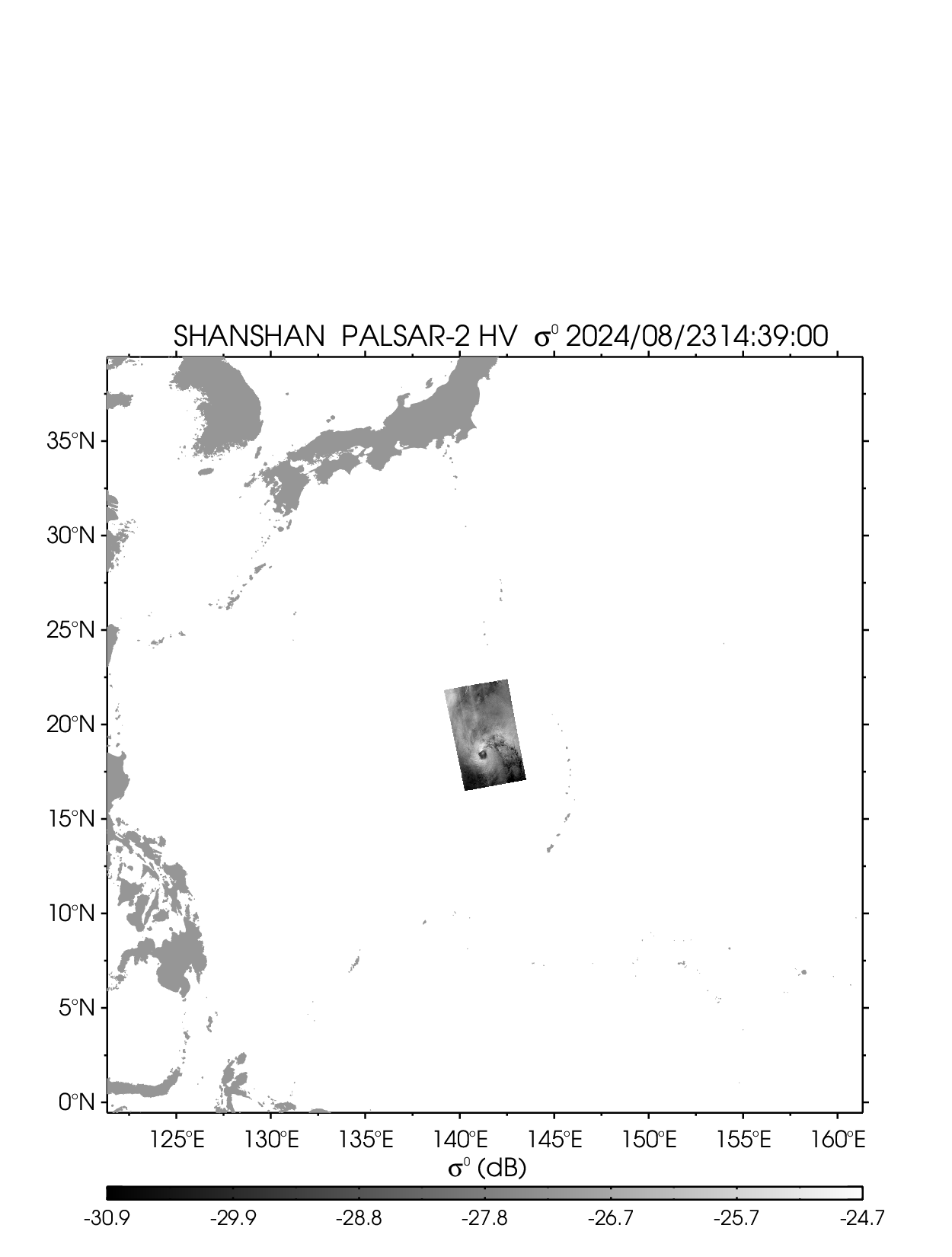
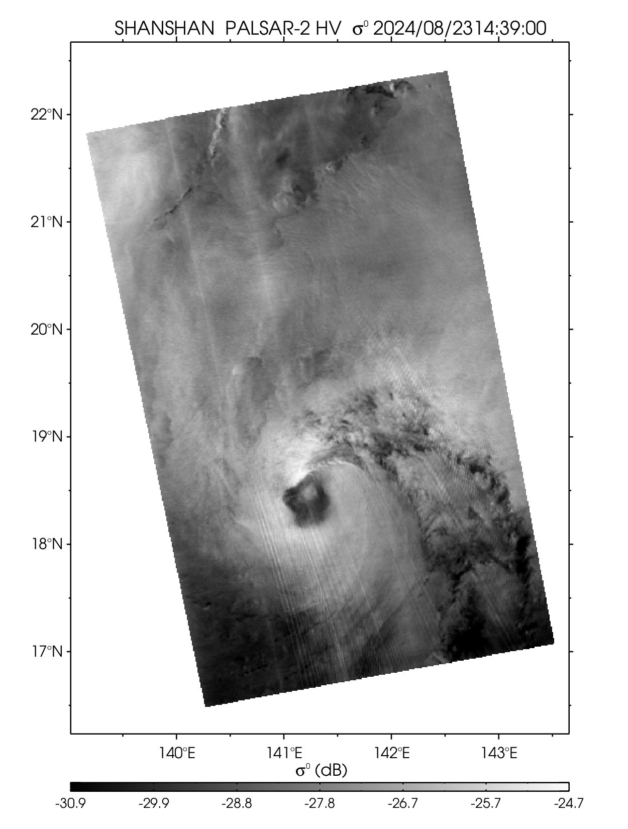
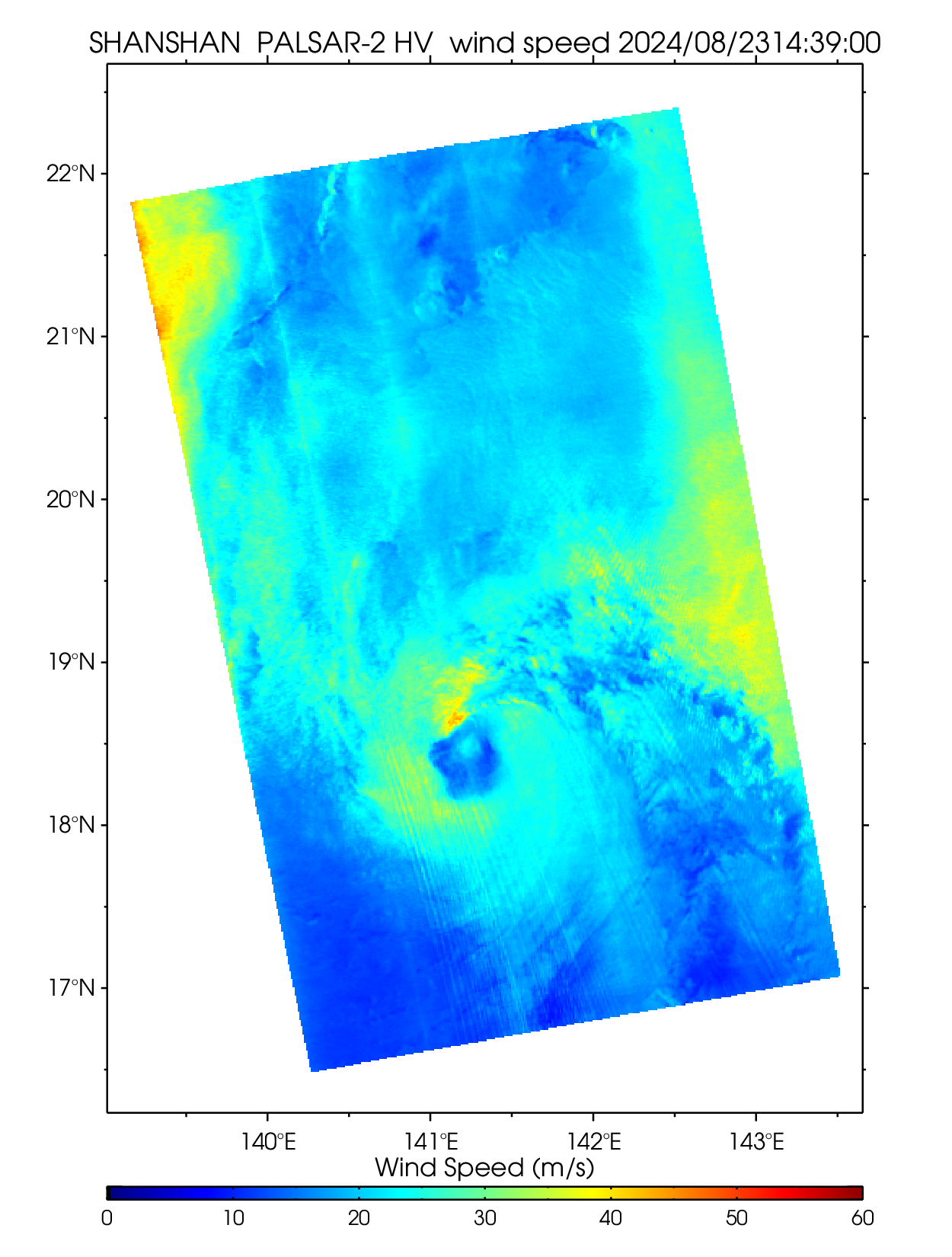
| 2410 SHANSHAN | ||||||||
| PALSAR-2 HV 2024-8-23 02:19 UTC | PALSAR-2 HV 2024-8-23 14:39 UTC | |||||||
 |
 |
 |
 |
 |
 |
|||
| NetCDF | NetCDF | |||||||
2023
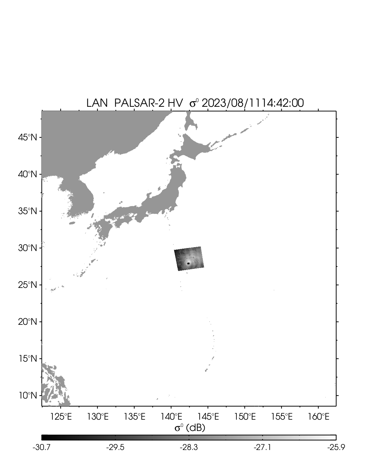
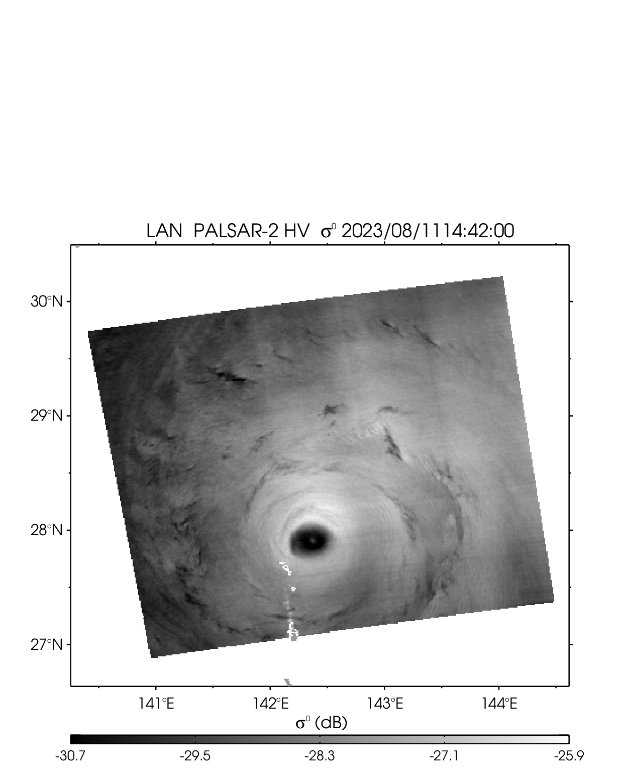
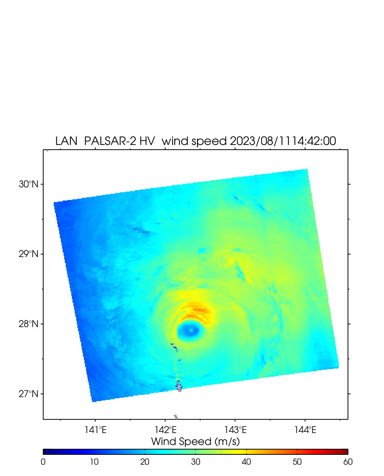
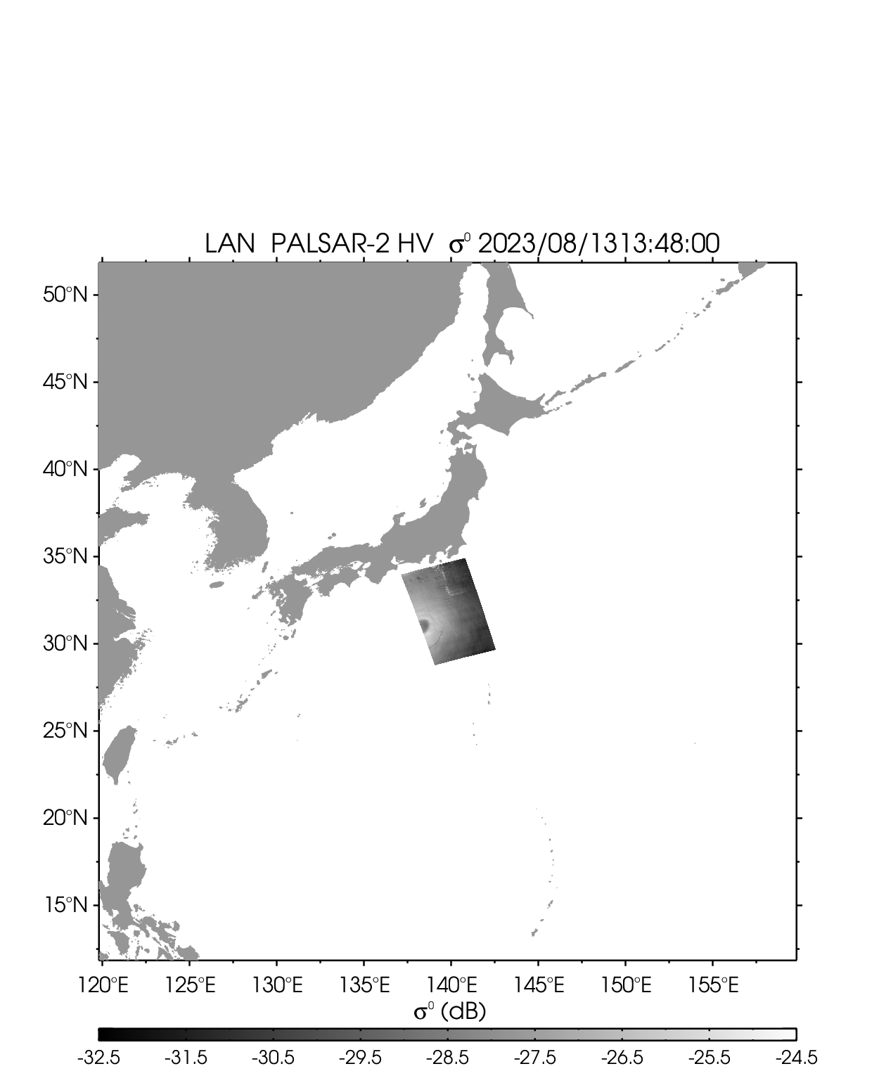
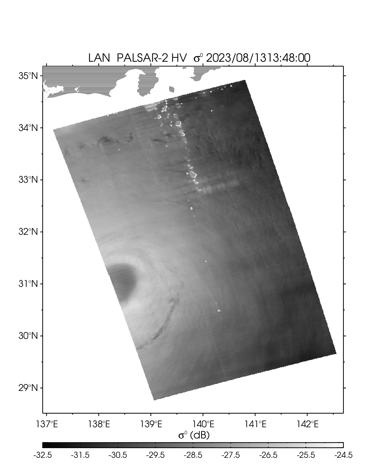
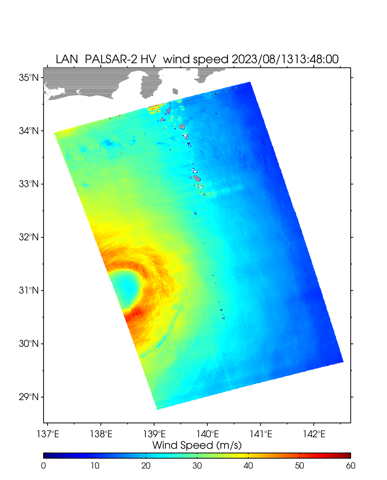
| 2307 LAN | ||||||||
|---|---|---|---|---|---|---|---|---|
| PALSAR-2 HV 2023-08-11 14:41 UTC | PALSAR-2 HV 2023-08-13 13:48 UTC | |||||||
 |
 |
 |
 |
 |
 |
|||
| NetCDF | NetCDF | |||||||
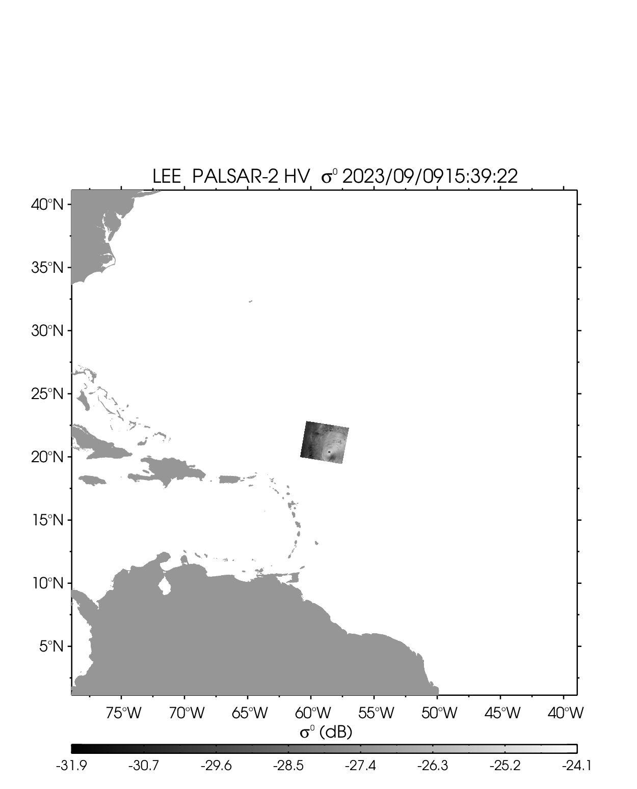
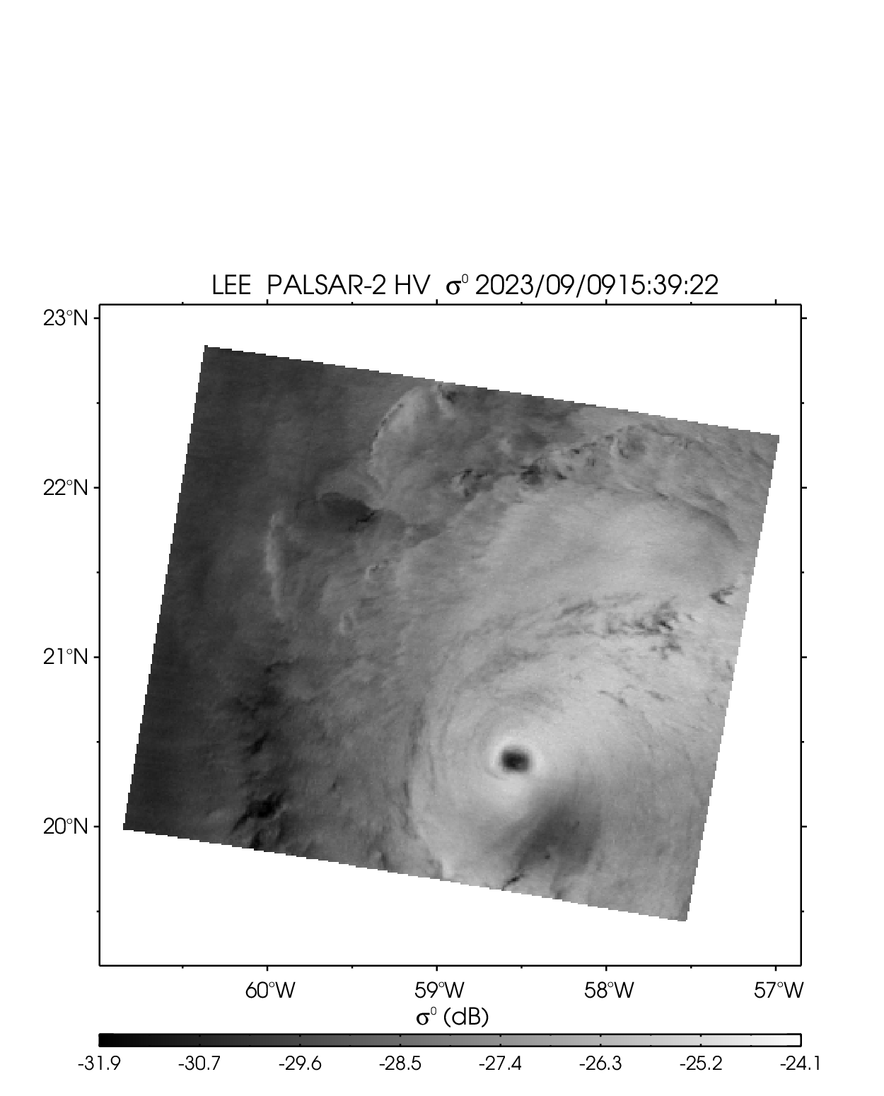
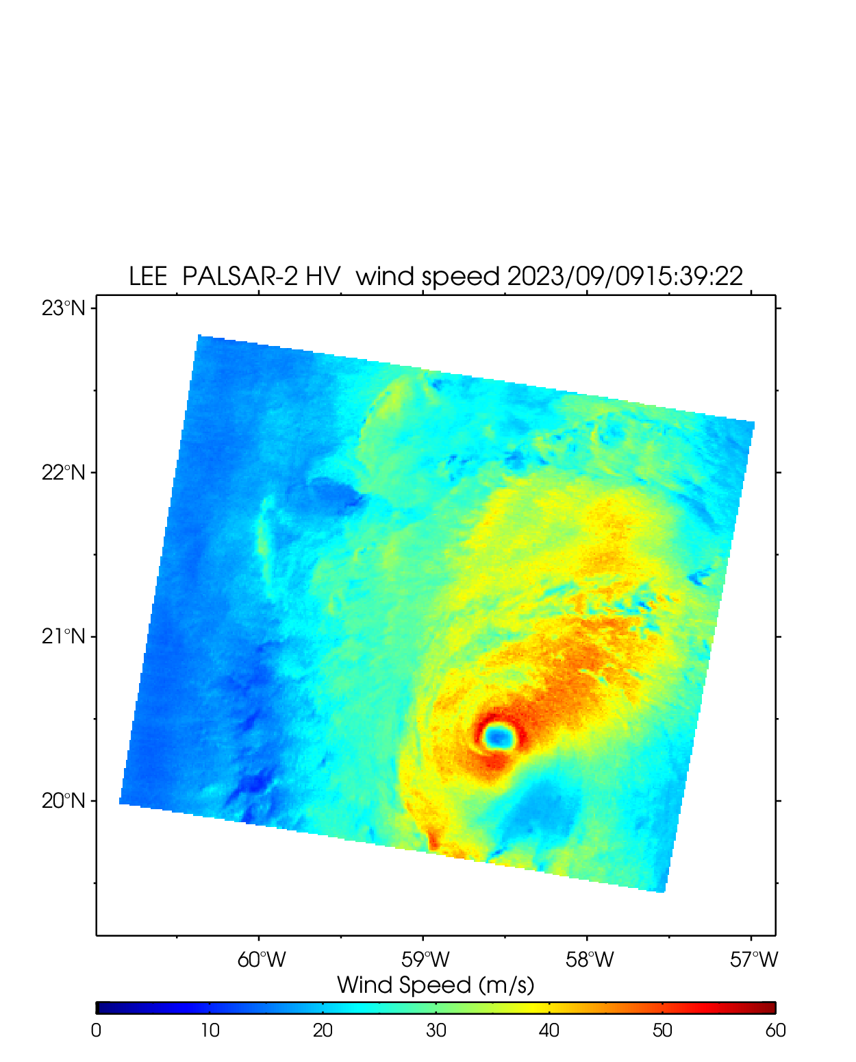
| Hurricane LEE | ||||||||
| PALSAR-2 HV 2023-09-09 15:39 UTC | ||||||||
 |
 |
 |
||||||
| NetCDF | ||||||||
2022
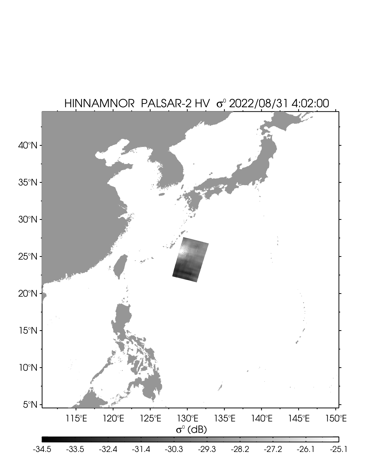
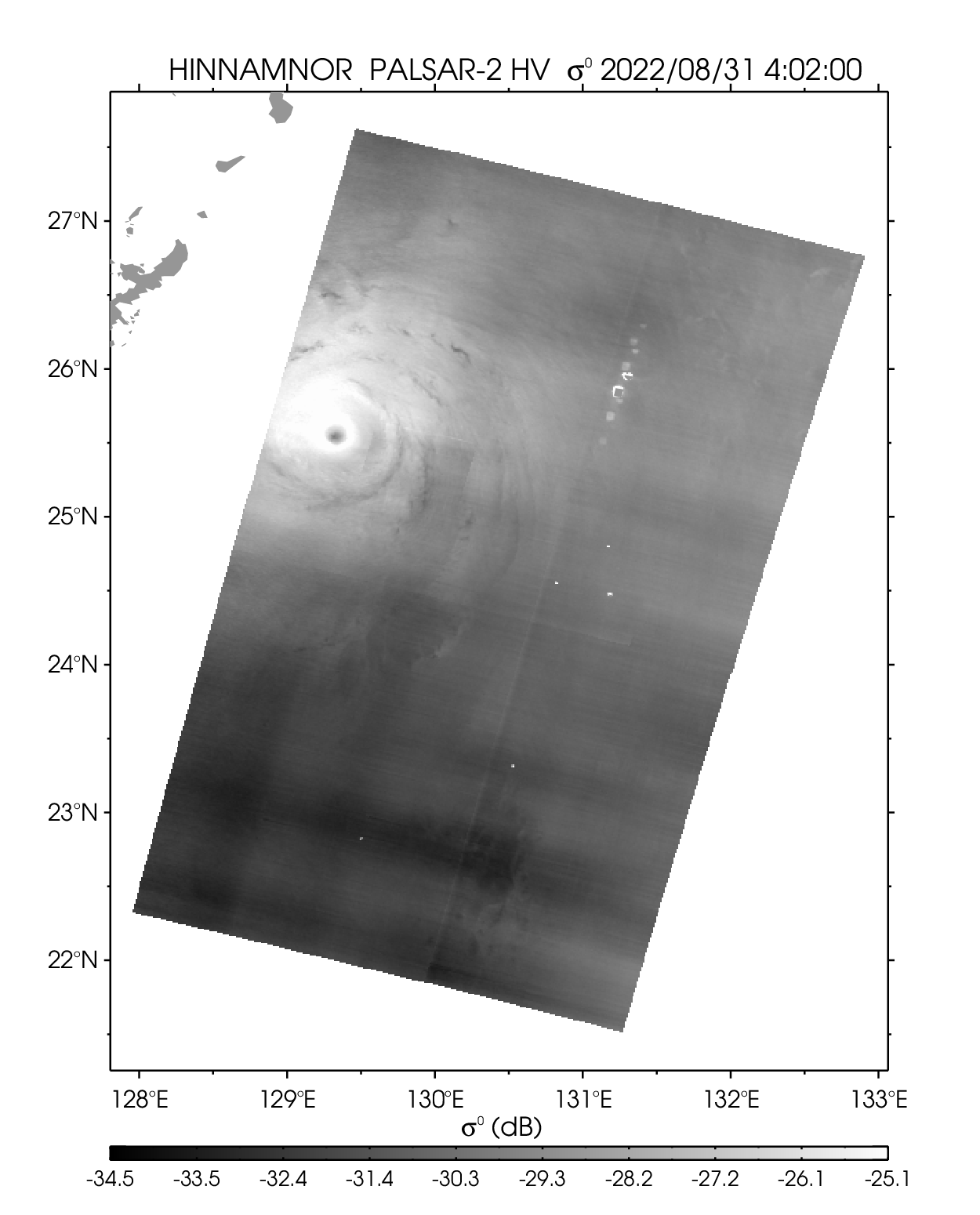
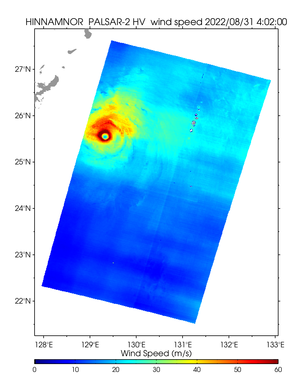
| 2211 HINNAMNOR | ||||||||
|---|---|---|---|---|---|---|---|---|
| PALSAR-2 HV 2022-08-31 04:02 UTC | ||||||||
 |
 |
 |
||||||
| NetCDF | ||||||||
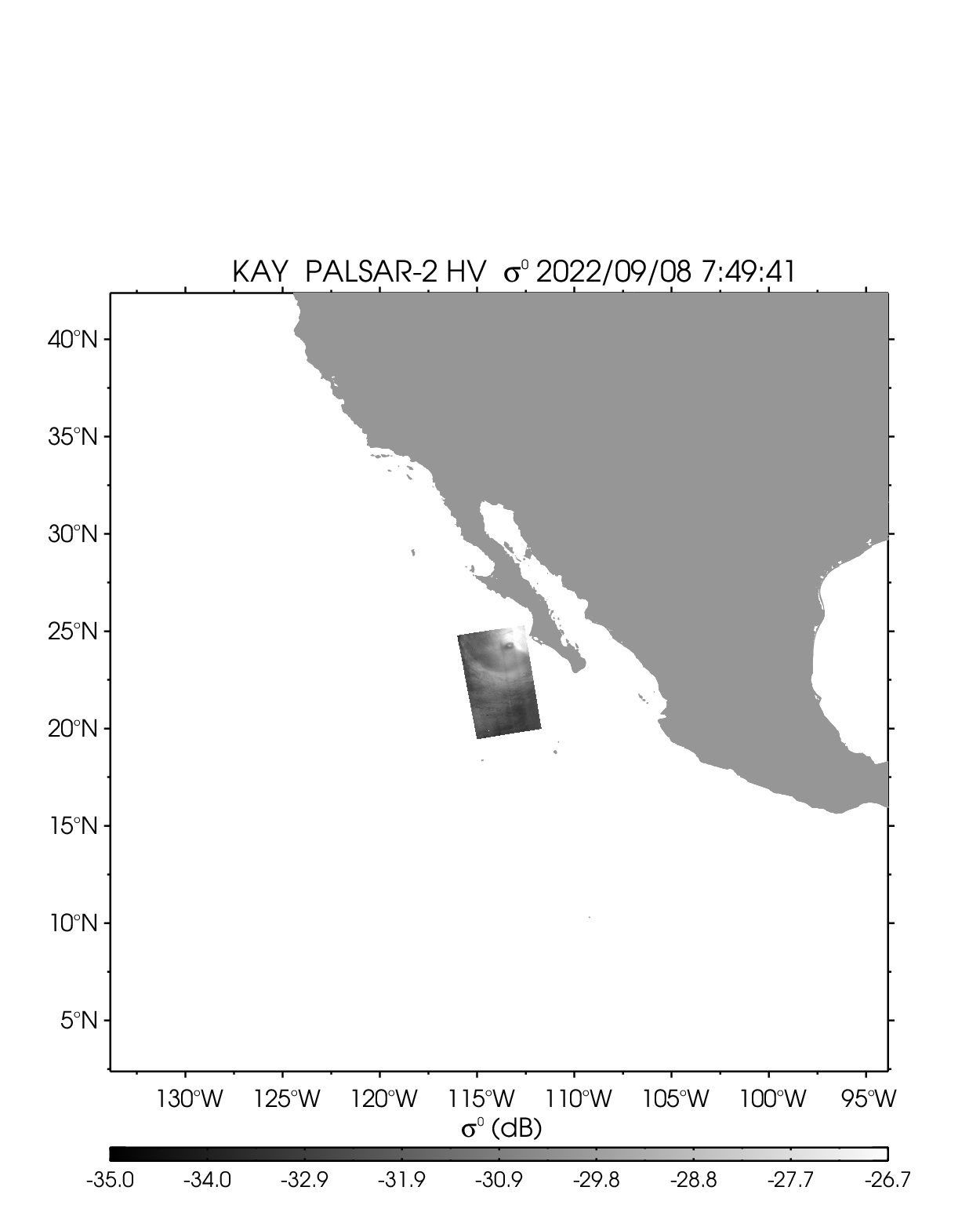
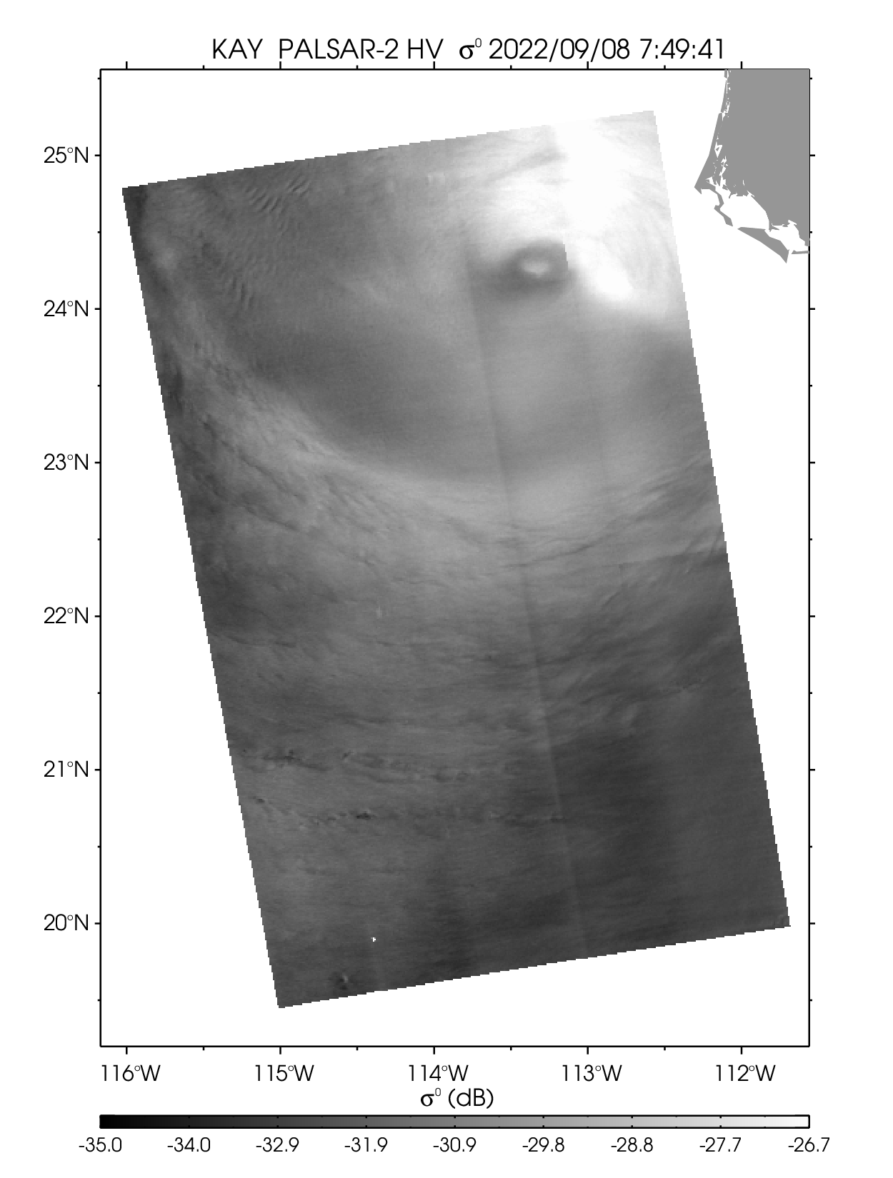
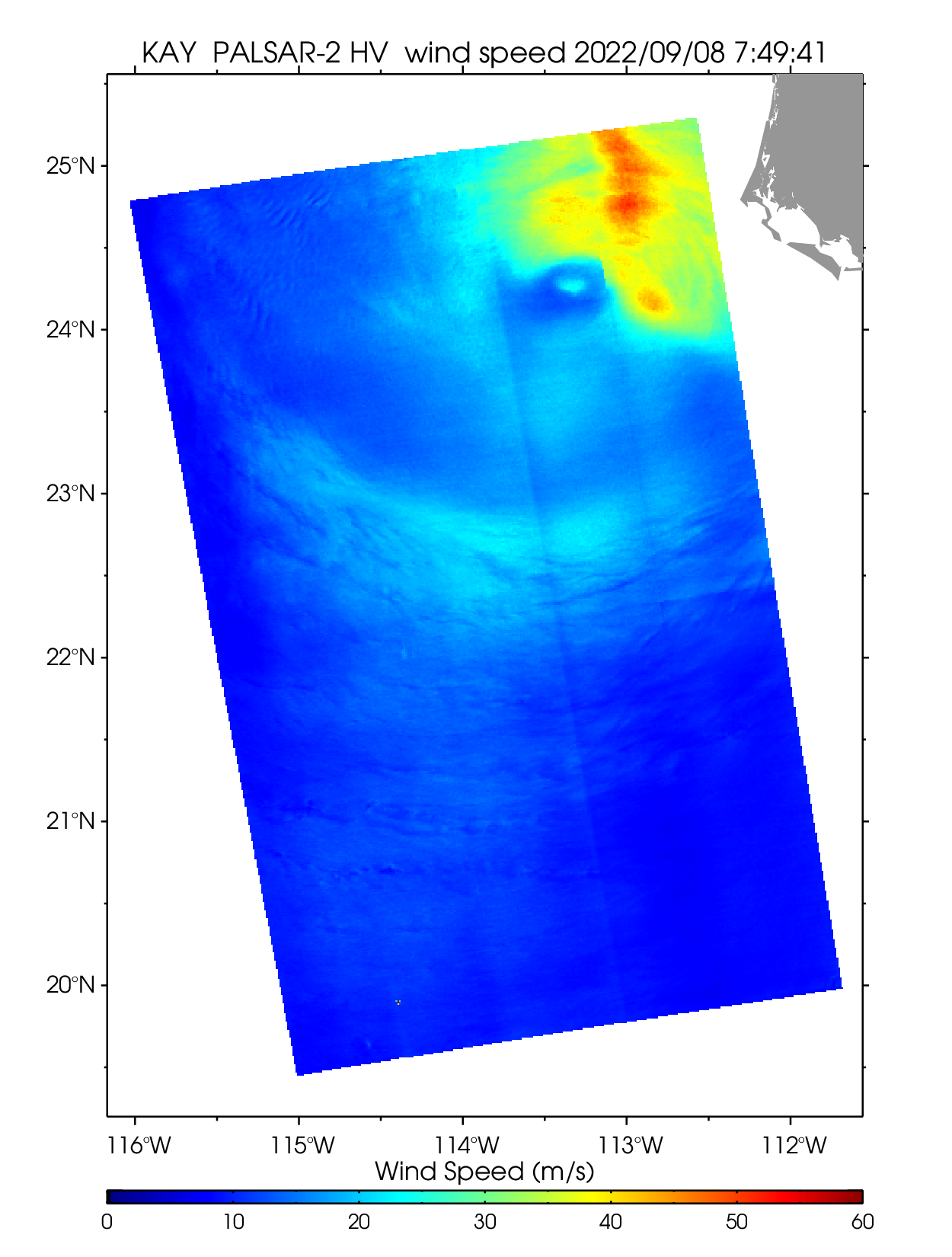
| Hurricane KAY | ||||||||
| PALSAR-2 HV 2022-09-08 07:49 UTC | ||||||||
 |
 |
 |
||||||
| NetCDF | ||||||||
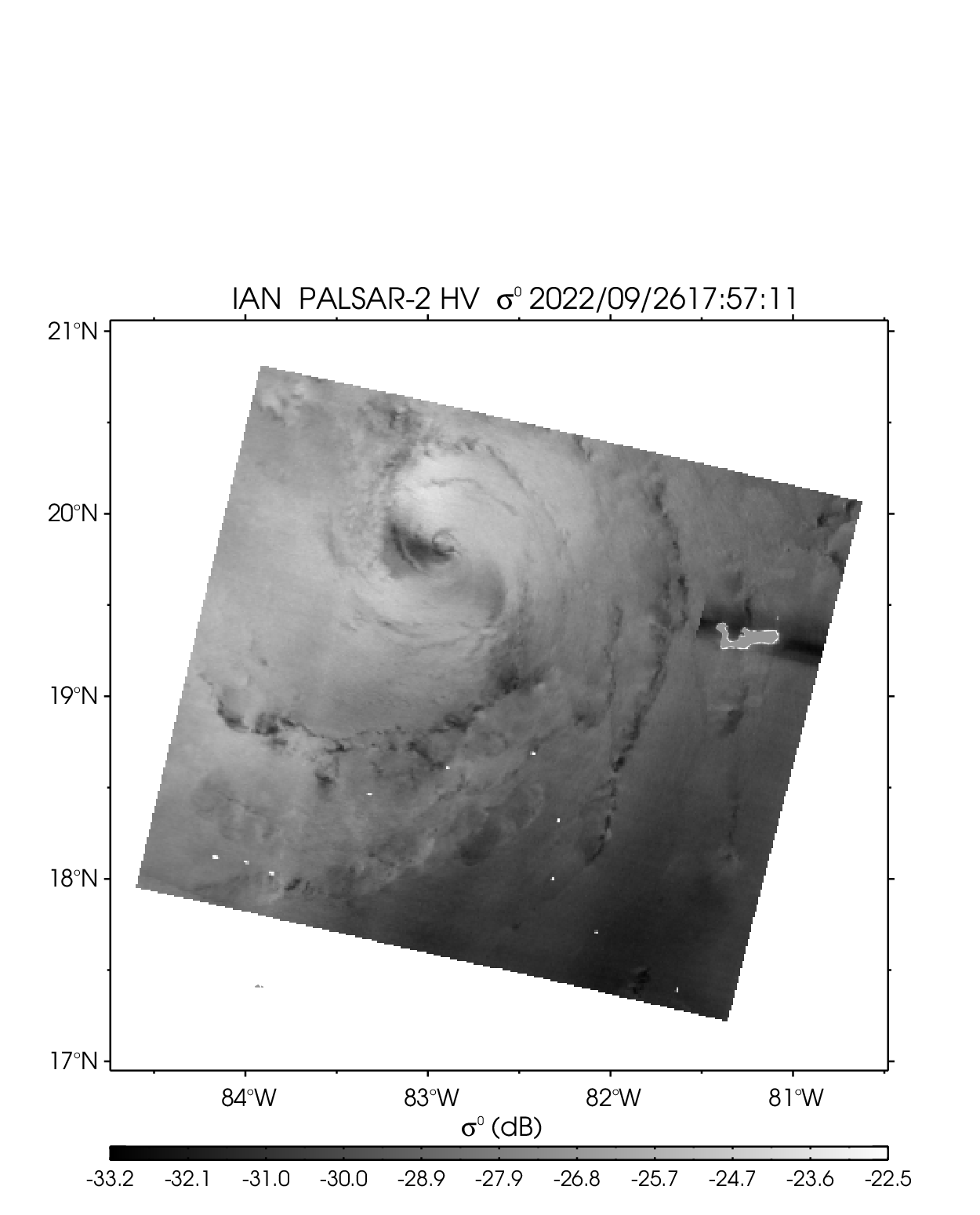
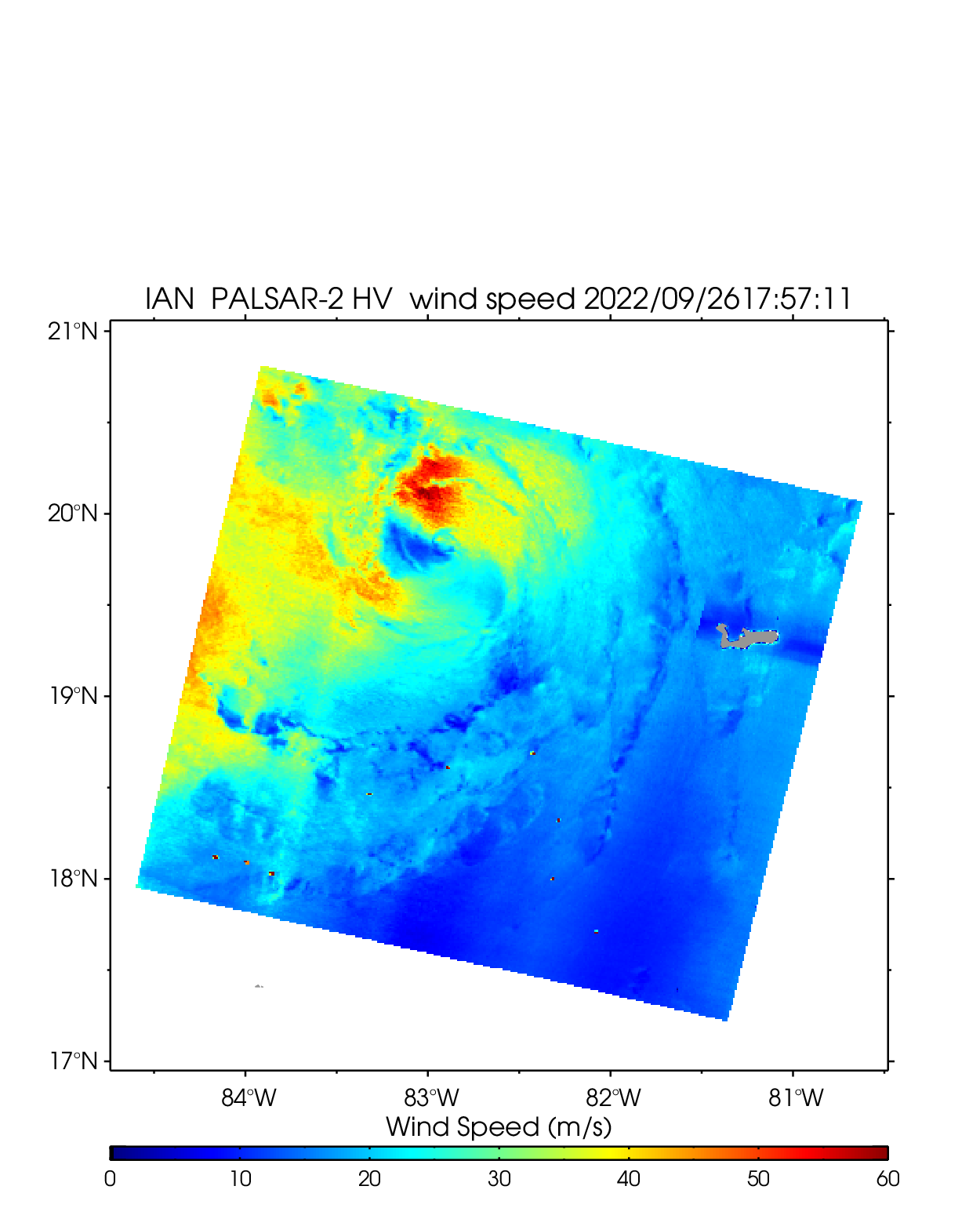
| Hurricane IAN | ||||||||
| PALSAR-2 HV 2022-09-26 17:57 UTC | ||||||||
 |
 |
 |
||||||
| NetCDF | ||||||||
2021
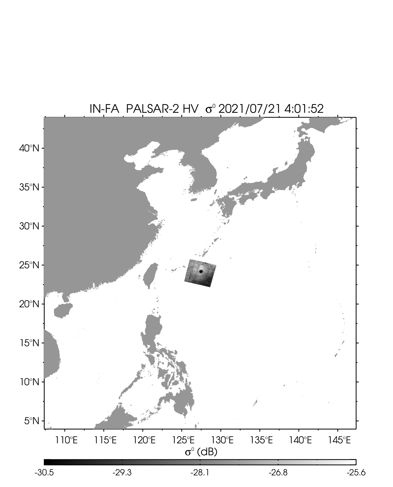
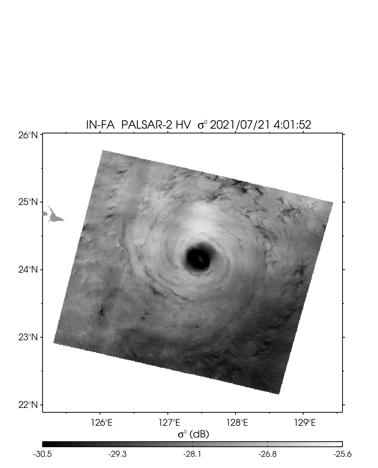
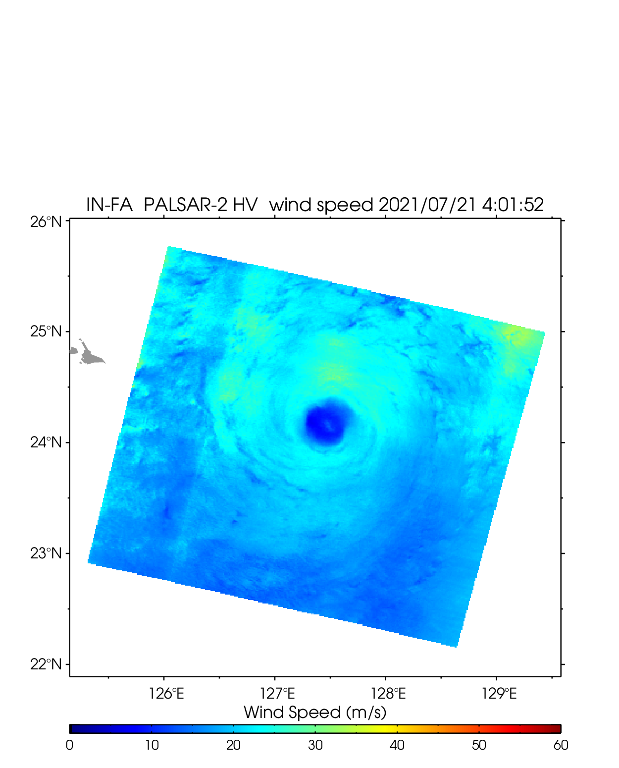
| 2106 INFA | ||||||||
|---|---|---|---|---|---|---|---|---|
| PALSAR-2 HV 2021-07-21 04:01 UTC | ||||||||
 |
 |
 |
||||||
| NetCDF | ||||||||
2020
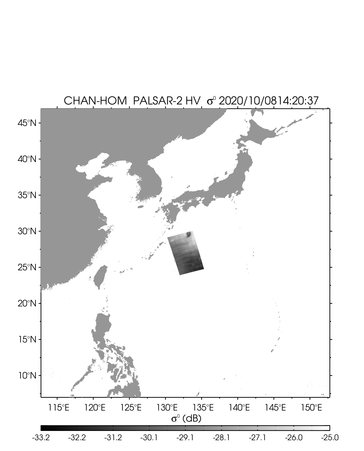
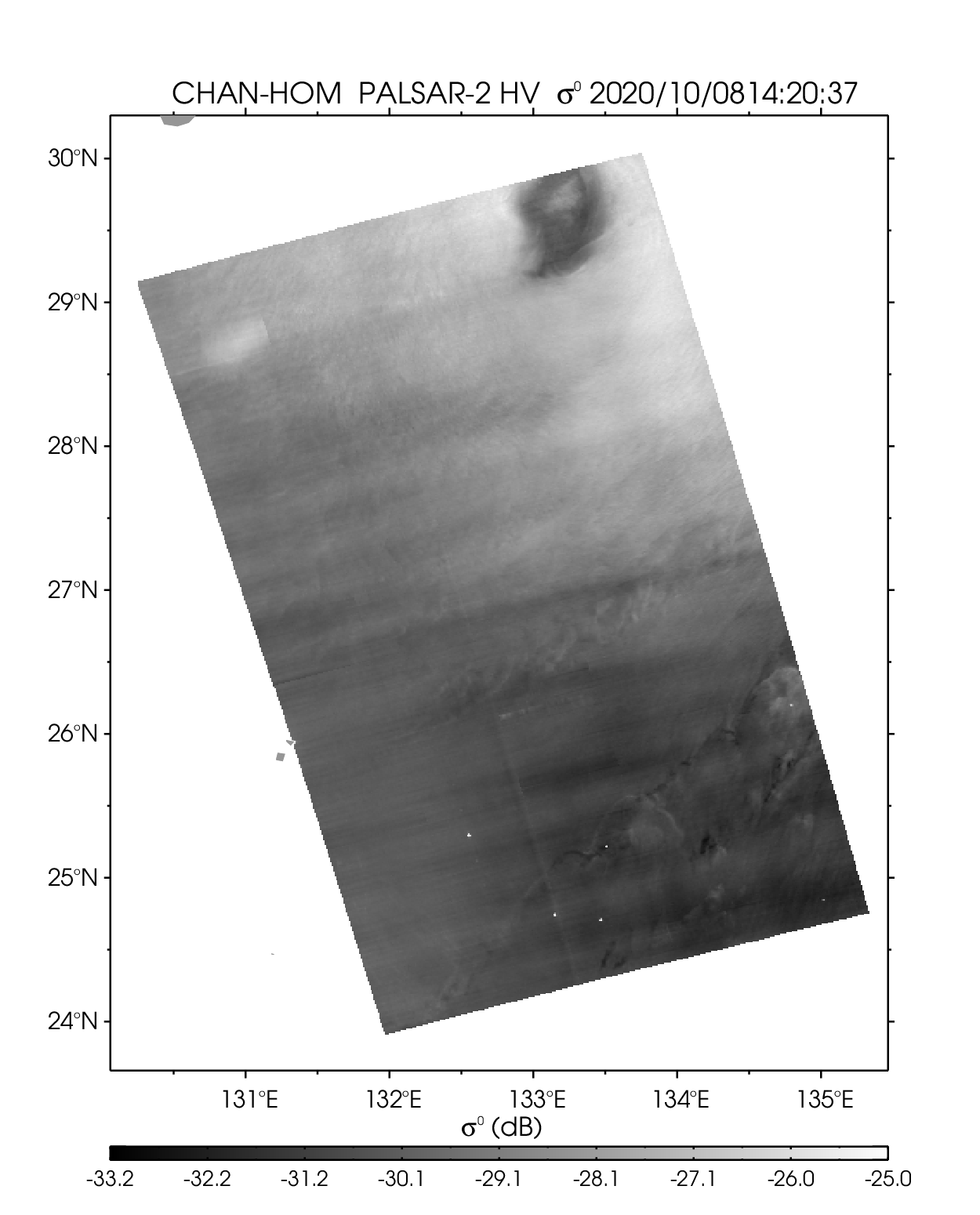
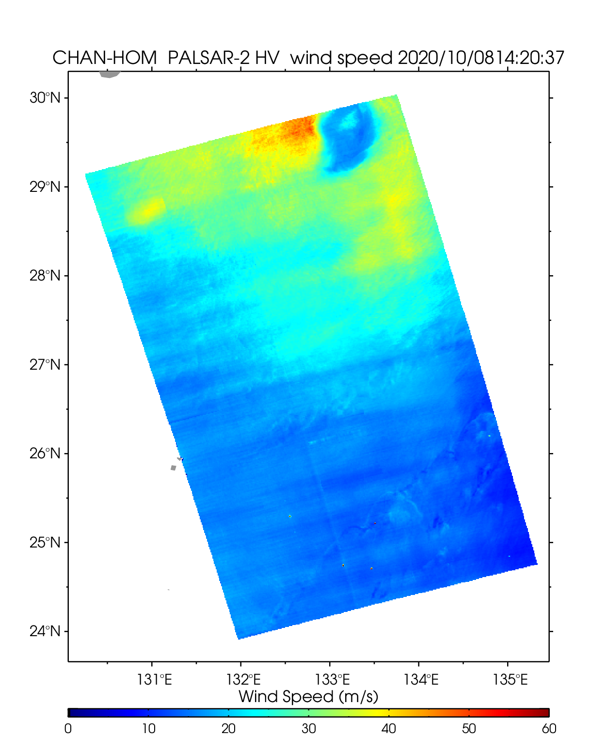
| 2014 CHAN-HOM | ||||||||
|---|---|---|---|---|---|---|---|---|
| PALSAR-2 HV 2020-10-08 14:20 UTC | ||||||||
 |
 |
 |
||||||
| NetCDF | ||||||||
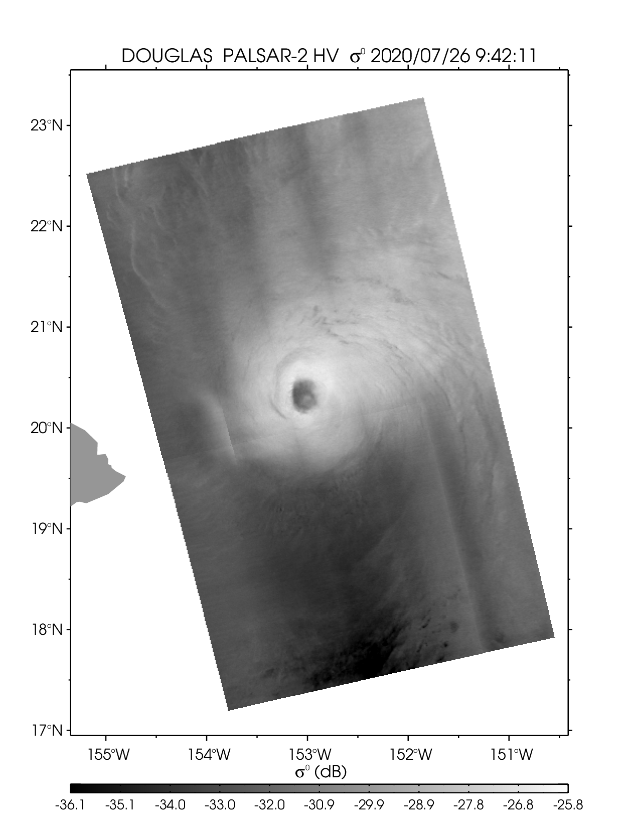
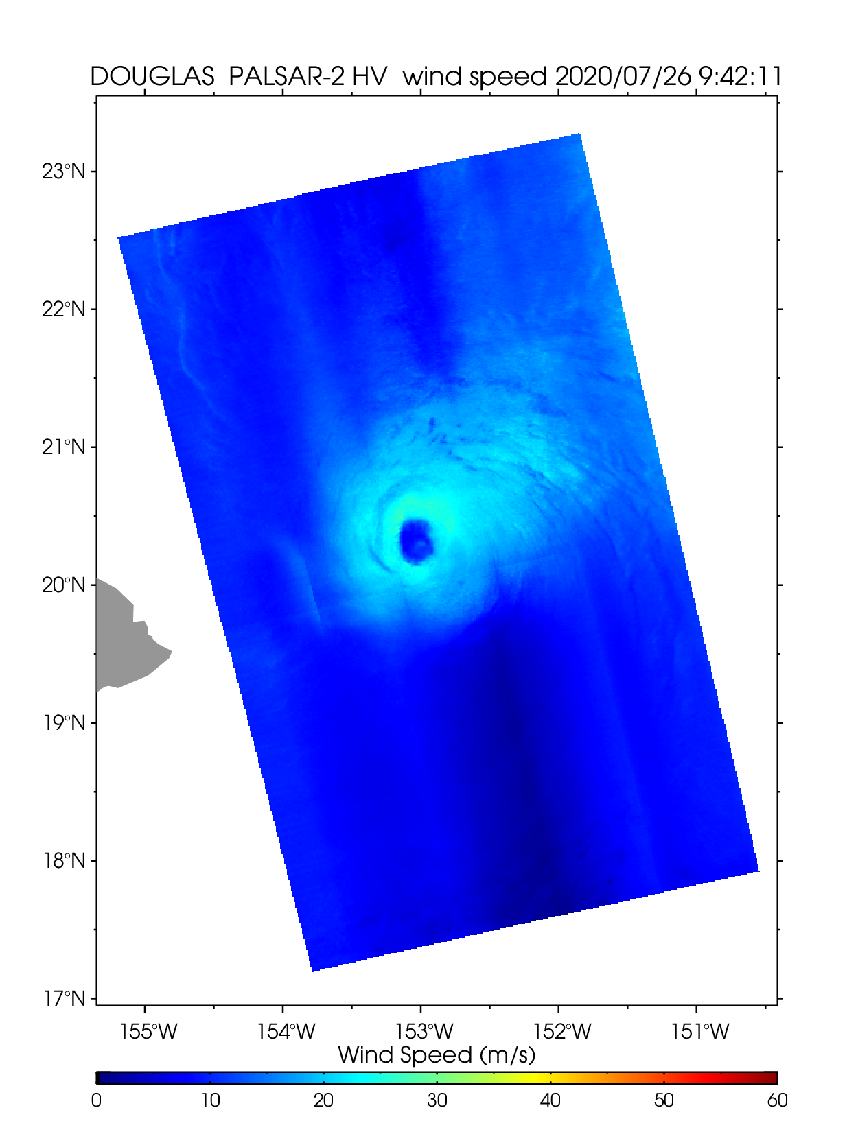
| Hurricane DOUGLAS | ||||||||
| PALSAR-2 HV 2020-07-26 09:42 UTC | ||||||||
 |
 |
 |
||||||
| NetCDF | ||||||||
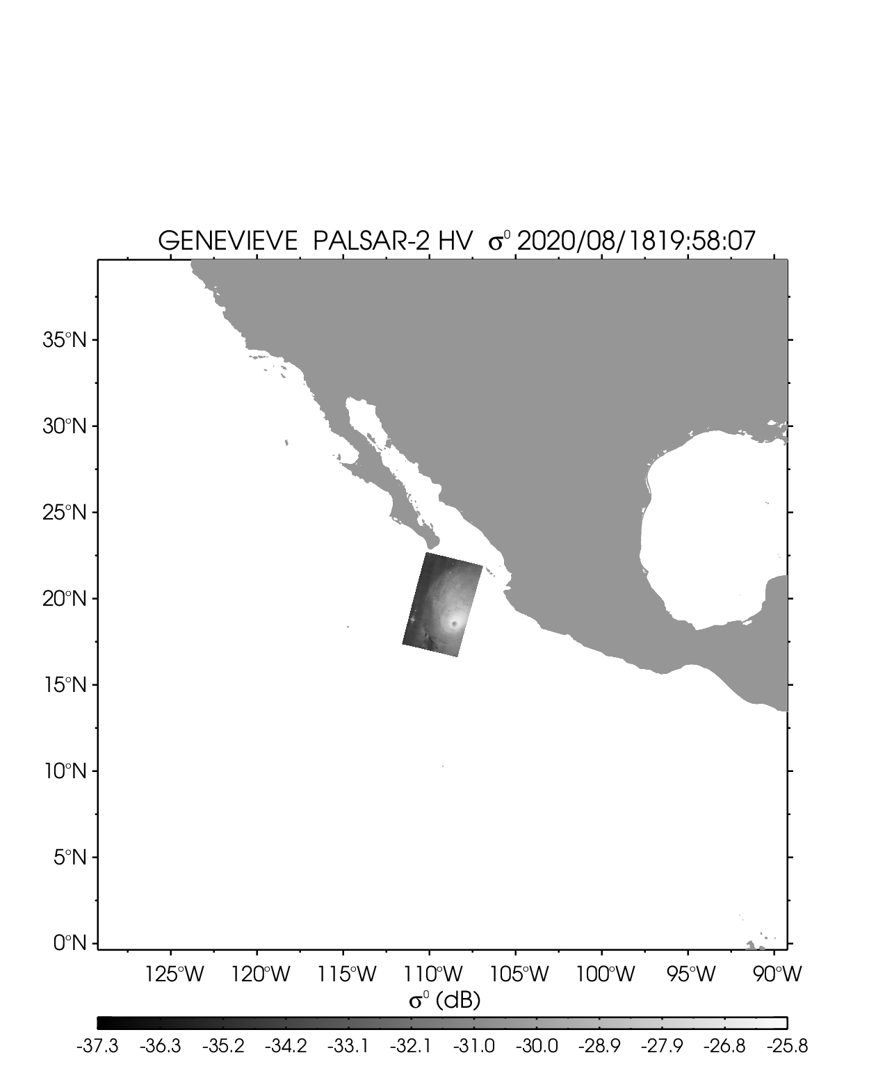
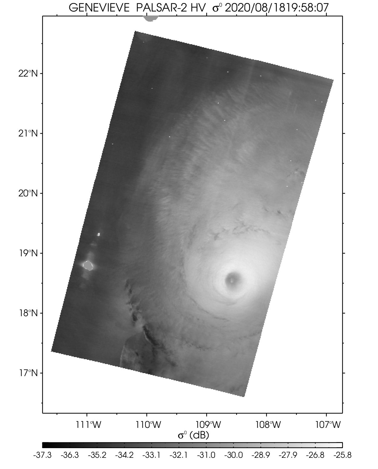
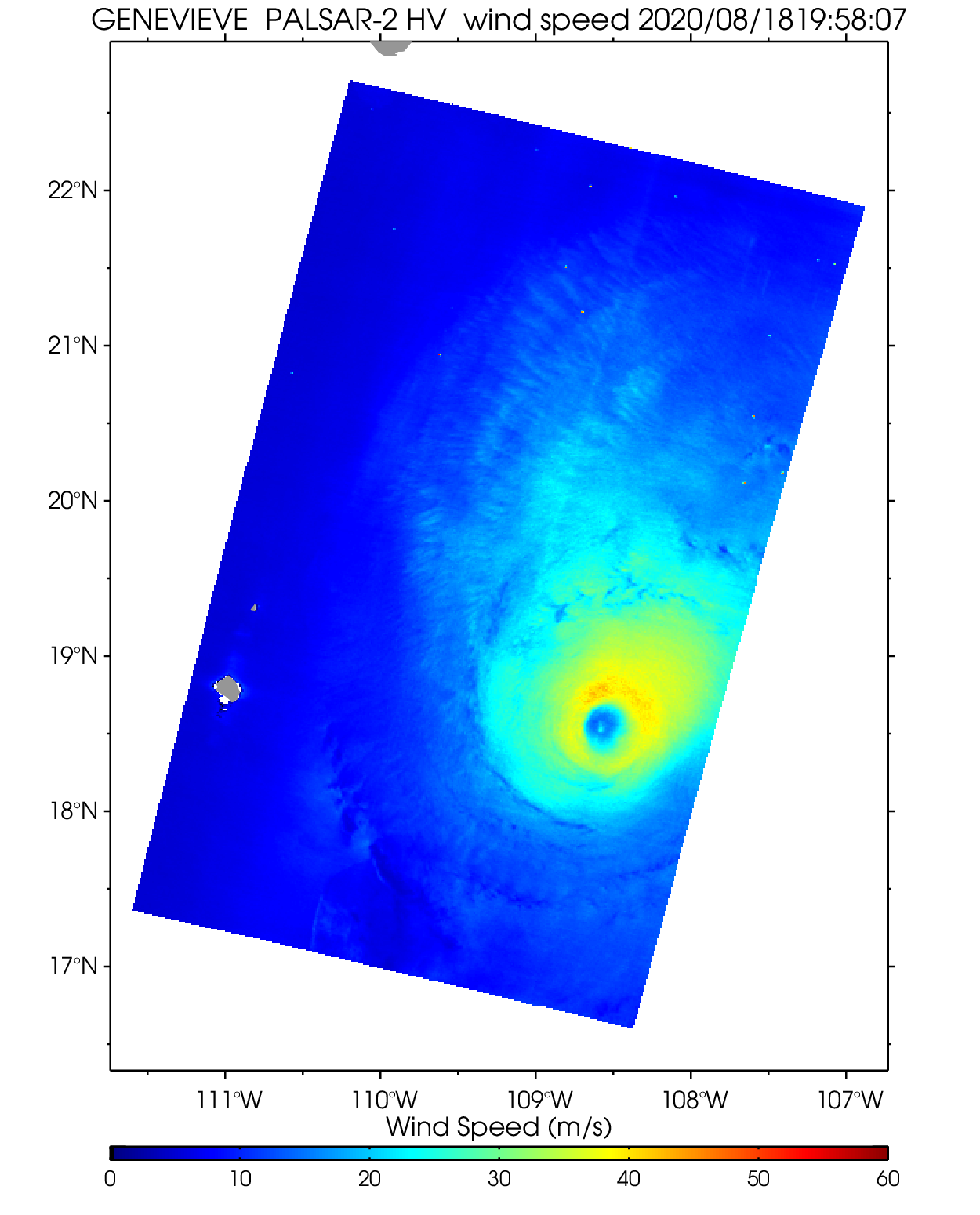
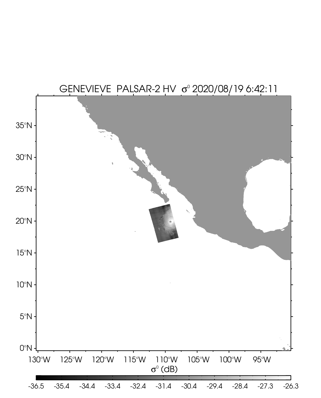
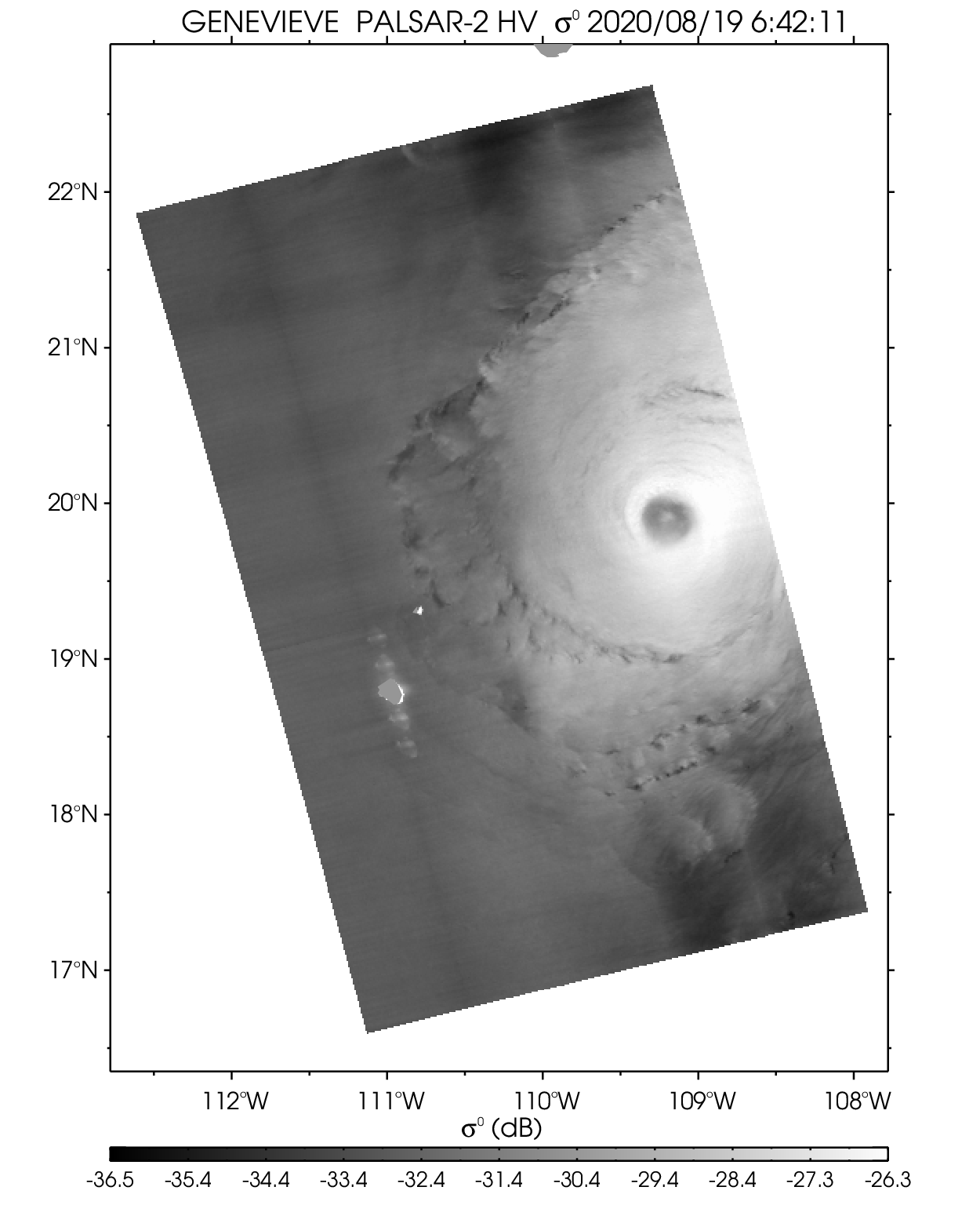
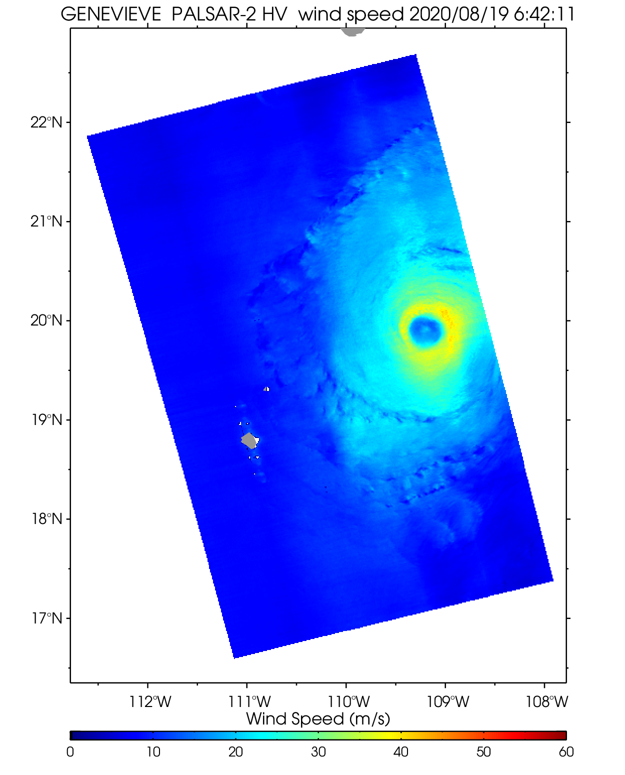
| Hurricane GENEVIEVE | ||||||||
| PALSAR-2 HV 2020-08-18 19:58 UTC | PALSAR-2 HV 2020-08-19 06:42 UTC | |||||||
 |
 |
 |
 |
 |
 |
|||
| NetCDF | NetCDF | |||||||
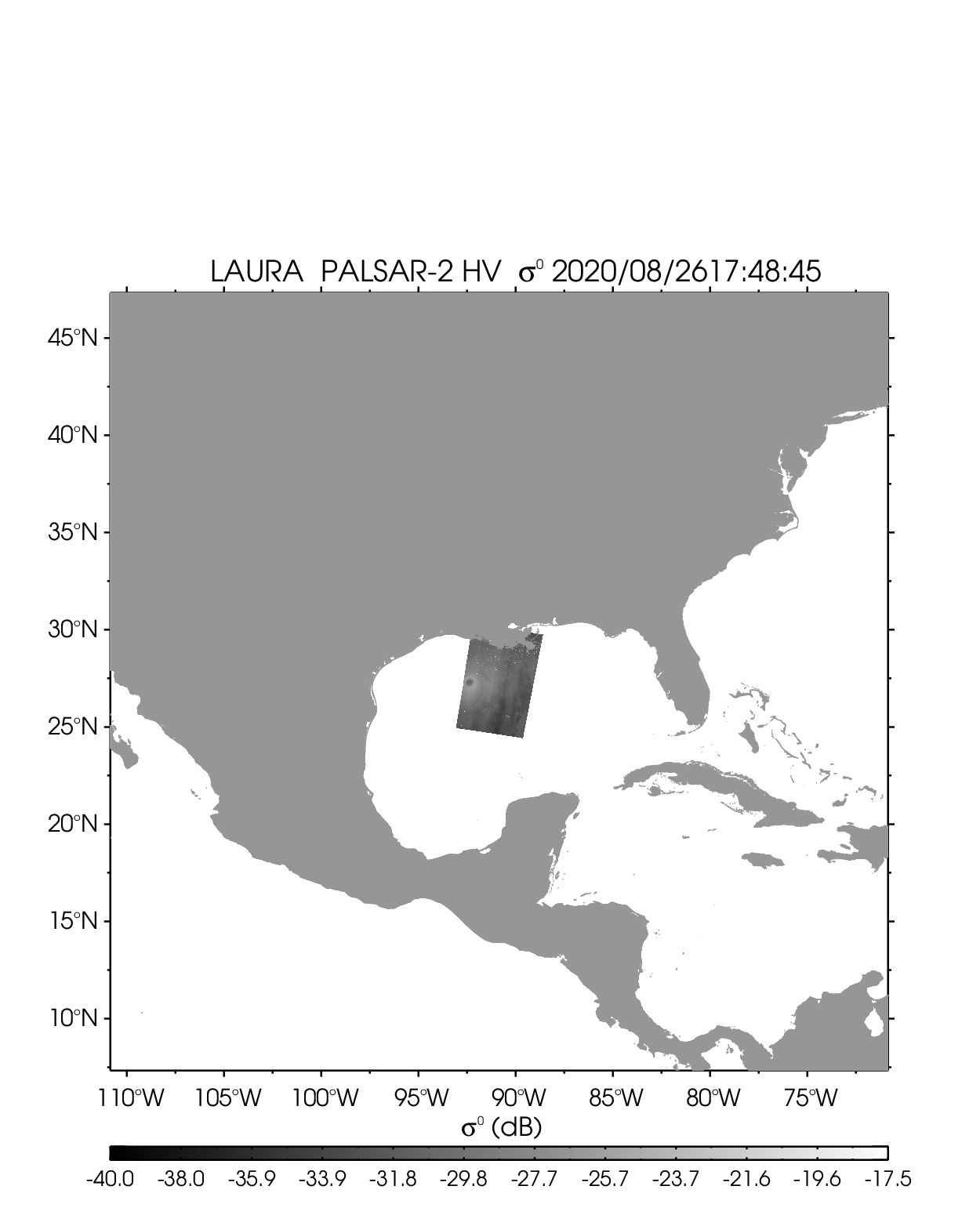
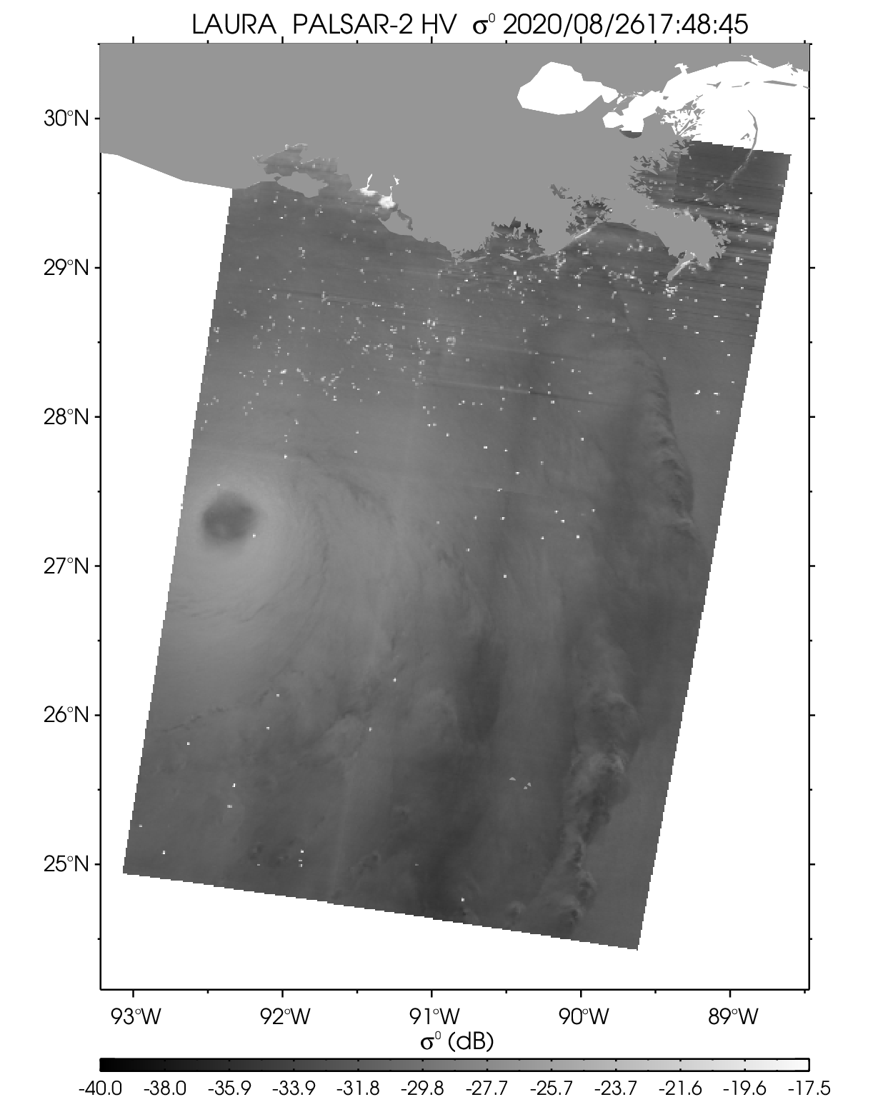
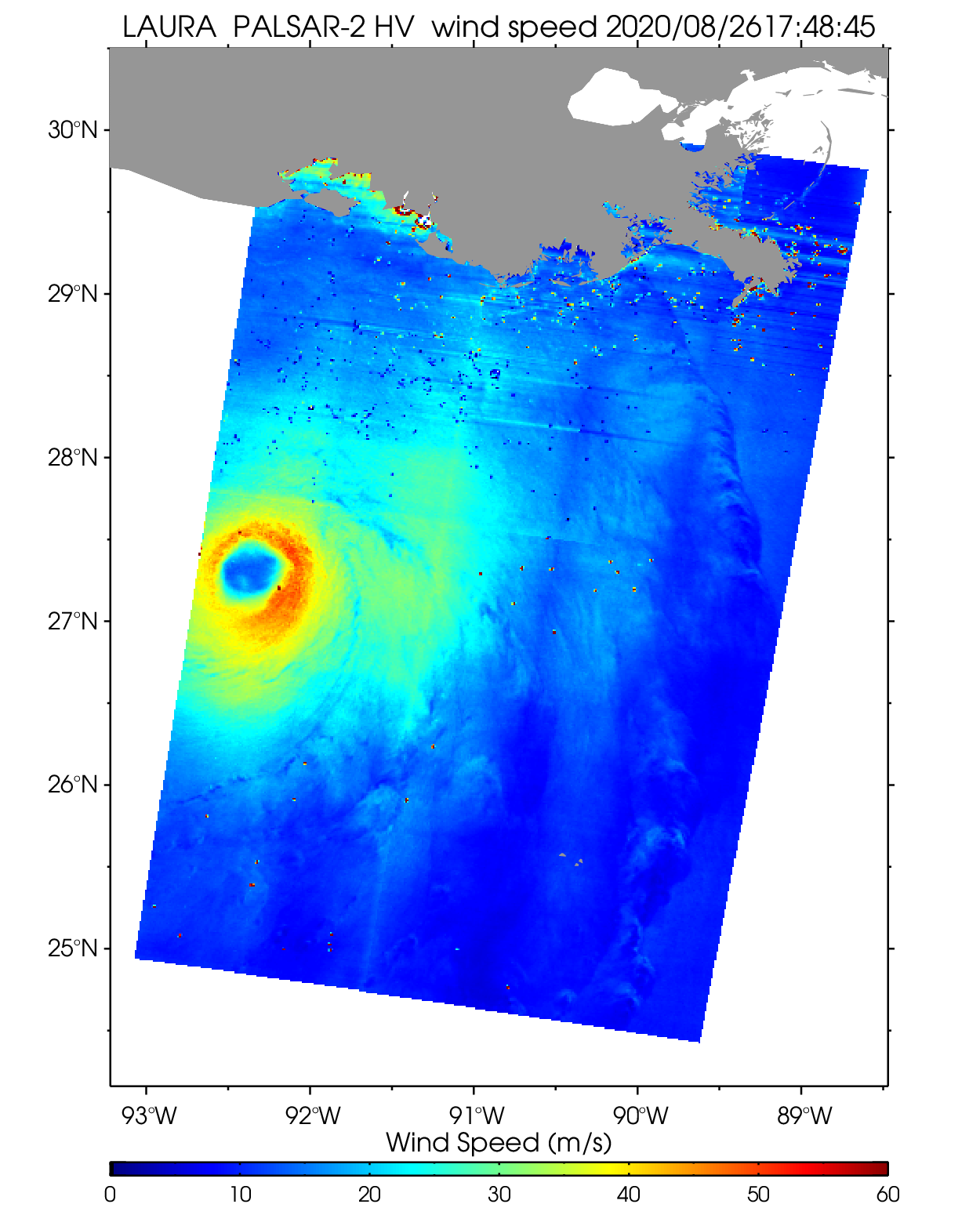
| Hurricane LAURA | ||||||||
| PALSAR-2 HV 2020-08-26 17:48 UTC | ||||||||
 |
 |
 |
||||||
| NetCDF | ||||||||
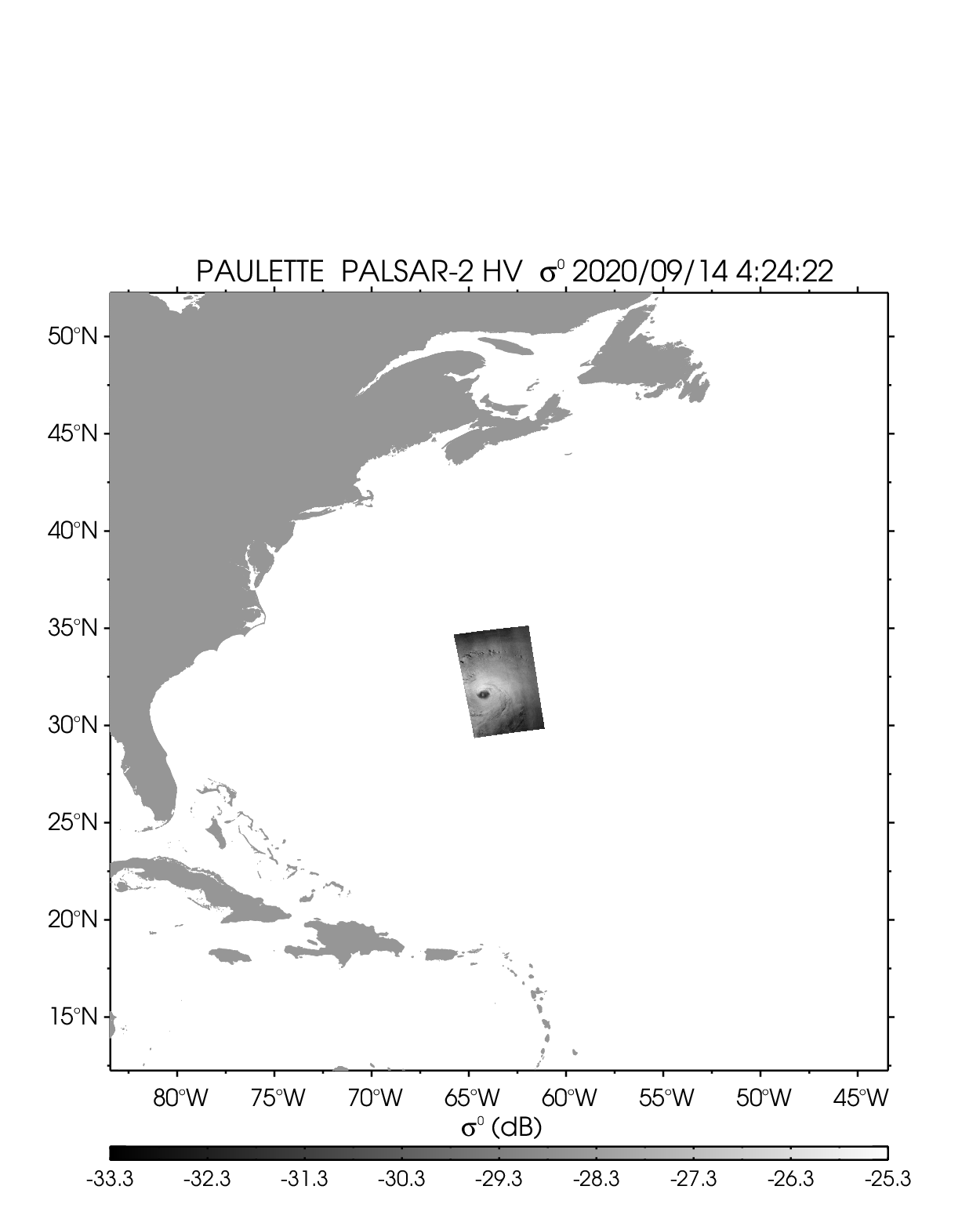
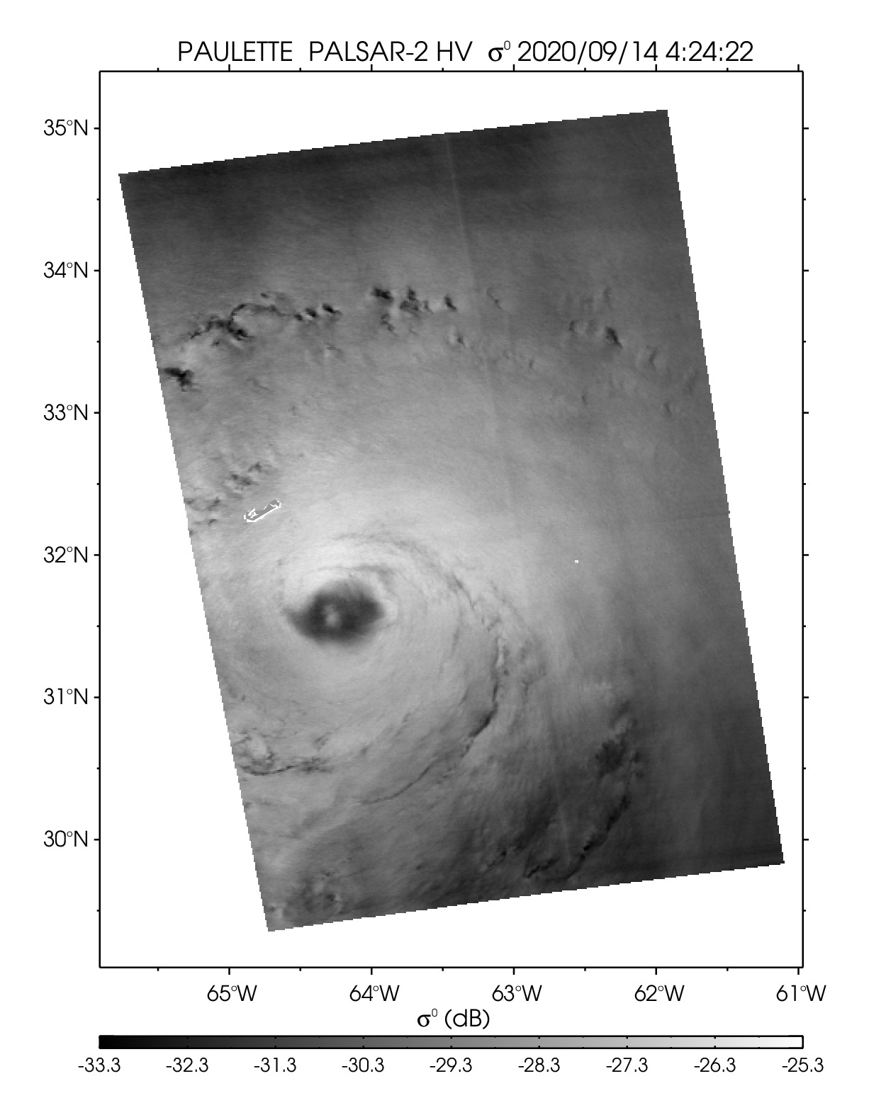
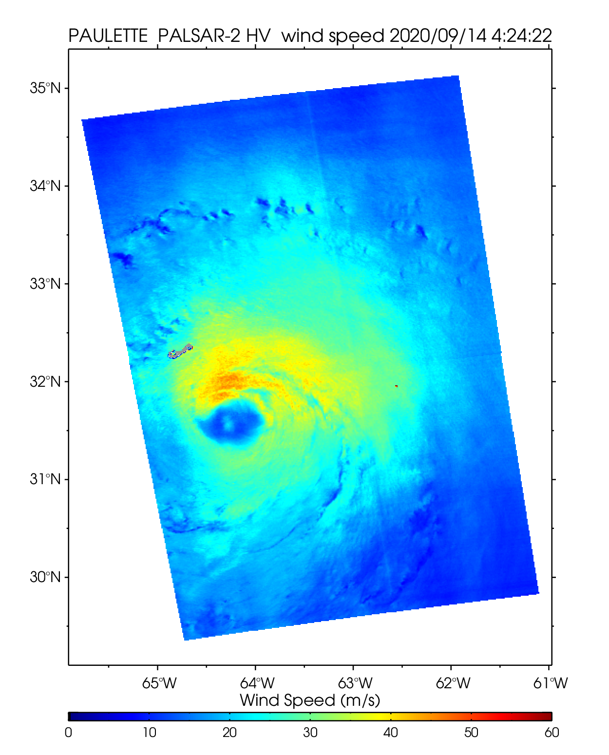
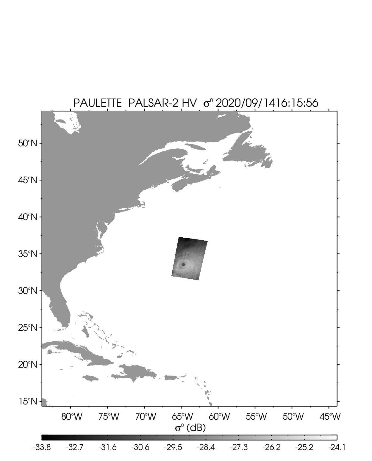
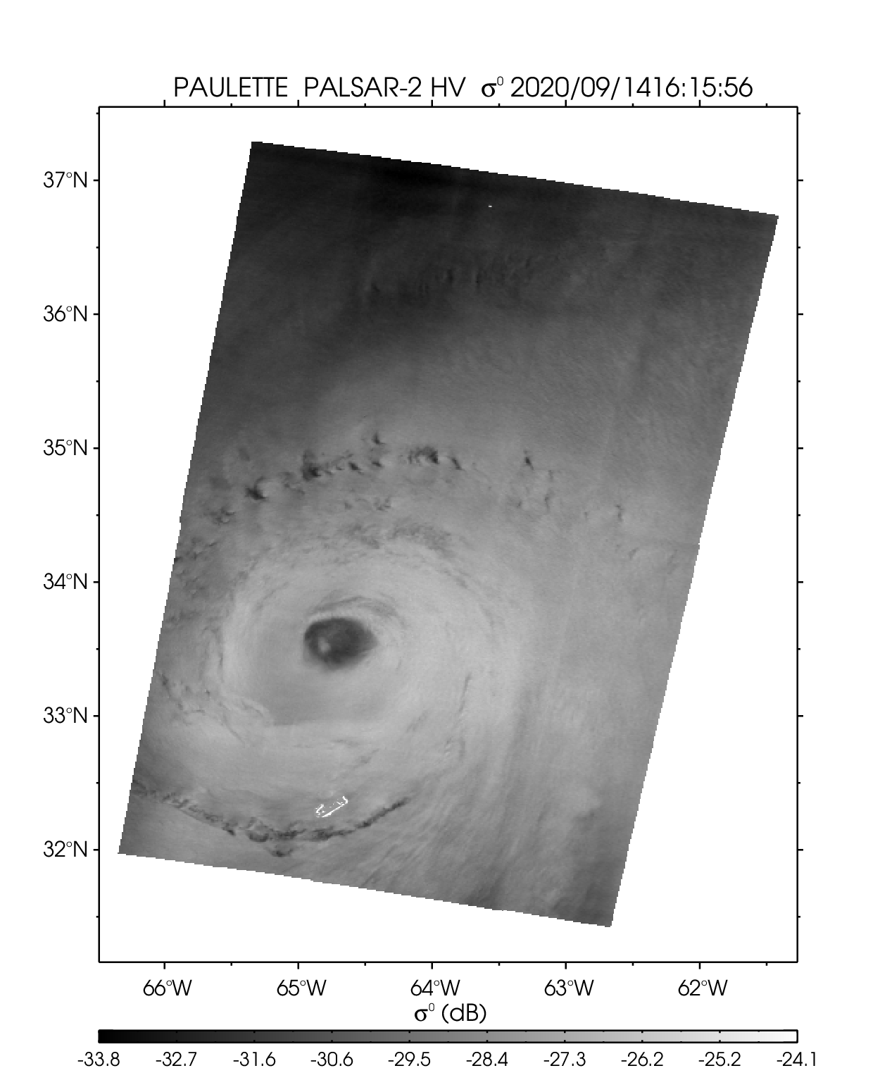
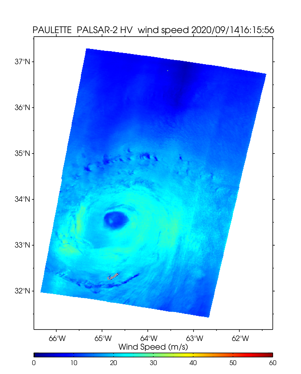
| Hurricane PAULETTE | ||||||||
| PALSAR-2 HV 2020-09-14 04:24 UTC | PALSAR-2 HV 2020-09-14 16:15 UTC | |||||||
 |
 |
 |
 |
 |
 |
|||
| NetCDF | NetCDF | |||||||
4. Detaset description
(1) Overview of the dataset
| Dataset name | SAR ocean surface wind field |
|---|---|
| Content | ・Normalized radar cross section (HH and HV polarization) ・Ocean wind speed ・Incidence angle ・Faraday rotation angle calculated from the Global Ionospheric Map (GIM)[3] and the International Geomagnetic Reference Field (IGRF)[4] ・Other parameters (see "NetCDF parameters" below) |
| Satellite data source | ALOS-2 ScanSAR mode typhoons/hurricanes observation data that meet following conditions. ・Incidence angle: Beam W2 and W3 (26–60 degrees) ・Period: 2020- ・The data that are assessed to have low ionospheric effects. |
| Data format | NetCDF |
| Processing algorithm | The method for estimating ocean surface wind from ALOS-2 cross-polarization (HV) data[5], ionospheric effects. Ionospheric effects[6] is reduced as much as possible. |
(2) NetCDF parameters
| Parameter | Description |
|---|---|
| LONGITUDE | Longitude at wind cell center |
| LATITUDE | Latitude at wind cell center |
| WIND SPEED | Ocean 10m wind speed from HV polarization |
| FARADAY_ROTATION_ANGLE | Faraday rotation angle from TEC, magnetic field, and SAR beam angles |
| INCIDENCE_ANGLE | Incidence angle at wind cell center |
| SENSOR_AZIMUTH_ANGLE | Azimuth angle from the north |
| SIGMA_NAUGHT_HH | Normalized radar cross section of HH polarization |
| SIGMA_NAUGHT_HV | Normalized radar cross section of HV polarization |
| MASK | Mask of data |
| ERA5_WIND_SPEED | ERA5 10m wind speed |
| ERA5_WIND_DIRECTION | ERA5 10m wind direction (meteorological conversion) |
| ACQUISITION_TIME | Seconds since 1970-01-01 00:00:00 |
| TITLE | "SAR ocean surface wind field" |
| SENSORID | Sensor ID |
5. Teams of Use
This dataset is available to use with no charge under the "Terms of Use of Research Data".
To publish images using the dataset as it is, please display "©JAXA" in the image.
6. Contact
This dataset is released on a trial basis, and we welcome feedback from users. Please send any comments or opinions regarding this dataset to the following email address.
ALOS-2/ALOS Science Project
Earth Observation Research Center (EORC)
Japan Aerospace Exploration Agency (JAXA)
E-mail: aprojectjaxa.jp
* References
- Knapp, K. R., M. C. Kruk, D. H. Levinson, H. J. Diamond, and C. J. Neumann, "The International Best Track Archive for Climate Stewardship (IBTrACS): Unifying tropical cyclone best track data,", Bulletin of the American Meteorological Society, 91, 363-376, 2010. doi.org/10.1175/2009BAMS2755.1
- Gahtan, J., K. R. Knapp, C. J. Schreck, H. J. Diamond, J. P. Kossin, and M. C. Kruk, "International Best Track Archive for Climate Stewardship (IBTrACS) Project, Version 4.01,", NOAA National Centers for Environmental Information. doi.org/10.25921/82ty-9e16
- CODE final product series for the IGS. Published by Astronomical Institute, University of Bern.
http://www.aiub.unibe.ch/download/CODE
10.7892/boris.75876.4 - Alken, P., E. Thébault, C.D. Beggan, et al. "International Geomagnetic Reference Field: the thirteenth generation,", Earth Planets Space, 73 (49), 2021. doi.org/10.1186/s40623-020-01288-x
- Isoguchi, O., T. Tadono, M. Ohki, U. Shimada, M. Yamaguchi, and M. Hayashi, "Hurricane Ocean Surface Wind Retrieval from ALOS-2 PALSAR-2 Cross-Polarized Measurements," IGARSS2021, 7291–7294, Brussels, Belgium, 2021. doi.org/10.1109/IGARSS47720.2021.9554411
- Isoguchi, O., K. Ishizuka, T. Tadono, T. Motohka, and M. Shimada, "Effect of Faraday Rotation on L-Band Ocean Normalized Radar Cross Section and Wind Speed Detection,", IEEE JSTARS, 12(7), 2477–2485, 2019. doi.org/10.1109/JSTARS.2019.2894814