1) Digital Elevation Model (DEM) and Mapping | 2) Land Use Monitoring and Land Cover Classification | 3) Disaster Monitoring | 4) Geological Surveying and Mineral Resource Exploration | 5) Terrestrial Ecosystem and Forestry Management | 6) Oceanography and Coastal Zone Related Research | 7) Snow and Ice Related Research | 8) Agriculture Management | 9) Hydrology and Water Resource Management | 10) Application Research using Geographical Information | 11) PRISM / AVNIR-2 | 12) PALSAR | 13) Thailand (JAXA-GISTDA collaboration)
3) Disaster Monitoring 2018
Observation Result for Eruption of Anak Krakatau Volcano in Indonesia by ALOS-2.
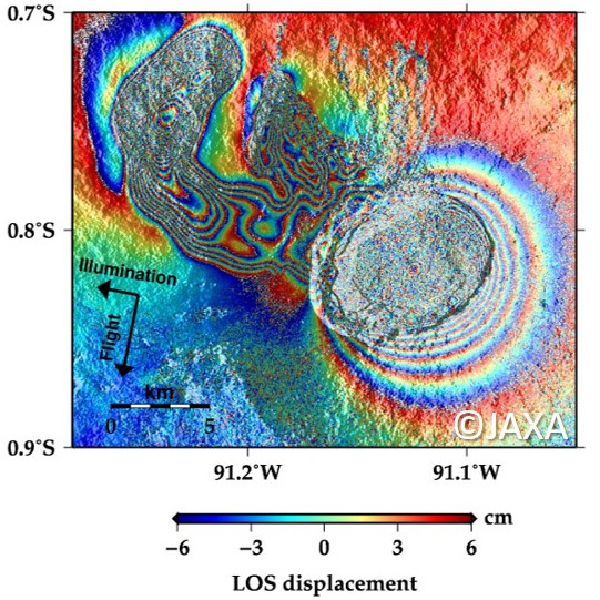
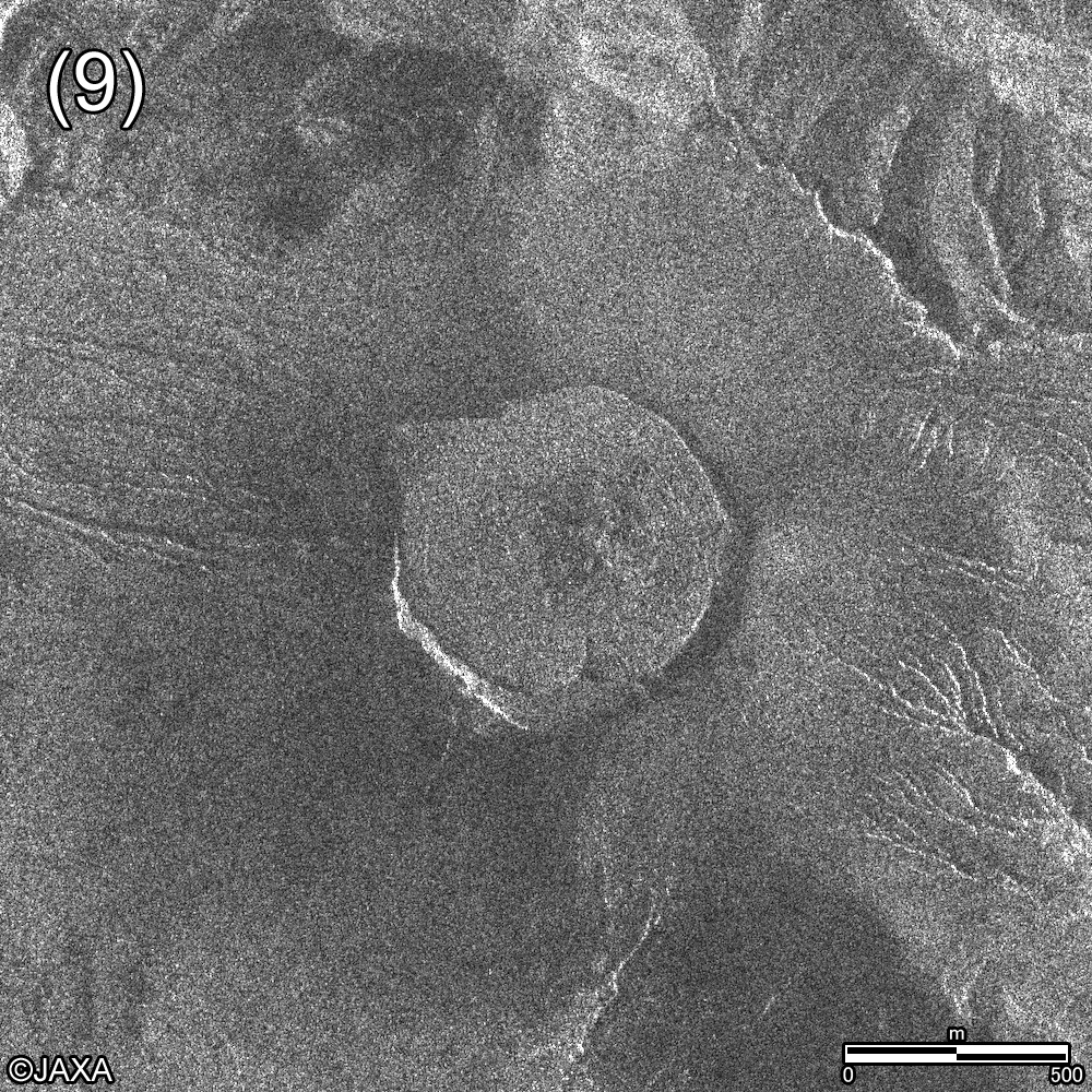
ALOS-2/PALSAR-2 Observation Result for Eruption of Mt. Sierra Negra in Galapagos.
Jun. 13, 2018
Jun. 8, 2018
Jun. 5, 2018
Jun. 1, 2018
May 23, 2018
May 21, 2018
May 15, 2018
May 9, 2018
PALSAR-2
Mt. Kilauea
earthquake
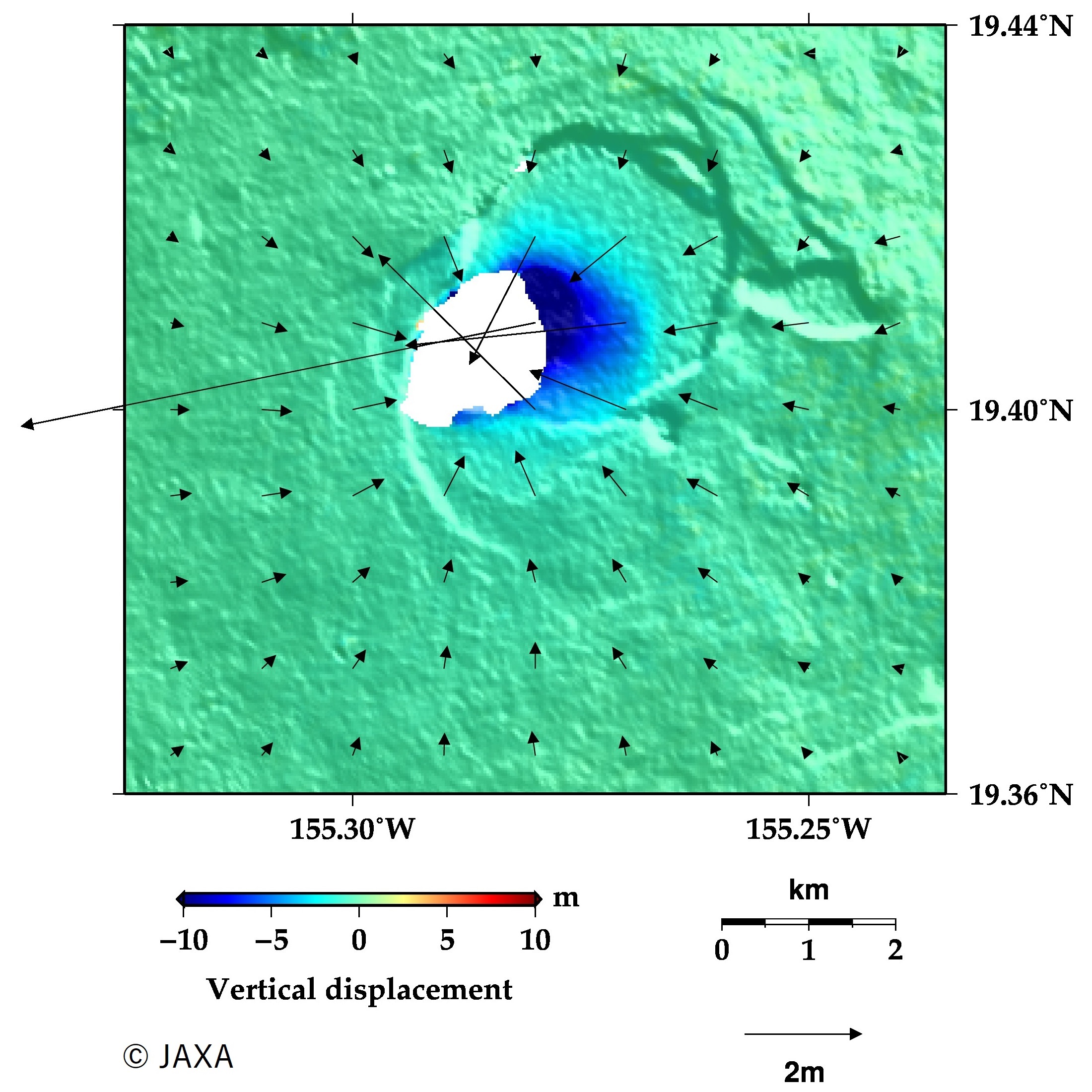
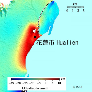
ALOS-2/PALSAR-2 Observation Result for Eruption of Mt. Kilauea and Earthquake in Hawaii. [Update on Jun. 22, 2018]
ALOS-2/PALSAR-2 Observation Result for Eruption of Mt. Fuego in Guatemala.
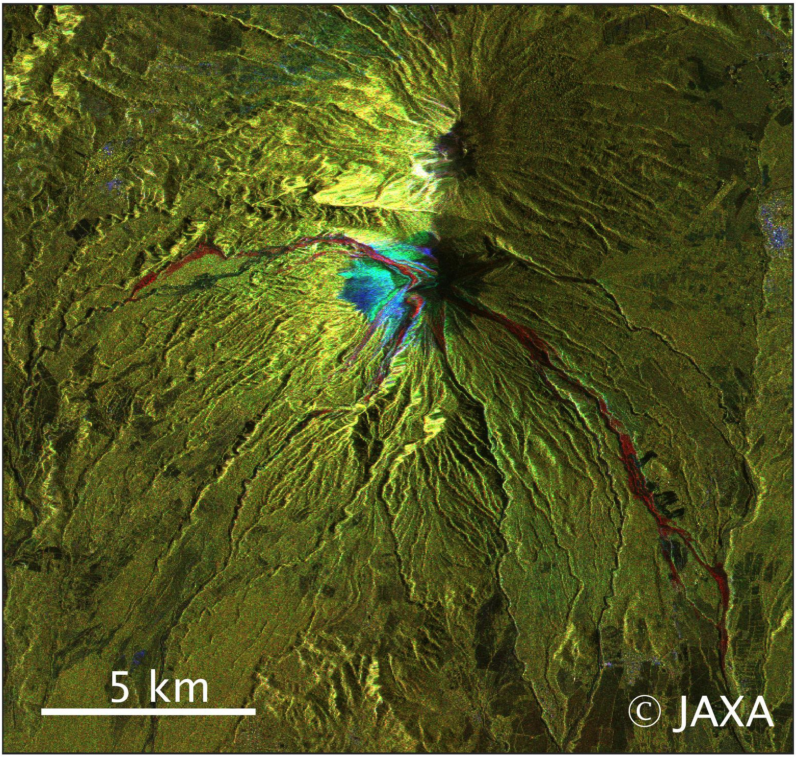
Observation Results for Eruption of Shinmoedake by ALOS-2 and COSMO-SkyMed