


1) Digital Elevation Model (DEM) and Mapping | 2) Land Use Monitoring and Land Cover Classification | 3) Disaster Monitoring | 4) Geological Surveying and Mineral Resource Exploration | 5) Terrestrial Ecosystem and Forestry Management | 6) Oceanography and Coastal Zone Related Research | 7) Snow and Ice Related Research | 8) Agriculture Management | 9) Hydrology and Water Resource Management | 10) Application Research using Geographical Information | 11) PRISM / AVNIR-2 | 12) PALSAR | 13) Thailand (JAXA-GISTDA collaboration)
3) Disaster Monitoring 2006
PALSAR
Estimated tanker oil-spill of the caoast of Guimaras island in Philippines by "Daichi" (ALOS) on August 25, 2006.
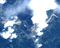
PALSAR
Estimated tanker oil-spill area in the eastern Indian Ocean observed by PALSAR.
PALSAR
"Heavy rain areas in Pakistan." and "Heavy rain areas in center of Mardan, Pakistan." observed by PALSAR.
PRISM
Flooded areas in ChoeleChoele City, Argentina observed by "Daichi"(ALOS) on July 30, 2006.
AVNIR-2
Heavy rain areas in Kagoshima Pref., Japan observed by "Daichi"(ALOS) in July, 2006.
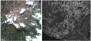
PALSAR
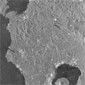
Image of heavy rain area in Kagoshima Pref., Japan observed by PALSAR.
PRISM
AVNIR-2
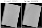
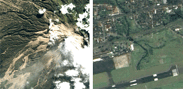
Comparison of Two Images Taken by "Daichi" -Pre-disaster and Post-disaster- (PANDANGARAN, the South of Java, Indonesia)
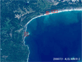
AVNIR-2
Sakurajima Island, Kagoshima Pref., Japan observed by AVNIR-2 on Jun. 20, 2006.
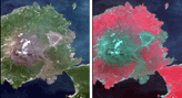
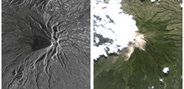
PRISM
AVNIR-2
Pan-sharpen image of Mt. Merapi and Yogyakarta, Java, Indonesia generated by AVNIR-2 and PRISM with active high-speed viewer "ZOOMA".
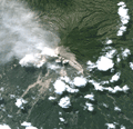
AVNIR-2
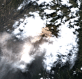
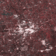
Mt. Merapi volcano, Indonesia observed by AVNIR-2 on Jun. 14, 2006.
PRISM
AVNIR-2
Pan-sharpen image of Mt. Merapi and Yogyakarta, Java, Indonesia generated by AVNIR-2 and PRISM on Jun. 12, 2006.
AVNIR-2
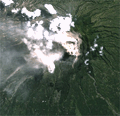
Mt. Merapi volcano, Indonesia observed by AVNIR-2 on Jun. 10, 2006.
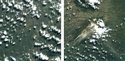
AVNIR-2
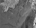
Mt. Merapi volcano, Indonesia observed by AVNIR-2 on Jun. 9, 2006.
AVNIR-2
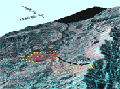
PALSAR
Disaster area in Yogyakarta, Indonesia observed by ALOS on May 28, 2006(JST).
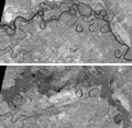
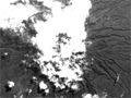
PALSAR
The northern Kingdom of Thailand observed by PALSAR on May 25, 2006(JST).
AVNIR-2
PALSAR
Mt. Merapi volcano, Indonesia observed by PALSAR and AVNIR-2 on May 16, 2006.
AVNIR-2
PALSAR
Mt. Merapi volcano, Indonesia observed by PALSAR and AVNIR-2 on April 29, 2006.
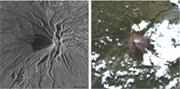
PRISM
Mt. Merapi volcano, Indonesia observed by PRISM on April 27, 2006.
AVNIR-2

View of Leyte Island in the Republic of the Philippines, observed by the AVNIR-2 on Feb. 20, 2006.
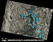
PALSAR
The image data on Leyte Island in the Republic of the Philippines, observed by the PALSAR on Feb. 24, 2006.