1) Digital Elevation Model (DEM) and Mapping | 2) Land Use Monitoring and Land Cover Classification | 3) Disaster Monitoring | 4) Geological Surveying and Mineral Resource Exploration | 5) Terrestrial Ecosystem and Forestry Management | 6) Oceanography and Coastal Zone Related Research | 7) Snow and Ice Related Research | 8) Agriculture Management | 9) Hydrology and Water Resource Management | 10) Application Research using Geographical Information | 11) PRISM / AVNIR-2 | 12) PALSAR | 13) Thailand (JAXA-GISTDA collaboration)
3) Disaster Monitoring 2015
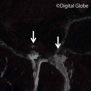
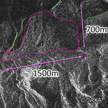
Emergency observation and initial GLOF assessment of glacial lakes in western Bhutan by ALOS-2.
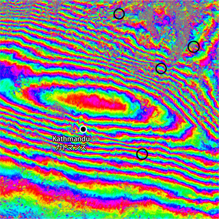
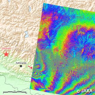
ALOS-2/PALSAR-2 Observation Results of the 2015 Nepal Earthquake (4).
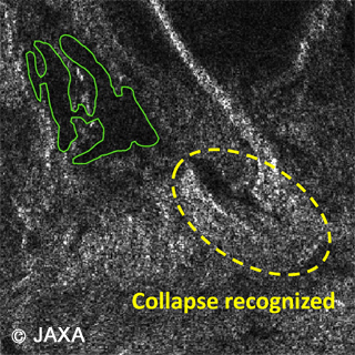
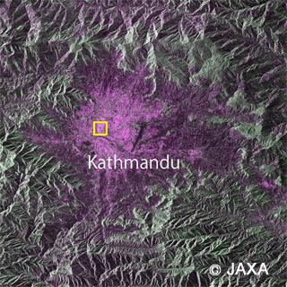
Result of damage interpretations in the Nepal Himalayas using Commercial Very-High-Resolution Satellite Images and ALOS Images.
ALOS-2/PALSAR-2 Observation Results of the 2015 Nepal Earthquake (3).
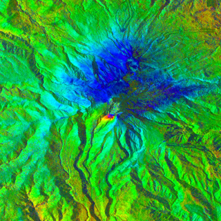
ALOS-2/PALSAR-2 Observation Results of Mt. Calbuco Volcano eruption in Chile (2).
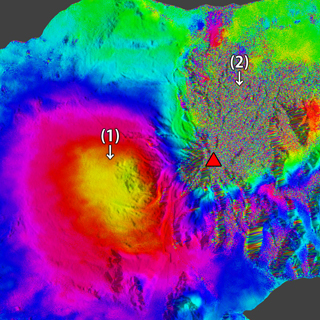
ALOS-2/PALSAR-2 Observation Results of the 2015 Nepal Earthquake (1).
ALOS-2/PALSAR-2 Observation Results of the 2015 Nepal Earthquake (2).
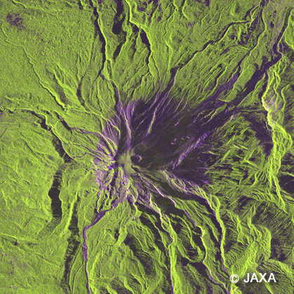
ALOS-2/PALSAR-2 Observation Results of Mt. Calbuco Volcano eruption in Chile.