
ALOS-2/PALSAR-2 Observation Result for Eruption of Mt. Fuego in Guatemala
Posted: Jun. 8, 2018, 9:00 (UTC)
Overviews
- Mt. Fuego in Guatemala, has been erupting since June 3, 2018.
- JAXA performed an emergency observation by ALOS-2 (“DAICHI-2”) on June 7, 2018 (UTC), and captured area of a pyroclastic flow around Mt. Fuego.
- The observation data were provided to local institutions. ALOS-2 will be able to be contributed to monitor volcanic activity regardless of clouds, volcanic plumes, and sun light.
Mt. Fuego in Guatemala is one of the most active volcanos in the world, and it has been erupting since June 7, 2018. JAXA performed an emergency observation with the Phased Array type L-band Synthetic Aperture Radar-2 (PALSAR-2) onboard the Advanced Land Observing Satellite-2 (ALOS-2, "DAICHI-2"). Table 1 summarizes the observation data by ALOS-2. Figure 1 shows the topography around Mt Fuego.
Table 1: Summary of the emergency observation of ALOS-2.
| Observation time (UTC) | Path number | Orbit | Observation mode | Polarization | Beam direction | Beam number |
| June 7, 2018 | 53 | Ascending | Stripmap 10m | HH+HV | Right | F2-6 |
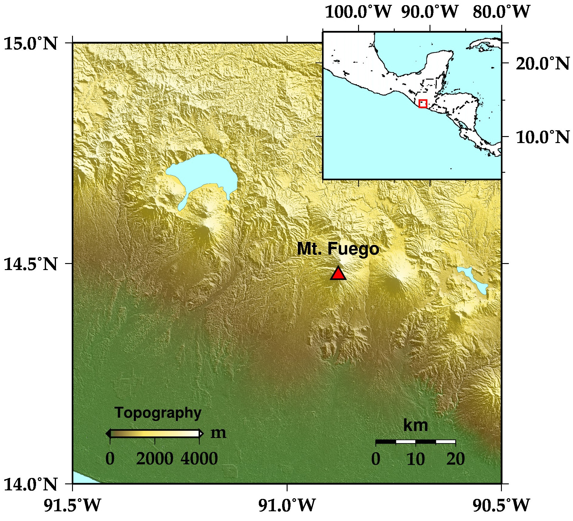 Fig. 1: Topography around Mt. Fuego.
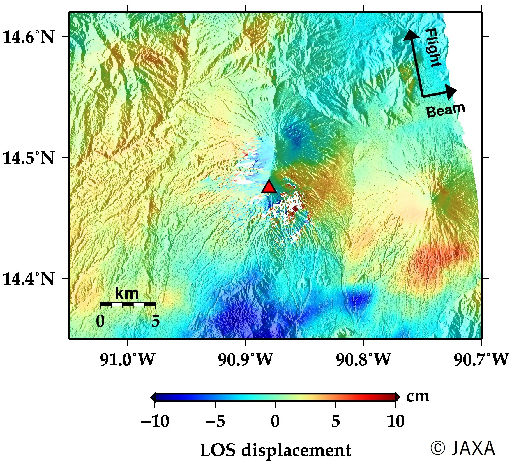 Fig. 2: An interferometric image of the ALOS-2 PALSAR-2 data acquired on May 24 and June 7, 2018.
(Click to view enlarged image)
Figure 2 shows an interferogram using the ALOS-2 PALSAR-2 data acquired on May 24 and June 7, 2018. In this figure, there seems to be no signal of crustal deformation due to the eruption. The blue area in southern Mt. Fuego is considered as meteorological noise on PALSAR-2 images.
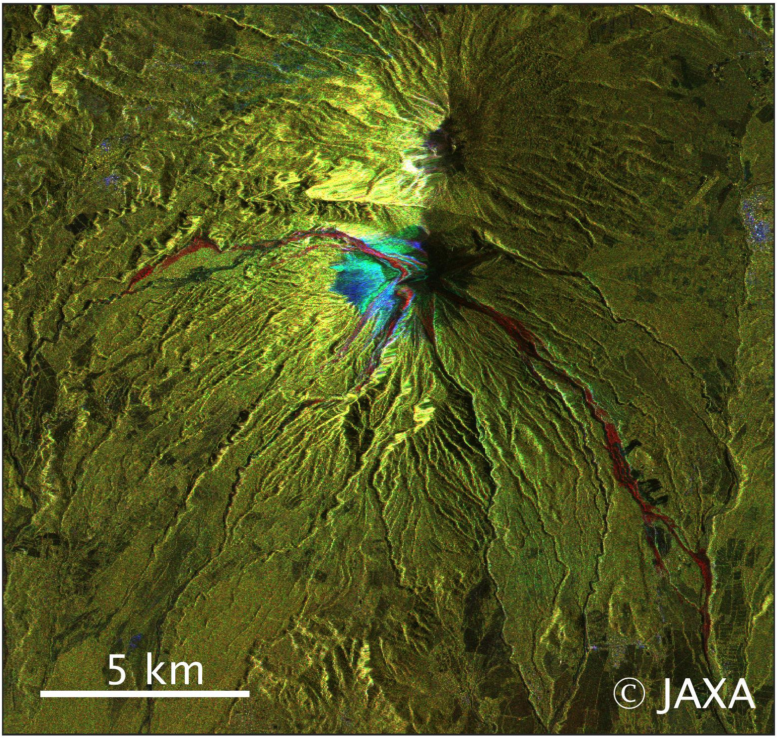 Fig. 3: Polarimetric color-composite image of the ALOS-2 PALSAR-2 data acquired on May 24 and June 7, 2018 around Mt. Fuego.
(Click to view enlarged image)
Figure 3 shows a color-composite image (red: June 7 HV polarization, green: May 24 HV pol., blue: May 24 HH pol.) where pyroclastic flow can be seen in red color. This image shows the area of pyroclastic flow in western and southeastern Mt. Fuego. Moreover, there is surface change due to accumulation of volcanic ash.
© JAXA EORC
Japan Aerospace Exploration Agency
Earth Observation Research Center
© Copyright 1997- All Rights Reserved.
© Copyright 1997- All Rights Reserved.