
Observation Result for Eruption of Anak Krakatau Volcano in Indonesia by ALOS-2
Posted: Dec 26, 2018, 9:00 (UTC)
Overview
- On December 22, 2018, Tsunami probably related to the eruption of Anak Krakatau caused serious damages on coastal cities close to the island.
- JAXA performed an emergency observation by ALOS-2 (“DAICHI-2”) on December 24, 2018 (UTC), and ALOS-2 captured significant topographic changes in the southern island.
On December 22, 2018, Anak Krakatau erupted and the probably-related tsunami caused serious damages on coastal cities.
JAXA performed an emergency observation with the Phased Array type L-band Synthetic Aperture Radar-2 (PALSAR-2)
aboard the Advanced Land Observing Satellite-2 (ALOS-2, "DAICHI-2") on December 24, 2018.
Table 1 summarizes the observation data by ALOS-2. Figure 1 shows the observation area by ALOS-2.
Table 1: Overview of observation by ALOS-2
| Observation date | Path | Mode | Orbit | Direction | Beam | Pol. |
| December 24, 2018 | 135 | Stripmap 10m | Ascending | Right | F2_5 | HH+HV |
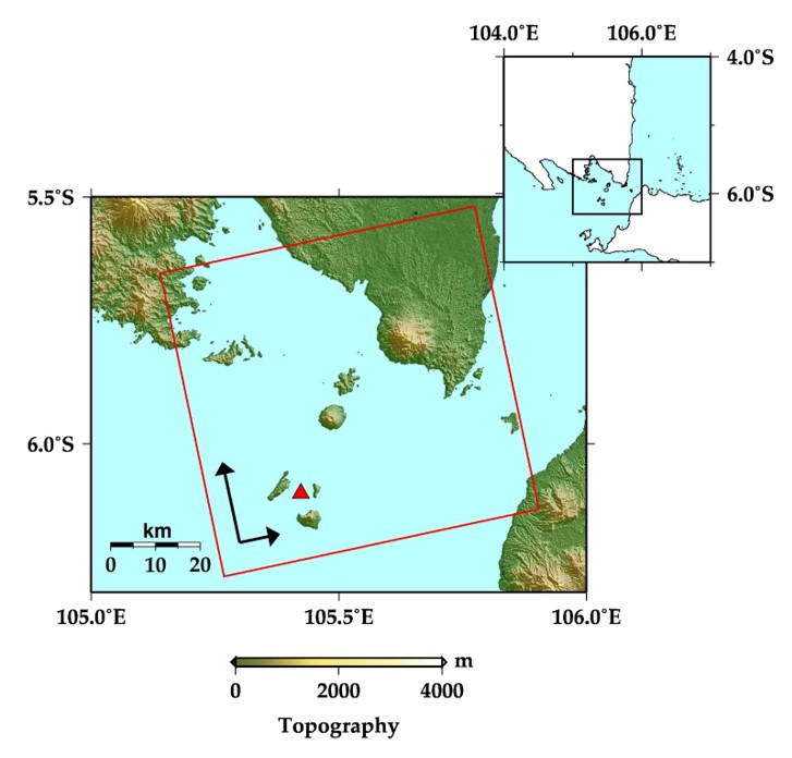 Fig. 1: Observation area by ALOS-2.
Figure 2 shows a comparison of intensity images on August 20 and December 24, 2018.
Significant topographic change in the southern part of the Anak Krakatau Island was recognized in the white-dotted circle in the figure.
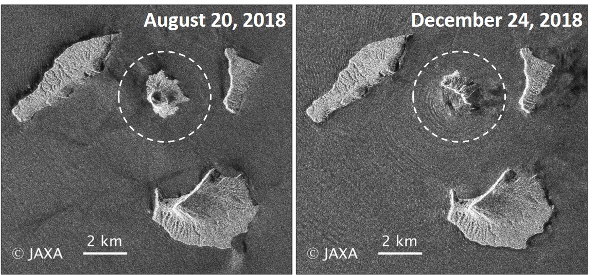 Fig. 2: Comparison of the two HH amplitude images acquired before (August 20, 2018) and after (December 24, 2018) the eruption. The white-dotted circle shows Anak Krakatau Island.
(Click to view enlarged image)
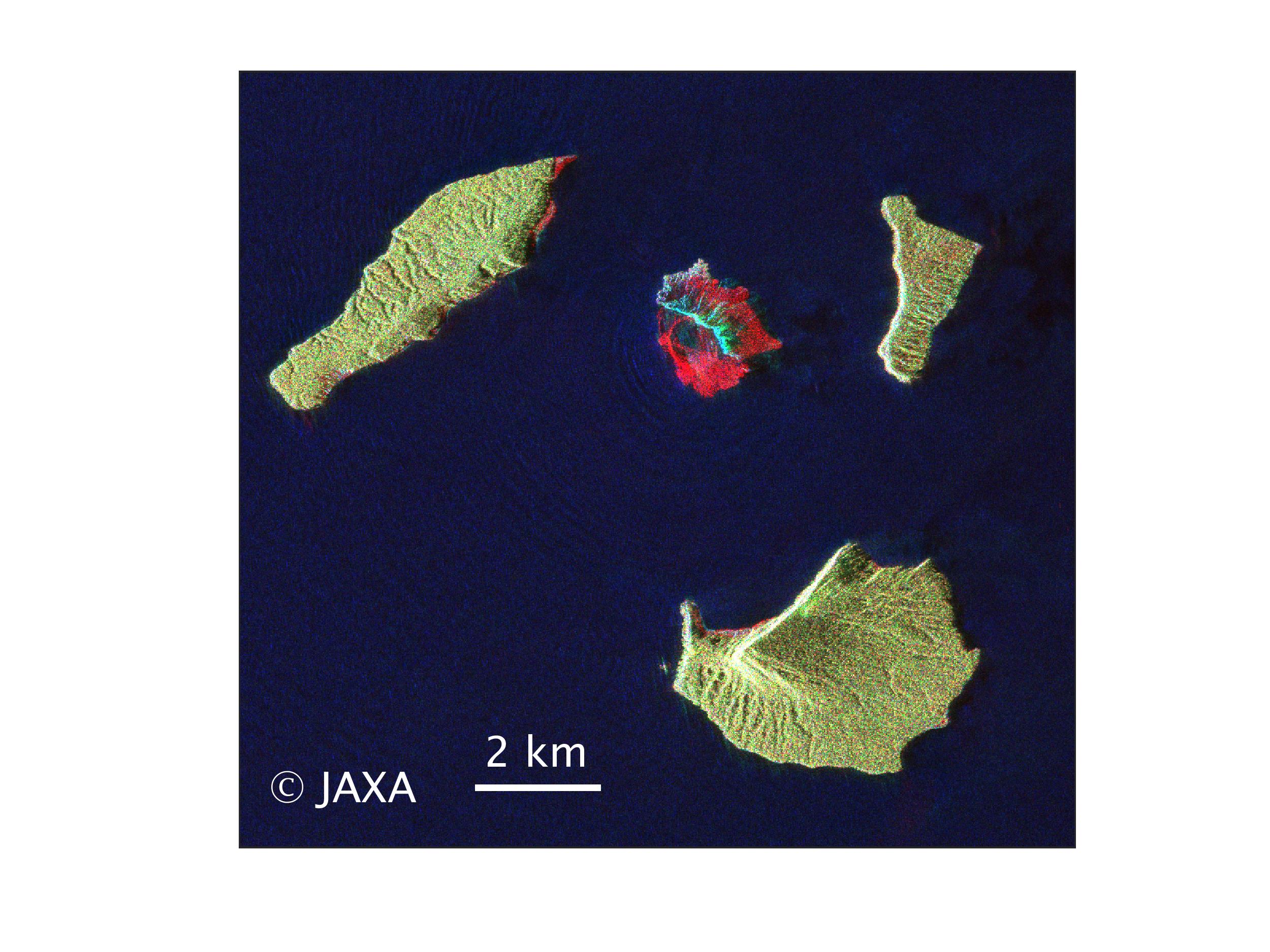 Fig. 3: Polarimetric color-composite image acquired before (August 20, 2018) and after (December 24, 2018) the eruption.
(Click to view enlarged image)
Figure 3 shows a polarimetric color-composite image (red: August 20 HV polarization, green: December 24 HV pol., blue: December 24 HH pol.), where the topographic change is easier to identify than Figure 2.
© JAXA EORC
Japan Aerospace Exploration Agency
Earth Observation Research Center
© Copyright 1997- All Rights Reserved.
© Copyright 1997- All Rights Reserved.