International Asian Harvest mOnitoring system for Rice (INAHOR)
Estimation of Paddy Rice Planted Area using Synthetic Aperture Radar - Development of Software “INAHOR”
Software “INAHOR” (International Asian Harvest mOnitoring system for Rice) has been developed, which estimates the area of the paddy rice to be planted. This uses data from the L-Band Synthetic Aperture Radar (PALSAR-2) on the Advanced Land Observation Satellites “DAICHI 2” (ALOS-2) operated for two or more time periods. In South East Asia, in particular in the rainy season when paddy rice is planted, the subject area is often covered with heavy cloud. However, the synthetic aperture radar can monitor rice conditions regardless of cloud presence. EORC is advancing a collaboration project with research organizations in Indonesia and Vietnam, and the Asian Development Bank. These are for various countries to be able to collect agricultural statistics data much effectively using this software.
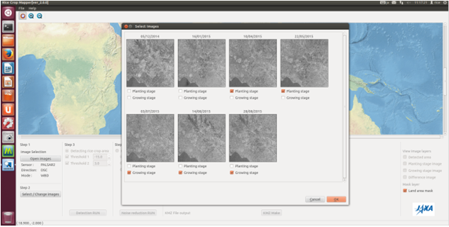
Selection of the Synthetic Aperture Radar to be used
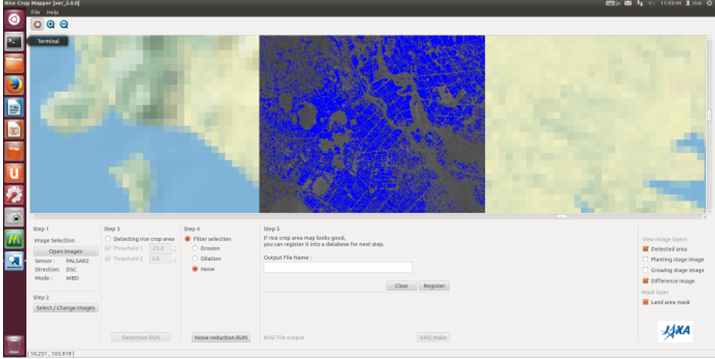
Estimation Results for the Paddy Rice Planted Area (blue section)