


Observed images, research and application examples by ALOS series.
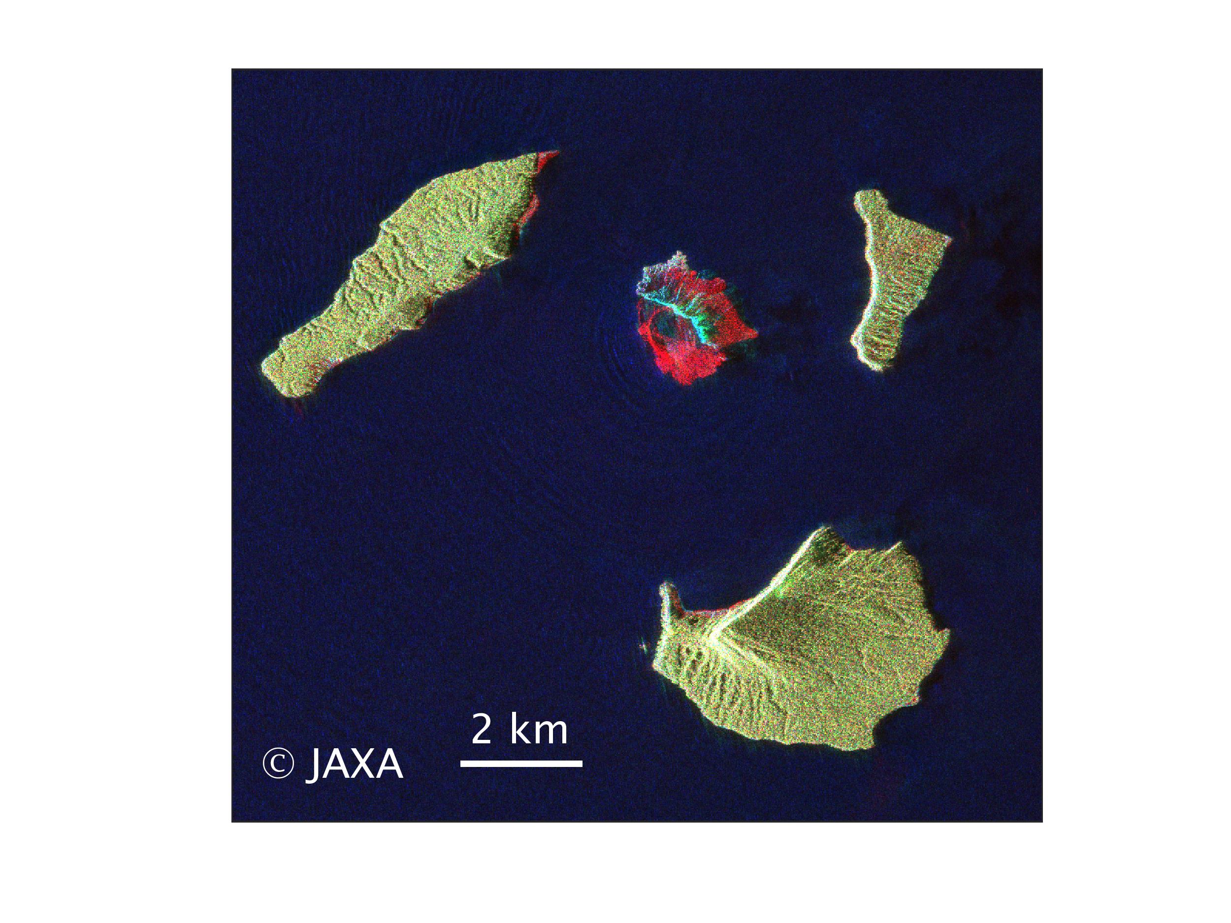
Observation Result for Eruption of Anak Krakatau Volcano in Indonesia by ALOS-2.
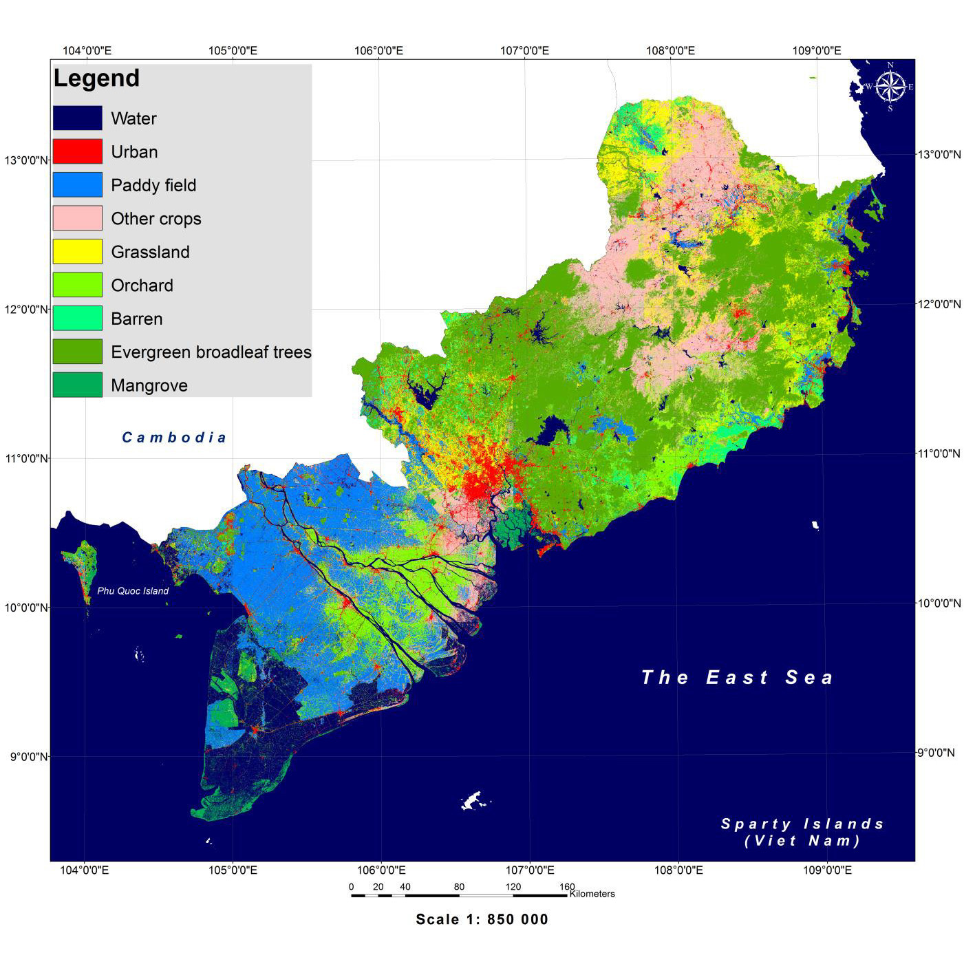
HRLULC map of the southern region of Vietnam (ver.18.09) has been released.
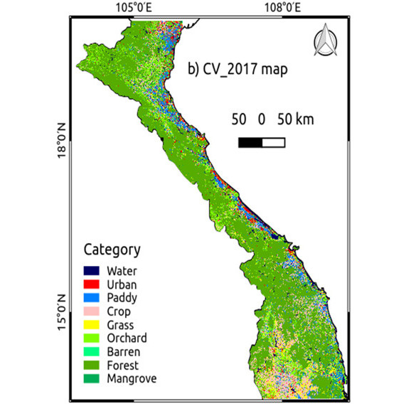
HRLULC map of the central region of Vietnam (ver.18.07) has been released.
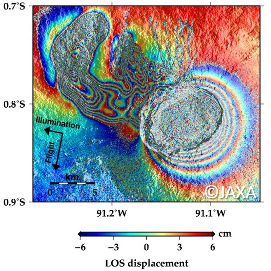
ALOS-2/PALSAR-2 Observation Result for Eruption of Mt. Sierra Negra in Galapagos.
Jun. 13, 2018
Jun. 8, 2018
Jun. 5, 2018
Jun. 1, 2018
May 23, 2018
May 21, 2018
May 15, 2018
May 9, 2018
PALSAR-2
Mt. Kilauea
earthquake
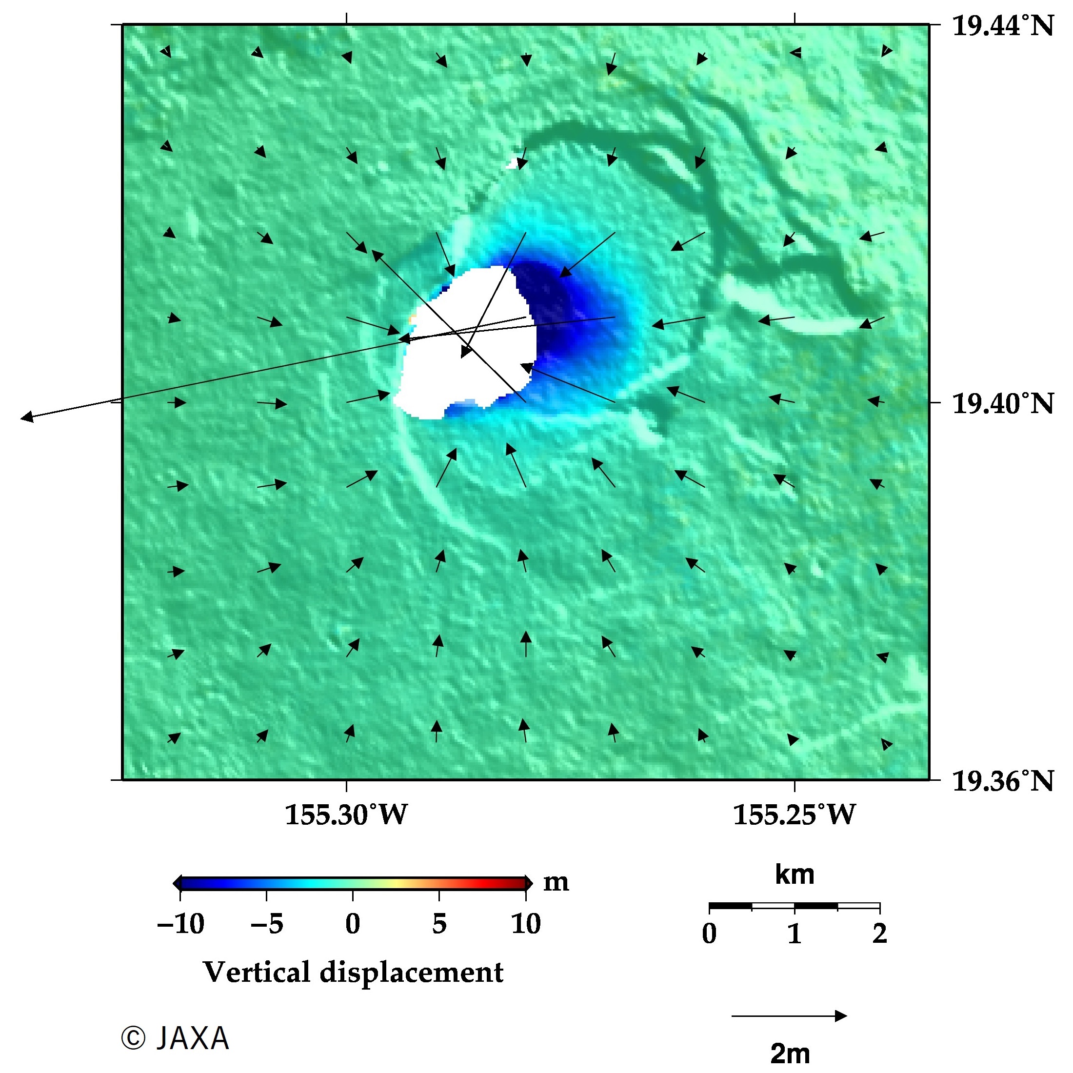
ALOS-2/PALSAR-2 Observation Result for Eruption of Mt. Kilauea and Earthquake in Hawaii. [Update on Jun. 22, 2018]

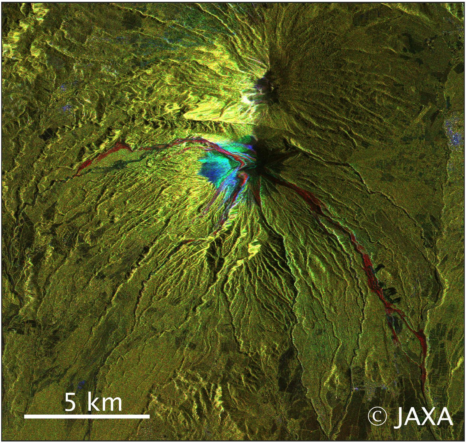
ALOS-2/PALSAR-2 Observation Result for Eruption of Mt. Fuego in Guatemala.
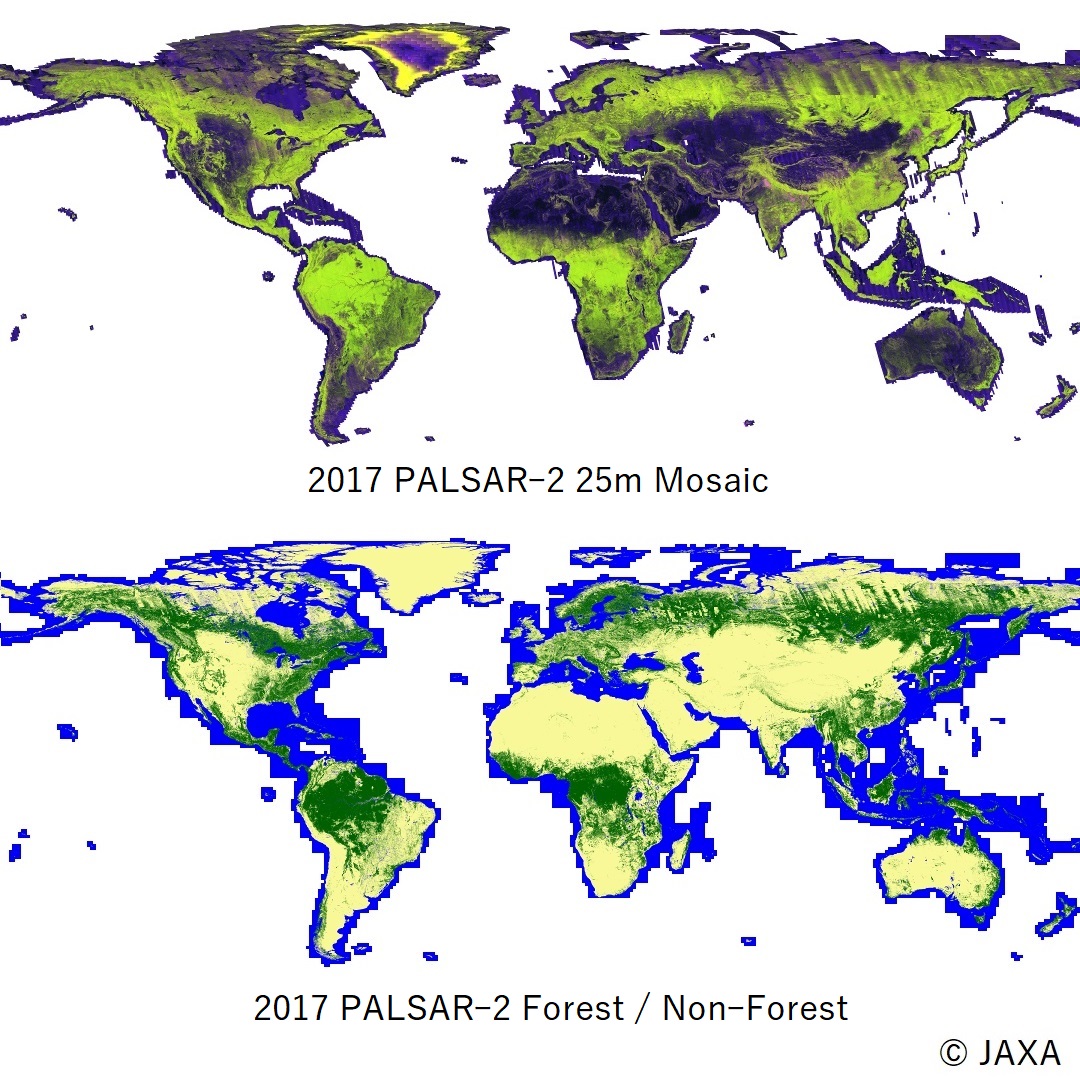
PALSAR-2 Global mosaic and forest/non-forest map (2017 global dataset, and low resolution dataset of 2015-2017) are released.
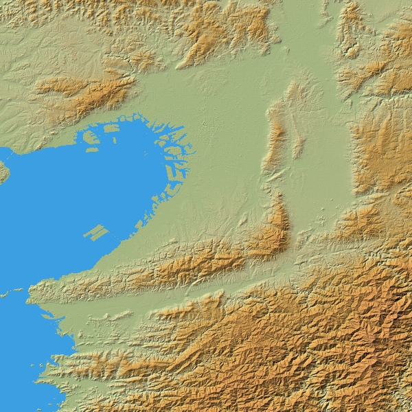
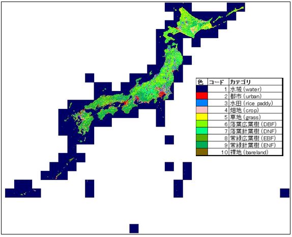
"High Resolution Land Use Land Cover Diagram Homepage updated (ver.18.03).
Observation Results for Eruption of Shinmoedake by ALOS-2 and COSMO-SkyMed
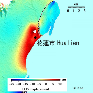
ALOS-2/PALSAR-2 observation results on Hualien Earthquake, Taiwan.