Dataset
Dataset
This page shows the research products processed in EORC, JAXA. These will be used in many application fields to contribute the Earth science.
K&C Mosaic
The reference dataset for the "ALOS Kyoto and Carbon Initiative Project".
Global PALSAR-2/PALSAR/JERS-1 Mosaic and Forest/Non-Forest map
Global 25m-resolution mosaic using ALOS-2 PALSAR-2, ALOS PALSAR, and JERS-1 SAR images and global forest/non-forest map.
Old Version
PALSAR mosaic dataset with 10m spatial resolution.
- Porto Velho, Rondonia, Brazil
- Riau, Indonesia
- Congo River
The global forest and non-forest area distribution in 2007 and 2009 by PALSAR.
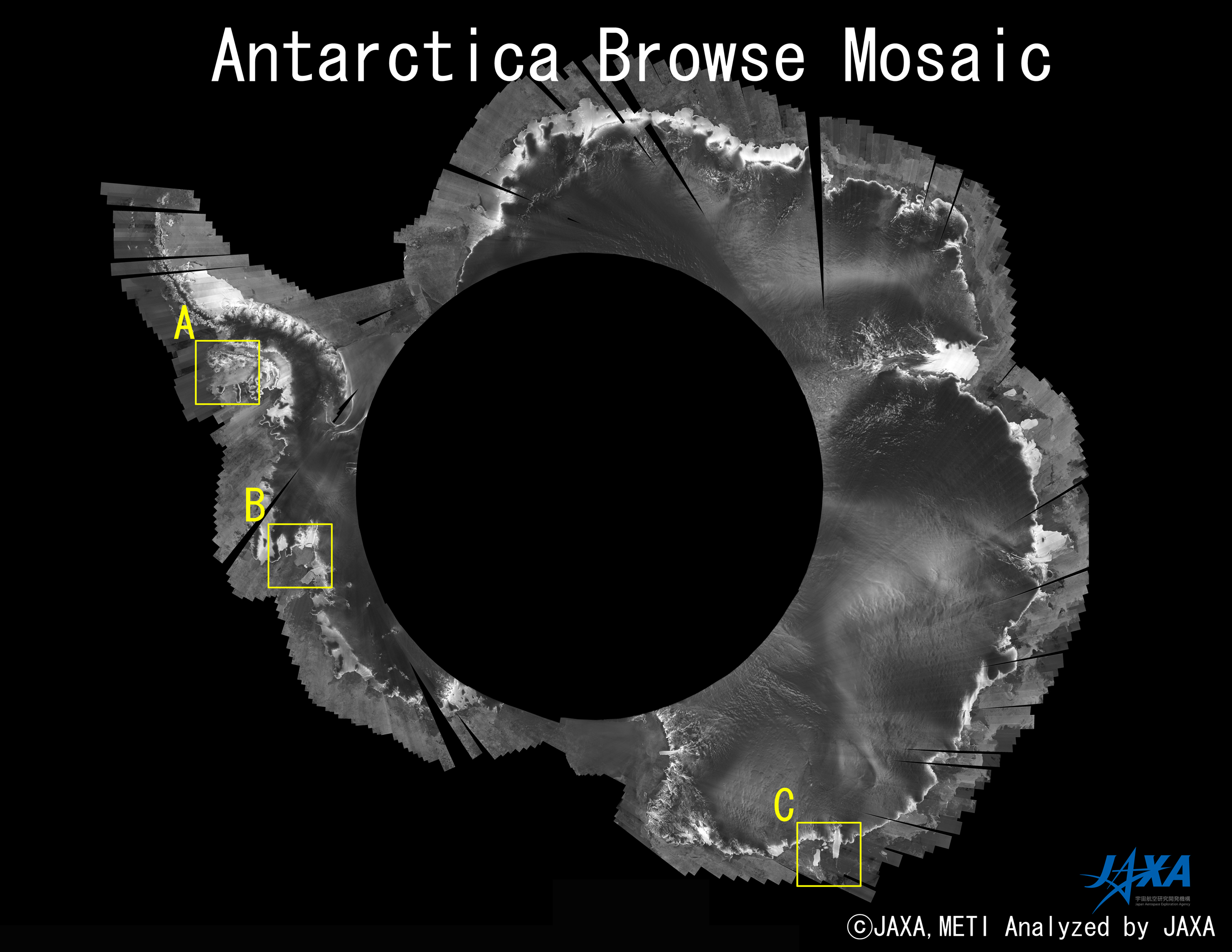
IPY Dataset Homepage
Monitoring the north and south polar regions using PALSAR for contributing " International Polar Year ".
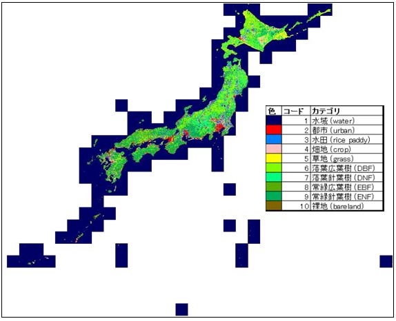
High Resolution Land-Use and Land-Cover Map
Research products developed by ALOS/ALOS-2 Science Project and "Earth Observation Priority Research: Ecosystem Research Group".
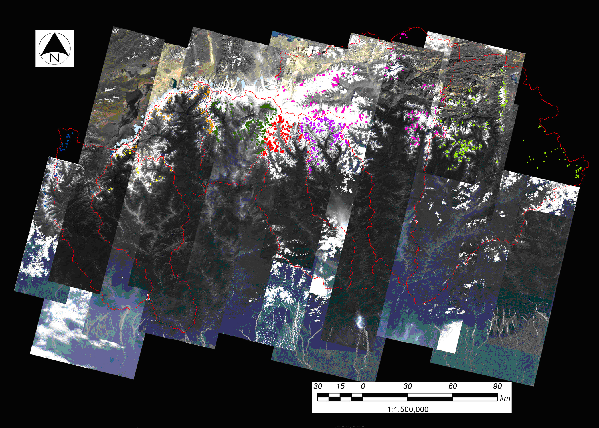
Glacial Lake Inventory of Bhutan
Data Release Glacial Lake Inventory of Bhutan using AVNIR-2 and PRISM.
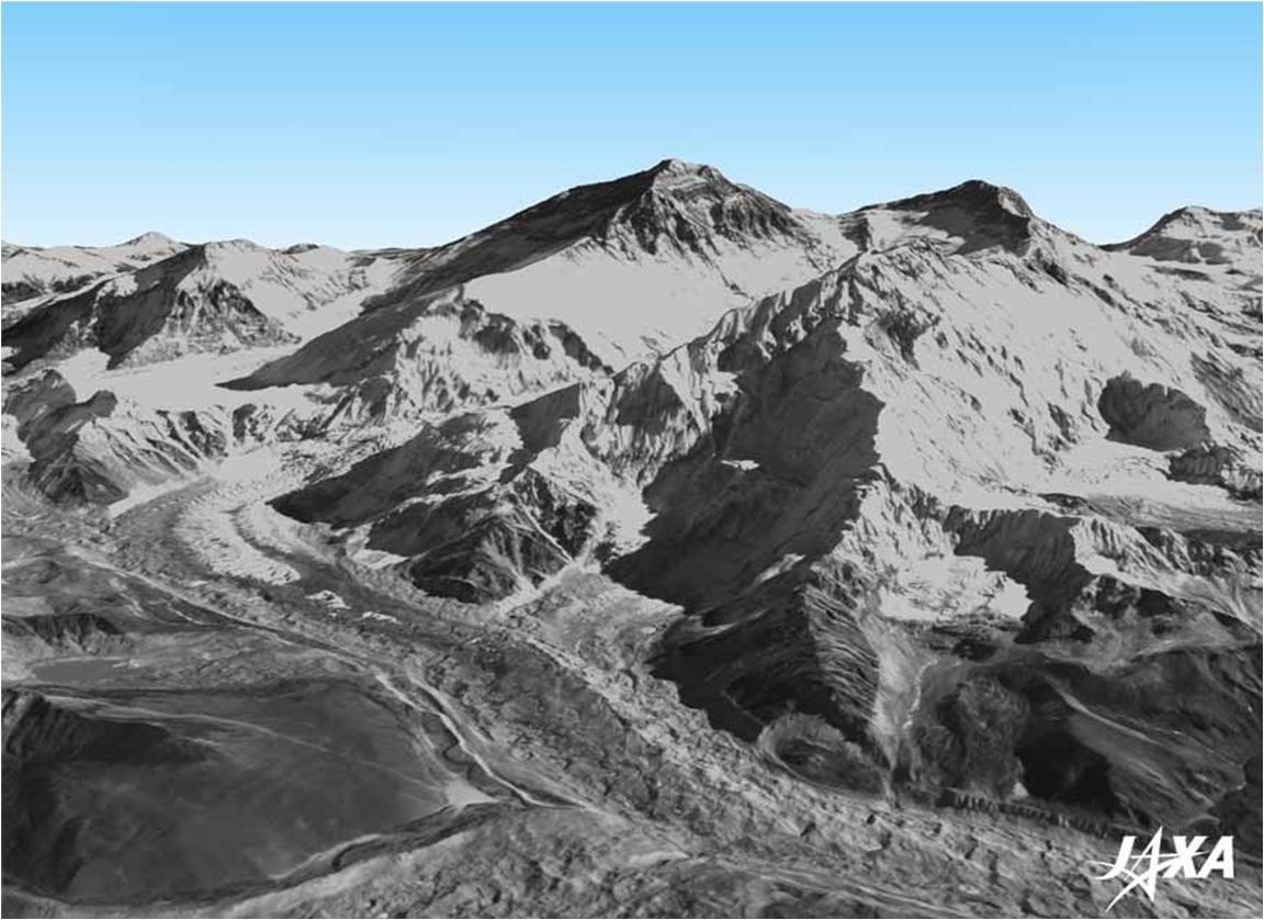
Precise Global Digital 3D Map "ALOS World 3D"
JAXA is starting to process the precise global digital 3D map using some 3 million data images acquired by the ALOS. The digital 3D map to be compiled this time has the world's best precision of five meters in spatial resolution with five meters height accuracy that enables us to express land terrain all over the world. Hence its strong character will prove useful in various areas including mapping, damage prediction of a natural disaster, water resource research etc.
ALOS Ortho Rectified Image Product (ALOS-ORI)
This consists of the ALOS/AVNIR-2 ORI product with approx.10-meter mesh in horizontal resolution. The dataset of the Japanese islands is released.