Dataset
PALSAR 10m Mosaic Data Download Page
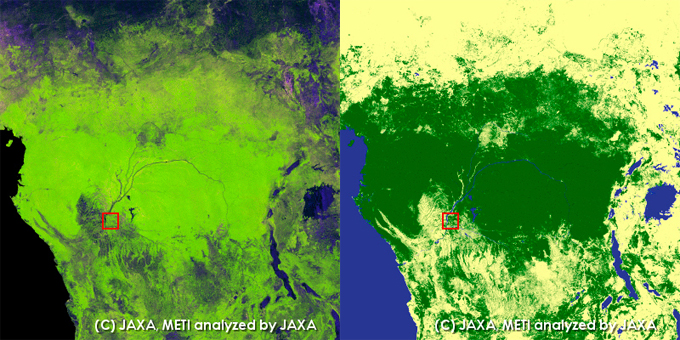
Three samples of the 10-meter resolution*1 PALSAR mosaic data (RAW data) and the corresponding forest/non-forest distribution can be downloaded by clicking the given FTP site. All these data are processed for the geometric correction*2 and radiometric correction*3. The observation mode is FBD(HH,HV) and the off-nadir angle is 34.3 degrees. The data covers one-degree square area which is shown in the red rectangle of the following figures.
*1 Mosaic data are projected onto the equi-latitude and longitude coordinates and the spatial resolution of 10m corresponds to nearly 0.323 sec.
*2 geometric correction means the ortho-rectification.
*3 radiometric correction means the radiometric slope correction that reduces the intensity variance caused by the topography.
1) Porto Velho, Rondonia, Brazil
| Year | Thumbnail Image |
|---|---|
| Thumbnail Image |  |
| Download Data |
2) Riau, Indonesia
| Year | Thumbnail Image |
|---|---|
| Thumbnail Image |  |
| Download Data |
3) Congo River
| Year | Thumbnail Image |
|---|---|
| Thumbnail Image |  |
| Download Data |
|
*4 The header file adhere to ENVI software is included in the zip archive of RAW data.
This dataset is available to use with no charge under the "Terms for Use".
To publish images using the dataset, please display "©JAXA, METI" in the image.