 Climate System and Radiation Process
The software (for Radiative Transfer Code and Satellite Data Simulator) required for the higher-level earth observation satellites has been developed for the basis of researches. Also, research on how to use this software effectively is being conducted. For example, jointly with the University of Tokyo, research will be done with the world latest Global Cloud-resolving Numerical Atmospheric Model (NICAM). This will simulate the Earth’s atmosphere, expressing cloud and precipitation process very realistically, and the NICAM will be assessed using the data collected from two or more satellites. Also, research is being done to contribute to the enhancement of weather forecast accuracy by introducing cloud and precipitation data from satellites into numerical weather prediction. These are joint-works with the Meteorological Research Institute in the Japan Meteorological Agency, and RIKEN.

Takuji Kubota
Associate Senior Researcher
Earth Observation Research Center
Space Technology Directorate 1
Example of the Results of Passive Microwave Radiometer Simulation around Japan

Simulation Results of the Tropical Rainfall Measuring Mission's microwave observation system (TRMM Microwave Imager: TMI) observations around Japan using the satellite data simulator (Joint-Simulator): The atmospheric data obtained using the JMA Non-Hydrostatic Model provided by the Meteorological Research Institute, Japan Meteorological Agency, has been employed for the calculation.
The difference in brightness in the above simulation results clearly shows the temperature corresponding to the TMI’s observed frequencies and polarized waves.
Comparison between Geostationary Meteorological Satellite (GMS) data and Simulation Data (Hashino et al. 2013)
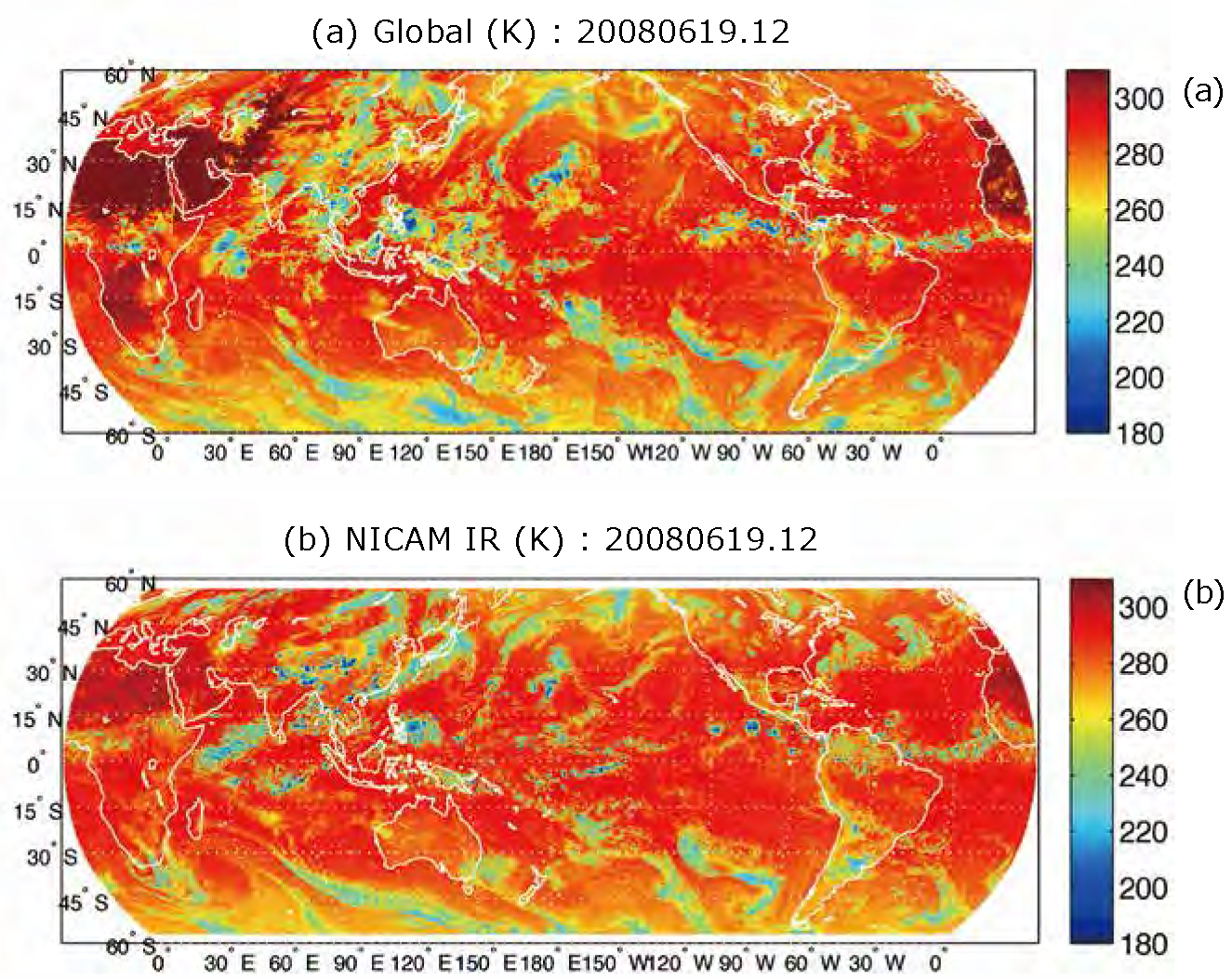
(a) Geostationary Meteorological Satellite Data (IR 10.8 µm)
(b) Synthetic satellite data created based on the Global
Cloud-resolving Atmospheric Model (NICAM) 3.5km resolution simulation data with satellite data simulator (Joint-Simulator) applied
Comparing (a) to (b) clarifies that NICAM reproduces the horizontal cloud distribution successfully.


