 Agriculture
Japan depends on imports for most of its food. When we turn our eyes to the world, 800 million people, 10% of the world population, lack adequate nourishment. Concerning issue, we hope to help create societies where the governments of various nations of the world, international organizations and private enterprises can make decisions effectively and efficiently for crop production, import and export, and food assistance. This can be based on scientific and objectively measured crop growing conditions and yield prediction data using earth observations. EORC works hard on research and development to continuously survey and make forecasts about crop yields. This includes where crops are produced, growing conditions, when and how much is harvested etc., in cooperation with research organizations and government agencies in and out of Japan.

Kei Oyoshi
Associate Senior Researcher
Earth Observation Research Center
Space Technology Directorate 1
Estimation of Paddy Rice Planted Area using Synthetic Aperture Radar (ALOS-2) Development of Software "INAHOR"
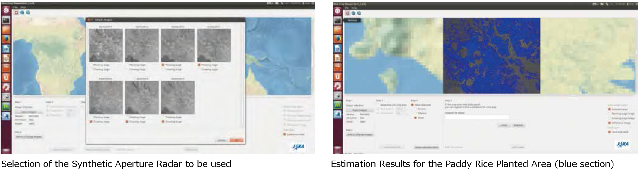
Software "INAHOR" (International Asian Harvest mOnitoring system for Rice) has been developed, which estimates the area of the paddy rice to be planted. This uses data from the L-Band Synthetic Aperture Radar (PALSAR-2) on the Advanced Land Observation Satellites "DAICHI 2" (ALOS-2) operated for two or more time periods. In South East Asia, in particular in the rainy season when paddy rice is planted, the subject area is often covered with heavy cloud. However, the synthetic aperture radar can monitor rice conditions regardless of cloud presence. EORC is advancing collaboration projects with organizations in Indonesia, Vietnam and other countries, and the Asian Development Bank. These are for various countries to be able to collect agricultural statistics data much effectively using this software and ALOS-2 data.
Development of the Agro-meteorological Information Service System (JASMIN) for assessing Crop Conditions
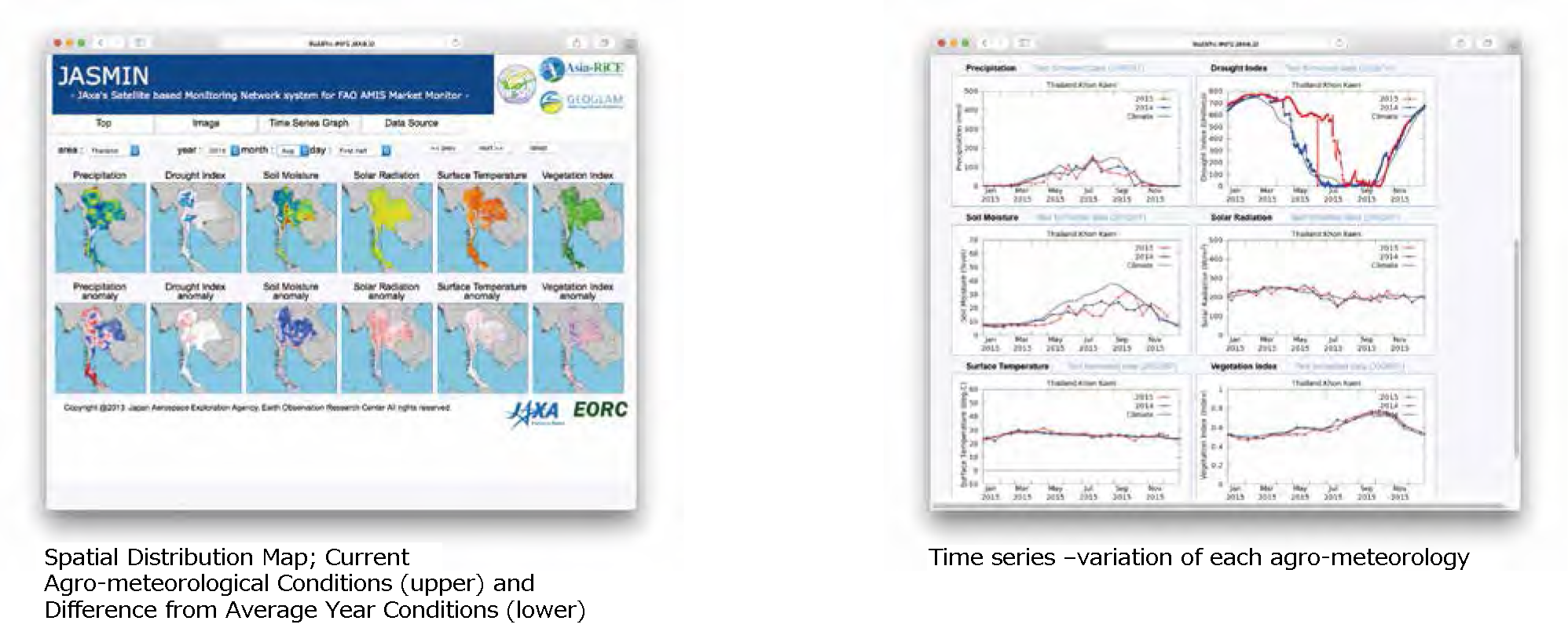
Crop growth is strongly related to agro-meteorological factors such as solar radiation, temperature and the water environment. Therefore, when a wide range and timely agro-meteorological data can be obtained, it is very useful to assess crop conditions on an entire country scale. The system "JASMIN (JAXA’s Satellite based Monitoring Network system for FAO AMIS outlook)" has been developed so the latest conditions of precipitation, soil moisture, solar radiation etc., can be accessed through the web site. For various agrometeorological information data items, using this system, current conditions and the difference compared to average year conditions can be comprehensively assessed. Also, EORC works on research for estimating main crops shortterm production using such information and crop models.


