6th SAFE Workshop AGENDA - April 23, 2014
< Last Update: 15 May. 2014 >
BERJAYA TIMES SQUARE, KUALA LUMPUR, Malaysia
![]()
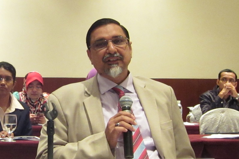
Co-Chair:
Associate Prof. Dr. Abdul Rashid Bin Mohamed Shariff, Universiti Putra Malaysia (UPM), Malaysia,
Dr. Lal Samarakoon, Director of Geoinformatics Center, Asian Institute of Technology (AIT)
| Time | Agenda Item(s) |
|---|---|
| 9:00 | Registration Open | 9:00-9:30 | Review board meeting (Closed) |
| 9:30-17:00 SAFE Workshop | |
| 9:30-10:25 (5min) |
Opening session |
| 5min 10min |
- Introductions by all participants |
| 9:55-10:10 |
- Report of the SAFE Workshop: APRSAF-20 outcomes (SAFE secretariat) Mr. Ko Hamamoto |
| 10:10-10:25 |
- Key Remarks (Dr. Noordin Bin Ahmad, Director General, ANGKASA) |
| 10:25-12:25 | Progress Report of On-going prototyping (20mins each, including 5mins Q&A/Discussion) |
| 10:25-10:45 |
- Monitoring of Agricultural Land Abandonment Using Remote Sensing (Dr. Farrah Melissa Muharam, UPM, Malaysia) |
| 10:45-11:05 |
- Rice Crop Monitoring in the Mekong Delta, Vietnam (Dr. Lam Dao Nguyen, STAC, VNSC, VAST, Vietnam) |
| 11:05-11:25 |
- Utilizing satellite data, numerical rainfall forecasts, combining with ground observations in flood forecasting for the Thai Binh river system (Mr. Dang Ngoc Tinh, Division Chief, NHMS/MONRE, NCHMF, Vietnam) |
| 11:25-11:45 |
- Assessment and evaluation of erosion and sedimentation on the coast from Hai Phong to Thanh Hoa province, in Vietnam (Dr. Nguyen Tanh Hung, Deputy Director, KLORCE, VAWR, Vietnam) |
| 11:45-12:05 |
- The assessment of Mangrove Forest Carbon Stock Monitoring of Indonesia using Remote Sensing Approach (Dr. Ety Parwati, LAPAN, Indonesia) |
| 12:05-12:25 |
- SAR Technology Application for Paddy Crop Monitoring in Central Area of Paddy Production, in Indonesia (Dr. Wahyu Supriatna, ICALRD, Indonesia) |
| 12:25-14:00 | Group photo Lunch Break |
| 14:00-14:05 | Report of Review board meeting (Co-Chair) |
| 14:05-14:45 | Special report from Local stakeholders (20mins each, including 5mins Q&A/Discussion) |
| 14:05-14:25 |
- Above ground Biomass Carbon Mapping and Changes Monitoring in the Forests of Peninsular Malaysia Using L-band ALOS PALSAR and JERS-1 (Mr. Hamdan Omar, Forest Research Institute Malaysia) |
| 14:25-14:45 |
- Spot-5 Multispectral Images for 60-75 days of rice mapping (Mr. Amiruddin Bin Ramli, UPM, Malaysia) |
| 14:45-15:15 | Final report of Prototypes expecting completion 1 (30mins each, including 10mins Q&A/Discussion) |
| 14:45-15:15 |
- Assessment of drought impact on rice production in Indonesia by satellite remote sensing and dissemination with WEB-GIS (Dr. Rizatus Shofiyati, ICALRD, Indonesia) |
| 15:15-15:25 | Coffee Break |
| 15:25-16:25 | Final report of Prototypes expecting completion 2 (30mins each, including 10mins Q&A/Discussion) |
| 15:25-15:55 |
- Water and Food Security under the Climate Change (Mr. So Im Monichoth, MOWRAM, Cambodia) |
| 15:55-16:25 |
- Investigation of sedimentation process and stability of the area around the cross-dams in Meghna estuary (Mr. Md. Sohel Rana, LGED, Bangladesh) |
| 16:25-16:45 | Special report from Post prototype (20mins each, including 5mins Q&A/Discussion) |
| 16:25-16:45 |
- 16:25-16:45 (Mr. Ajith Gunawardena, CEA, Sri Lanka) |
| 16:45-17:00 |
Wrap-up
|


