Report of the SAFE Workshop in APRSAF-20
Hanoi, Vietnam
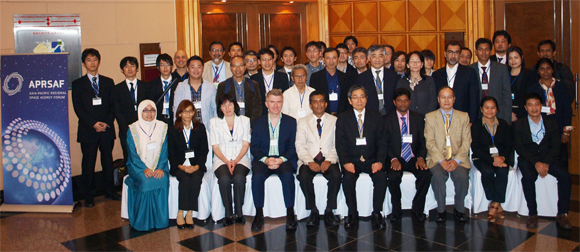
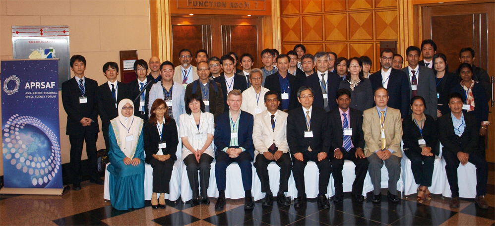
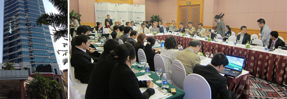
The SAFE Workshop in APRSAF20 was successfully and fruitfully finished at the Melia Hanoi hotel in Hanoi, Vietnam held on Dec 2. After the workshop, the result was reported to the Earth Observation Working Group and the plenary session which held continuously from Dec 3 to 6.
The workshop was led by co-chairs, Prof. Doan Minh Chung, Director of Space Technology Institute (STI)/Vietnam Academy of Science and Technology (VAST) and Dr. Lal Samarakoon, Director of Geoinformatics Center (GIC), Asian Institute of Technology (AIT). The total number of participants was 61 from several countries and int. organizations.
In the workshop, 4 new SAFE prototype proposals were reviewed and the status of 7 on-going prototypes was reported. At the same time, final report of Sri Lanka wetlands was confirmed.
The recommendations for the SAFE initiative were set as below;
RECOMMENDATIONS
[SAFE (Space Applications For Environment)]
- Welcomes two new SAFE prototypes with important societal benefits for the region, namely: Coastal Erosion (Vietnam) and Flood Forecasting (Vietnam): and recognizes the good progress of the ongoing SAFE prototypes;
- Congratulates the Central Environmental Authority (CEA), Sri Lanka on the completion of their SAFE prototype on Wetlands Mapping and welcomes the interest of donor agencies to move forward to implement operationally;
- Approves the new management procedure for evaluating compatibility with donor agency projects from the outset, to increase appeal to donor agencies and to promote emergence of sustainable applications of SAFE results. Instructs the SAFE secretariat to put this procedure into effect for management of the SAFE prototypes.
Workshop Report from secretariat
- 4 new prototype proposals reviewed:
- Assessment and Evaluation of Erosion and Sedimentation on the Coast from Hai Phong to Thanh Hoa Province, in Vietnam (VAWR, Vietnam)
- Utilizing Satellite Data, Numerical Rainfall Forecasts, Combining with Ground Observations in Flood Forecasting for the Thai Binh River System (NHMS/MONRE, Vietnam)
- Development of Methodology for Glacier and Lake Monitoring System to Evaluate Environmental Changes on the Base of Remote Sensing and GIS-Technologies (Ulugh Beg Astronomical Institute of the Uzbek Academy of Sciences, Uzbekistan)
- Spatial and Temporal Changes of "Trees Outside Forest" sources in Upper Mahaweli Catchment in Sri Lanka: Determinants and Vulnerability assessment (University of Sri Jayawardhenapura, Sri Lanka)
- Progress reports from on-going and completing prototypes:
- Mapping and change detection of wetlands in SE river basin in Sri Lanka using optical and PALSAR remote sensing (CEA, Sri Lanka)
- Assessment of drought impact on rice production in Indonesia by satellite remote sensing and dissemination with web-GIS (ICALRD, Indonesia)
- Water & Food Security under Climate Change (MOWRAM, Cambodia)
- Investigation of sedimentation process and stability of the area around the cross-dams in Meghna estuary (LGED, Bangladesh)
- The assessment of Mangrove Forest Carbon Stock Monitoring of Indonesia using Remote Sensing Approach (LAPAN, Indonesia)
- SAR Technology Application for Paddy Crop Monitoring in Center of Paddy Area, in Indonesia (ICALRD, Indonesia)
- Monitoring of Agricultural Land Abandonment Using Remote Sensing (Universiti Putra Malaysia, Malaysia)
- Rice Crop Monitoring in the Mekong Delta, Vietnam (HCMIRG/VAST, Vietnam)
Result of Reviewing New Proposals
| 1 | Assessment and Evaluation of Erosion and Sedimentation on the Coast from Hai Phong to Thanh Hoa Province, in Vietnam (VAWR, Vietnam) | APPROVED with comments |
| 2 | Utilizing Satellite Data, Numerical Rainfall Forecasts, Combining with Ground Observations in Flood Forecasting for the Thai Binh River System (NHMS/MONRE, Vietnam) | APPROVED |
| 3 | Development of Methodology for Glacier and Lake Monitoring System to Evaluate Environmental Changes on the Base of Remote Sensing and GIS-Technologies (Ulugh Beg Astronomical Institute of the Uzbek Academy of Sciences, Uzbekistan) | Request revision |
| 4 | Spatial and Temporal Changes of “Trees Outside Forest” sources in Upper Mahaweli Catchment in Sri Lanka: Determinants and Vulnerability assessment (University of Sri Jayawardhenapura, Sri Lanka) | Request revision |
Reviewer's comments
1. Vietnam (Coastal erosion)
- - Need emphasis on morphological change study
- - EO Data selection and sourcing needs to be clarified
- - Sustainability of operational application needs to be confirmed
- - Engagement of related gov't ministries will be key to success (rivers, meteorology)
2. Vietnam (Flood forecasting)
- - Clarify role of ICHARM
- - Clarify relationship with ADB project
- - Confirm role of existing in-situ sensors for calibration
- - Good opportunity to develop methodology for broader application
3. Uzbekistan (Glacier & Lake monitoring)
- - Relevant end user engagement and clarity needed
- - Need much more technical details and basic schedule etc.
- - Outcomes and their application to be clarified
4. Sri Lanka (Trees Outside Forests)
- - Consistency of satellite data requirements with target years needs very careful study
- - Sustainability of operational application needs to be confirmed
Progress report and results on Ongoing Prototypes
Completing prototyping
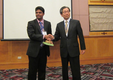
Sri Lanka (Wetlands mapping & change detection)
- - Successful completion of the prototype for wetland monitoring by CEA (Sri Lanka) was confirmed.
- - CEA presented the future plan of applying the outcome of SAFE prototyping to Northern Part of Sri Lanka: CEA and JAXA will discuss the necessary measures to assist CEA's plan.
- - Significance of map information or database has been acknowledged in Sri Lankan stakeholders for conserving nations.
- - Continuous monitoring of wetlands and providing the information to the public should be important for nature conservation as it may also contribute the decision makings by policy makers
On-goings
1. Indonesia (Drought impact on rice production)
- - Coordination meeting at ICALRD in August 2013 delivering the progress and planning developing & updating of drought systems.
- - Workshop for end-user in August 2013 in West Java
- - Nation-wide drought condition data of rice field at sub-district level: COMPLETE
- - Satellite-based model of drought validated using ground-truth data: ONGOING
- - A Web-based system to disseminate drought information to end users: ONGOING
- - Suggestion to study the relationship between KBDI and drought information as same as VHI and drought for longer period to discuss the accuracy
2. Cambodia (Drought impact on rice production)
- - Since July the team has been working on a website for data-sharing, for rainfall, weather, and rice growth information.
- - Since November intensive flux & radiosonde observations are underway.
- - Rainfall prediction system for post-monsoon season: ONGOING;
- - Information dissemination to agricultural sector: ONGOING;
- - Achieving capacity for models, algorithms, data processing, and data management: ONGOING;
- - Stakeholder meeting: ONGOING.
- - Recommend to share rice crop growing information
3. Bangladesh (Sedimentation & stability)
- - Next steps are to: complete sediment transport models in Meghna Estuary; evaluate performance of cross dams; evaluate impact of climate change in terms of sea level rise and amplified storm surges; carry out training/technology transfer of LGED staff; plan and carry out stakeholder meetings
- - Analysis of the satellite datasets: COMPLETE;
- - Identification of relationship between hydrodynamic events and observed morphology changes: COMPLETE;
- - Numerical models analyzing morphological changes: ONGOING;
- - Impact assessment of climate change on the morphology changes of MES area: ONGOING;
- - Stakeholder meeting: PLANNING
- - Recommend to invite some stakeholder which is in charge of eco system protection
4. Indonesia (Carbon stock mangroves)
- - Achievements include: Mangrove forest map 1997, 1998, 2000, 2013. And 2013 mangrove map validation
- - Change assessment 1994, 1997, 1998, 2000, 2013. Still have problem in area calculation on 2013 data
- - Next steps include: evaluation of existing method and development of mangrove forest mapping model; biomass and carbon stock estimation model by using remote sensing.
- - Consider to integrate tropical rainfall forest monitoring with this prototyping
- - Double-Check the use of NDVI for biomass estimation and try the use of SW spectral band
- - Evaluate the use of PALSAR MOSAIC usage in mapping mangrove
5. Vietnam (Mekong Rice Crop)
- - Cosmo-Skymed, Radarsat-2, and Terrasar-X data has all been requested - and the Cosmo data has already been obtained.
- - Cultivated area maps have been developed.
- - Nagoya SAFE meeting comments have been acted upon
- - It is hoped to use SCANSAR from ALOS-2 and Sentinel-1 to cover the whole delta.
- - Rice distribution maps of the Vietnam's Mekong Delta using MODIS and ScanSAR data: ONGOING;
- - Rice yield estimation maps of An Giang province for a few districts using SAR data: ONGOING;
- - GIS database of rice: PLANNING;
- - Capacity for monitoring/estimating rice crops using RS data: PLANNING;
- - Stakeholder meeting: PLANNING.
- - Look forward to having C/L/X comparison study and correlation study between NDVI and backscattering for phenology
6. Indonesia (Paddy Crop Monitoring)
- - Kick-off just a few weeks ago
- - In 2014, expect:
- - Selected Satellite based model of estimating planted, harvested area, and production of paddy in the center of paddy area validated using ground truth data
- - Paddy area information at district and sub-district level of acreage, area harvested, and production of paddy derived from remote sensing data analysis in Subang with empirical model.
7. Malaysia (Abandoned Lands)
- - Phenology matrix for differentiation: ONGOING;
- - Identification and automated mapping of abandoned agricultural field: ONGOING;
- - Recommendation on RS data for abandoned agricultural fields identification: PLANNING;
- - Capacity for identifying & mapping abandoned agricultural fields by RS data: PLANNING;
- - Stakeholder meeting: PLANNING.
As a result of the workshop, prototyping line-up was updated:
| Status | Countries | Prototyping Title |
|---|---|---|
| Completed | Vietnam | Integrated water resource management |
| Vietnam | Forest monitoring | |
| Lao PDR | Forest monitoring and management | |
| Cambodia | Water Cycle and Agricultural Activities | |
| Pakistan | Monitoring Water Cycle Variations & Assessing Climate Change Impacts | |
| Sri Lanka | Risk of Sea Level Rise on Coastal Zone | |
| Indonesia | Potential Drought Monitoring | |
| Vietnam | Mangrove Forest Mapping and Carbon Stock Estimation | |
| Thailand | Economic Fish Larvae Mapping and Monitoring | |
| Sri Lanka | Modeling ocean frontal zones using high resolution satellite and float data to locate tune fish aggregations | |
| Sri Lanka | Mapping and Detecting Wetlands in River Basin | |
| On-going | Indonesia | Assessment of drought impact on rice production in Indonesia by satellite remote sensing and dissemination with web-GIS |
| Cambodia | Water and Food Security under the Climate Change | |
| Bangladesh | Investigation of sedimentation process and stability of the area around the cross-dams in Meghna estuary | |
| Indonesia | The assessment of Mangrove Forest Carbon Stock Monitoring of Indonesia using Remote Sensing Approach | |
| Indonesia | SAR Technology Application for Paddy Crop Monitoring in Center of Paddy Area, in Indonesia | |
| Malaysia | Monitoring of Agricultural Land Abandonment Using Remote Sensing | |
| Vietnam | Rice Crop Monitoring in the Mekong Delta, Vietnam | |
| Approved | Vietnam | Utilizing Satellite Data, Numerical Rainfall Forecasts, Combining with Ground Observations in Flood Forecasting for the Thai Binh River System |
| Approved with Comments |
Vietnam | Assessment and Evaluation of Erosion and Sedimentation on the Coast from Hai Phong to Thanh Hoa Province, in Vietnam |