Image Library
General Topics
2017
2017/10/12 2017/9/13
2017/8/9 2017/7/25 |
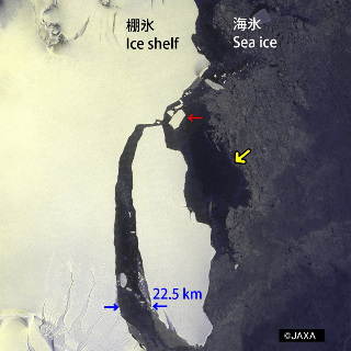
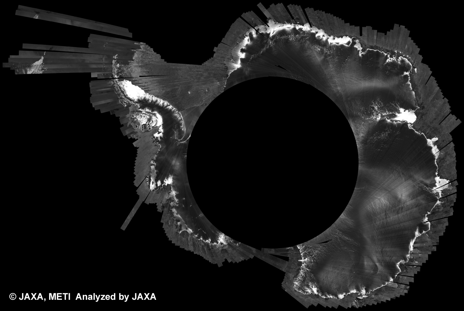
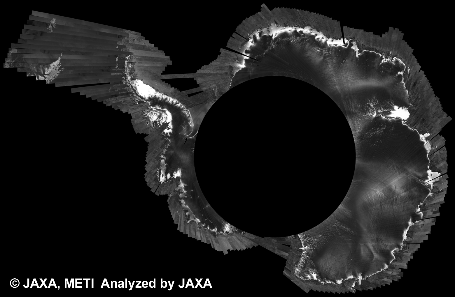
ALOS-2/PALSAR-2 Observation results on detachment of a large iceberg from Larsen-C Ice Shelf in Antarctic Peninsula. [Update on Oct. 12, 2017] PALSAR-2
Snow and Ice Related Research
|
 |
|---|
2014
Dec. 10, 2014 |
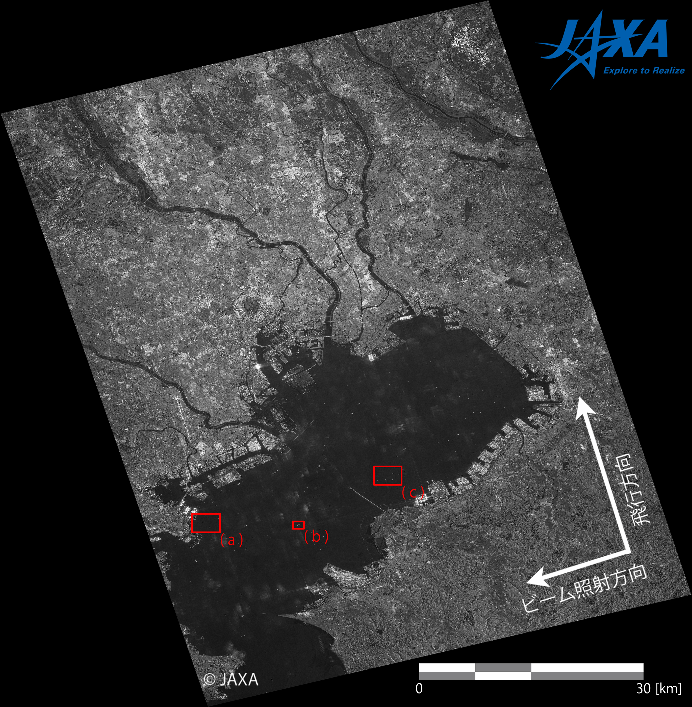
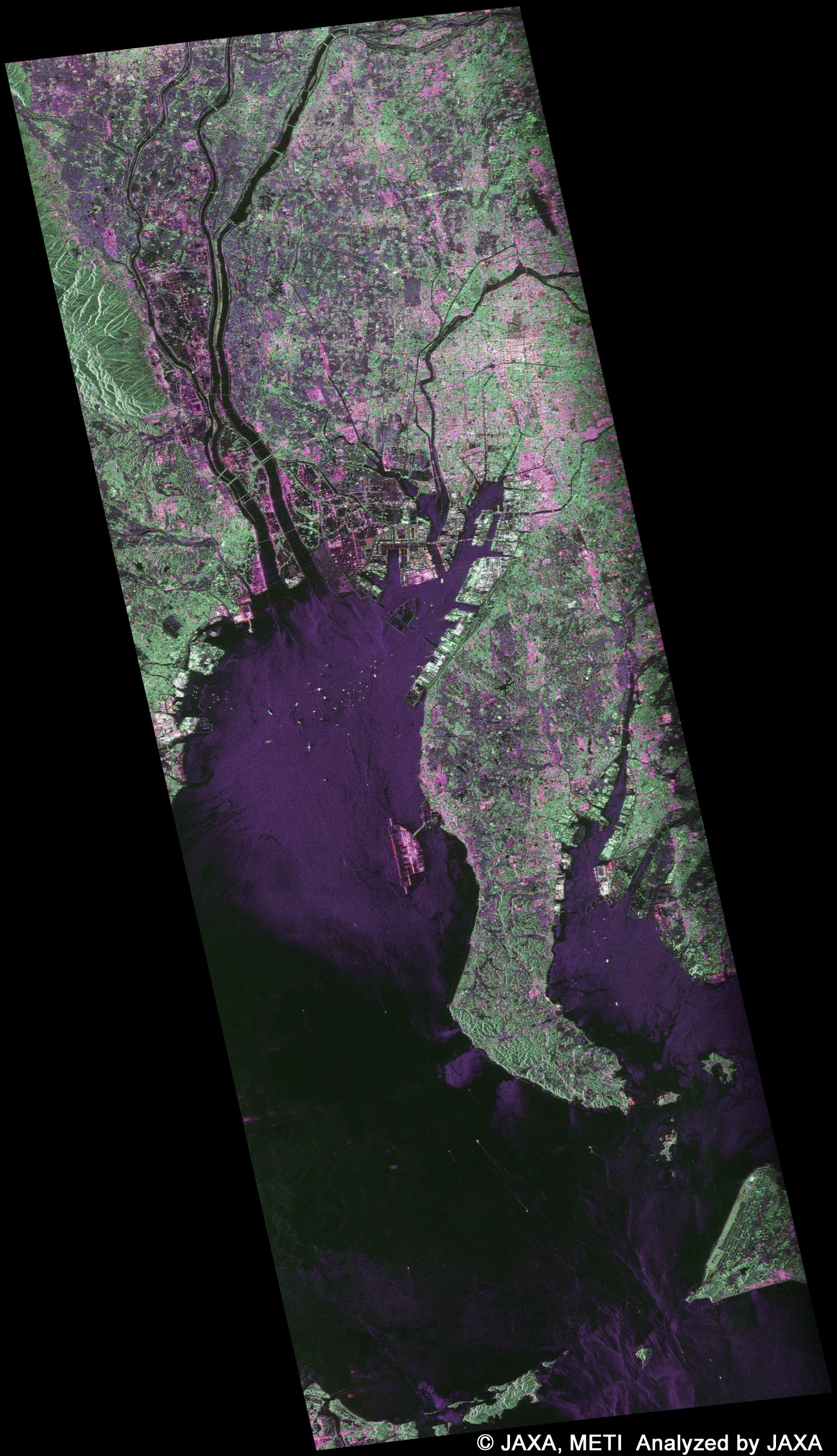
ALOS-2 images during the initial functional verification and calibration/validation phases - ship monitoring Tokyo Bay
Singapore Straits
off the coast of Kii Peninsula
PALSAR-2
|
 |
|---|---|---|
Dec. 8, 2014 |
ALOS-2 images during the initial functional verification and calibration/validation phases - Iceland Iceland
PALSAR-2
|
 |
Dec. 4, 2014 |
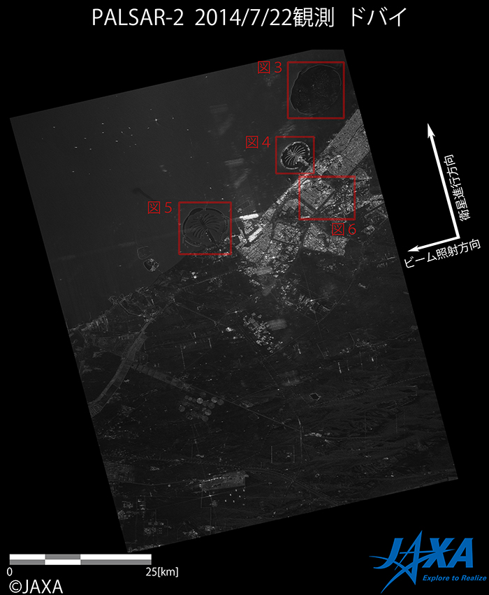
ALOS-2 images during the initial functional verification and calibration/validation phases - Dubai Dubai
PALSAR-2
|
 |
Jul. 2, 2014 |
First Image Data Acquisition by DAICHI-2 (ALOS-2) Tokyo Chiba Pref.
PALSAR-2
|
 |
2011
May 30, 2011 |
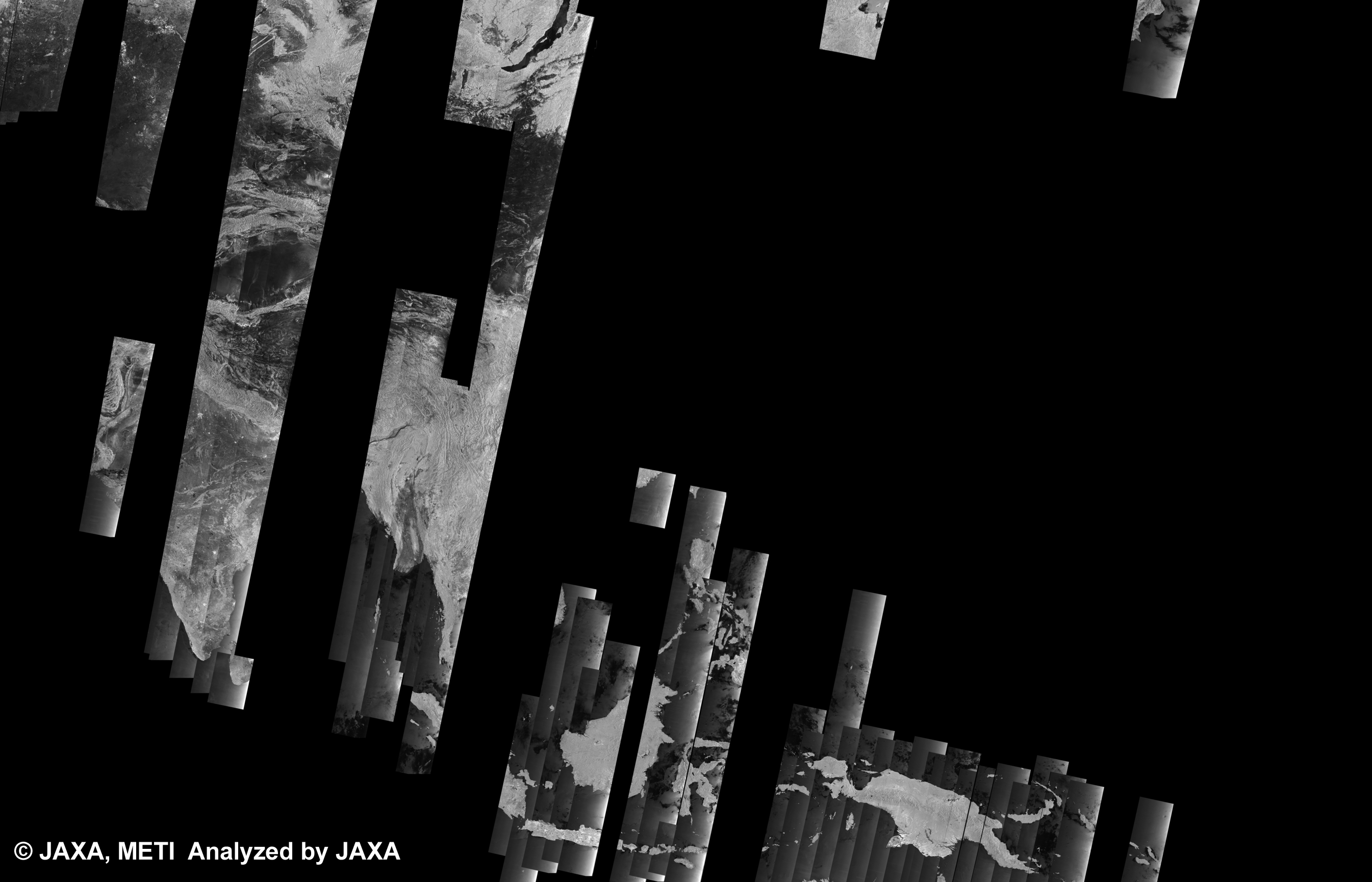
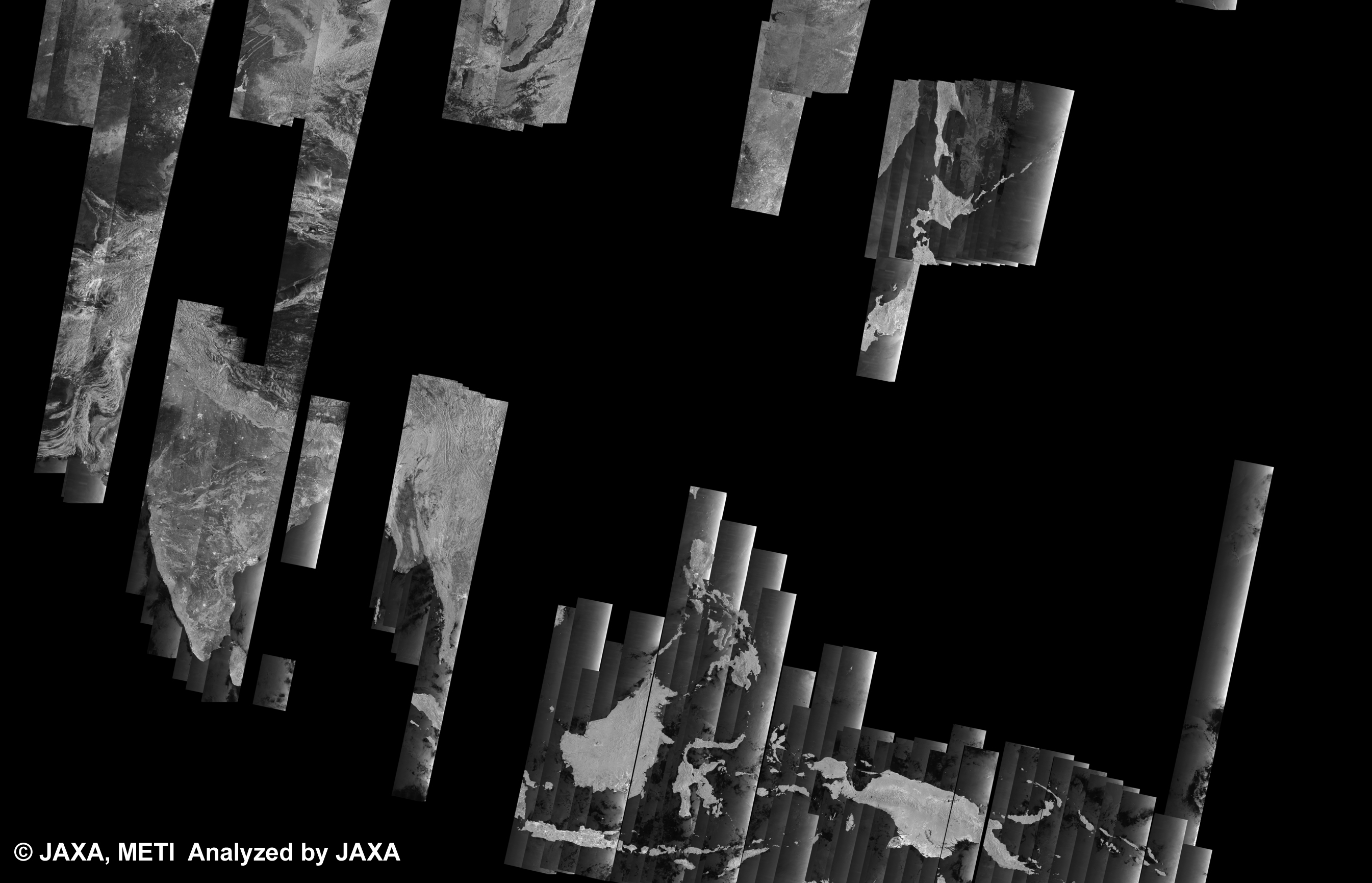
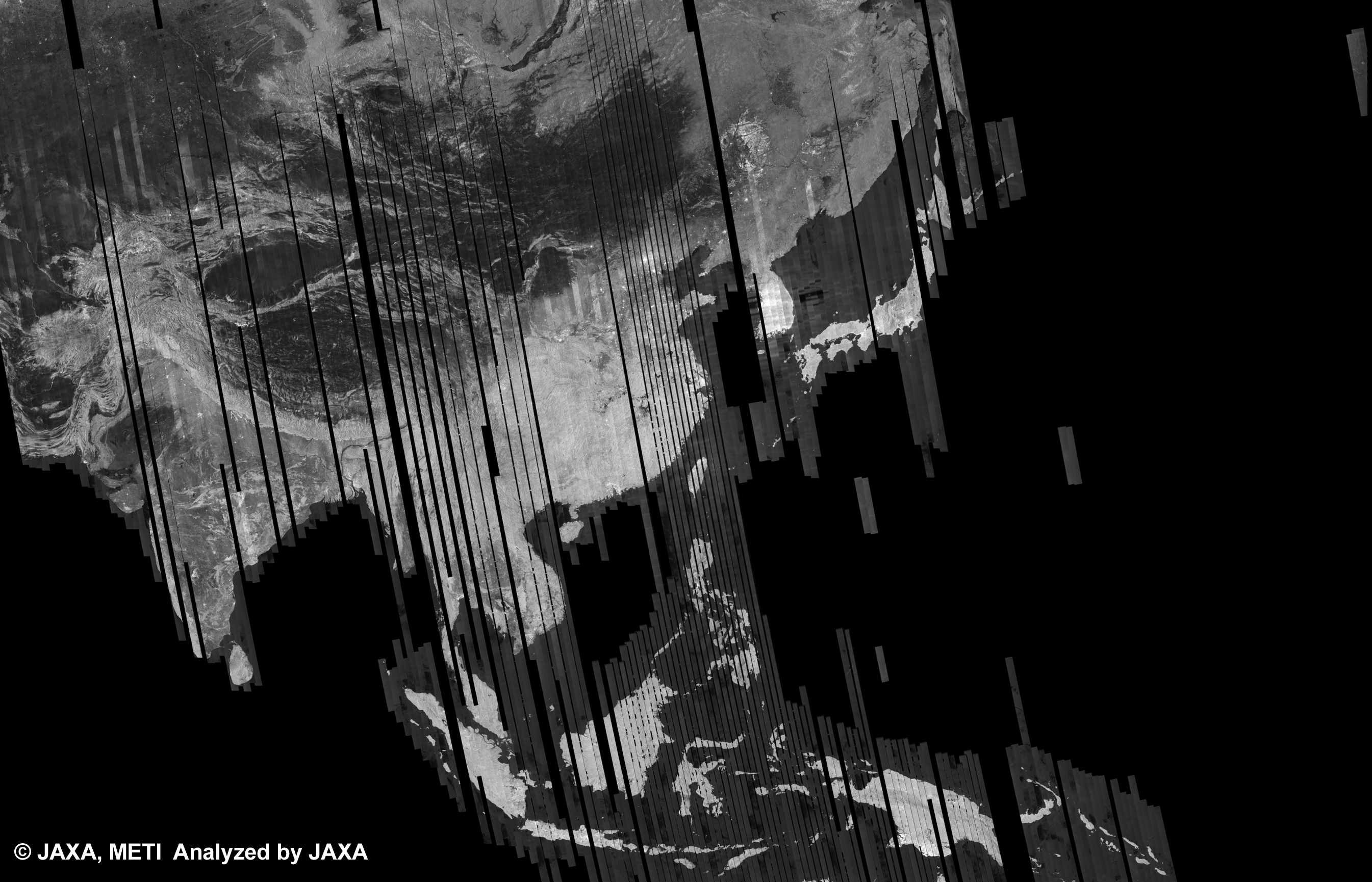
PALSAR 500m Browse Mosaic product (cycle42) have been released at K&C Mosaic Homepage. PALSAR
|
 |
|---|---|---|
May 18, 2011 |
PALSAR 500m Browse Mosaic product (cycle41) have been released at K&C Mosaic Homepage. PALSAR
|
 |
Mar. 7, 2011 |
PALSAR 500m Browse Mosaic product (cycle40) have been released at K&C Mosaic Homepage. PALSAR
|
 |
Mar. 7, 2011 |
PALSAR 500m Browse Mosaic product (cycle39) have been released at K&C Mosaic Homepage. PALSAR
|
 |
2010
Dec. 10, 2010 |
PALSAR 500m Browse Mosaic product (cycle38) have been released at K&C Mosaic Homepage. PALSAR
|
 |
|---|---|---|
Nov. 12, 2010 |
PALSAR 500m Browse Mosaic product (cycle37) have been released at K&C Mosaic Homepage. PALSAR
|
 |
Nov. 12, 2010 |
PALSAR 500m Browse Mosaic product (cycle36) have been released at K&C Mosaic Homepage. PALSAR
|
 |
Oct. 29, 2010 |
PALSAR 500m Browse Mosaic product (cycle35) have been released at K&C Mosaic Homepage. PALSAR
|
 |
Oct. 22, 2010 |
PALSAR 500m Browse Mosaic product (cycle34) have been released at K&C Mosaic Homepage. PALSAR
|
 |
Oct. 15, 2010 |
PALSAR 500m Browse Mosaic product (cycle33) have been released at K&C Mosaic Homepage. PALSAR
|
 |
Mar. 16, 2010 |
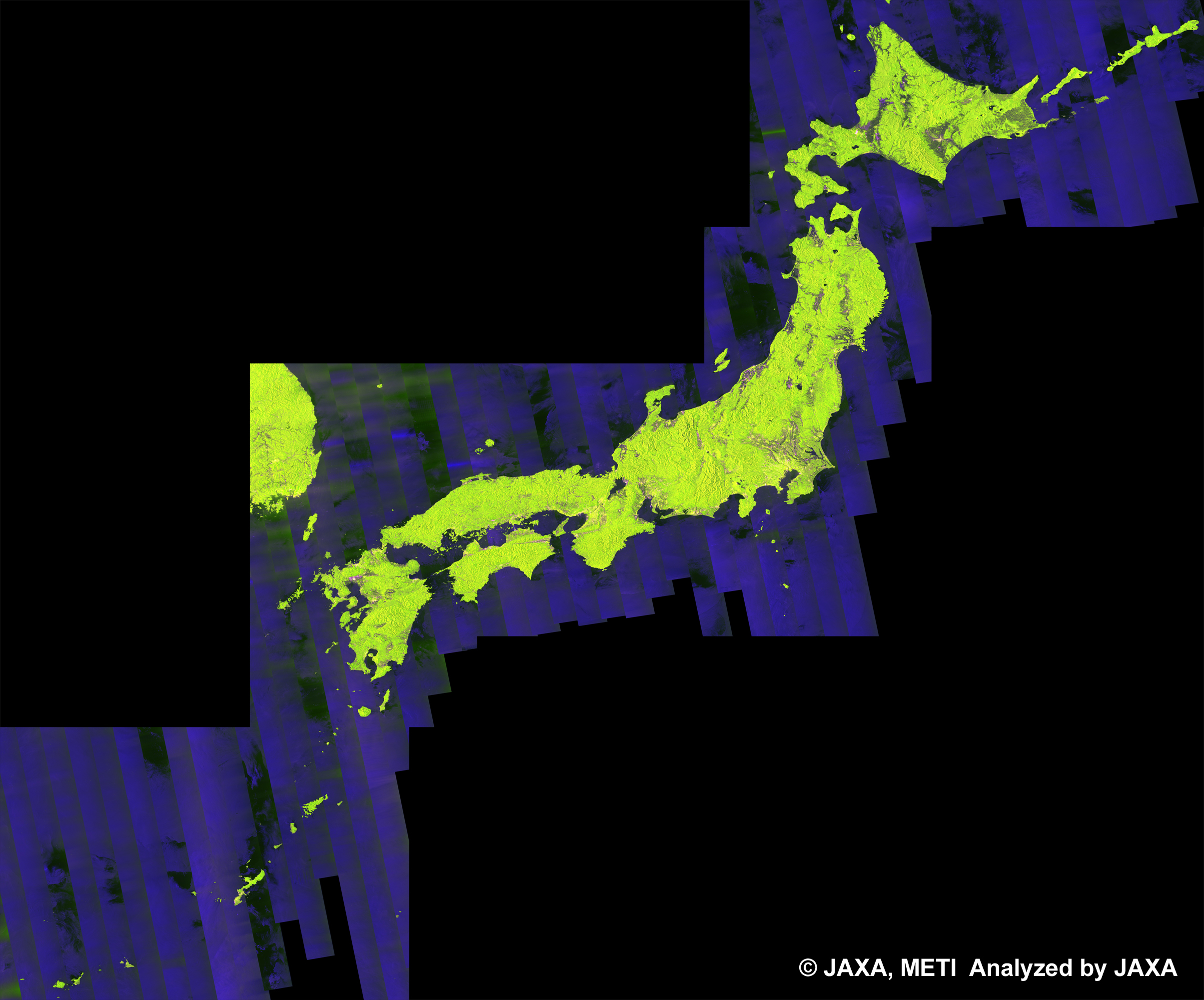
PALSAR 500m Browse Mosaic product (cycle32) and PALSAR 50m Orthorectified Mosaic product have been released at K&C Mosaic Homepage. PALSAR
|
 |
Feb. 9, 2010 |
PALSAR 500m Browse Mosaic product (cycle31) have been released at K&C Mosaic Homepage. PALSAR
|
 |
Feb. 9, 2010 |
PALSAR 50m Orthorectified Mosaic product have been released at K&C Mosaic Homepage. PALSAR
|
 |
2009
Dec. 14, 2009 |
PALSAR 500m Browse Mosaic product (cycle30) have been released at K&C Mosaic Homepage. PALSAR
|
 |
|---|---|---|
Oct. 29, 2009 |
PALSAR 500m Browse Mosaic product have been released at K&C Mosaic Homepage. PALSAR
|
 |
Oct. 20, 2009 |
PALSAR 500m Browse Mosaic product have been released at K&C Mosaic Homepage. PALSAR
|
 |
Apr. 24, 2009 |
PALSAR 50m Orthorectified Mosaic product and PALSAR 500m Browse Mosaic product have been released at K&C Mosaic Homepage. PALSAR
|
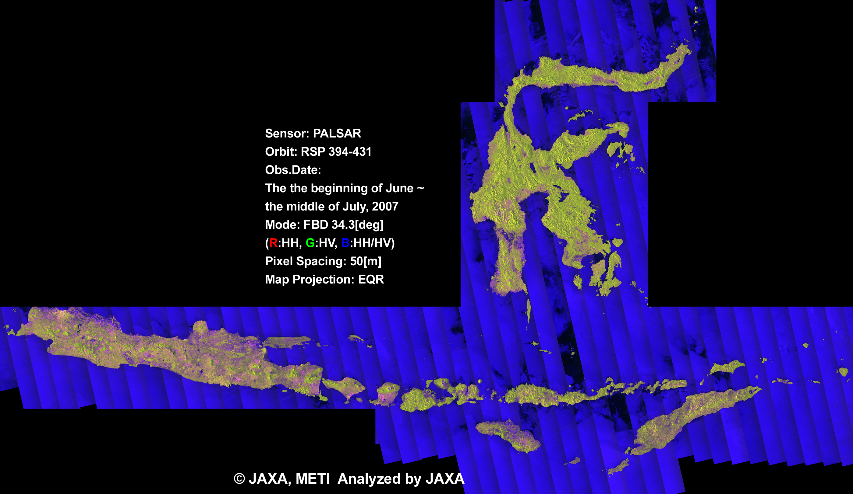 |
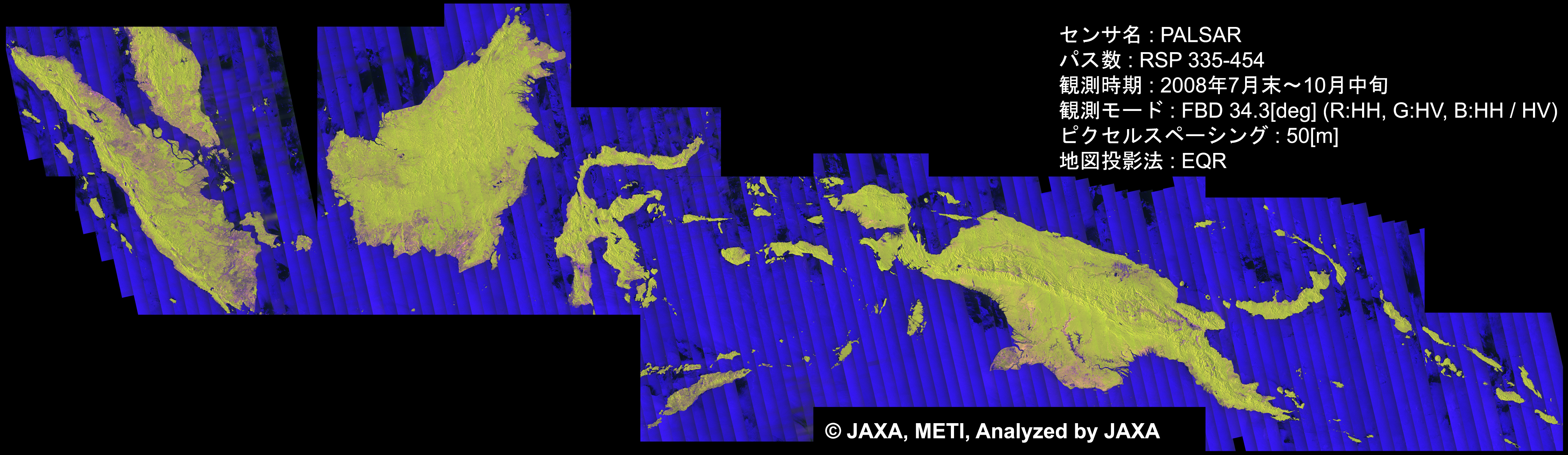
Feb. 20, 2009 |
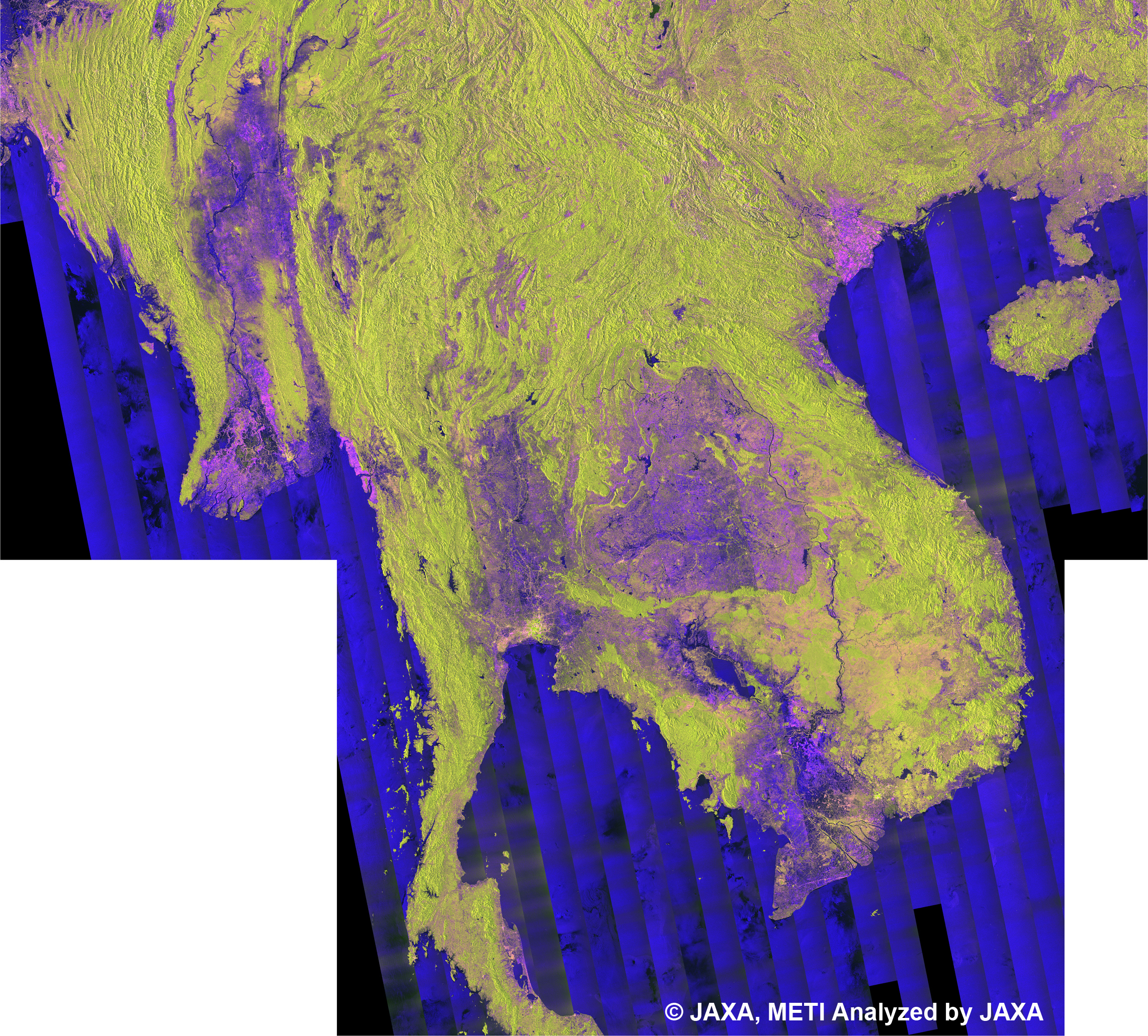
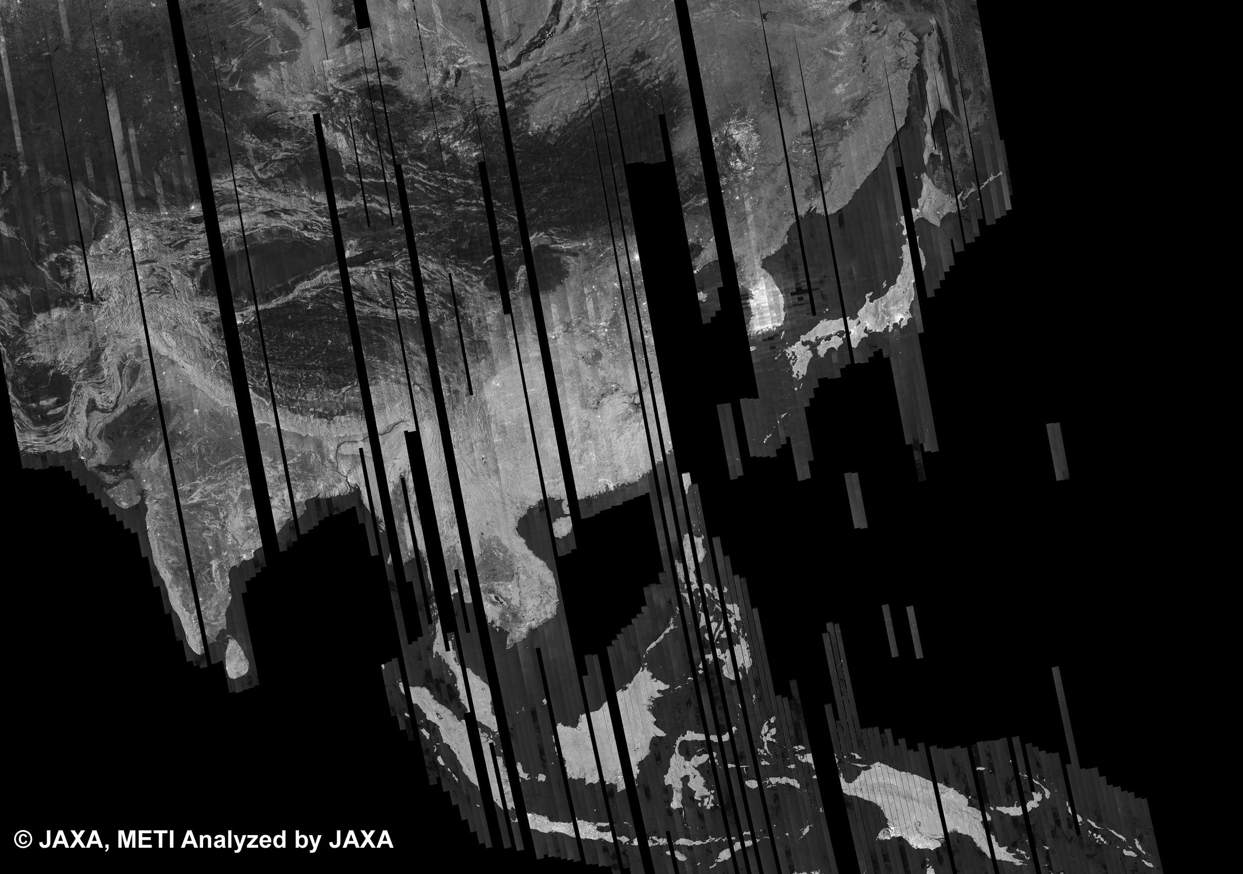
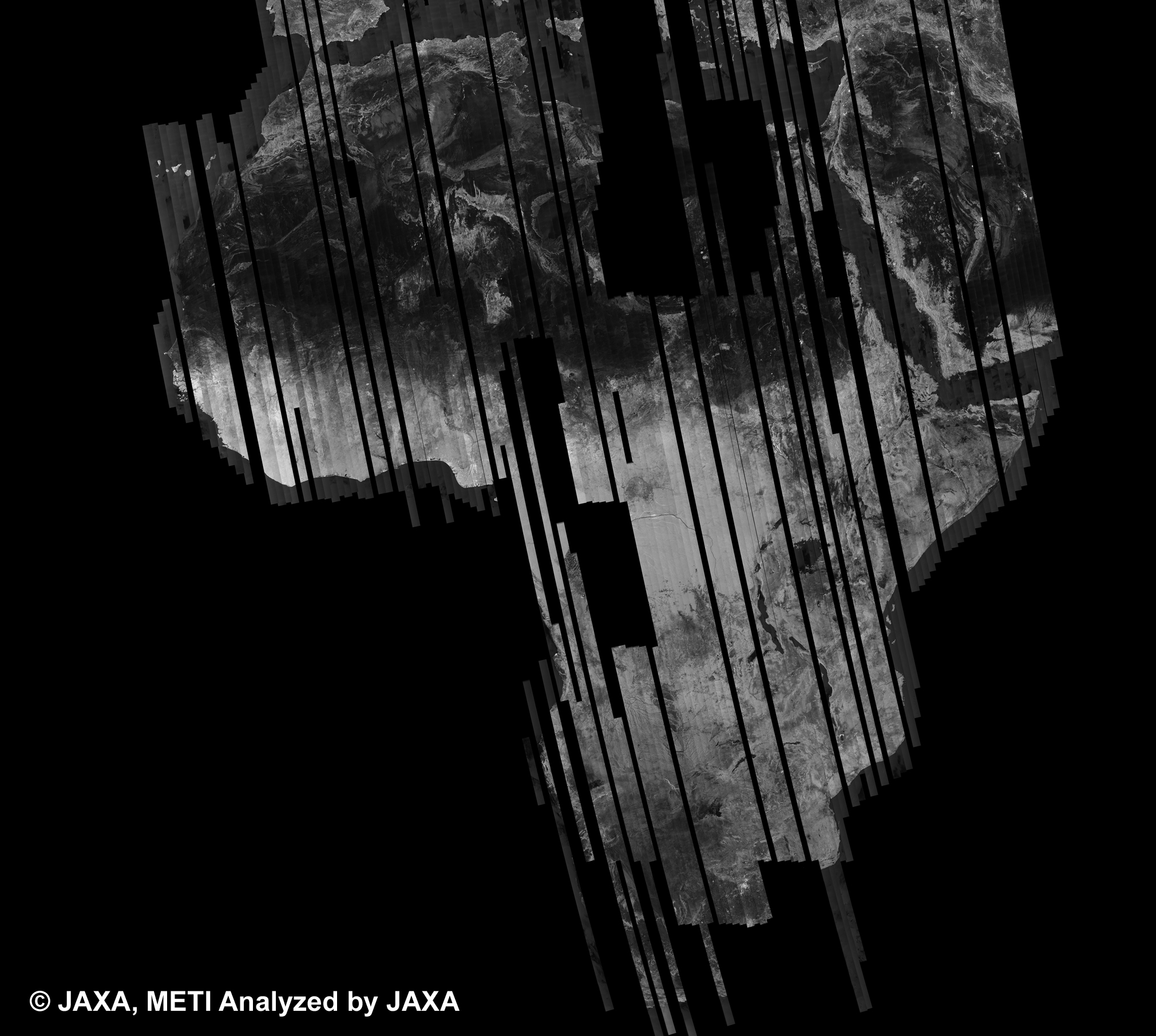
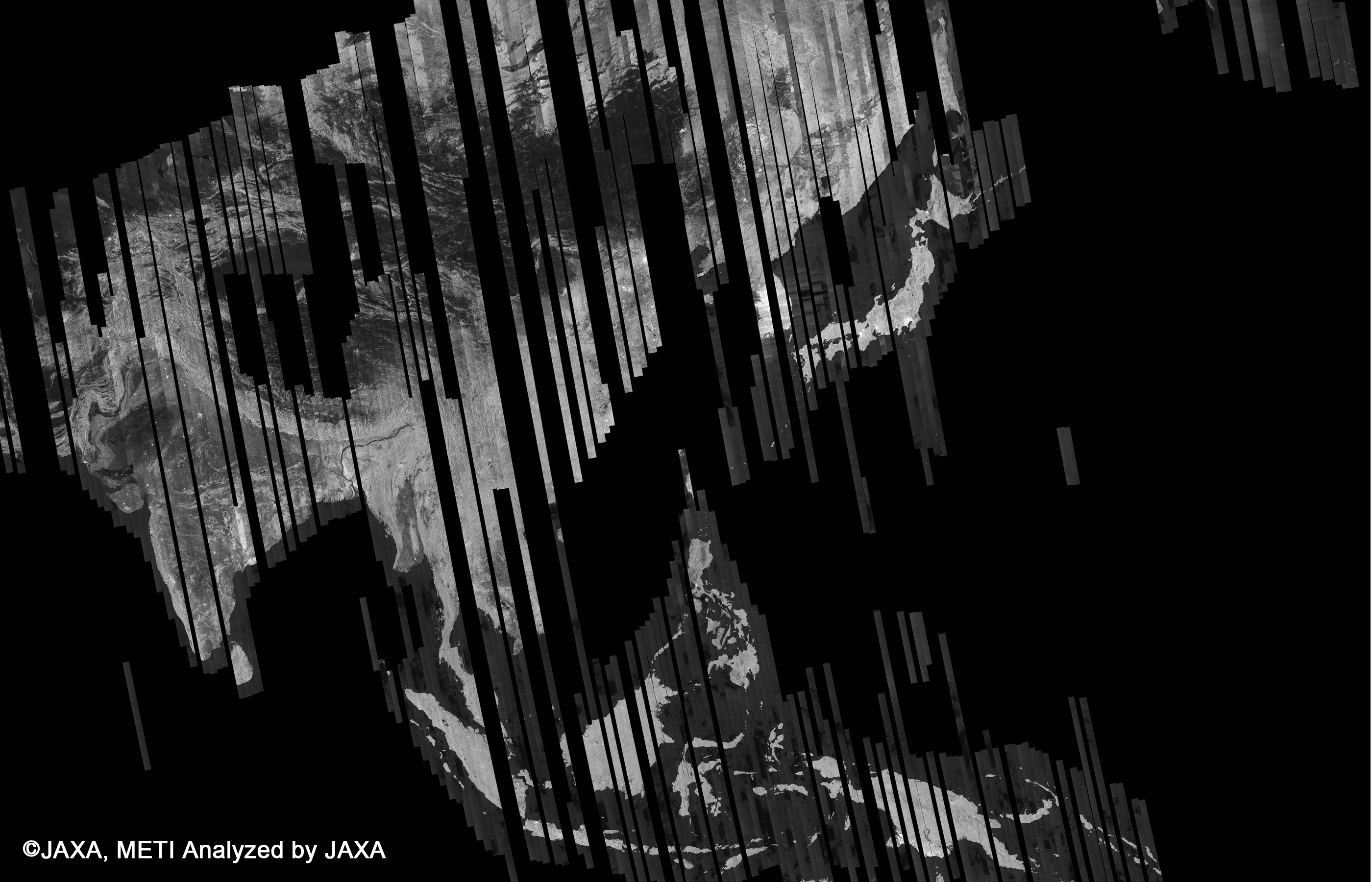
The Japan, Indochina, Borneo, New Guinea, Solomon, Sulawesi and Sumatra of PALSAR 50m Orthorectified Mosaic Product were added. PALSAR
|
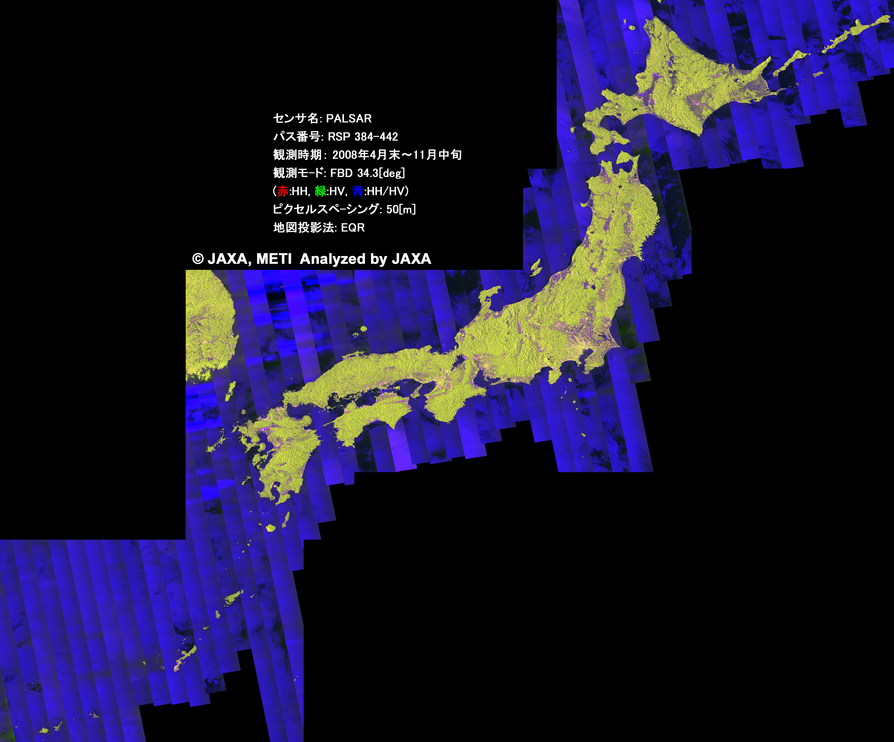 |
Jan. 28, 2009 |
The Japan, Indochina, Borneo, New Guinea, Solomon, Sulawesi and Sumatra of PALSAR 50m Orthorectified Mosaic Product were added. PALSAR
|
 |
2008
Dec. 22, 2008 |
The Borneo, New Guinea, Solomon, Sulawesi and Sumatra of PALSAR 50m Orthorectified Mosaic Product were added. PALSAR
|
 |
|---|---|---|
Apr. 24, 2009 |
K&C Browse Mosic Products of Cycle 21. PALSAR
|
|
Nov. 28, 2008 |
The Indochina of PALSAR 50m Orthorectified Mosaic Product were added. PALSAR
|
 |
Sep. 17, 2008 |
K&C Mosic Products of Cycle 20. PALSAR
|
 |
Oct. 3, 2008 |
K&C Mosic Products of Cycle 17. PALSAR
|
 |
Jul. 24, 2008 |
K&C Mosic Products of Cycle 18. PALSAR
|
 |
2007
Jan. 10, 2007 |
Ariake Sea captured by AVNIR-2. AVNIR-2
Oceanography and Coastal Zone Related Research
|
 |
|---|
2006
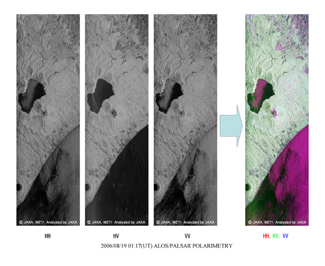
Dec. 21, 2006 |
Polarimetric observation by PALSAR. PALSAR
|
 |
|---|---|---|
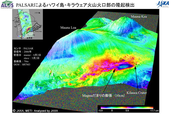
Nov. 6, 2006 |
Detection of a rise around Kilauea caldera, Hawaii Island, by the PALSAR. PALSAR
|
 |
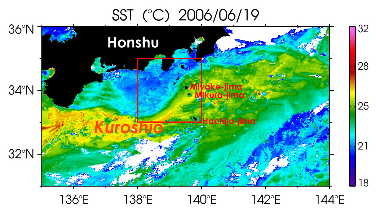
Aug. 31, 2006 |
Vortex streets developed in the lee of an island by Kuroshio. PRISM AVNIR-2
Oceanography and Coastal Zone Related Research
|
 |
Aug. 16, 2006 |
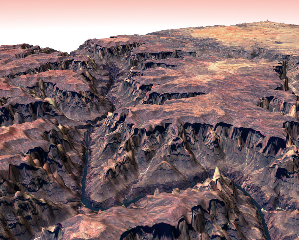
Pan-sharpen image using PRISM (on Jun. 18, 2006) and AVNIR-2 (on May 10, 2006) images over Grand Canyon, U.S.. PRISM AVNIR-2
Digital Elevation Model (DEM) and Mapping
|
 |
Aug. 11, 2006 |
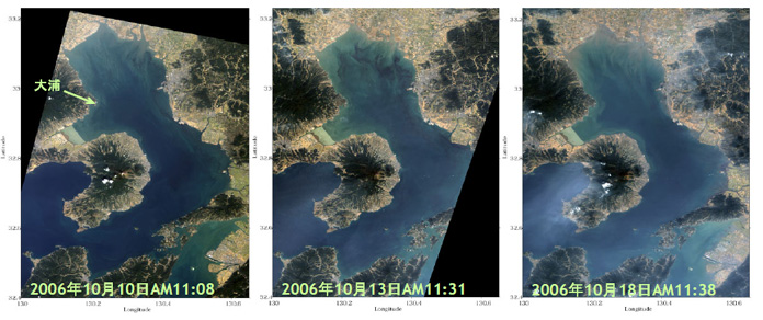
Redtide around Japan from spring to early summer in 2006 captured by AVNIR-2. AVNIR-2
Terrestrial Ecosystem and Forestry Management
|
 |
Jul. 18, 2006 |
Around Nagoya, Japan image observed by PALSAR (Polarimetric) on Apr. 26, 2006. PALSAR
Land Use Monitoring and Land Cover Classification
|
 |
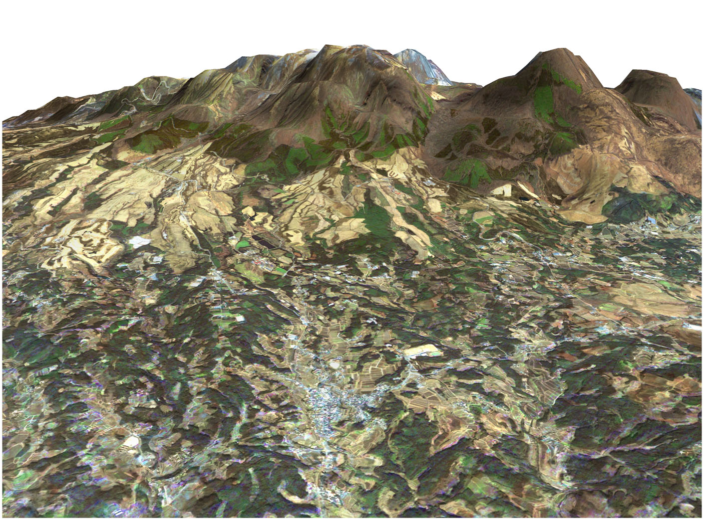
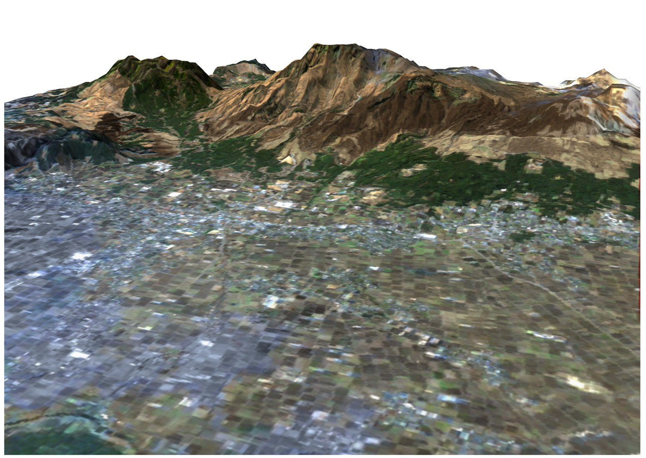
Jul. 12, 2006 |
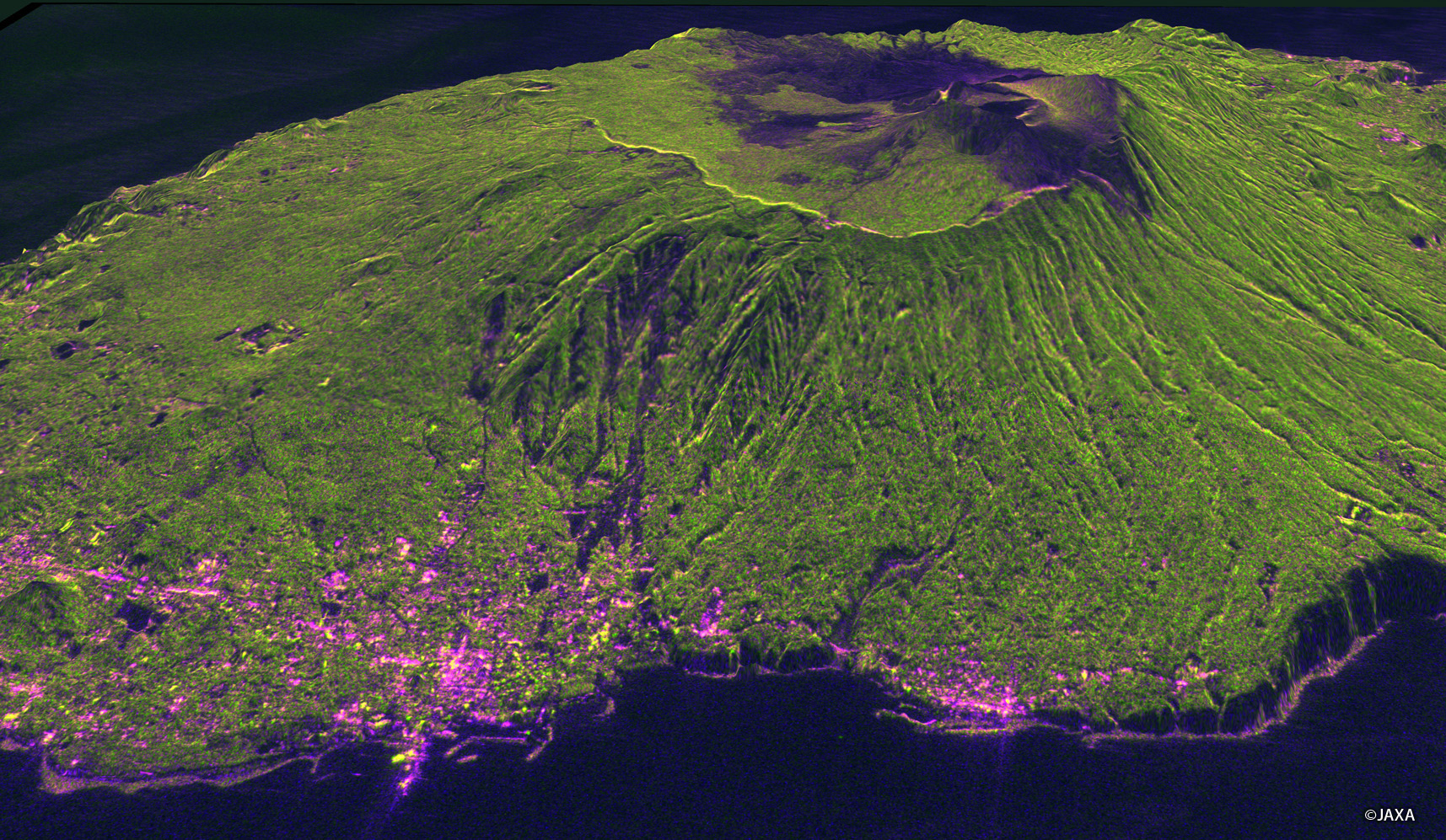
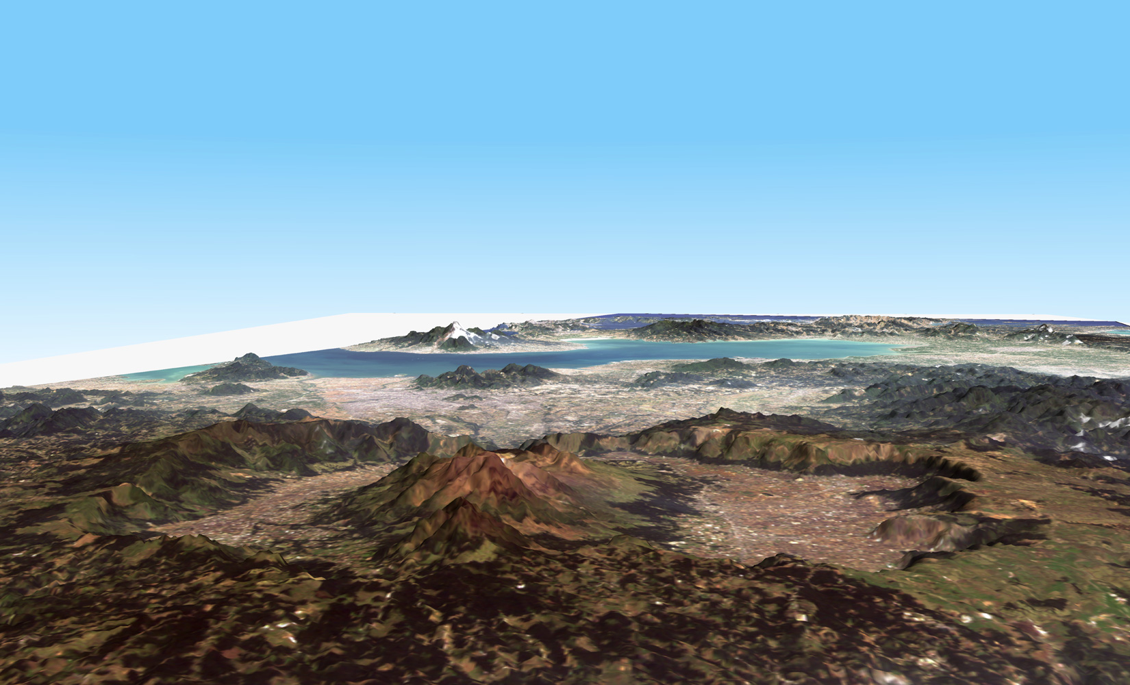
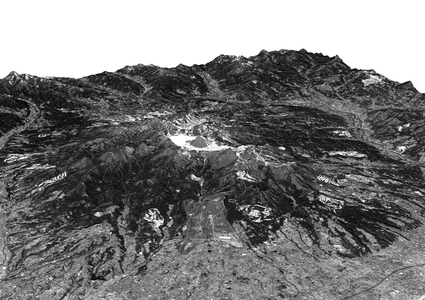
Three-Dimensional View of Mt. Aso in Japan, using PRISM on Mar. 23, 2006. PRISM
Digital Elevation Model (DEM) and Mapping
|
 |
Jul. 10, 2006 |
The bird's-eye view of Mt. Aso in Japan observed by AVNIR-2 on May 4, 2006. AVNIR-2
Application Research using Geographical Information
|
 |
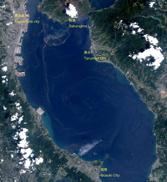
Jul. 6, 2006 |
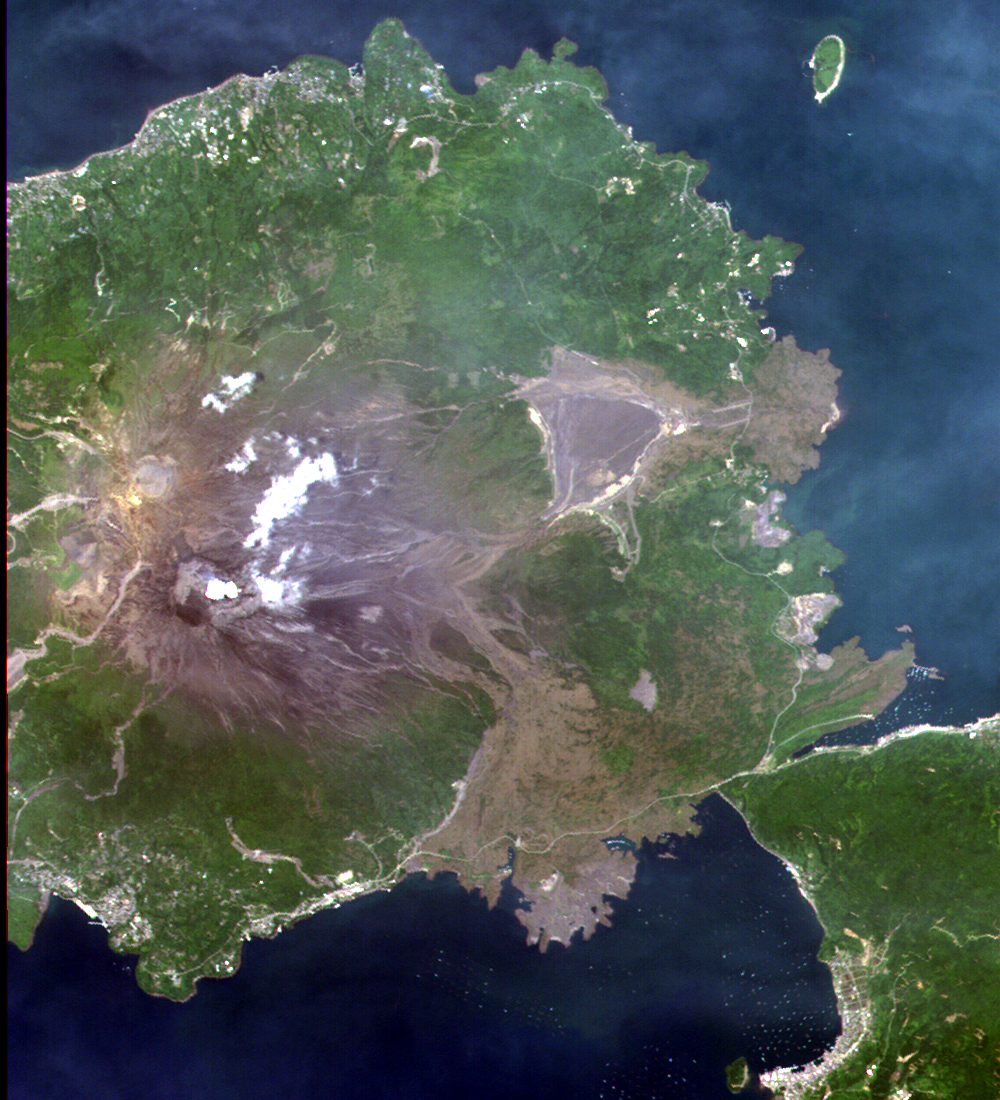
Sakurajima Island, Kagoshima Pref., Japan observed by AVNIR-2 on Jun. 20, 2006. AVNIR-2
Land Use Monitoring and Land Cover Classification
|
 |
Jul. 3, 2006 |
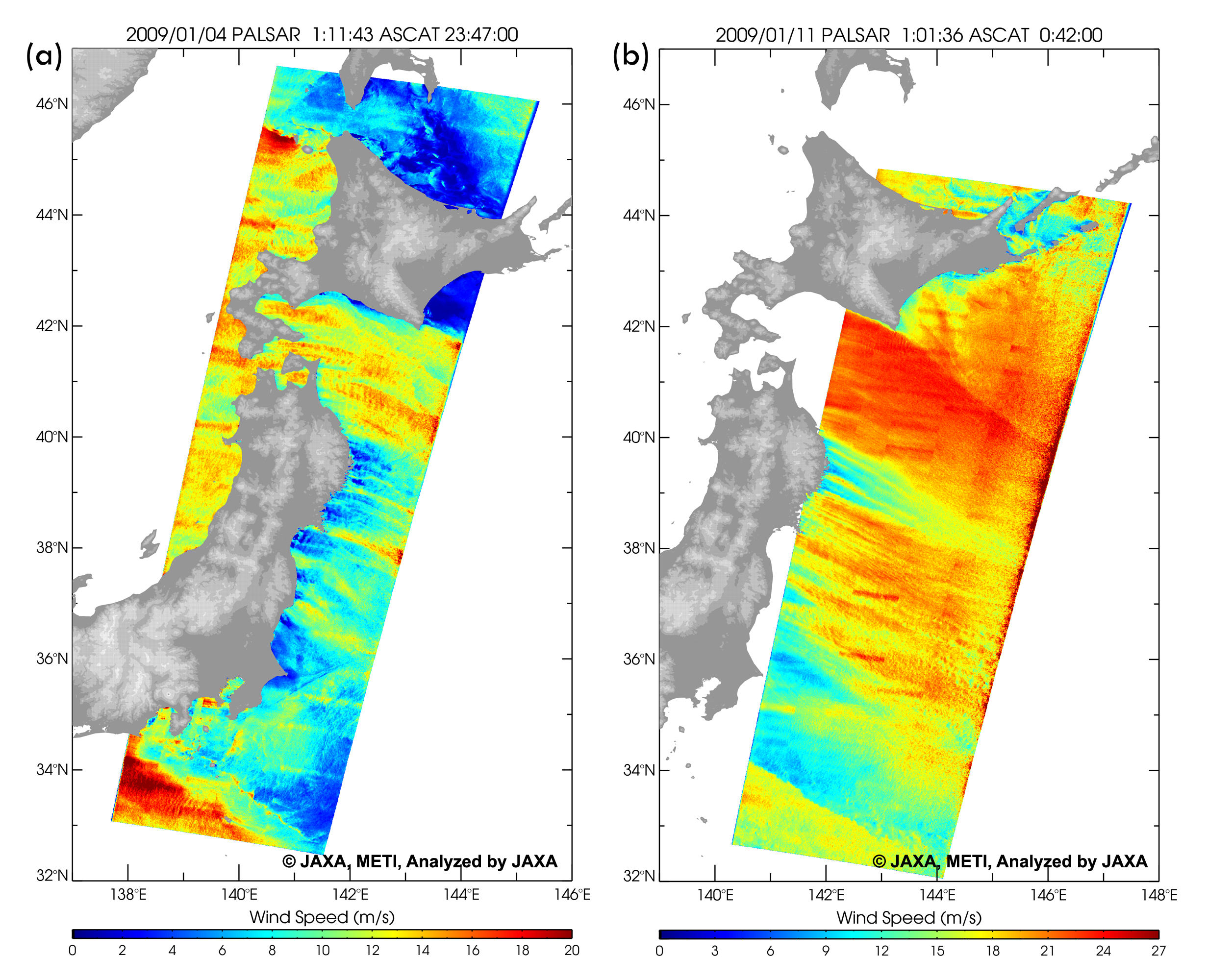
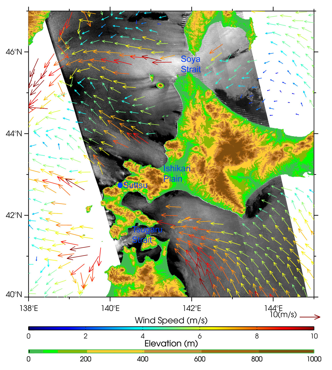
Gap winds around Hokkaido, Japan, observed by PALSAR (ScanSAR) on 8 June 2006. PALSAR
Oceanography and Coastal Zone Related Research
|
 |
Jun. 27, 2006 |
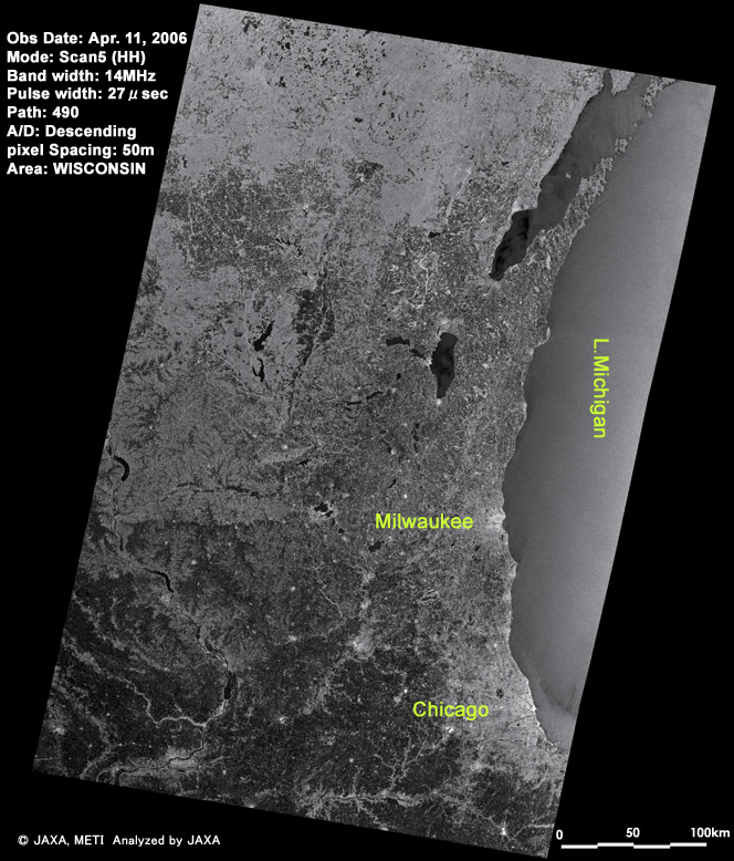
Around Lake Michigan, U.S.A. image observed by PALSAR on Apr. 11, 2006. PALSAR
Application Research using Geographical Information
|
 |
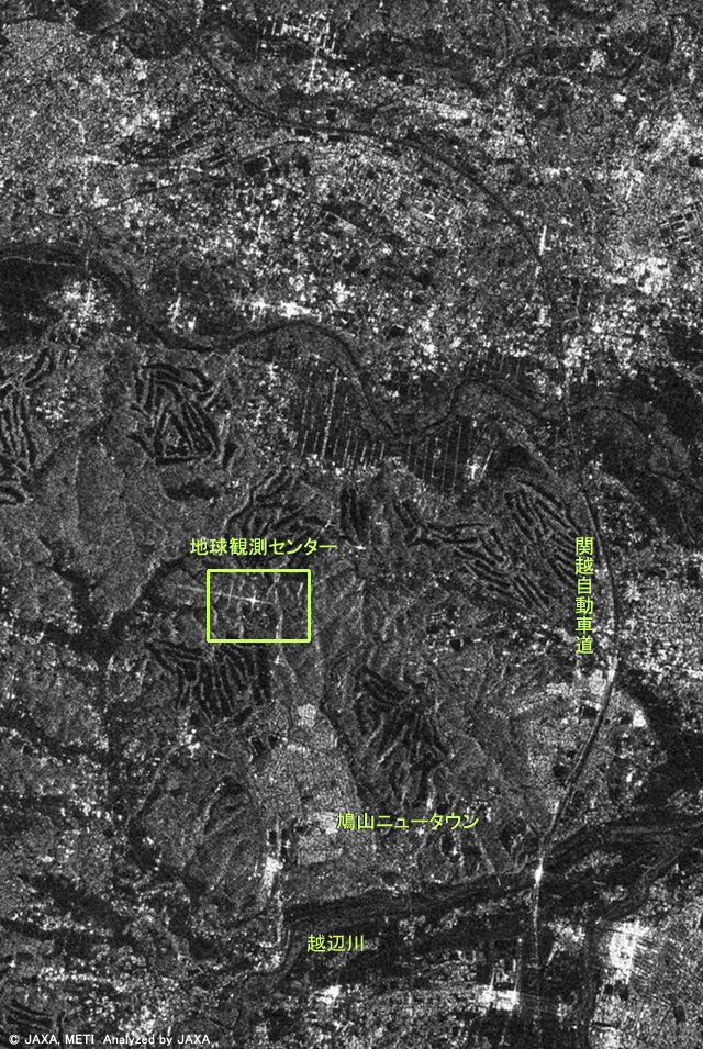
Jun. 21, 2006 |
Hatoyama Town, Hiki-gun, Saitama Pref., Japan observed by PALSAR on Apr. 27, 2006. PALSAR
|
 |
Jun. 19, 2006 |
Pan-sharpen image over Saitama Pref., Japan observed by PRISM and AVNIR-2 on April 30, 2006 with active high-speed viewer "ZOOMA". PRISM AVNIR-2
Digital Elevation Model (DEM) and Mapping
Application Research using Geographical Information
|
 |
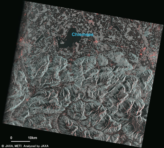
Jun. 16, 2006 |
Border of Germany (Freistaat Bayern) and Austria (Bundesland Salzburg) observed by PALSAR (FBD) on Apr. 25, 2006. PALSAR
|
 |
Jun. 1, 2006 |
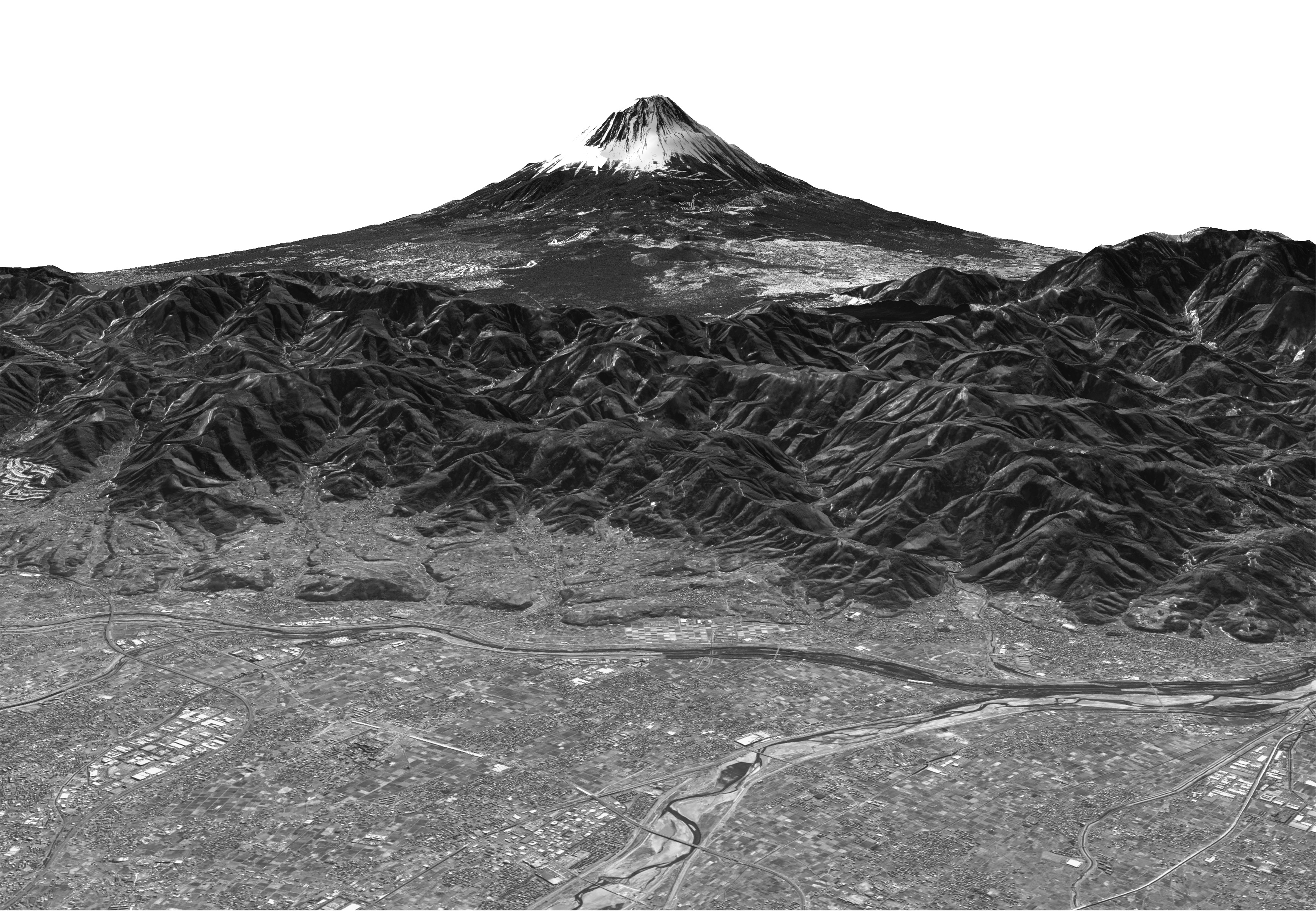
Three-Dimensional View of Mt. Fuji using PRISM. PRISM
Digital Elevation Model (DEM) and Mapping
|
 |
May 22, 2006 |
The red tide area in Kagoshima Bay, Japan, observed by AVNIR-2. AVNIR-2
Oceanography and Coastal Zone Related Research
|
 |
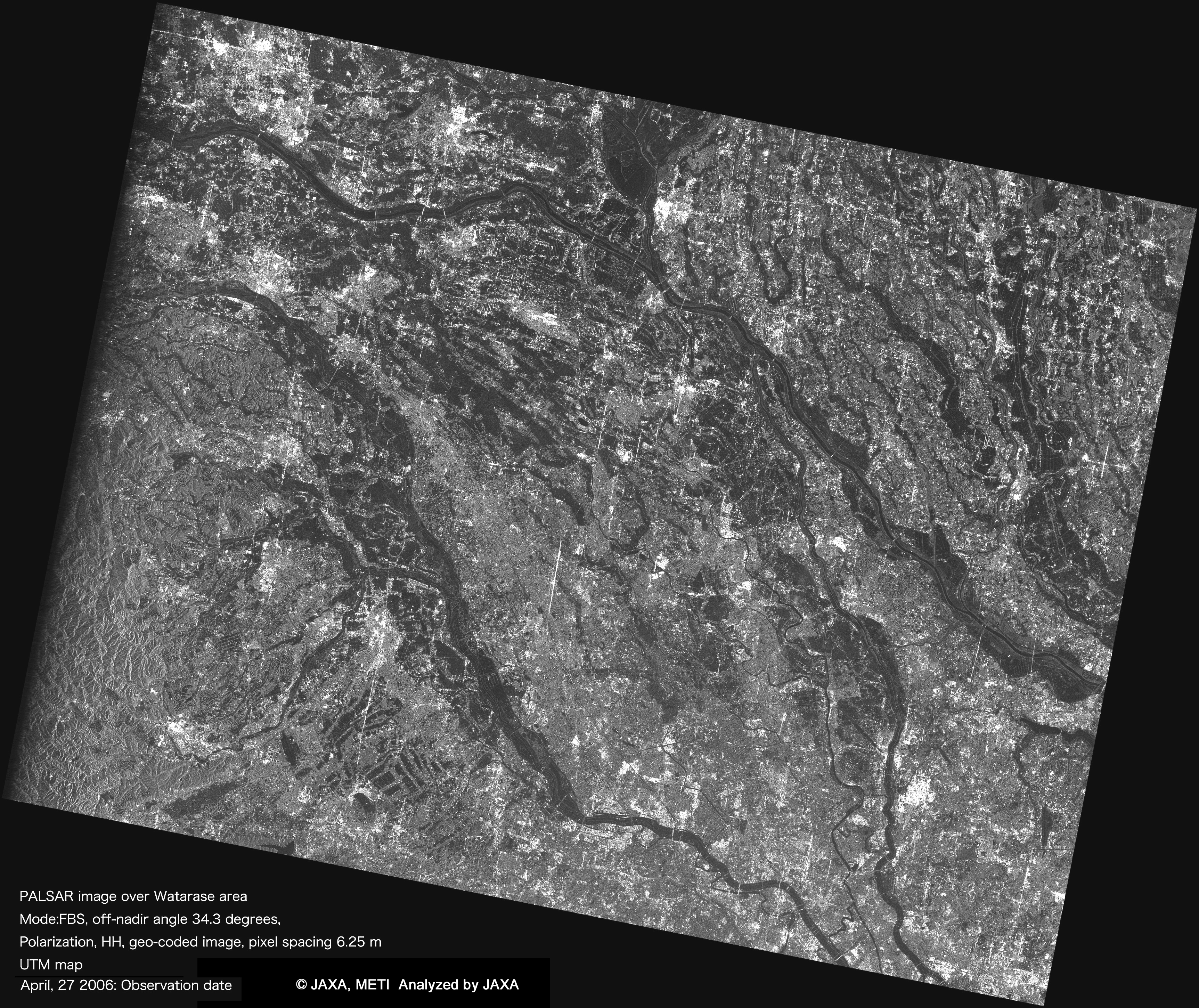
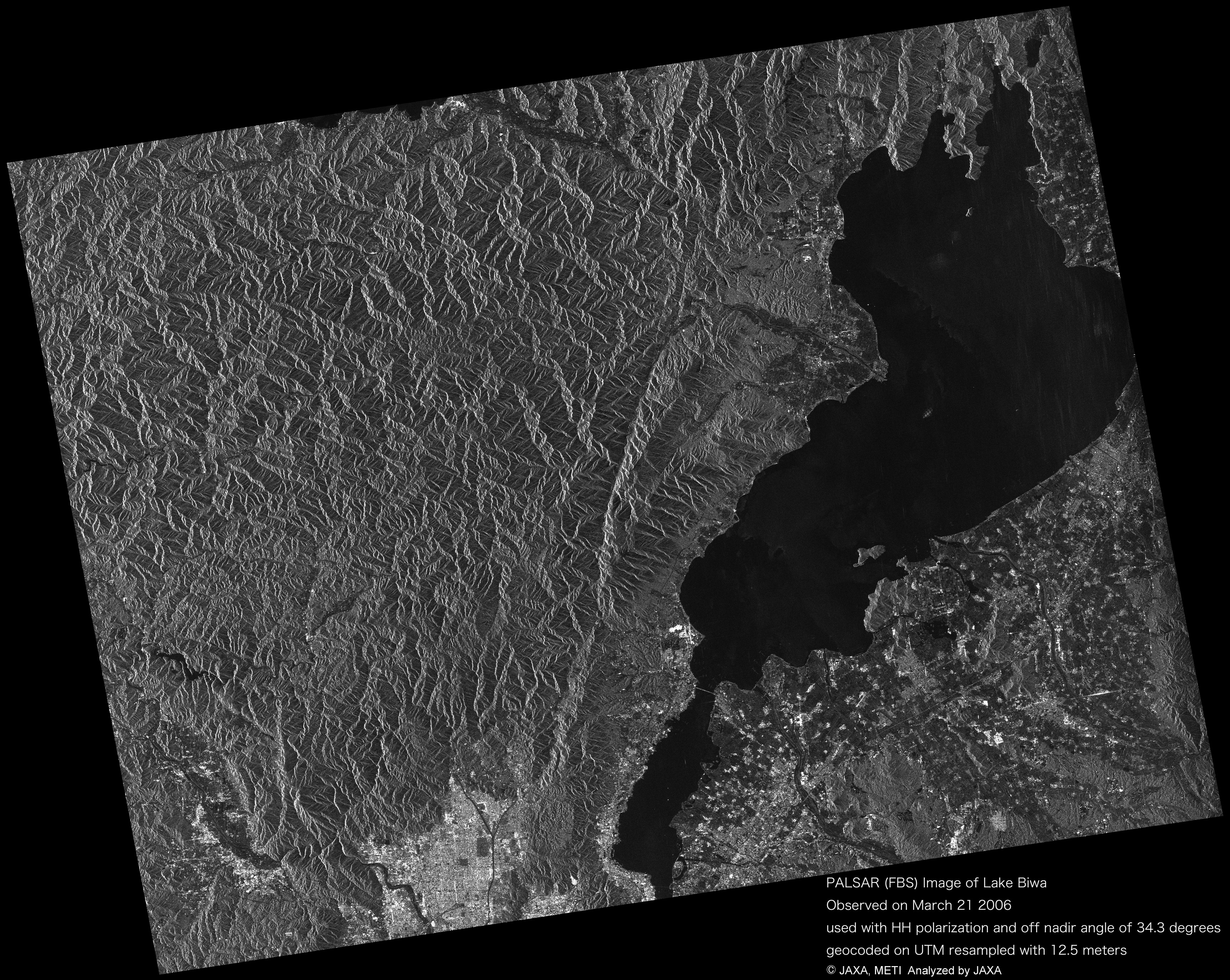
May 16, 2006 |
Watarase area, Japan acquired by PALSAR (FBS, 34.3deg.) on Apr. 27, 2006. PALSAR
|
 |
May 11, 2006 |
Pan-sharpen image around Tsukuba City, Ibaraki Pref., Japan observed by AVNIR-2 on March 25, 2006 and PRISM on March 27 with active high-speed viewer "ZOOMA". PRISM AVNIR-2
Digital Elevation Model (DEM) and Mapping
|
 |
May 9, 2006 |
Pan-sharpen image with generated digital surface model (DSM) using PRISM and AVNIR-2 images over Kujyu mountain range, Oita Pref., Japan. PRISM AVNIR-2
Digital Elevation Model (DEM) and Mapping
|
 |
Apr. 26, 2006 |
PRISM image observed over west part of Chiba Prefecture, Japan on Mar. 27, 2006 displayed by "ZOOMA", which is innovative and active high-speed viewer. It can be useful to see high-resolution image. When you browse for the first time, the viewer will be automatically set with free of charge. PRISM
Digital Elevation Model (DEM) and Mapping
|
 |
Apr. 21, 2006 |
Sea of Okhotsk and Sea ice, image data acquired by PALSAR (ScanSAR) during the night on Apr. 18, 2006. PALSAR
Oceanography and Coastal Zone Related Research
|
 |
Apr. 19, 2006 |
Pan-sharpen image with generated digital surface model (DSM) using PRISM and AVNIR-2 images over Mt. Aso, Kumamoto Prefecture, Japan. PRISM AVNIR-2
Digital Elevation Model (DEM) and Mapping
|
 |
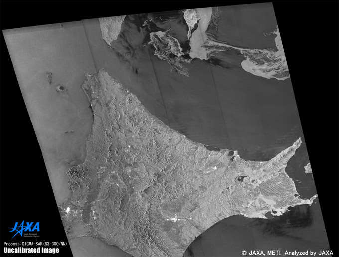
Apr. 12, 2006 |
The image data on Lake Biwa in Shiga Prefecture was observed by the PALSAR on Mar. 21, 2006. PALSAR
|
 |
Mar. 16, 2006 |
The image data of Mt. Haruna was observed by the PRISM on Feb. 14, 2006. PRISM
Digital Elevation Model (DEM) and Mapping
|
 |
Mar. 16, 200 |
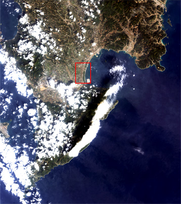
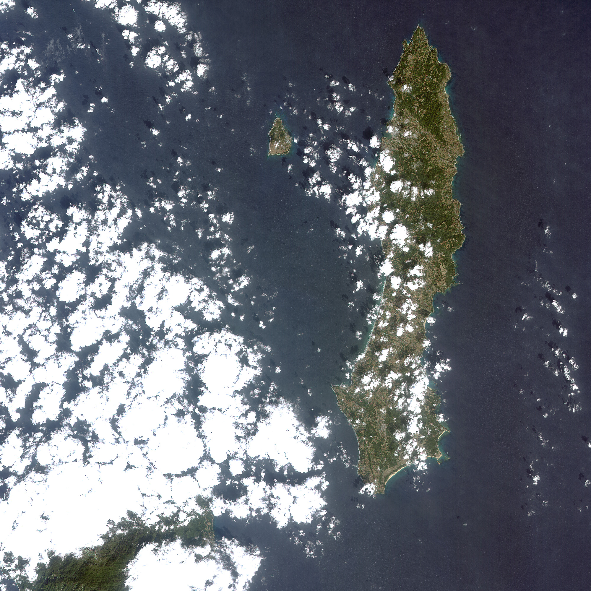
The image data of Osumi Peninsula in Kagoshima Prefecture was observed by the AVNIR-2 on Feb. 17, 2006. AVNIR-2
|
 |
Feb. 23, 2006 |
The image data of Tanegashima Island in Kagoshima Prefecture was observed by the AVNIR-2 on Feb. 17, 2006. AVNIR-2
|
 |
Feb. 20, 2006 |
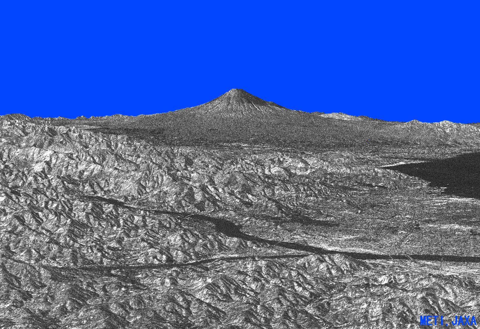
The image data of Mt. Fuji and Izu Peninsular and Shizuoka City was observed by the PALSAR on Feb. 15, 2006. PALSAR
|
 |
Feb. 16, 2006 |
The image data of Mt. Fuji was observed by the PRISM on Feb.14, 2006 and a three-dimensional movie compiled from observed images. PRISM
Digital Elevation Model (DEM) and Mapping
|
 |
Feb. 16, 2006 |
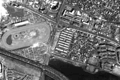
The image data of Shimizu Port near Shizuoka city was observed by the PRISM on Feb.14, 2006 PRISM
Digital Elevation Model (DEM) and Mapping
|