Image Library
View of Mt. Fuji, Japan observed by the Panchromatic Remote-sensing Instrument for Stereo Mapping (PRISM) aboard the ALOS.
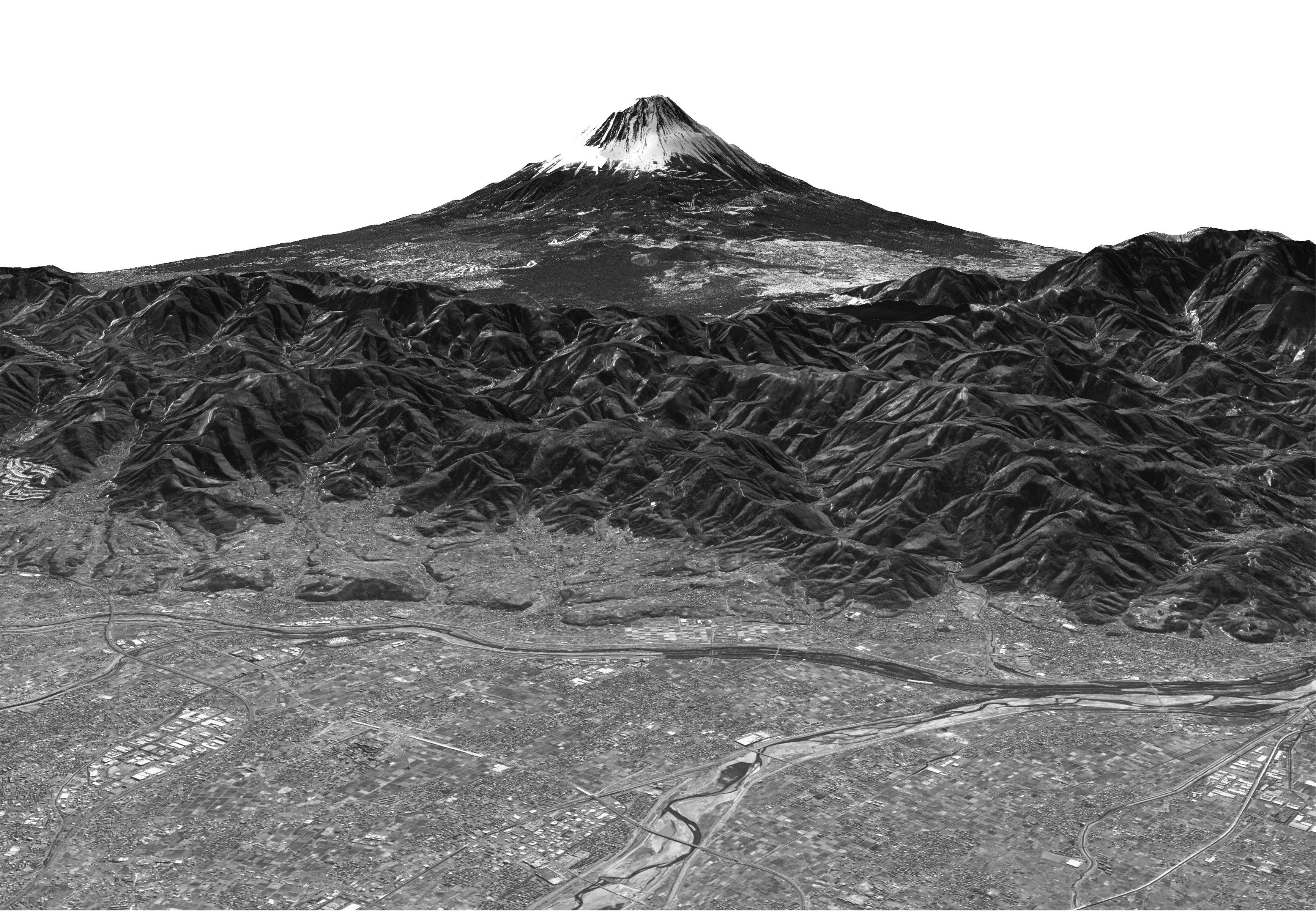
Fig.1: Mt. Fuji observed by the PRISM
(Click to view enlarged image)
-
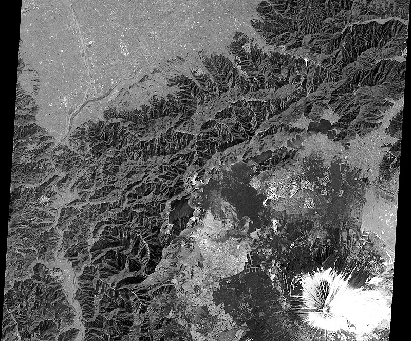 Foward view image(Click to view enlarged image)
 -
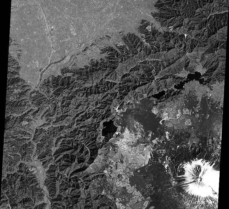 Nadir view image(Click to view enlarged image)
 -
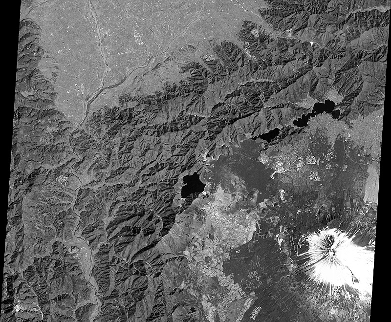 Backward view image(Click to view enlarged image)
The image data of Mt. Fuji was observed by the Panchromatic Remote-sensing Instrument for Stereo Mapping (PRISM) onboard the Advanced Land Observing Satellite "Daichi" during the daytime (around 10:30 a.m.) on Feb. 14, 2006 (JST). The height of the mountain was calculated based on backward, nadir and foward view images shown on the right, then the bird's-eye picture was compiled by overlapping the nadir view image. You can see detailed streets and rivers in the Kofu Basin in the front in the image, Motosu Lake in the center right, and Fuji-Subaru Line that leads to the snow capped top of Mt. Fuji from Motosu Lake. The height is indicated twice as much in this bird's-eye picture.
JAXA EORC