Image Library
ALOS-2 images during the initial functional verification and calibration/validation phases - ship monitoring
Japan Aerospace Exploration Agency (JAXA) is conducting the initial functional verification and calibration/validation (Cal/Val) of the Advanced Land Observing Satellite 2 (ALOS-2; Japanese name: "Daichi-2") launched in May 24, 2014 (JST). Data obtained by ALOS-2 are expected to contribute to the monitoring disasters, deforestation, sea ice in Okhotsk and polar regions, and many more.
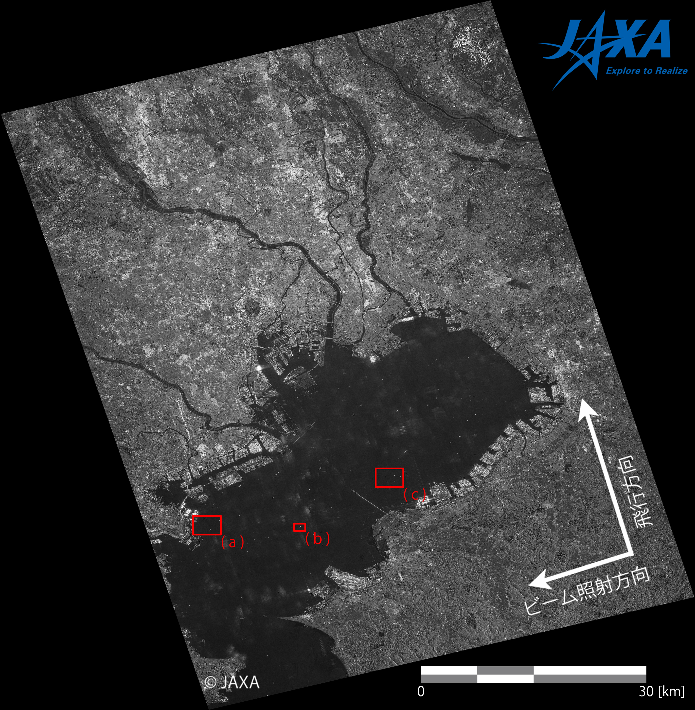
Some of images taken by the Phased Array-type L-band Synthetic Aperture Radar 2 (PALSAR-2)*1 onboard ALOS-2 during the initial functional verification and Cal/Val phases have been introduced four times before. This time, examples of ship monitoring with PALSAR-2 images are introduced:The introduced images were obtained by using the test radio wave transmitted from the ALOS-2/PALSAR-2.
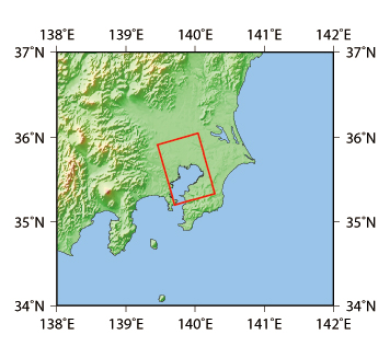
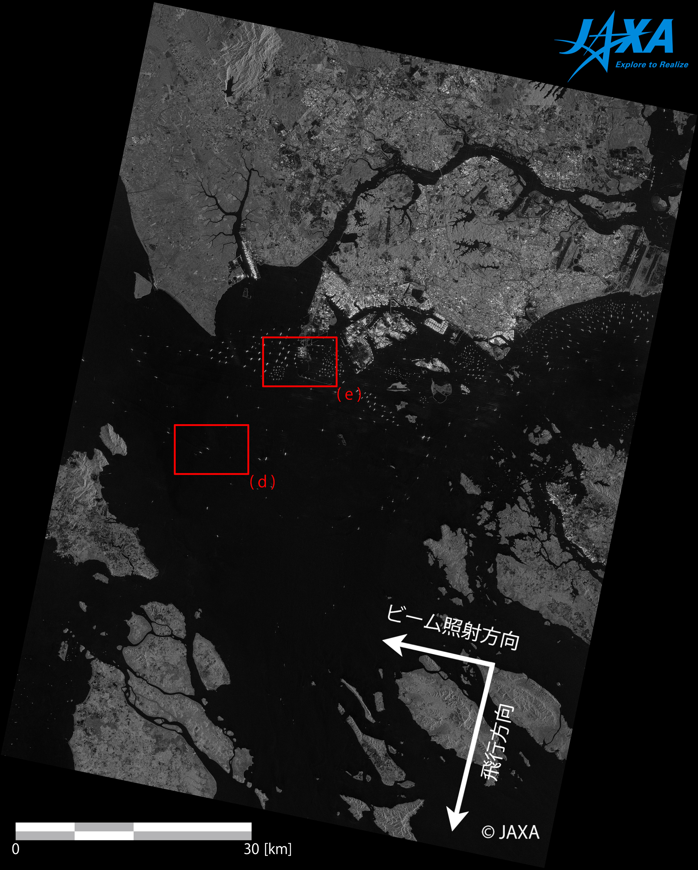
1. Tokyo Bay
-
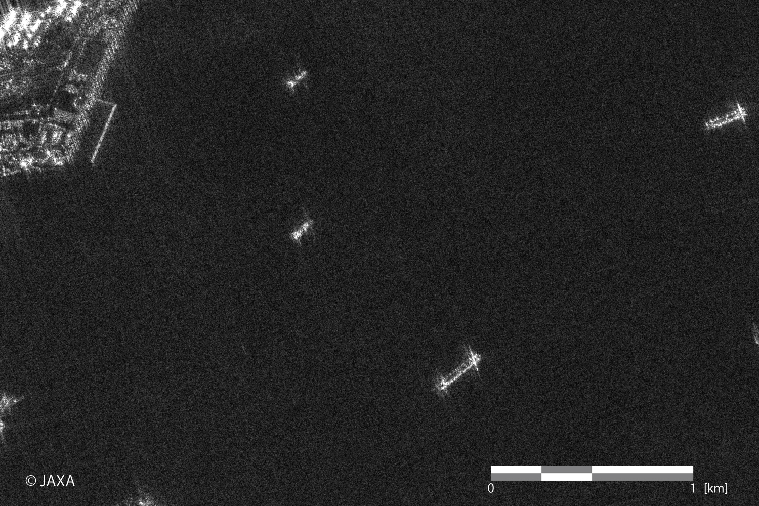 (a)(Click to view enlarged image)
 -
(b)(Click to view enlarged image)
-
(c)(Click to view enlarged image)
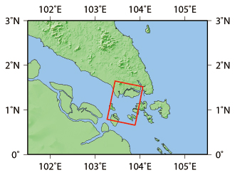
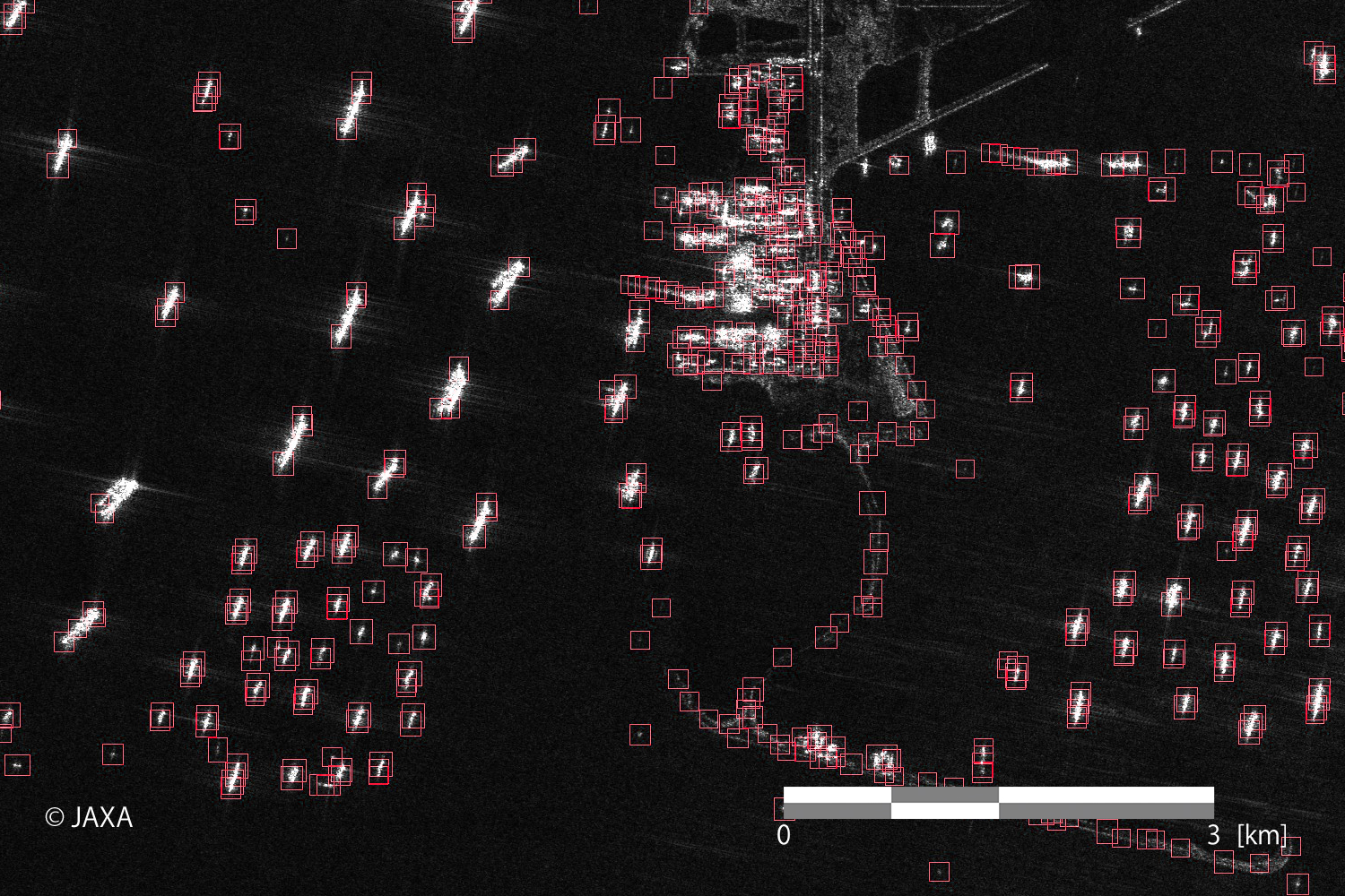
2. Singapore Straits
-
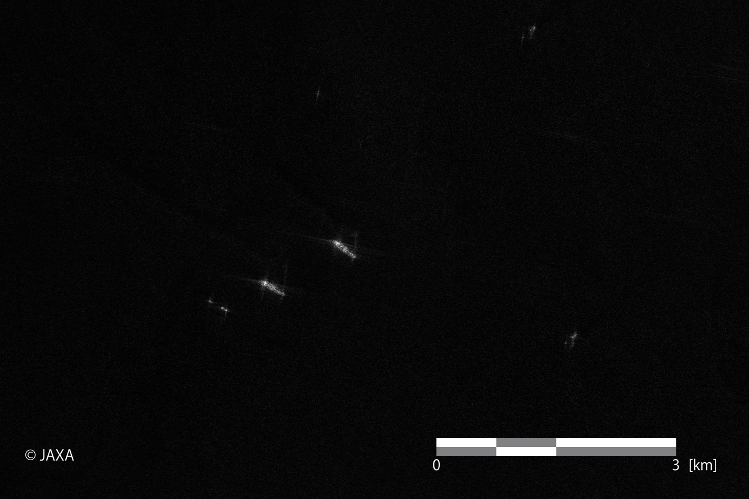 Figure 6. Identified ships in the image.
The left and right images are from the red boxes (d) and (e), respectively.
(Click to view enlarged image) -
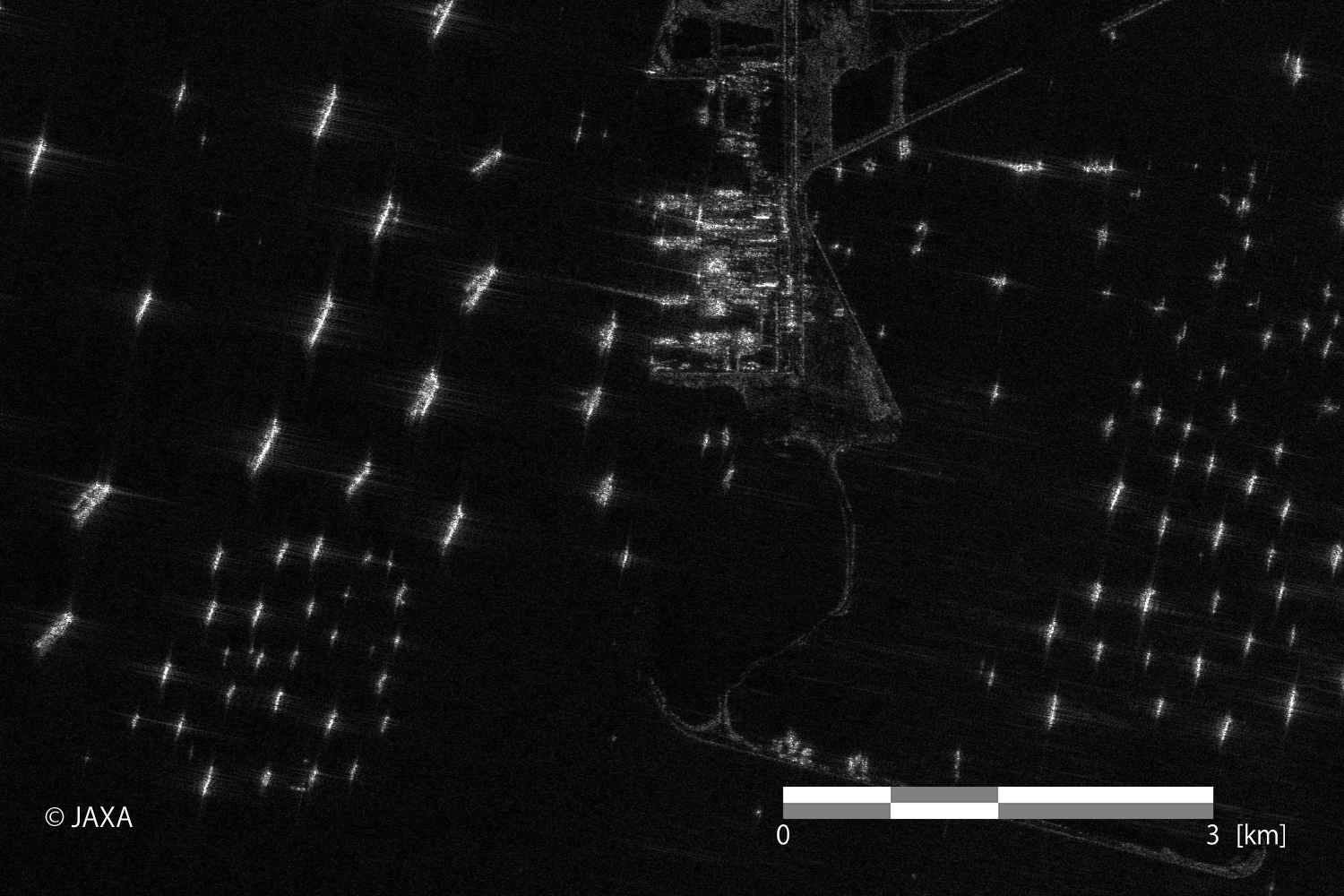 Figure 6. Identified ships in the image.
The left and right images are from the red boxes (d) and (e), respectively.
(Click to view enlarged image) -
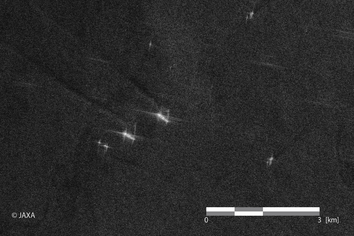 Figure 7. Image corrected the brightness of the left image of Figure 6(Click to view enlarged image)
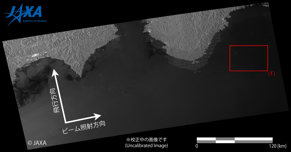
The Fine mode (10 m resolution) can cover a wider swath than the Ultrafine mode (3 m resolution). The swath of the image is approximately 70 km.
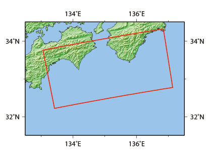
The PALSAR-2 image (the right image of Figure 6) can show a lot of ships anchored outside of the port of Singapore before/after sailing through the Strait of Malacca. As shown in Figure 7, ship wakes are also appeared in the image. In synthetic aperture radar (SAR) images, ships moving to the observing SAR are displaced from their wakes in the positive direction of satellite moving. It is because Doppler frequency caused by relative movements between the SAR and the ships is positively shifted compared to other targets such as ocean surfaces. Conversely, ships moving away from the SAR are displaced from their wakes in the opposite direction of satellite moving.3. off the coast of Kii Peninsula
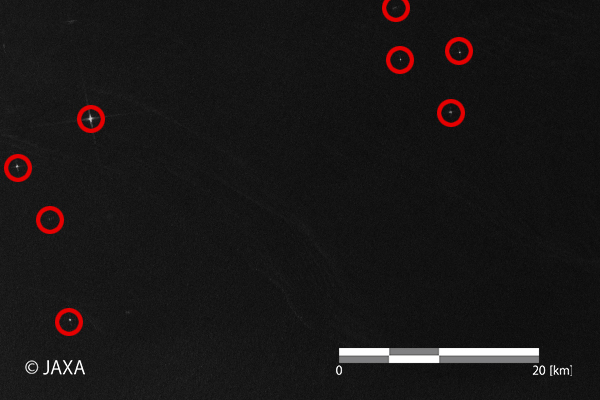
The bright points with red circles are estimated to be ships.
4. Automatic ship detection
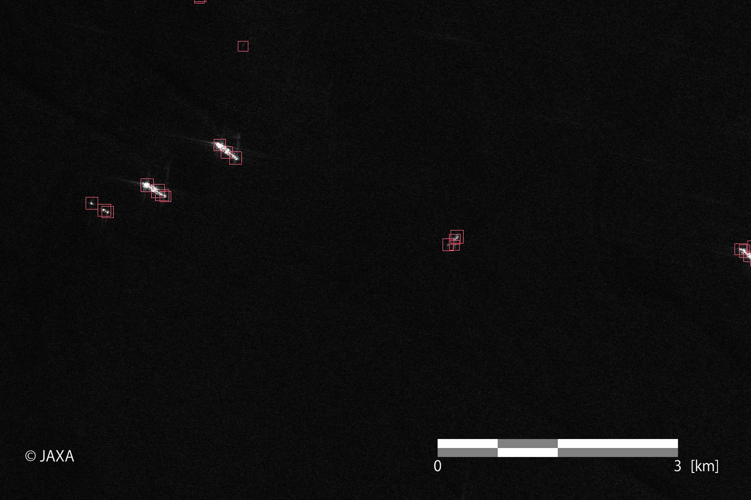
As shown above, the PALSAR-2 can obtain wide-swath and high-resolution images containing ship information regardless of weather conditions and day/night. Various needs can be satisfied by utilizing different characteristics of each observation mode.
One of further applications of PALSAR-2 images to marine monitoring is more detailed information extraction by combining SAR-based ship detection results and AIS data*2.