Image Library
View of Shimizu Port, Japan observed by the Panchromatic Remote-sensing Instrument for Stereo Mapping (PRISM) aboard the ALOS.

Fig.1: View of Shimizu Port, Japan observed by the Panchromatic Remote-sensing Instrument for Stereo Mapping (PRISM) aboard the ALOS.
(Click to view enlarged image)
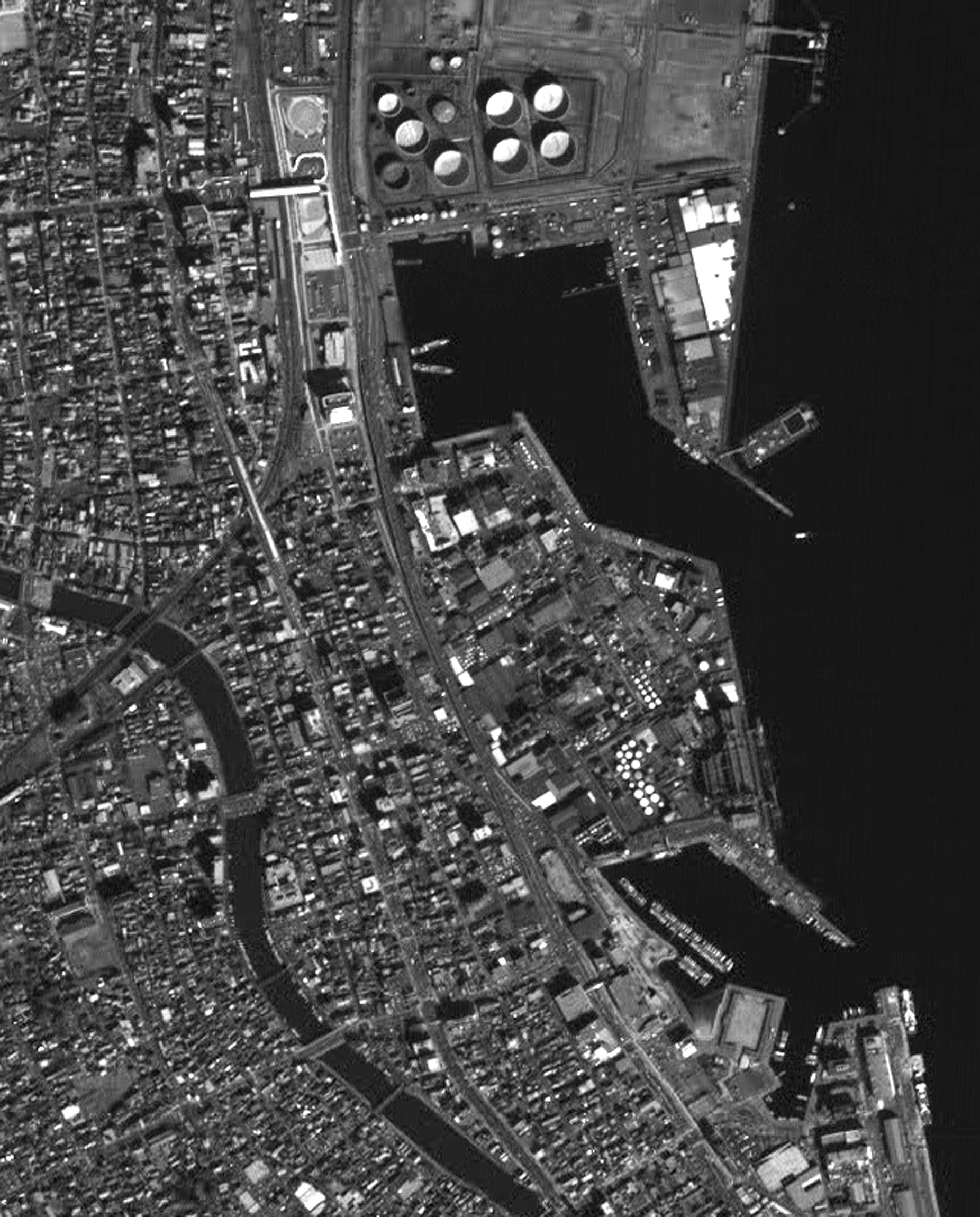
Fig.2: The area of Shimizu Port was enlarged
(Click to view enlarged image)
The image data of Shimizu Port near Shizuoka city was observed by the Panchromatic Remote-sensing Instrument for Stereo Mapping (PRISM) onboard the Advanced Land Observing Satellite "Daichi" during the daytime (around 10:30 a.m.) on Feb. 14, 2006 (JST). The area of Shimizu Port was enlarged (right) from the nadir view image on the left. In the image taken by the PRISM, whose spatial resolution is 2.5 meters, we can see ships at the port, boats in the yacht harbor, cars on the roads, Shimizu station on the JR Tokai Railway line, and houses.
Note: Spatial resolution indicates the physical size of an object that can be distinguished in an image.
JAXA EORC