Report of SAFE Executive Board Meeting, Sep 2023
< Last Update: Oct. 11, 2023 >
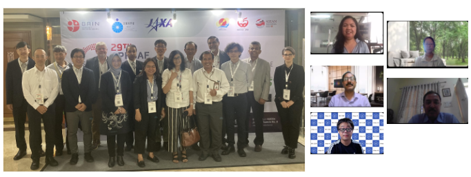
The APRSAF/SAFE Executive Board Meeting was held on September 18, 2023. It was co-chaired by Dr. Rajeev Jaiswal (Indian Space Research Organisation (ISRO)) and Dr. Shinichi Sobue (the Japan Aerospace Exploration Agency (JAXA)). The main topic of meeting was discussing on progress and future plan of three SAFE projects, SAFE Agromet Project, SAFE Rice Monitoring Project, and SAFE CH4Rice (Assessment of Methane Emission from Rice Paddies and Water Management) Project. In the opening remarks, Dr. Rahmat Arief, Head of Research Center for Remote Sensing (BRIN), Indonesia expressed a hearty welcome of hosting the APRSAF-29 meetings this time.
The participants confirmed the continuous use of agromet data provided by ISRO and JAXA in the AFSIS RGO reports. As a further capacity building program to expand the rice monitoring by satellite data, a proposal to JAIF (Japan-ASEAN Integration Fund) entitled Improvement of Paddy Rice Area Statistics and Damage Assessment using Earth Observation Satellite for ASEAN” is going to be submitted by GISTDA. After we successfully launched CH4Rice Project in the last APRSAF meeting, the project progressed with confirmation of study sites. In the afternoon, APRSAF-29/SAFE Training Program “Rice Planted Area Mapping using Earth Observation Satellite” was conducted successfully with online and onsite hybrid participation.
Result of the APRSAF/SAFE Executive Board Meeting
1. Agromet Project
- Summary
- Confirmed the continuous use of agromet data provided by ISRO and JAXA in the AFSIS RGO reports.
- Confirmed the capacity building support provided for technical staffs in ASEAN-AFSIS for continuity as well as the sustainability of the Agromet project
- Confirmed the expansion of AFSIS RGO reporting coverage to 9 countries including Brunei and Malaysia and VEDAS/JASMAI cover these two countries
- Agromet project is expected to close next year (SAFE EBM in 2024), however continue to support AFSIS’s RGO activities.
- Discussion and Future Plan
- Agreed that the main objective of the project is achieved. It was confirmed that satisfactory use of Agromet information in AFSIS monthly report preparations (with the cooperation of AFSIS) will have positive contribution to local, regional and global (through GEOGLAM) food security.
- Explore to promote good results to other areas and to other initiatives.
2. Rice Monitoring Project
- Summary
- Confirmed the good progress of the project conducted under multilateral cooperation led by GISTDA with ISRO and JAXA etc.
- Confirmed the preparation of a proposal to JAIF (Japan-ASEAN Integration Fund) entitled ”Improvement of Paddy Rice Area Statistics and Damage Assessment using Earth Observation Satellite for ASEAN” led by GISTDA, the Proponent Agency
- JAXA generates training data for rice mapping in collaboration with AFSIS, this activity will cover all ASEAN under AFSIS’s new project funded by MAFF/Japan.
- ISRO shares VEDAS updates on scripting environment, introduce multi-temporal analysis (e.g. forest changes, flood maps), and continuously update with data (sharing latest ALOS-2 ScanSAR data) and upgraded with analysis tools for rice crop monitoring
- Discussion and Future Plan
- Continue ISRO-JAXA, GISTDA-JAXA rice map comparison to improve/promote the use of satellite data in rice crop mapping and monitoring.
- Continue the promotion of satellite data sharing, tools development and facilitation to expand for practical and productive usage.
- Support to submit new Proposal to JAIF at next ASEAN SCOSA (Oct 16) /COSTI (Oct 19-20) meeting to avoid delays in the approval process.
- Continue discussions and collaboration with private sector to utilize SAFE assets to their business. Agricultural machinery company will deliver a talk on the collaboration utilizing SAFE asset at SAWG tomorrow.
3. CH4Rice Project
- Summary
- Confirmed the good progress of the project planning and coordination under multilateral cooperation led by VNSC
- Confirmed the study sites and identify the ALOS data observation plan by participating agencies (BRIN, GISTDA, ISRO, JAXA, PUST/UT, VNSC/CESBIO).
- Confirmed the current effort to deploy water level measuring sensors with number of technical collaborators in few sites (Bangladesh, India, Japan, Vietnam).
- Discussion and Future Plan
- Continue to coordinate the collection of water-level data (field survey and IoT equipment), but water level equipment deployment need clearance in each country
- Compare ground-based water inundation (water or non-water, water level estimation is difficult) with satellite observation for water/non-water classification
- Need to consider mixed pixel problem such as growing stage mixture
- Direct CH4 flux measurement is important to utilize project results in carbon credit (e.g. UNFCCC CDM), and already being done/will be done in some sites (Bangladesh, India, and Vietnam)
- Confirm the participation of PhilSA to CH4Rice project
- Coordinate presentation of GISTDA’s CEOS Chair initiative regarding GHG related topics at the CEOS plenary in November 2023
4. AOB
-
- In Indonesia, there is an effort by BRIN to create a combined dataset for national rice growing regions, currently they are using Sentinel-1/2 and need more high spatial resolution data as a basis for this dataset.
- Confirmed multiple SAR data (X/C/L, RISAT-1A, NISAR&ALOS-2/4) utilization an important issue for further discussion in SAFE EBM.