Report of the SAFE Workshop in APRSAF-26, Nagoya, Japan
< Last Update: Dec. 9, 2019 >
The SAFE Workshop in APRSAF-26 was successfully completed at JICA Chubu Nagoya Global Plaza, Japan on November 25, 2019. After the workshop, the result was reported to the Space Applications Working Group (SAWG) and the plenary session of APRSAF-26 which were held continuously from November 26 to 29.
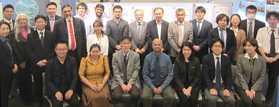
The workshop was led by co-chairs, Dr. Tanita Suepa, GISTDA and Dr. OYOSHI Kei, JAXA. The total number of participants was 25 from 6 countries and 2 international organizations.
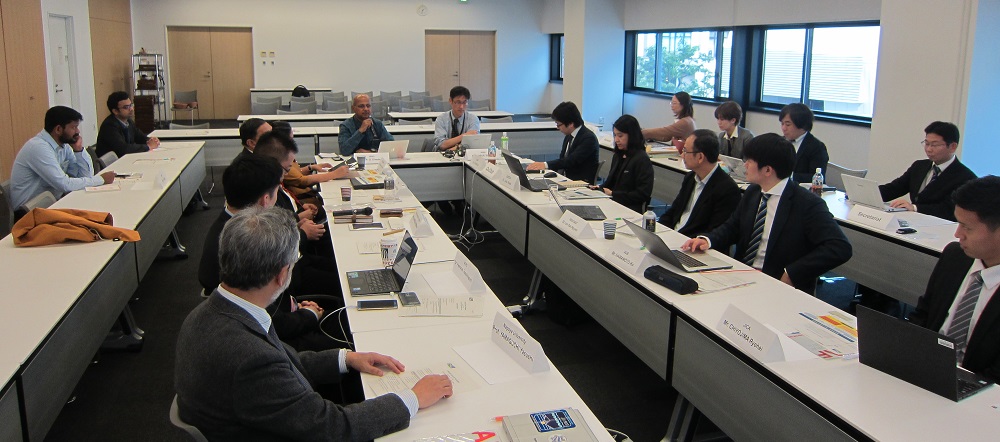
SAFE Evolution was discussed including new SAFE TOR and SAFE Projects. Just before the workshop, the SAFE Executive Board Meeting (co-chaired by Dr. P. G. Diwakar, ISRO and Dr. SOBUE Shinichi, JAXA) was held and ideas for new SAFE Projects, contents of revised SAFE TOR and recommendation for current SAFE Projects were discussed. During the SAFE Workshop, the revised SAFE TOR was acknowledged and we shared the concept of multi-lateral collaboration scheme to share the common interest / knowledge and method / technology in Asia Pacific region. Also, future collaborations of APN (Asia-Pacific Network) project of Nagoya University with JASMIN information services on the possible use for mitigation of drought; SERVIR-Mekong project of ADPC as a successful example of regional data sharing (service provision) for SAFE collaboration were recognized.
The final results of on-going prototype and follow-up activity were reported in the workshop as well. The participants confirmed their progress toward operational use. The final report of on-going prototype was ‘Smoke haze monitoring in Indonesia’ reported by LAPAN. The completion of prototyping was confirmed and interest to receive continuous support for provision of GCOM-C data and software improvement by JAXA and the University of Tokyo were expressed. The other report of follow-up activity was ‘Promote rice-planted areas and production estimation using space based technologies’ reported by MAFF, Cambodia. It was confirmed that the validation framework for checking planted area statistics reported from local offices using space technology as well as the manual for the validation framework were developed. On the other hand, since large discrepancies were found between INAHOR results and the ground based reported statistics for certain areas, these areas will need to be reviewed to determine the causes and possible solutions.
In the APRSAF-26/SAWG, which was held on the next day, SAFE Evolution was further discussed. Several recommendations were forwarded to the plenary and they were endorsed at the plenary.
The summary of the SAFE Executive Board Meeting and SAFE Workshop are given below;
SAFE Evolution
Revision of SAFE TOR (Acknowledgement)
- As an activity for SAFE Evolution, new SAFE TOR has been discussed and endorsed in the SAFE WS and at the SAFE Executive Board Meeting.
- SAFE will report the new TOR as “SAFE EVOLUTION” from the bilateral to multilateral activites(data/information and knowledge sharing on portal/platform) in upcoming APRSAF-26 as one of achievements of SAFE activities.
- Project Leader and Project Coordinator for each project will be requested to nominate (with brief CVs) from SAFE participating organization and will be decided as soon as possible after APRSAF-26. Also their roles and responsibilities will be coordinated with a template prepared by the SAFE secretariat.
Ideas for new SAFE projects
- Monitoring for renewable energy (Solar PV)
- Monitoring of Crop Water Requirement
- Soil moisture and Evapotranspiration (expanding of Agro-Met)
- Ocean Health (coastal zone, river water quality etc.)
- Land subsidence studies
- and also consider
- SDGs
- ECVs (Essential Climate Variables)
- Future Earth topics
* Project leader and coordinator should be selected based on each SAFE projects
SAFE Projects
SAFE Evolution Agromet Project
- Progress Confirmation
- Progress of comparison/validation of agromet products (ISRO and JAXA, GISTDA and JAXA) and capacity building were reported.
- Held training course for SCOSA and AFSIS members about use of agromet information, which leads to ASEAN connectivity in agriculture monitoring.
- Future Collaboration
- Shared the achievement of APN project of Nagoya University and recognized the possibility of future collaboration with JASMIN for drought monitoring.
- Introduced from ADPC about SERVIR-Mekong as a successful example of regional data sharing (service provision) collaboration.
- Suggestions by Executive Board Meeting
- Implement a SAFE agromet project information platform / portal that should be established as a means for advertising the plan, data and tools, etc.
- Need to have a scheme to get end users feedback about the use of satellite data to data / information providers through web platform.
- Encouraged to consider further how end users will access the information. Also, provision of actionable information is key (i.e., not providing ARD that needs further analysis like as Essential Agriculture Variables).
- Consider to go forward to agromet-based forecasting
- Recommendations toward next step
- Showed the importance that consider indicators for hydrological drought, meteorological drought and vegetation stress, and go forward with agromet-based forecasting.
SAFE Evolution Rice Crop Monitoring Project
- Suggestions
- Need to further refine scope & objectives of rice crop monitoring project with clear focus of end-user (Government system and farmer specific. This calls for appropriate spatial and temporal resolution to be considered for products / information needs, research and operation)
- Consider the concept of a ‘Virtual Constellation’, as used in CEOS, for enabling optical and microwave data for use through data sharing in the region. Also Historical data would help in preparing training data, necessary for the rice crop monitoring project.
- An archive of historical regional EO data set and other data should be established, as this is a necessity for the machine/deep learning related software usage.
- Recommendations toward next step
- Consider to redefine/ redesign the project with a focus on Agromet based initial estimation, followed by use of Very High Spatial Resolution Data for verification/validation using discrete samples, including Moderate(10-100m) Spatial resolution data with required temporal resolution imaging for the region. Microwave & Optical data to be appropriately chosen as part of the project.
SAFE Prototypes
Meeting Summary: Haze Monitoring (Indonesia)
- Progress Confirmation
- Action Item was closed and Prototyping was completed.
- Conducting consultations with stakeholders in country (e.g., BMKG, MoEF; four times from 2017-2019).
- Himawari data is automatically downloaded and processed to detect fires, the software development was supported by The University of Tokyo. GCOM-C was shown to successfully detect smoke haze using the VN8 band.
- Recommendations toward future activities and operational use
- Suggested that smoke forecasts/estimations using winds vector data with hotspot locations would be a good next step to tried in Indonesia.
- JAXA and The University of Tokyo continue to support for GCOM-C data provision and software improvement fitting to user requirement such as information provision frequency.
Meeting Summary: Paddy Area Estimation (Cambodia)
- Progress Confirmation
- Prototyping has been carried out.
- A number of coordination and knowledge sharing/training meetings have taken place with provincial/district office staff so they can implement the framework.
- The validation framework for checking planted area statistics reported from local offices using space technology was developed as well as the manual for the validation framework.
- Demonstration of the validation framework was expanded to 6 Provinces.
- Recommendations toward future activities and operational use
- A machine learning version of INAHOR is being used. It has demonstrated reasonable accuracy for the study areas.
- Since large discrepancies between INAHOR results and the ground based reported statistics for certain areas, these areas will need to be reviewed to determine the causes and possible solutions. The results will be revisited and revalidated again, before final report generation.