Image Library
Calculation of flooded area caused by heavy rain in Pakistan
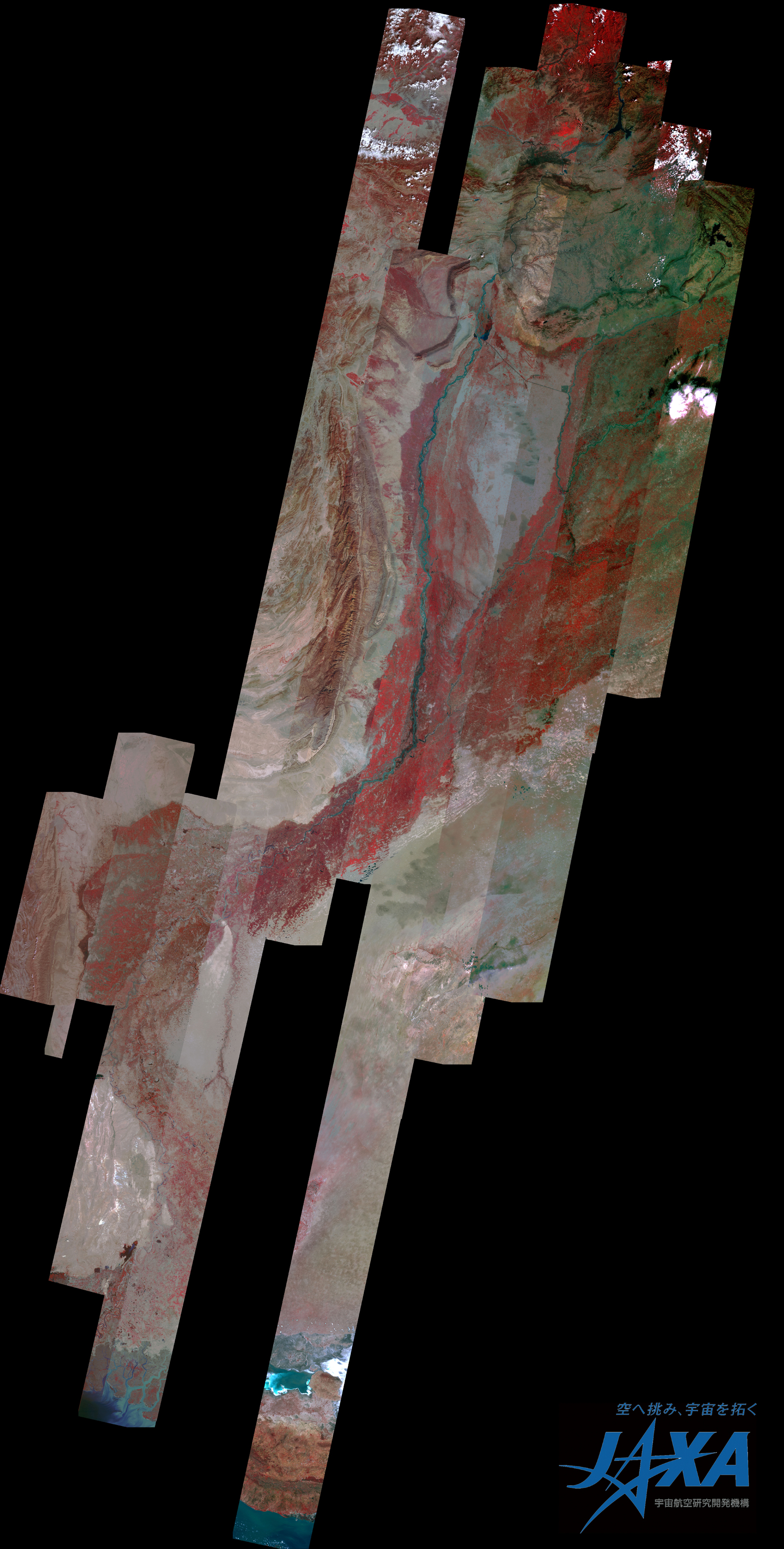
Northwestern Pakistan in the central Asia has been seriously damaged due to floods caused by heavy rain, which had occurred continuously since end of July 2010. The Japan Aerospace Exploration Agency (JAXA) has performed the follow-up observations continuously to monitor the state of the damage. Flooded areas along the Indus River were calculated from the merged image of before and after the disaster.
Fig. 1 shows merged images assigned band 3, 2 and 1 of AVNIR-2 as the true color composite.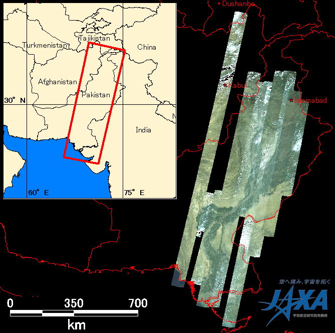
Enlarged Image
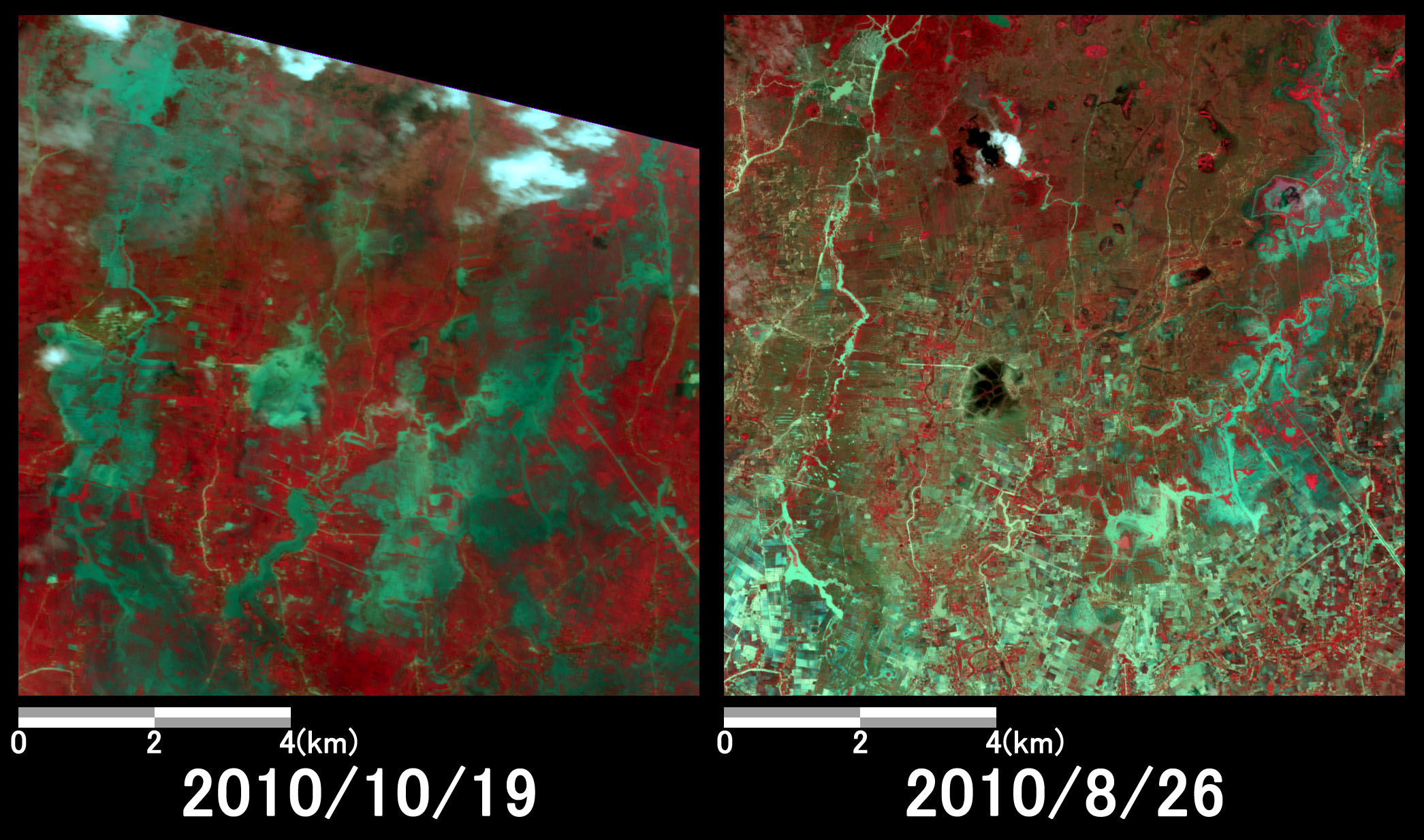
The flooded area could be calculated approximately 24,000 square kilometers from the mosaic image and is 11 times as large as the area of Tokyo.
* Advanced Visible and Near Infrared Radiometer type 2 (AVNIR-2):
AVNIR-2 is a visible and near infrared radiometer for observing land and coastal zones. It provides 10-m spatial-resolution image and 70-km swath on the ground. The pointing angle of AVNIR-2 is +44 and - 44 degrees.