Image Library

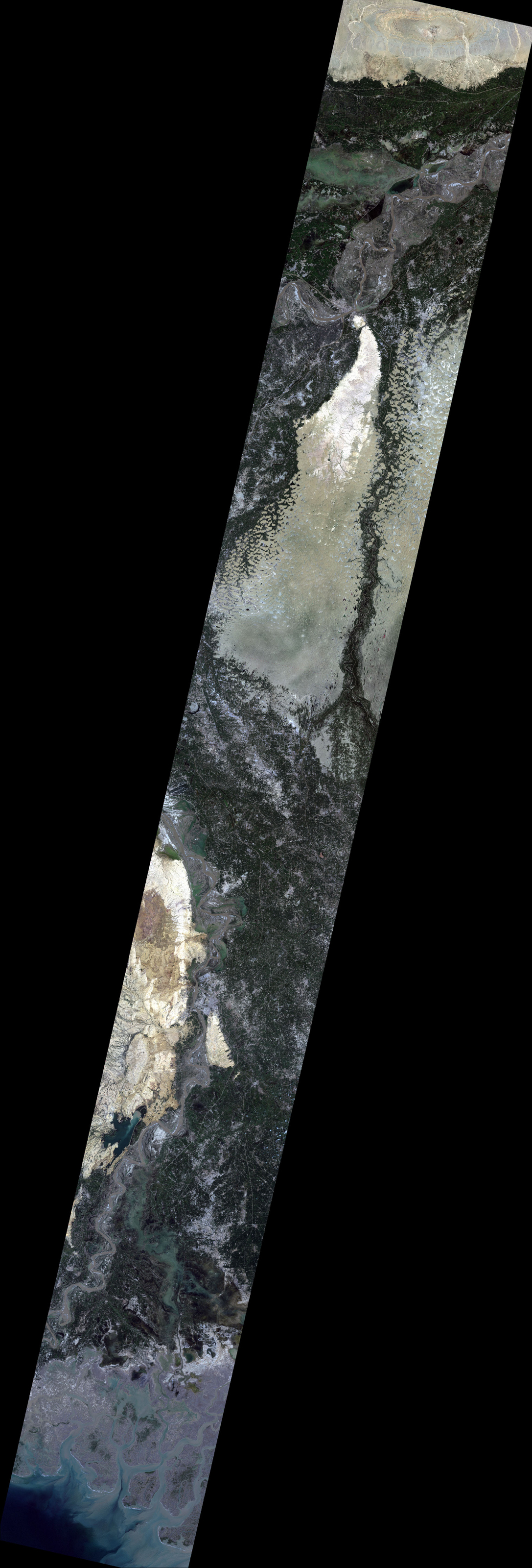
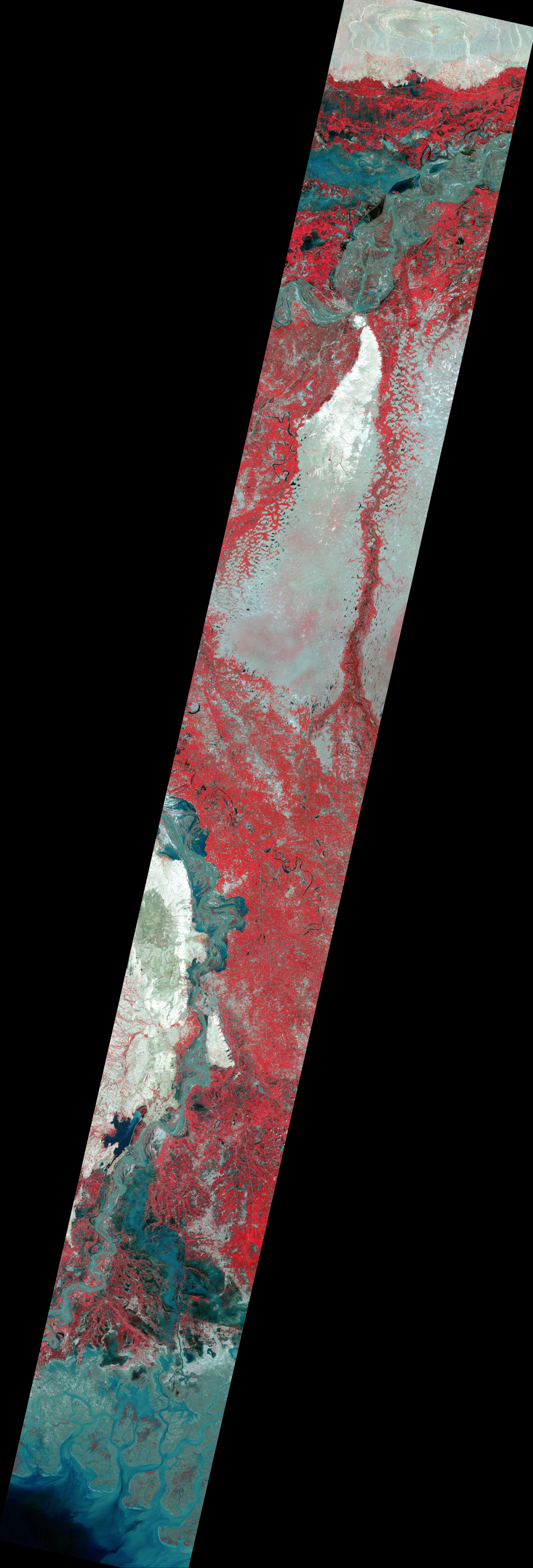
Observation of concentrated heavy rain in Pakistan by AVNIR-2 onboard "Daichi" (ALOS) (9)

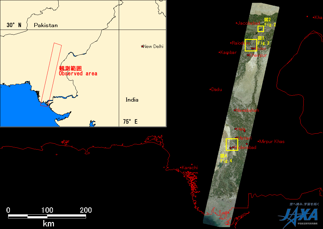
Northwestern Pakistan in the central Asia has been seriously damaged due to floods and mudslides caused by heavy rain which had occurred continuously since end of July 2010.

The Japan Aerospace Exploration Agency (JAXA) has performed the follow-up observation to monitor the state of the damage by the Advanced Visible and Near Infrared Radiometer type 2 (AVNIR-2)* onboard the Advanced Land Observing Satellite (ALOS, "Daichi") at 15:04 (JST) or 6:04 (UTC) on September 23.

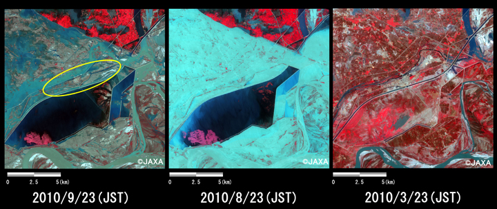
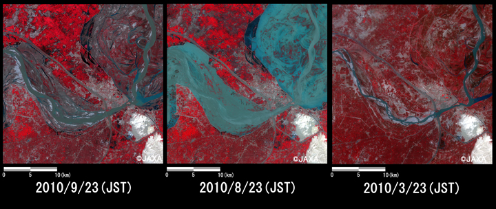
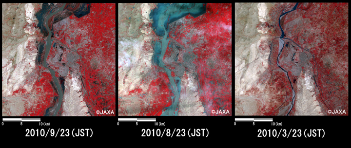
Fig. 1 shows an observed image and is assigned band 3, 2 and 1 of AVNIR-2 as the true color composite.
Enlarged Image
Fig.1
Fig.1: AVNIR-2 image with 0.0 degree pointing angle acquired at 15:04 on September 23, 2010 (JST). Yellow squares show location of Figs. 2 ~ 4.
Fig.2: Enlarged images of the swollen rivers at Khandh Kot (225 square kilometers, left: September 23, 2010; center: August 23, 2010; right: March 23, 2010).
(Click to view enlarged image)
Fig.3: Enlarged images of the swollen rivers at Sakkur (225 square kilometers, left: September 23, 2010; center: August 23, 2010; right: March 23, 2010).
(Click to view enlarged image)
Fig.4: Enlarged images of the swollen rivers at Hyderabad (900 square kilometers, left: September 23, 2010; center: August 23, 2010; right: March 23, 2010).
(Click to view enlarged image)
Figs. 2 to 4 show enlarged images of swollen rivers, which were taken after disaster on September 23 (left) and August 23 (middle), 2010 and before disaster on March 23, 2010 (right). The images are located in Khandh Kot (650km south-southwest from Islamabad), Sukkur (700 km south-southwest from Islamabad) and Hyderabad (1,200 km south-southwest from Islamabad), respectively. They are assigned band 4, 3 and 2 of AVNIR-2 as the false color composite, therefore vegetation can be seen in red color and submerged areas can be seen clear in light blue or blue color. The image taken in September 23 shows flooded area still remains. However in comparison to September 23 and August 23, the image taken on 23 September may suggest the water level on September 23, 2010 were becoming lower than one on 23 August because part of the land surface and some vegetation can be seen in flooded areas. The image taken on September 23, 2010 indicates that water level at the urban area shown by yellow circle in Fig.2 became lower and lower.

JAXA plans continuous observation of this region.

* Advanced Visible and Near Infrared Radiometer type 2 (AVNIR-2):

AVNIR-2 is a visible and near infrared radiometer for observing land and coastal zones.

It provides 10-m spatial-resolution image and 70-km swath on the ground. The pointing angle of AVNIR-2 is +44 and - 44 degrees. The images taken on September 23, August 23 and March 23, 2010 were acquired by 0.0 degree, 31.2 degrees east and 0.0 degree, respectively.

JAXA EORC