Image Library
Emergency observation of concentrated heavy rain in Pakistan by AVNIR-2 onboard "Daichi" (ALOS)
Northwestern Pakistan in the central Asia was seriously damaged due to floods and mudslides caused by heavy rain which had occurred since July 29, 2010. The Japan Aerospace Exploration Agency (JAXA) has decided to observe here by the Panchromatic Remote-sensing Instrument for Stereo Mapping (PRISM) and the Advanced Visible and Near Infrared Radiometer type 2 (AVNIR-2)* onboard the Advanced Land Observation Satellite (ALOS, "Daichi") at 15:02 (JST) or 6:02 (UTC) on August 3, 2010 as an emergency observation.
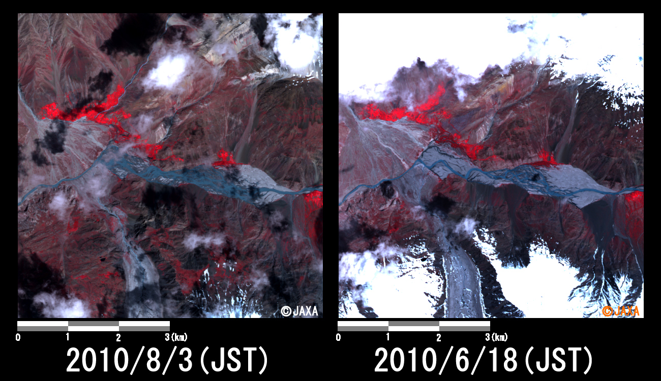
Fig. 1 shows an observed image of AVNIR-2 at 15:02 on August 3, 2010 (JST). It was assigned by channel 3, 2 and 1 for red, green and blue colors as true color composite. Although the floods in Khyber Pakhtunkhwa province of northwestern Pakistan couldn't be identified by clouds, fortunately swollen rivers in the boarder of Afghanistan could be seen.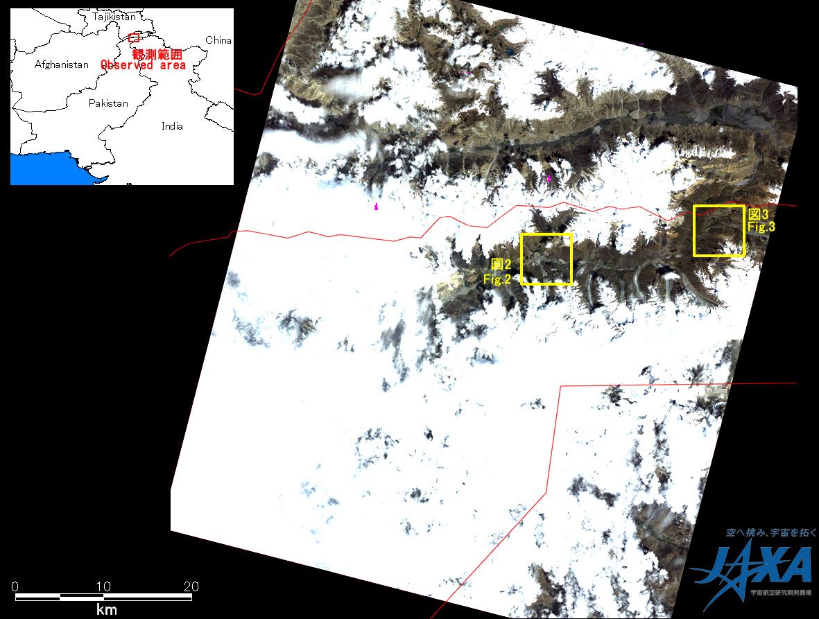

JAXA plans continuous observation of this area.
The acquired images were provided to "Sentinel Asia".
* Advanced Visible and Near Infrared Radiometer type 2 (AVNIR-2):
AVNIR-2 is a visible and near infrared radiometer for observing land and coastal zones.
It provides 10-m spatial-resolution image and 70-km swath on the ground. The pointing angle of AVNIR-2 is +44 and - 44 degrees. This image was acquired by 0.0 degree.