Northwestern Pakistan in the central Asia has been seriously damaged due to floods and mudslides at entire basin of Indus River caused by heavy rain which had occurred continuously since end of July 2010. The Japan Aerospace Exploration Agency (JAXA) has performed the follow-up observation to monitor the state of the damage by the Advanced Visible and Near Infrared Radiometer type 2 (AVNIR-2)* onboard the Advanced Land Observing Satellite (ALOS, "Daichi") at 15:13 (JST) or 6:13 (UTC) on September 28 and at 14:53 (JST) or 5:23 (UTC) on September 30, 2010.
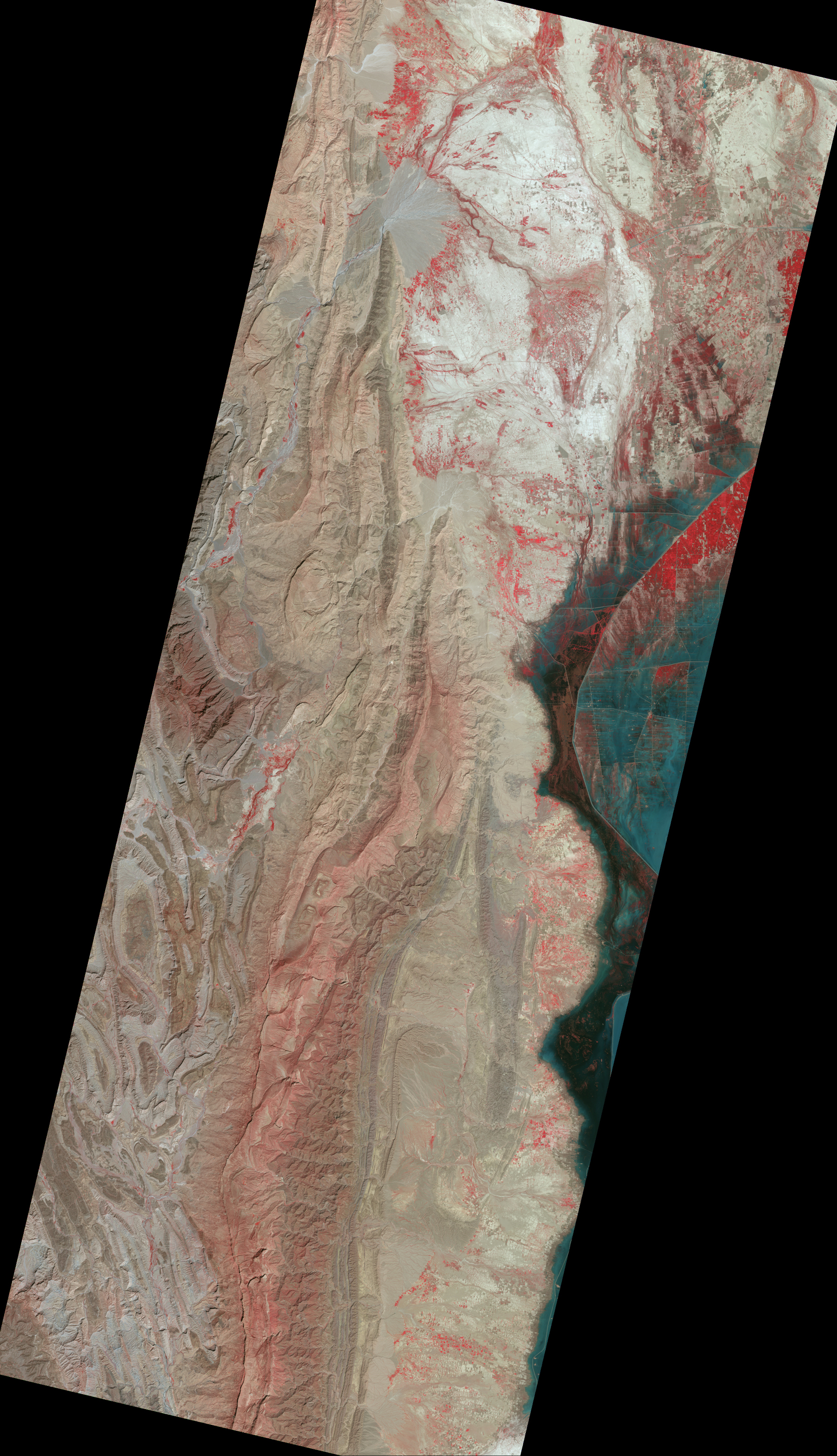
Fig. 1 shows observed images assigned band 3, 2 and 1 of AVNIR-2 as the true color composite.
Enlarged Image(left)
Enlarged Image(right)
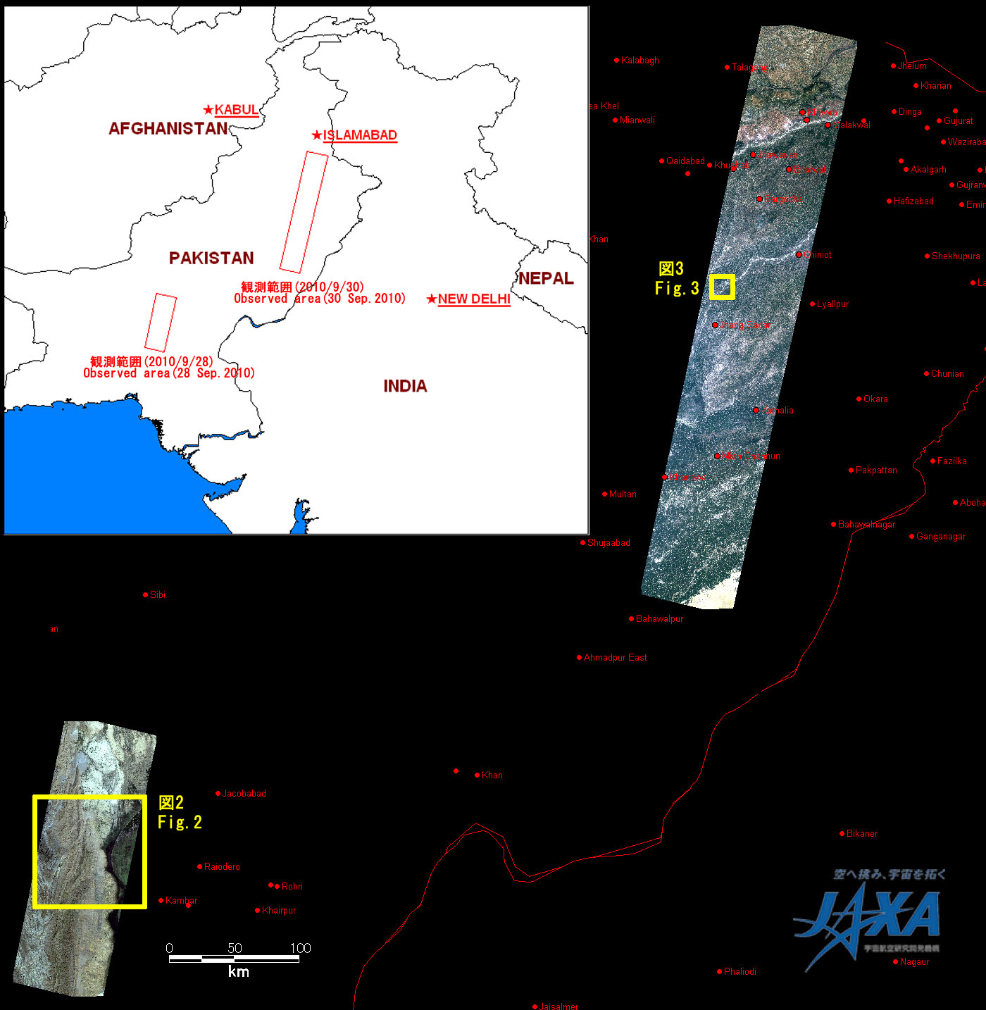
Fig.1: AVNIR-2 images with 0.0 degree pointing angle acquired at 15:13 on September 28 (left) and 14:53 on September 30, 2010 (right) (JST). Yellow squares show location of Figs. 2 to 3.
(Click to view enlarged image)
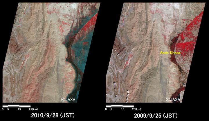
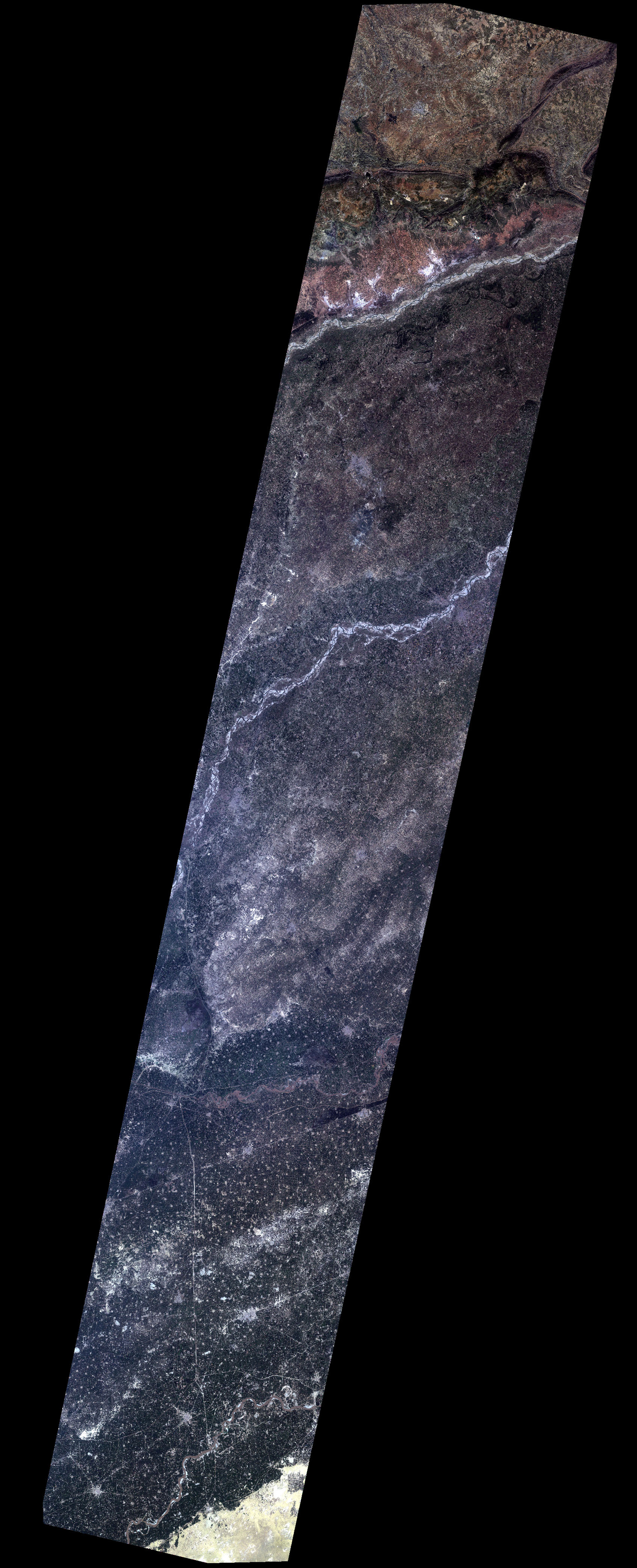
Fig. 2 shows enlarged images of swollen rivers or flooded areas in Ando Khosa (130 km west-southwest from Khairpur), which were taken after disaster on September 28, 2010 (left) and before disaster on September 25, 2009 (right). They are assigned band 4, 3 and 2 of AVNIR-2 as the false color composite, therefore vegetation and flood areas can be seen clear in red and light blue colors, respectively. In comparison to before as well as after disaster, it indicates that flooded area still remains unchanged though two months have passed since the heavy rain.
Fig.2: Enlarged images of the flooded area in Ando Khosa.
(8100 square kilometers, left: September 28, 2010; right: September 25, 2009).
(Click to view enlarged image)
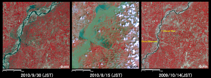
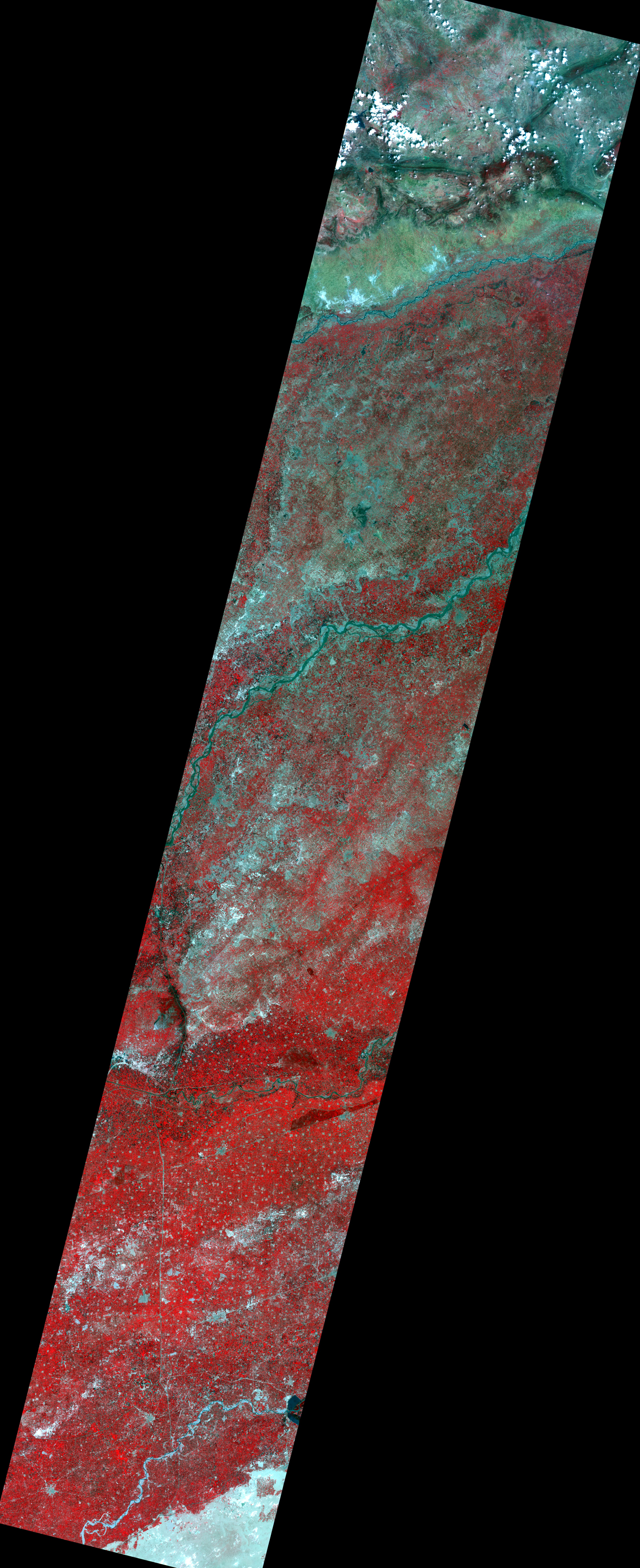
Fig. 3 shows enlarged images in Chund Bharwana (240 km south-southwest from Islamabad), which were taken after disaster on September 30 (left), August 15, 2010 (middle) and before disaster on October 14, 2009 (right). In comparison to the images taken on September 30 and August 15, 2010, they indicate that water level is subsiding as flow path of river can be seen in North Pakistan because vegetation is seen at old flood areas.
Fig.3: Enlarged images of the swollen river in Chund Bharwana.
(324 square kilometers, left: September 30, 2010; middle: August 15, 2010; right: Octorber 14, 2009).
(Click to view enlarged image)
JAXA plans continuous observation of this region.
* Advanced Visible and Near Infrared Radiometer type 2 (AVNIR-2):
AVNIR-2 is a visible and near infrared radiometer for observing land and coastal zones.
It provides 10-m spatial-resolution image and 70-km swath on the ground. The pointing angle of AVNIR-2 is +44 and - 44 degrees. The images taken on September 28, August 15, 2010, and September 25, October 14, 2009 were acquired by 0.0 degree.