Image Library
Observation of concentrated heavy rain in Pakistan by AVNIR-2 onboard "Daichi" (ALOS) (8)
Northwestern Pakistan in the central Asia has been seriously damaged due to floods and mudslides caused by heavy rain which had occurred continuously since end of July 2010.
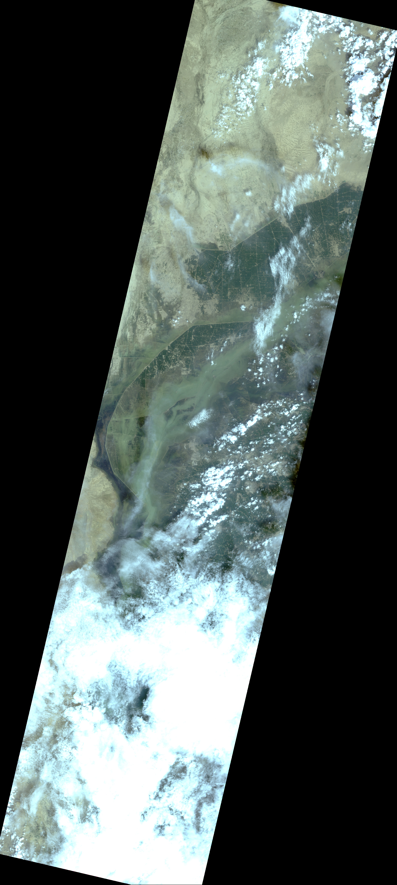
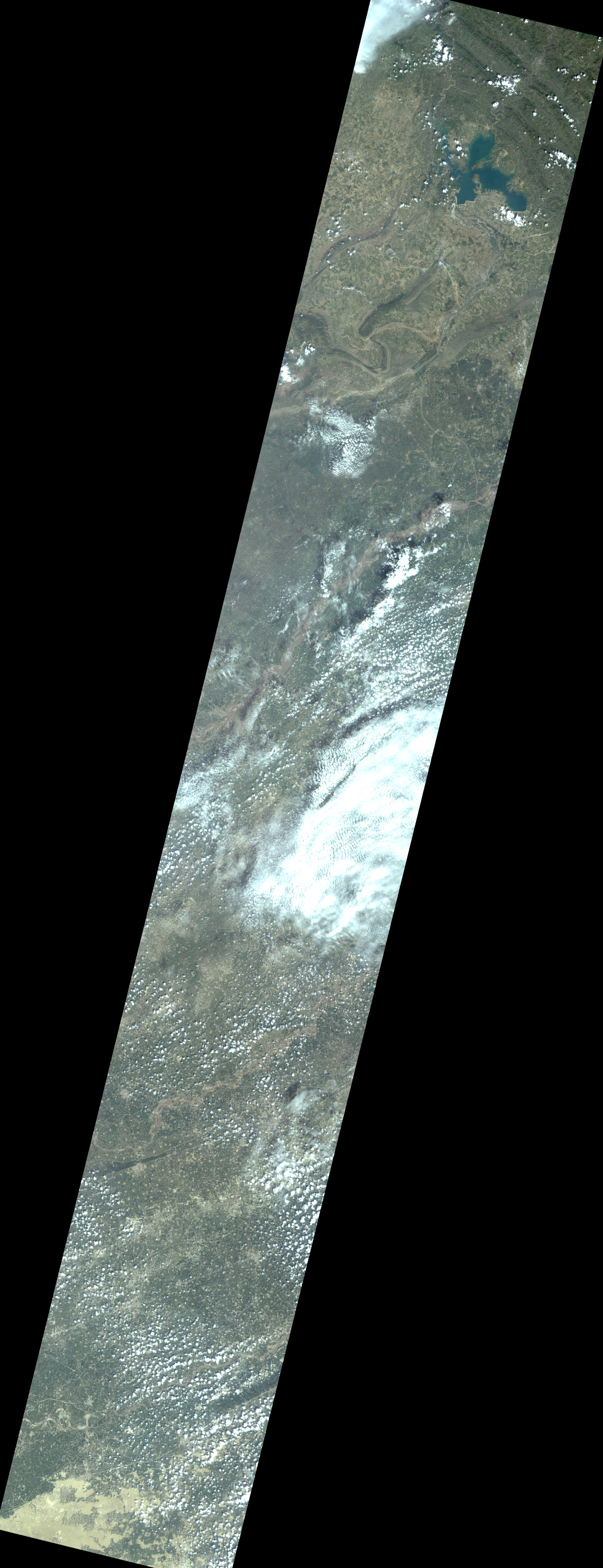
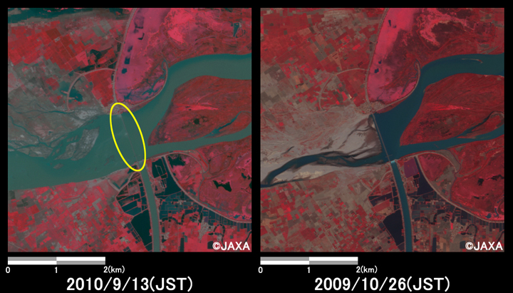
The Japan Aerospace Exploration Agency (JAXA) has performed the follow-up observation to monitor the state of the damage by the Advanced Visible and Near Infrared Radiometer type 2 (AVNIR-2)* onboard the Advanced Land Observing Satellite (ALOS, "Daichi") at 15:14 (JST) or 6:14 (UTC) on September 11 and at 14:56 (JST) or 5:56 (UTC) September 13, 2010. These observations show flood damages in south of Pakistan still remains wide inundation areas.
Fig. 1 show observed images assigned band 3, 2 and 1 of AVNIR-2 as the true color composite.Enlarged Image (left)
Enlarged Image (right)
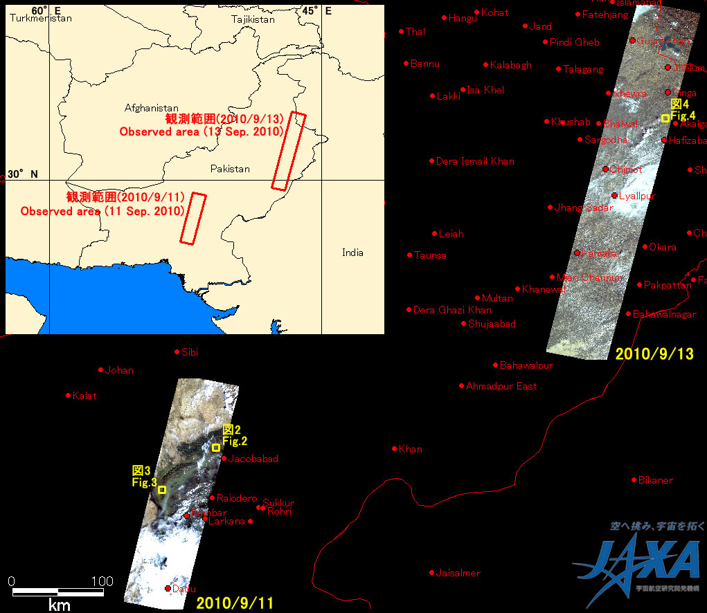
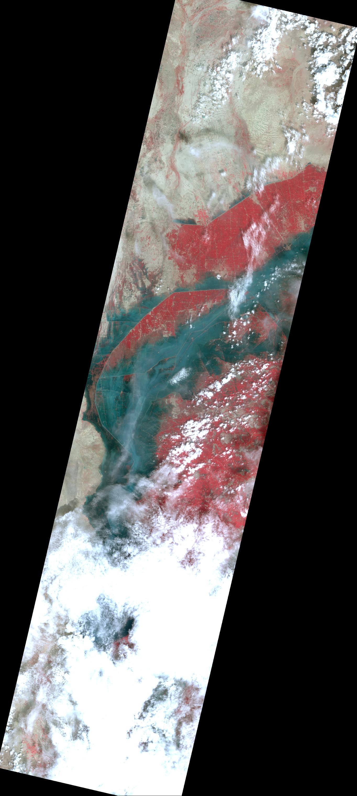
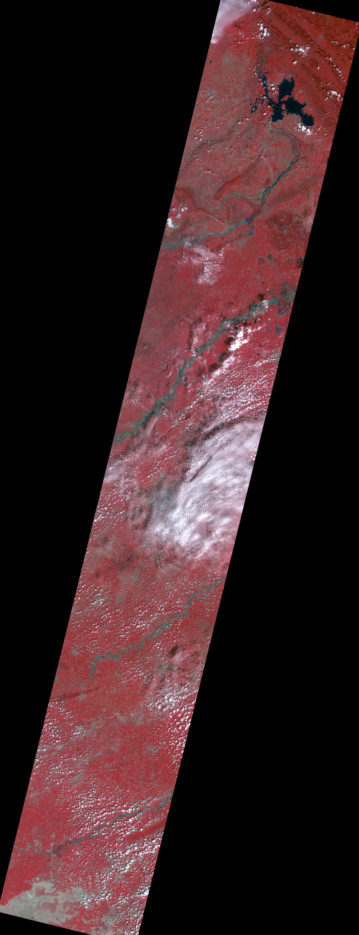
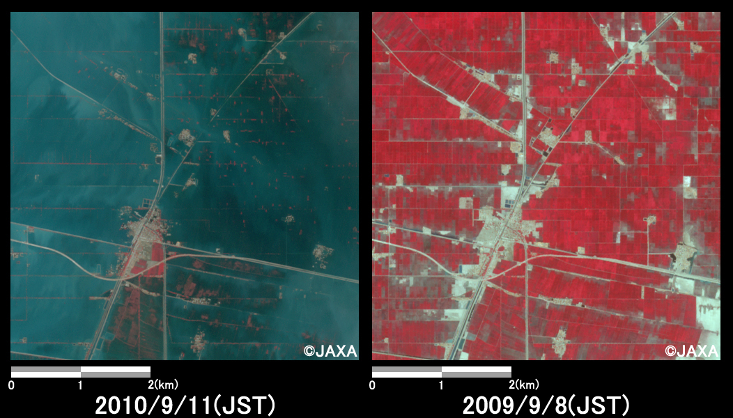
Figs. 2 and 3 show enlarged images of flooded urban area, which were taken on September 11, 2010 (left) and on September 8, 2009 as before disaster (right). Figs. 2 and 3 are located at Dera Allah Yar (13 km north-west from Jacobabad) and Qubba Saida Khan (84 km south-west from Jacobabad), respectively.
These are assigned band 4, 3 and 2 of AVNIR-2 as the false color composite, therefore vegetation and flood areas can be seen clear in red and light blue colors, respectively. In comparison to before as well as after disaster, they indicate that urban area was still flooded in large area.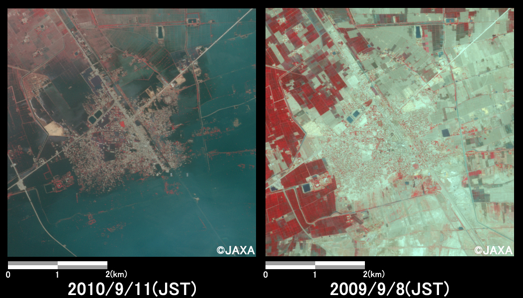
JAXA plans continuous observation of this region.
* Advanced Visible and Near Infrared Radiometer type 2 (AVNIR-2):
AVNIR-2 is a visible and near infrared radiometer for observing land and coastal zones.
It provides 10-m spatial-resolution image and 70-km swath on the ground. The pointing angle of AVNIR-2 is +44 and - 44 degrees. The images taken after disaster on September 11 and 13, 2010 and before disaster on September 8 and October 26, 2009 were acquired by 0.0 degree, respectively.