Seen from Space 2008
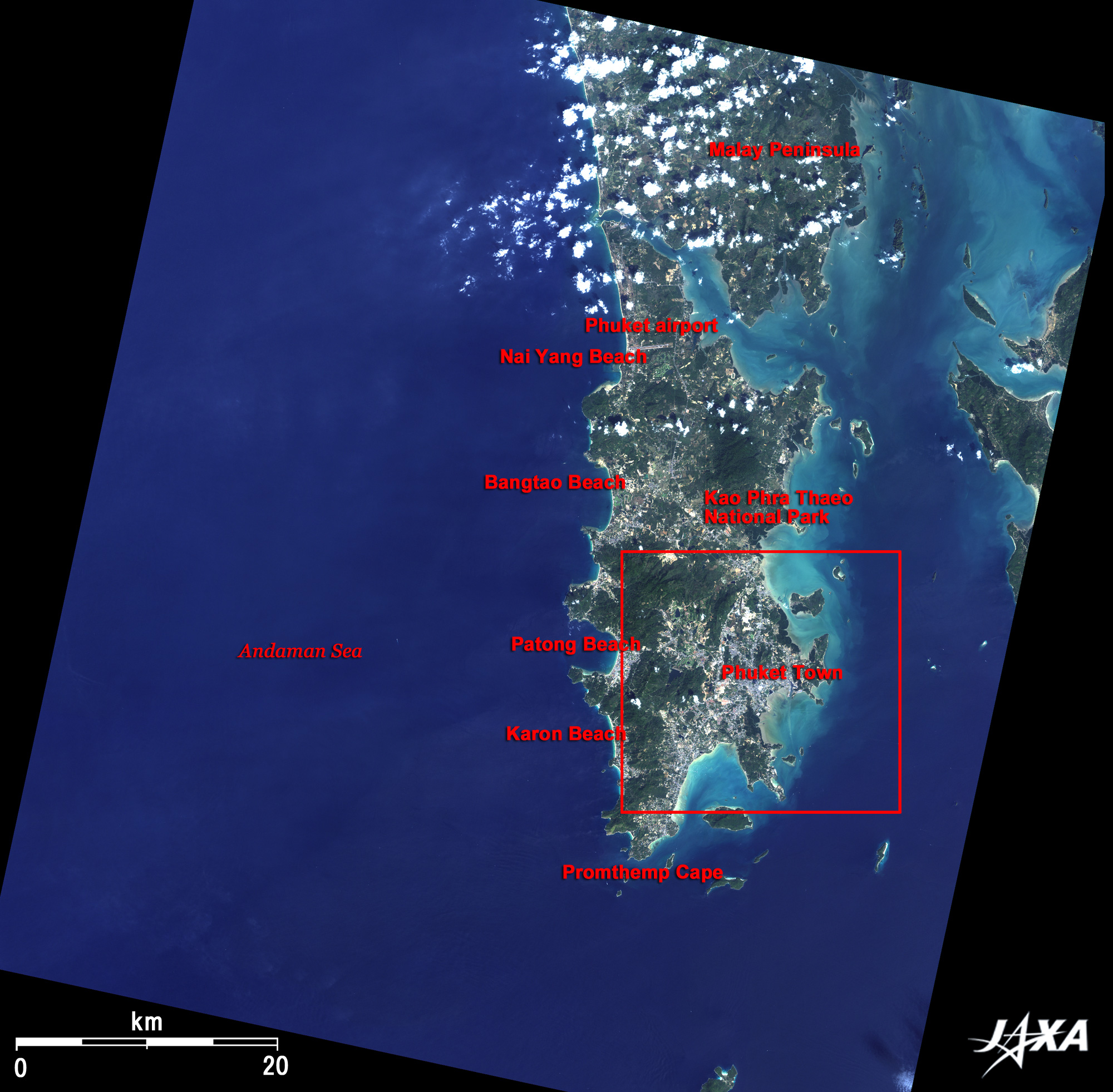
The Pearl of the Andaman Sea, Phuket
On the west coast of the island facing the Andaman Sea, many arched beaches fringed with white sands make a strong contrast with the deep-blue ocean. It is quite obvious at a glance that they are fine beach resorts. Famous beaches are, from north (top) to south (bottom), Nai Yang Beach, Bang Tao Beach, Patong Beach, and Karong Beach. Of these, shallow Patong Beach is the most popular for tourists who enjoy sea bathing, parasailing, and jet skiing. Cape Promthep at the southernmost tip is known as a famous spot for watching beautiful sunsets across the Andaman Sea. Phuket came from "Bugit" in Malay meaning "Hill." Some small hills (300m to 500m above sea level) covered with tropical forest are actually visible in the island. Khao Phra Theo National Park in the middle of the island is called the last hidden scenic spot in Phuket. In the dense forest, deep in the mountains, untouched tropical nature remains. It is also an important water source for the island, At the base of a mountain, tin was mined from the 16th century to the mid-20th century, and then rubber plantations have been operated. The runway visible to the north of the island is the Phuket International Airport. Direct flights from Japan are also available. The grey urban area on the eastern part of the island is the province capital Phuket Town (Phuket City).
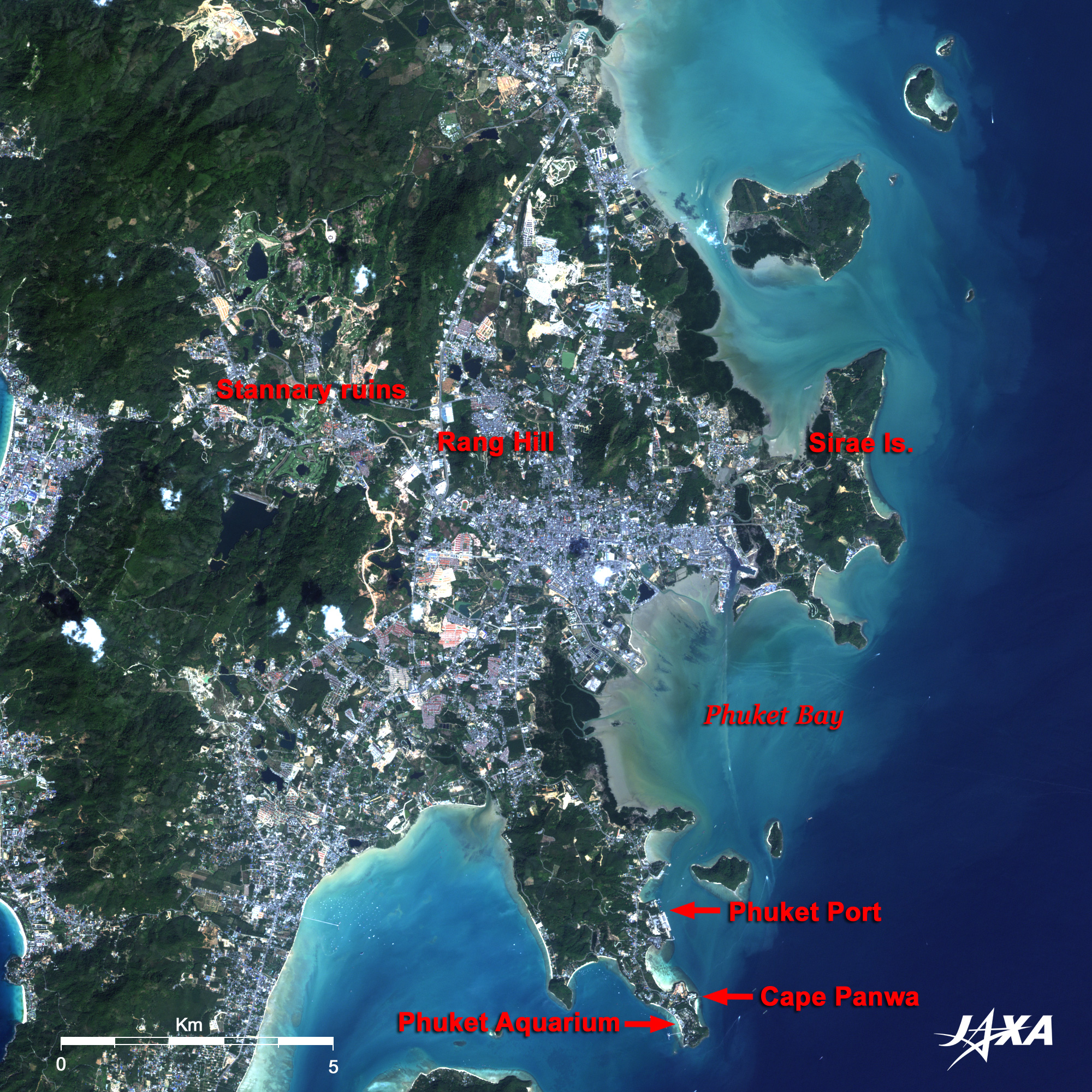
Si-R(a)e Island located just to the right of center in the figure has a village of maritime people regarded as the native people of Phuket. They maintain a traditional lifestyle there closely related to the sea. A number of ponds dot the northwest of Phuket Town and are the sites of former open-cast tin mining pits. They are now used as a natural land formation of golf courses. The white structure along the coast facing Phuket Bay is the long quay of the Port of Phuket. To its south, Cape Panwa juts out south into the sea. The Phuket Aquarium, located at the tip of the cape, keeps freshwater fishes such as arowanas and marine life of the Andaman Sea. On December 26, 2004, Phuket and other nearby areas on Thailand's western coast suffered extensive damage when they were struck by a tsunami caused by the 2004 Indian Ocean earthquake. The town recovered from the damage, beaches are bustling again, and now it is difficult to find the scars of the tsunami. Maritime people living along the coves of the island, immigrants came from Europe and China in quest for tin mining and trade, and tourists from all over the world looking for the beautiful Andaman Sea; Phuket is a tropical island always boasting a rich natural beauty and attracting people.
|