| |
 |
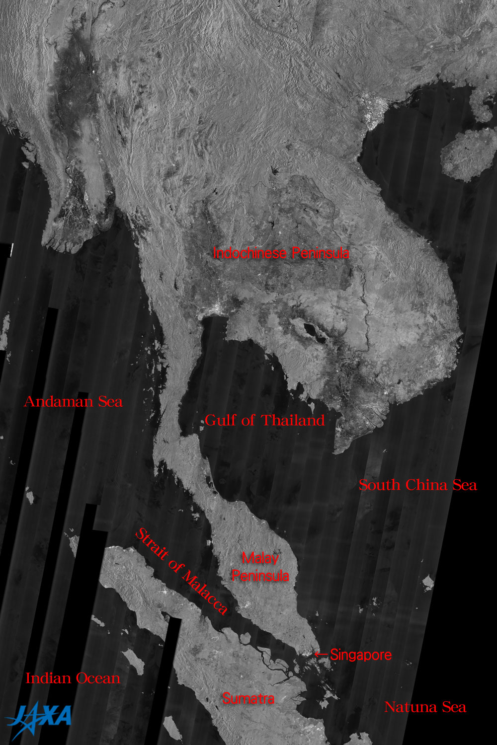
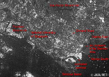
| Fig. 1 Southeast Asia observed by JERS-1/SAR |
Figure 1 depicts Southeast Asia as observed by the synthetic aperture radar (SAR) aboard the Japanese Earth Resources Satellite-1 (Fuyo-1). The water surfaces such as the sea and lakes look black and land looks gray. The bright spot on the tip on the Malay Peninsula extending from the Indochinese Peninsula is Singapore. In the southwest of the Malay Peninsula, Sumatra extends across the Strait of Malacca.
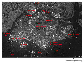 |
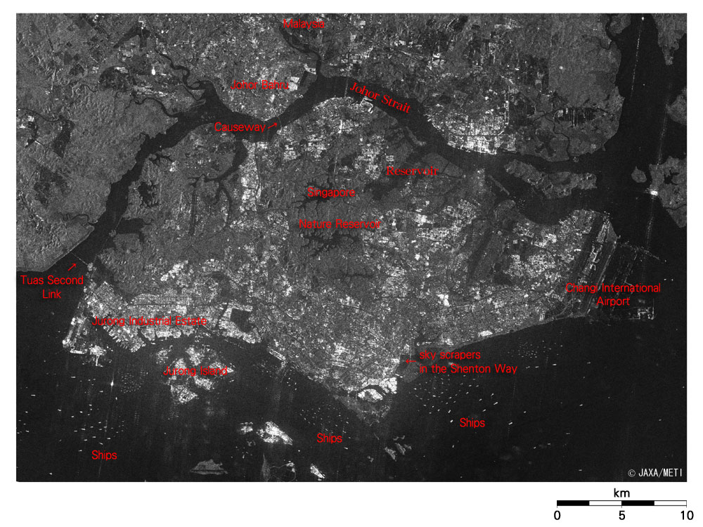
Fig. 2 SAR image of Singapore
Singapore (kmz, 2.98MB, Low Resolution) as seen on Google Earth. |
Singapore Island is diamond shaped and faces Malaysia across the Johor Strait on the north side. The two runways of Changi International Airport in the eastern end of the island look black. The bright central town, which contains the skyscrapers in the Shenton Way, can be seen near the southernmost tip of the island. There are harbor facilities such as the gantry cranes, which load and unload the containers in the container terminal on the southernmost tip on the island, and various plants such as the petroleum refinery plants in the Jurong Industrial Estate in the western area. They look very bright. There are many bright points on the sea in the south indicating that many ships are anchored. The comparatively bright areas in southern and northern areas are residential areas containing primarily high-rise multifamily housing units.
The area of Singapore is increasing gradually by reclamation and has now reached approximately 700 km2. At present, 4,300,000 people live there, so the population density is approximately 6,100 people per km2, equivalent to 18 times that of Japan. Therefore, the Housing Development Board has been constructing many high-rise multifamily housing units, and 85% of the people live in such units. There are many reservoirs in the central area, and the northern area looks black. The Nature Reservoir and other forests appear gray. Malaysia and Singapore are linked with two road bridges: the Causeway on the north side and the Tuas Second Link on the west side. The Malay Railway and water pipelines are installed in the former bridge. Half of the water consumed in Singapore is bought from Malaysia and supplied via these pipelines, and the remainder is provided from rainwater saved at the reservoirs and recycled water.
Most of the area on the Malaysian side looks gray indicating forests, but the area facing Johor Strait in the upper right looks very bright, in contrast to Johor Bahru, indicating an industrial complex.
 |
| Fig. 3 SAR image of central Singapore |
The miracle mile Orchard Road extending more than 1.5 km appears as a black line just right of the center of the figure; other wide roads look black also. The campus of National University of Singapore can be seen just left of the center of the figure. The Pandan Reservoir on the left of the figure and the Macritche Reservoir in the upper portion appear black. Sentosa Island, which is being developed as a resort area, appears gray, indicating that there are many trees. The Marina East and the Marina South on the right of the figure are on reclaimed land and appear gray, also indicating that there are many trees.
 |
 |
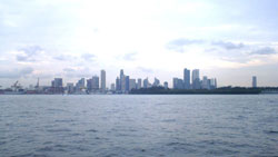
| Fig. 4 Skyscrapers in Shenton Way seen from the sea |
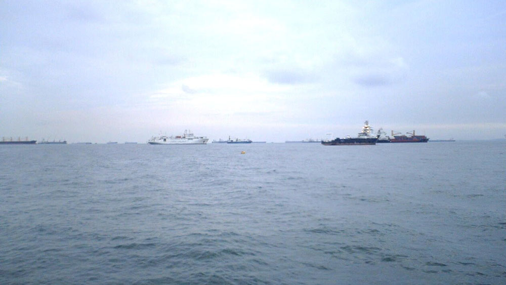
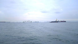
Fig. 5 Ships anchoring off Marina South |
Figures 4 and 5 were taken in July 2006. The bright objects in Figs. 2 and 3 are skyscrapers or ships.
Explanation of the images:
Figs. 1 to 3
| Satellite: |
Japanese Earth Resources Satellite -1 (JERS-1) (Fuyo-1) |
| Sensor: |
Synthetic Aperture Radar (SAR) |
| Date: |
August 1998 (Fig. 1),September 19, 1998 (Figs. 2 and 3)
|
| Frequency |
1,275 MHz (L-band) |
| Ground resolution |
18 m |
| Map Projection: |
Universal Transversal Mercator (UTM) |
|
Figures 1 to 3 indicate the strength of the SAR-transmitted radio signal as it is scattered back by the Earth's surface. Calm water surfaces, runways and roads that tend to scatter radio signals forward look black, while ships and artificial structures such as buildings, bridges and harbor facilities that reflect radio signals back well look bright, and the forests appear gray in the middle. This is a powerful demonstration of SAR's ability to observe the Earth's surface regardless of clouds because this is a hot and humid tropical climate zone that is usually covered by clouds. |
|
 |
Related Sites:
 The Panama Canal: A shortcut for ships crossing the isthmus The Panama Canal: A shortcut for ships crossing the isthmus
A Radar View of Southeast Asia - Indochina Peninsula
Extensive Observation Images of Indochina, Southeast Asia - What We Can Learn from Optical Sensor and Synthetic Aperture Radar Images
JERS-1 SThe JERS-1 SAR Global Forest Mapping (GRFM/GBFM) Program
Appendix:
We made up the following table because it is often said that the area of Singapore is the same as that of Awaji-shima Island or Tokyo's 23 wards. The population density of Tokyo's 23 wards is more than twice that of Singapore.
The population density of Tokyo's 23 wards in the daytime should be higher because its daytime population increases due to people commuting and going to schools from nearby prefectures.
| |
Area (km2) |
Population |
Population Density
(per km2) |
| Singapore |
700 |
4,300,000 |
6,100 |
| Awaji-shima Island |
590 |
160,000 |
270 |
| Tokyo's 23 wards |
620 |
8,400,000 |
13,500 |
| Japan (Ref.) |
378,000 |
127,000,000 |
337 |
|
|