Seen from Space 2011
Sriharikota: The Indian Satellite Launching Site
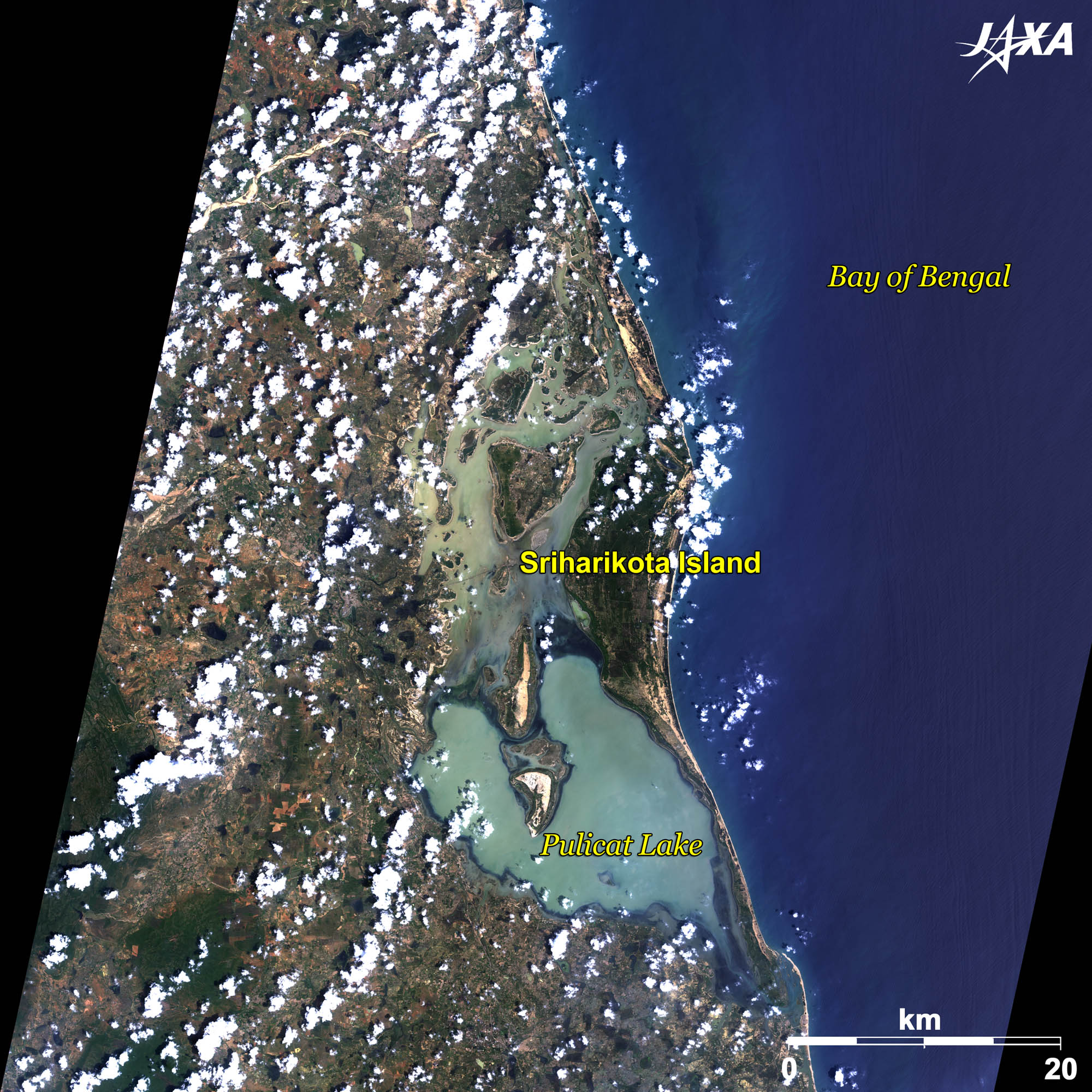 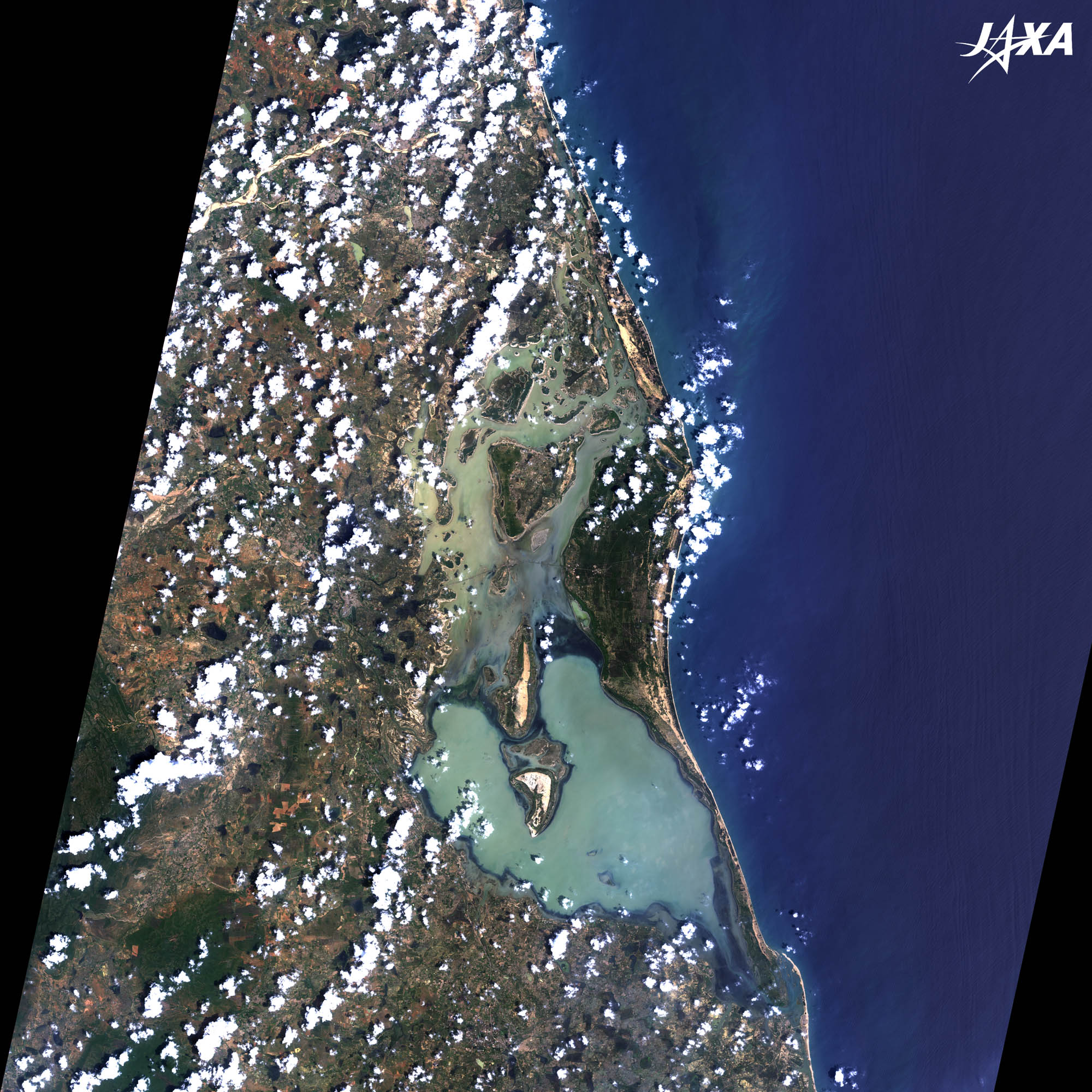 Fig. 1. Sriharikota Island and Its Surroundings
Figure 1 is an image taken by ALOS (“Daichi”) in September 2010. The image shows a part of the Sriharikota sandbank located along the Coromandel Coast in the southeast of India. The sandbank is located about 80 km north of Chennai, which was formerly called Madras, and faces the Bay of Bengal. Pulicat Lake, in the middle of the image, is the second largest lake in India. The lake is separated from the Bay of Bengal by the Sriharikota sandbank, which extends hundreds of kilometers north to south beside Sriharikota Island. Sriharikota Island is located at the central bulge of the sandbank. Satish Dhawan Space Center, formerly known as Sriharikota Launching Range, of the ISRO (Indian Space Research Organization) was established at Sriharikota Island. The center was renamed in 2002 after the death of ISRO‘s chairman, Satish Dhawan. The center is the only Indian satellite launching site. 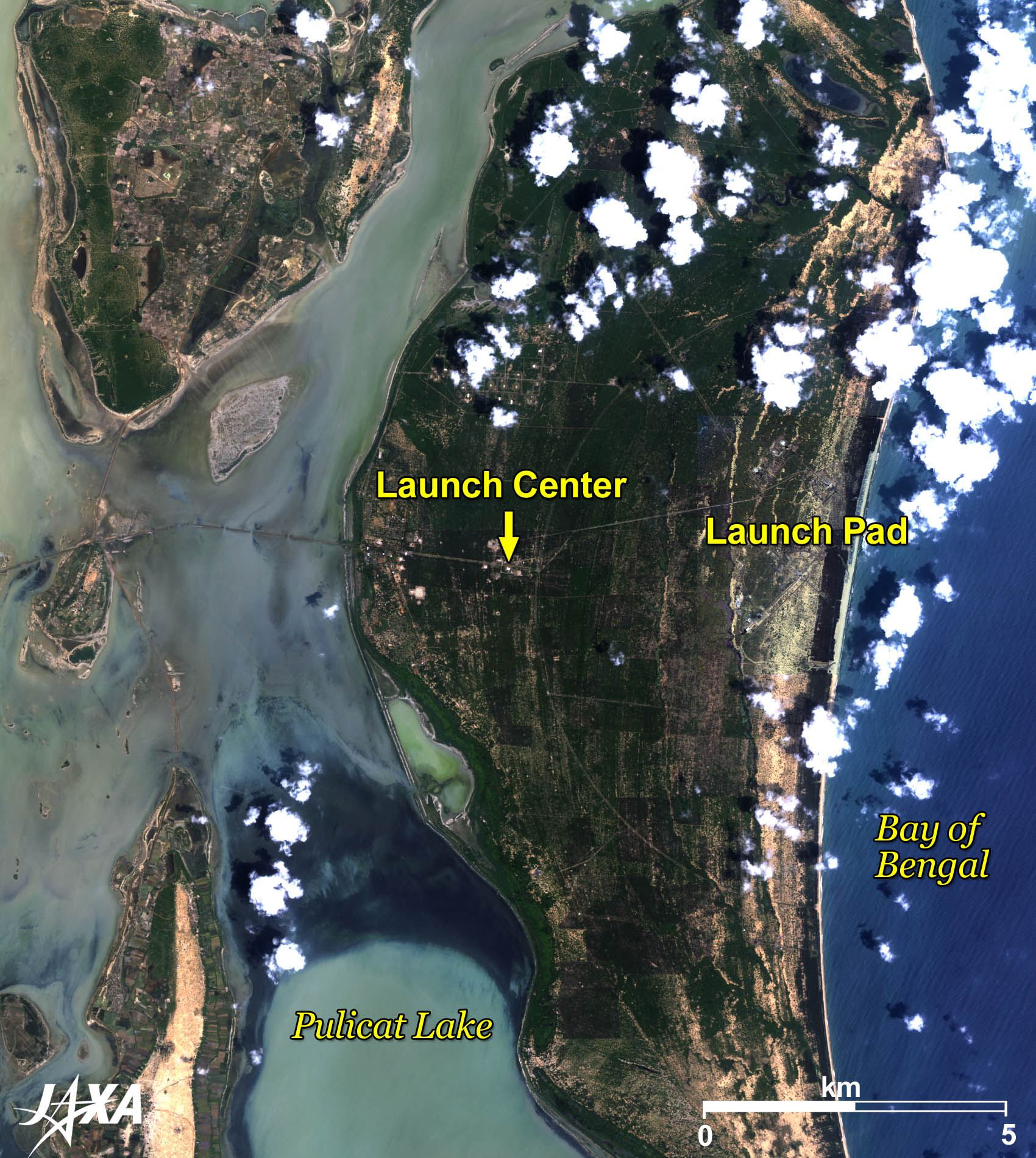
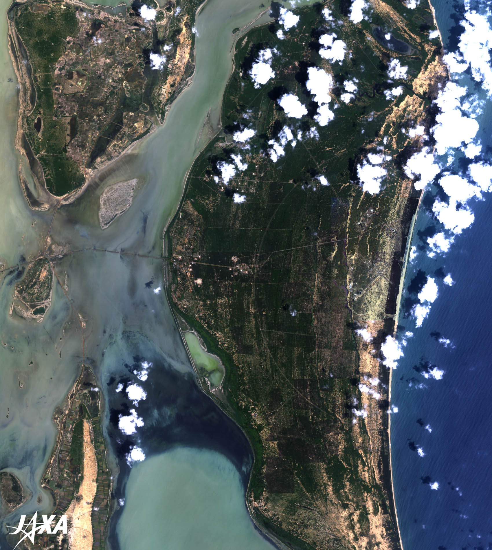
Fig. 2. Sriharikota Satellite Launch Center
Figure 2 is an enlarged image of the central part of Sriharikota Island. A road crossing the lake to the launching facilities is seen in the middle of the image. The space center is composed of vehicle assembly, launch operations, and tracking facilities. The first sounding rocket was launched in October 1971. 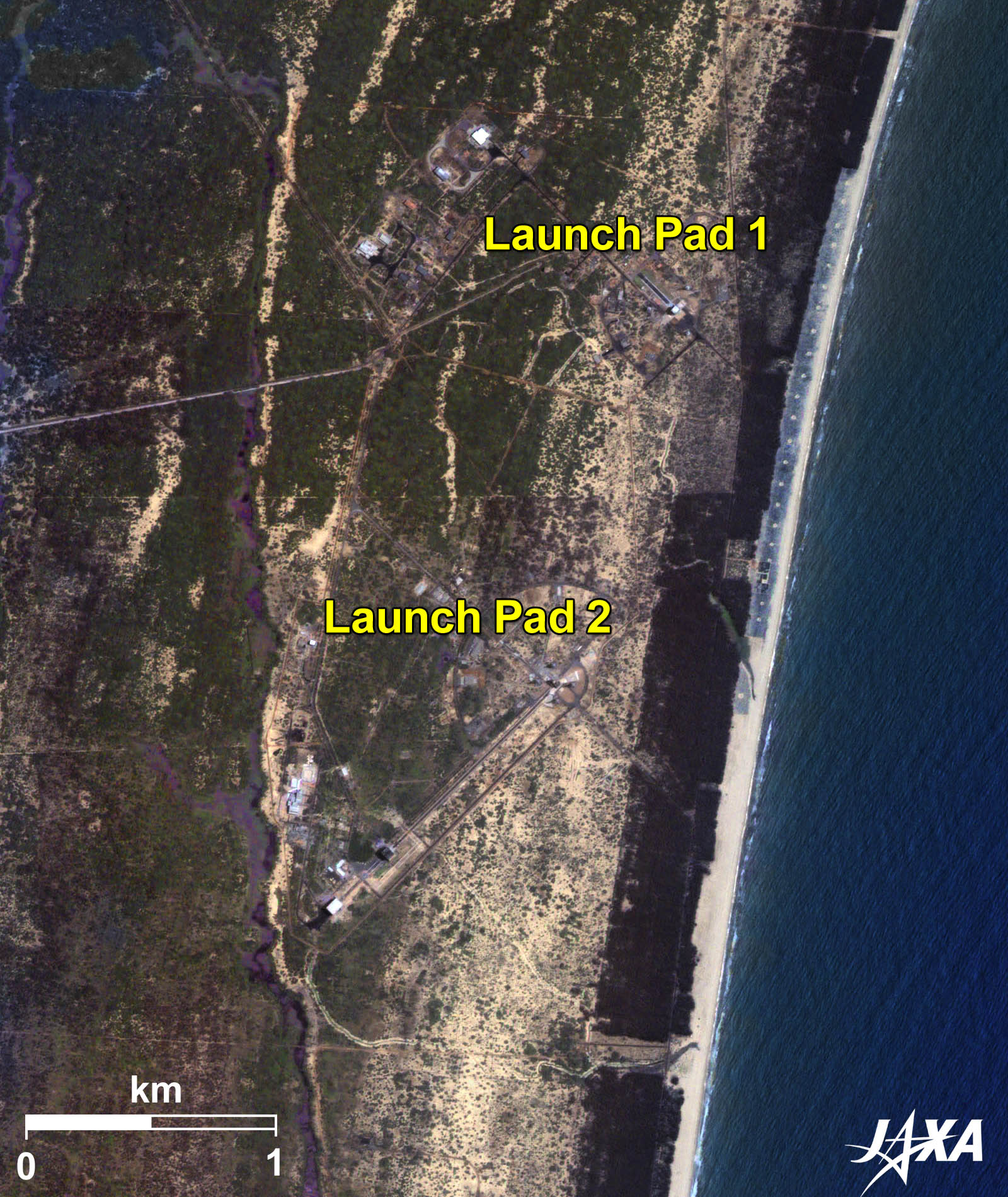 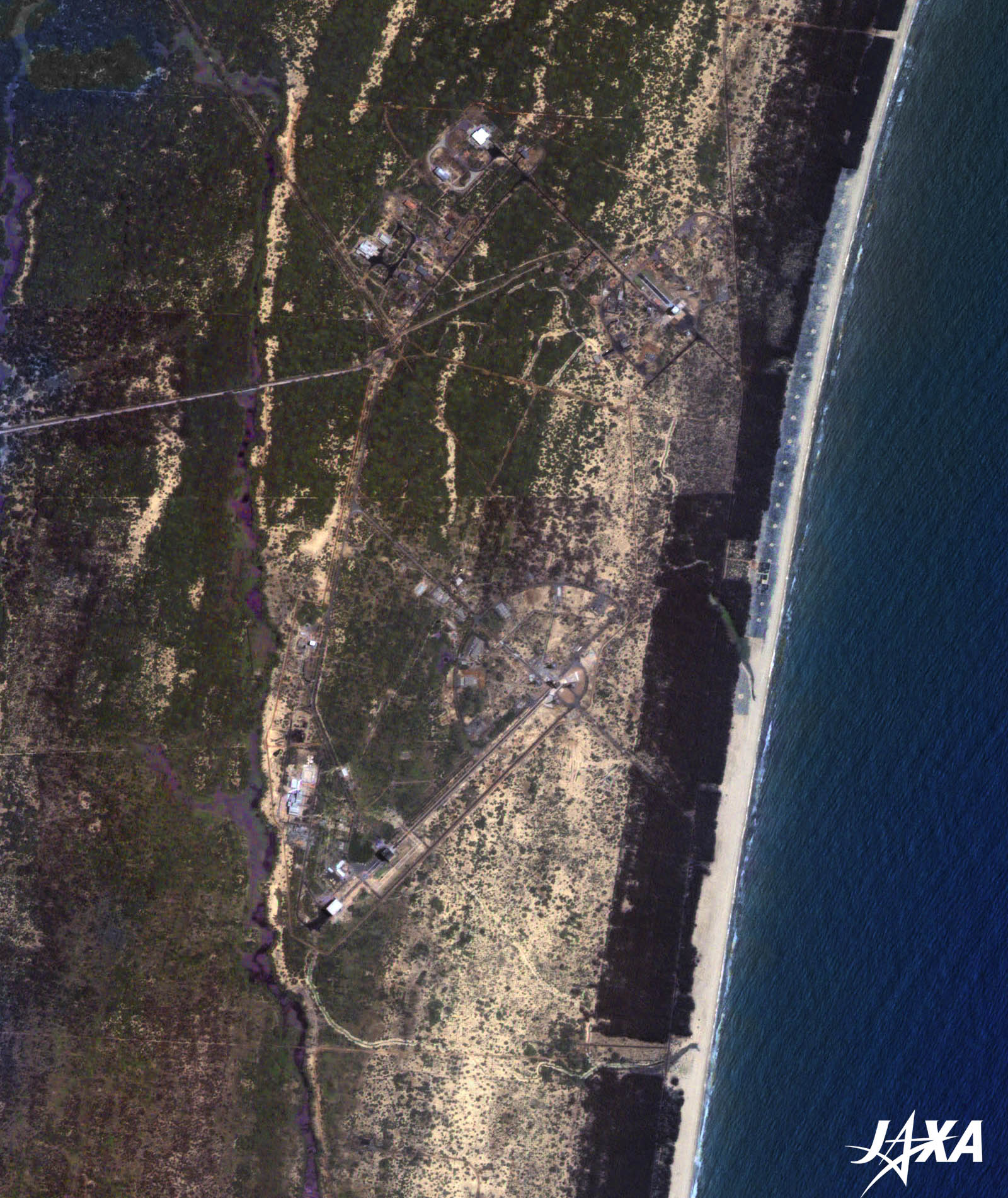 Fig. 3. Launch Pads at Sriharikota
Launch Pads at Sriharikota (kmz, 4.84 MB, Low Resolution) as seen on Google Earth. Two launch pads east of the launch center are currently in operation and a new launch pad will be added by 2015 for manned space missions. 
Indian Launch VehiclesIndia has developed four series of launch vehicle: SLV (Satellite Launch Vehicle), ASLV (Augmented Satellite Launch Vehicle), PSLV (Polar Satellite Launch Vehicle), and GSLV (Geosynchronous Satellite Launch Vehicle). SLV was a four-stage solid-propellant launcher developed by India. Its capability was to place a payload of 40 kg into a 400-km orbit. Its first launch took place in July 1980 and the final launch in 1983. ASLV was a five-stage solid-propellant launch vehicle. Its design was based on SLV with an augmented capability. It was launched four times and terminated to develop PSLV. PSLV is capable of placing satellites into sun synchronous orbits or geostationary transfer orbits. PSLV is a four -stage launch vehicle that uses solid propellants for the first and third stages and liquid propellants for the second and fourth stages. It launched a lunar explorer, Chandrayaan-1, in October 2008. PSLV is India’s main launcher at present. GSLV has been developed to place larger satellites into geostationary orbit or low Earth orbit. It adopts a cryogenic third stage and liquid propellant strap-on boosters. ISRO has made some test launches of GSLV. Explanation of the Images:
AVNIR-2 has four observation bands. The color composite images are produced by assigning red to Band 3 (610 to 690 nm), green to Band 2 (520 to 600 nm), and blue to Band 1 (420 to 500 nm). The resulting images have natural coloring as if seen by the naked eye. Each color indicates the following ground objects:
(Fig. 2 and 3) |