Seen from Space 2009
A Masterpiece of Khmer Architecture: The Angkor Ruins
|
Angkor is located north of Cambodia's Great Lake (Tonle Sap). Here you will find the ruins of the capital city of the Khmer Empire. Tonle Sap Lake is the largest freshwater lake in Southeast Asia. (For more on Tonle Sap Lake, please refer to the April 19, 2004 article on this site.) The shape of Tonle Sap changes dramatically with the seasons. In the Cambodian dry season (from the middle of October until April) it shrinks, but in the rainy season (from May until early October) it expands dramatically. Its area during the rainy season becomes three to four times larger than in the dry season. 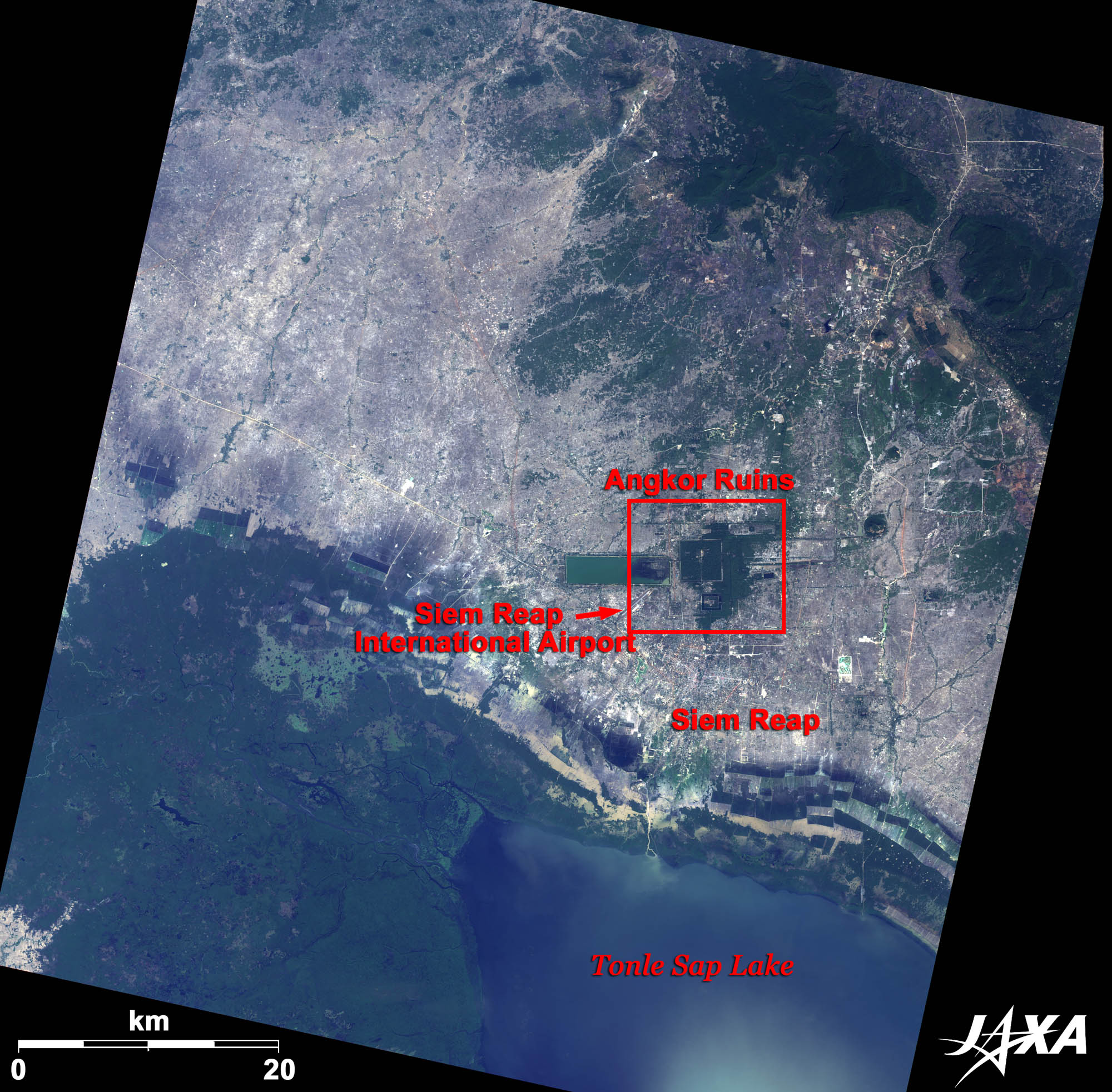  Fig. 1. Tonle Sap Lake and Angkor
Figure 1 shows Tonle Sap Lake and Angkor. The town seen between Angkor and Tonle Sap Lake is Siem Reap. Siem Reap is a base town for sightseeing around this area. An airport can also be seen in the image. The main ruins at Angkor are Angkor Wat and Angkor Thom. King Suryavarman II of the Khmer Empire constructed Angkor Wat in the early twelfth century and Angkor Thom was constructed by King Jayavarman VII in the late twelfth century. The temples were originally constructed in the Hindu style, and later converted to Buddhist temples. Angkor is the most significant site of Khmer architecture and was registered as a World Heritage Site of UNESCO in 1992. 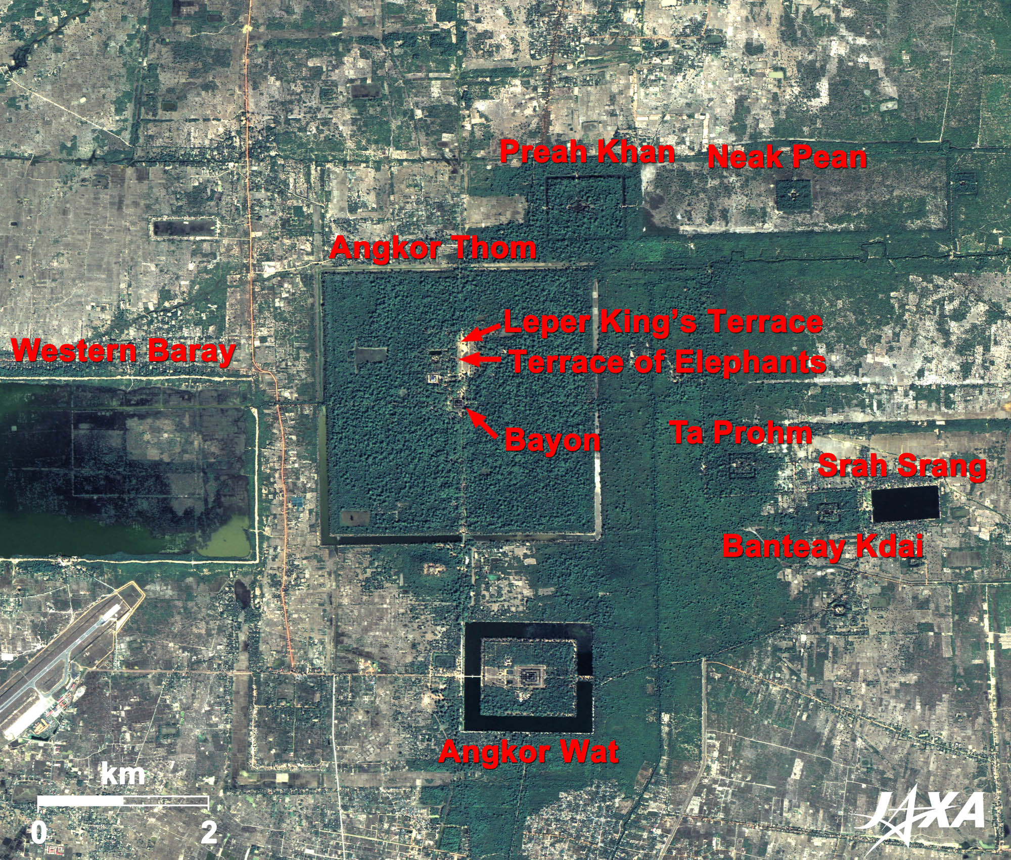 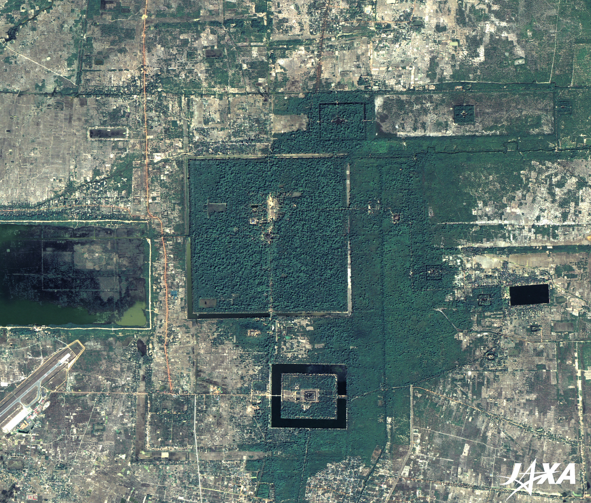 Fig. 2. The Angkor Ruins
The Angkor Ruins(kmz, 4.33MB, Low Resolution) as seen on Google Earth. Figure 2 covers the entire view of Angkor. The Western Baray reservoir is visible on the left side of the image. There was a similarly large reservoir on the right, but it has since dried up. Angkor Thom, covered by green trees, is located between them. Angkor Wat is located beneath it, surrounded by a moat. Other ruins are scattered around them. 
Angkor Wat and Angkor Thom
The word Angkor means "city" and Wat means "temple". The first western person, a Portuguese monk, visited Angkor Wat in 1586. A Japanese pilgrim visited the temple in 1632 and dedicated a statue of Buddha. The temple became widely known to the world when a French explorer wrote travel notes about it in the mid-nineteenth century. During the civil war of the 1970s and 1980s, soldiers used Angkor Wat as a military base and some statues were destroyed. The temple has been under restoration with international cooperation. The word Thom means "great". At the center of Angkor Thom are the ruins of a temple named Bayon. The Terrace of Elephants and the Leper King's Terrace lie north of it. 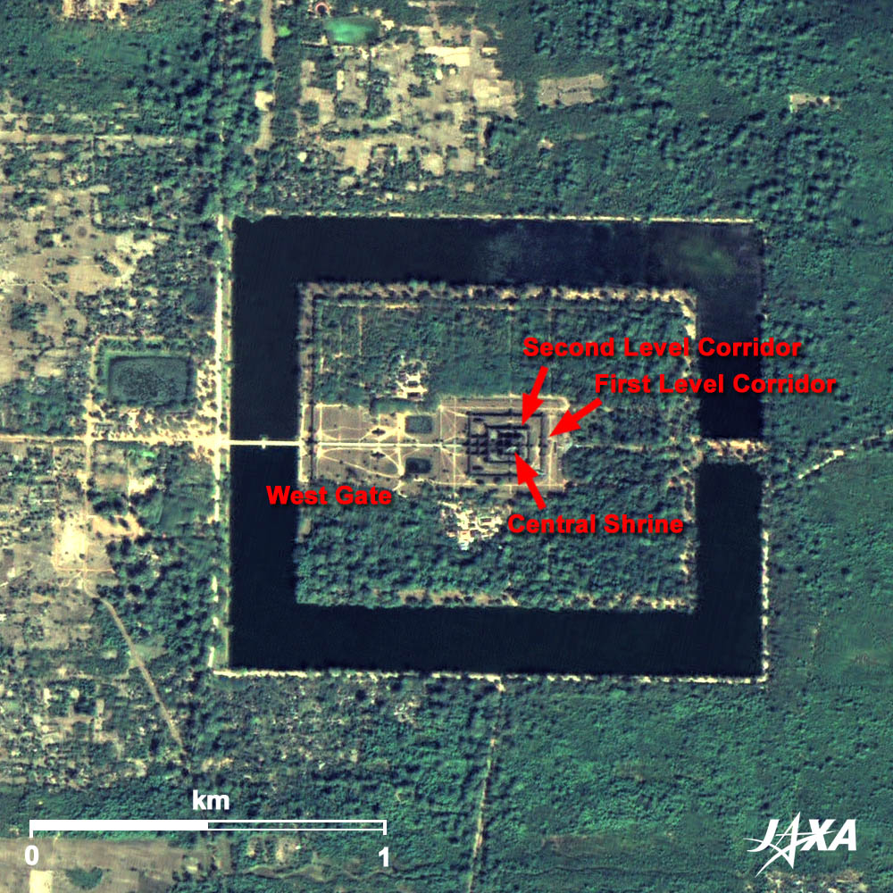 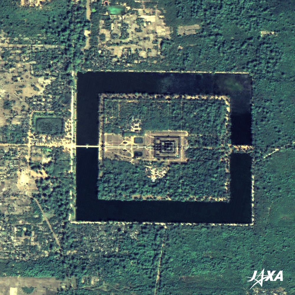 Fig. 3. Angkor Wat
Figure 3 shows an enlarged image of Angkor Wat. A stone bridge over the moat, the west gate beyond it, the front garden, and the three-folded corridors are visible in the image. The five shrines representing Mount Meru are also visible. Angkor Wat orients to the west, therefore, we can take the best photographs when we visit it in the afternoon. 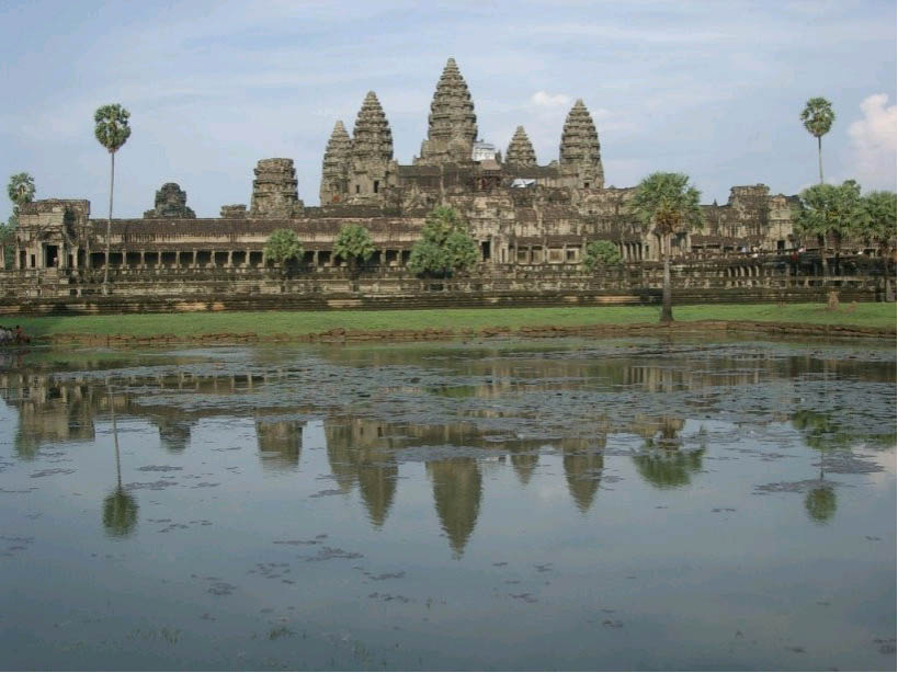 Photo: View of Angkor Wat
The photo above shows the view of the five shrines of Angkor Wat. Some ruins have not been renovated and are encroached by trees. Today, Angkor Wat is a major tourist destination in Cambodia. The temple should be protected from the collapse and its elegant shape maintained forever. Explanation of the Images: (Click the images twice to enlarge.)
AVNIR-2 has four observation bands. The composite images are usually produced by assigning red to Band 3 (610 to 690 nm), green to Band 2 (520 to 600 nm), and blue to Band 1 (420 to 500 nm). The resulting images have natural coloring as if seen by the naked eye. Thus, the following colors designate ground objects:
(Figures 2 and 3) |


