Seen from Space 2009
Gokaicho held at Zenkoji, Nagano
Gokaicho held at Zenkoji, Nagano
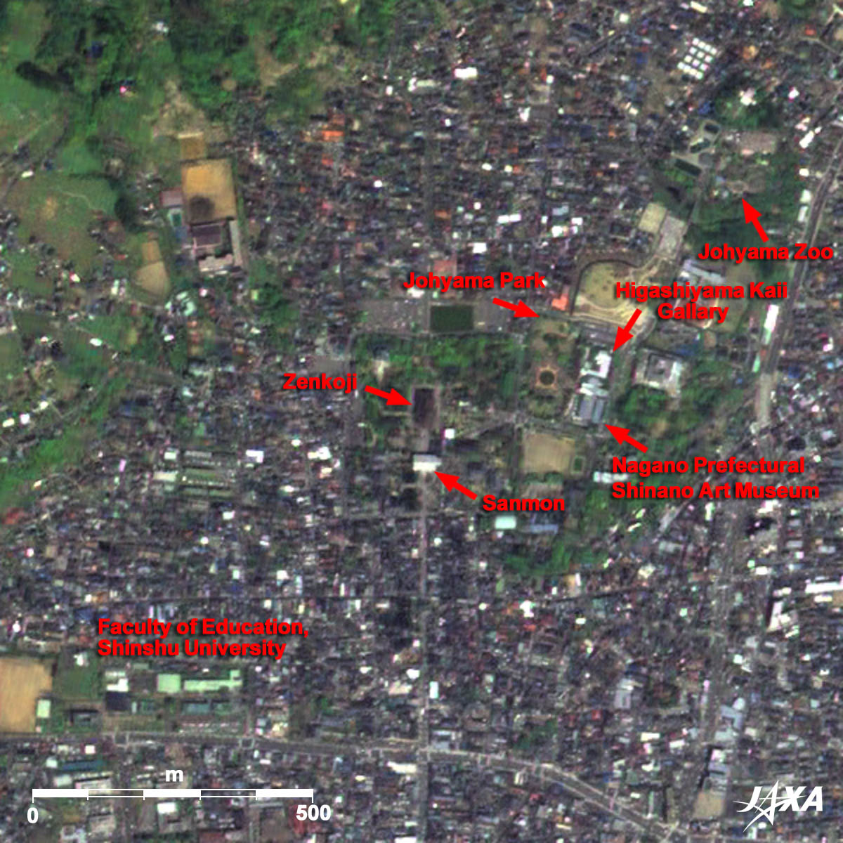 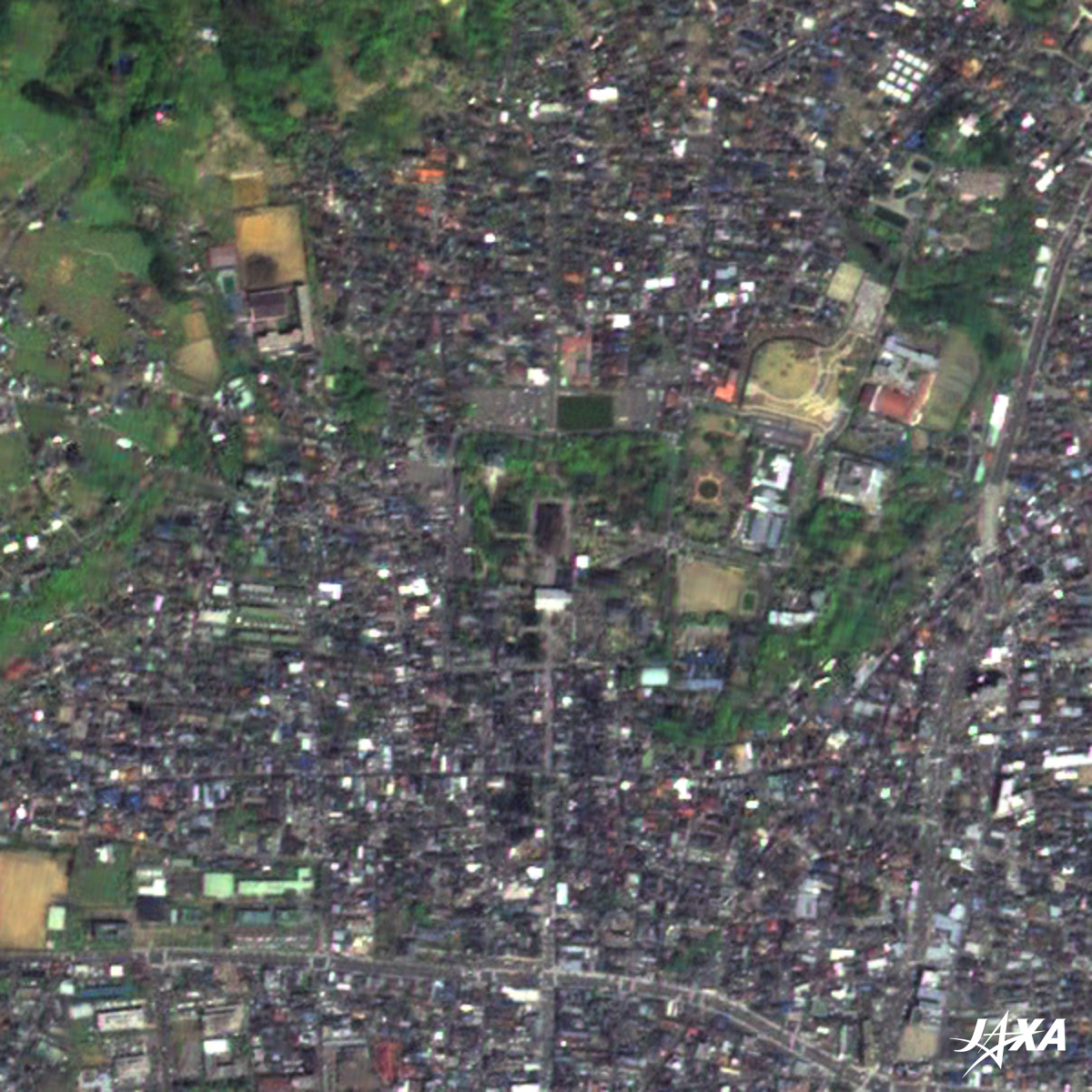 Fig. 1 Enlarged image of the area around Zenkoji
Zenkoji, Nagano(kmz, 2.02MB) as seen on Google Earth. Figure 1 is an enlarged image of the area around Zenkoji (ji means Temple). Zenkoji was founded before Buddhism in Japan was split into several different sects. It is not affiliated with any one particular sect of Buddhism, so all people are welcome, regardless of gender, creed, or religious belief. It currently belongs to and is co-managed by the Tendai-shu and Jodo-shu schools of Buddhism. According to legend, the temple was founded in 642 AD. The Hondo (Main Hall) is registered as a National Treasure. The Sanmon (Gate) and the Kyodo (Sutra Repository) are registered as Important Cultural Properties. The main Buddha statue is a Hibutsu (a hidden Buddha statue, not shown to the public). This Hibutsu is said to be the first Buddha statue to ever be brought to Japan. The commandments of the temple require absolute secrecy about the statue, prohibiting it from being shown to anyone-, including the chief priest of the temple. Therefore, a replica of the statue (Zenritsu Honzon) was created and is shown publicly once every six years in a ceremony called Gokaicho. This event takes place from April 5 to May 31 this year. The event attracts many worshippers and visitors. The last time the statue was on display was in 2003, when around 6.28 million people visited Zenkoji. This year, even more people will visit there. 
Nagano, a temple cityNagano has developed as a temple city. The area around the Faculty of Education at Shinshu University was called Nagano. Therefore, the name of Nagano came from the name of this area. The Winter Olympics were held around Nagano in February 1998. In addition, the Beijing Olympic-Torch relay took place in Nagano in April 2008. Thus, Nagano is connected to the memory of the Olympics. Johyama Park is located east of Zenkoji. There you can see some museums and a zoological park. Many people will visit Nagano-shi to celebrate Gokaicho. 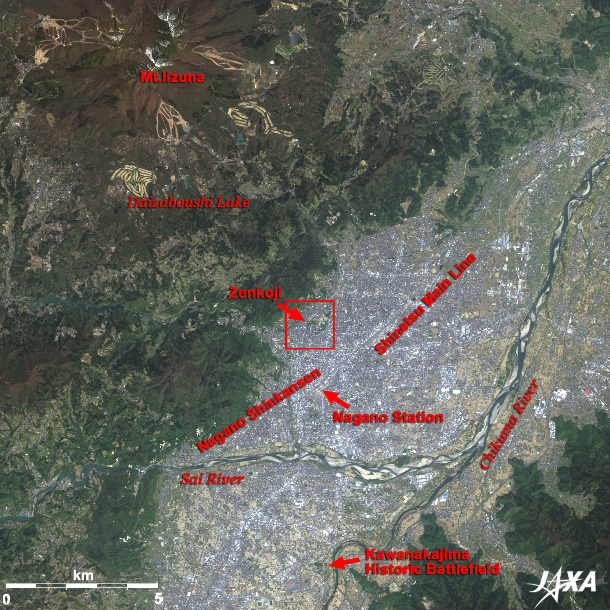 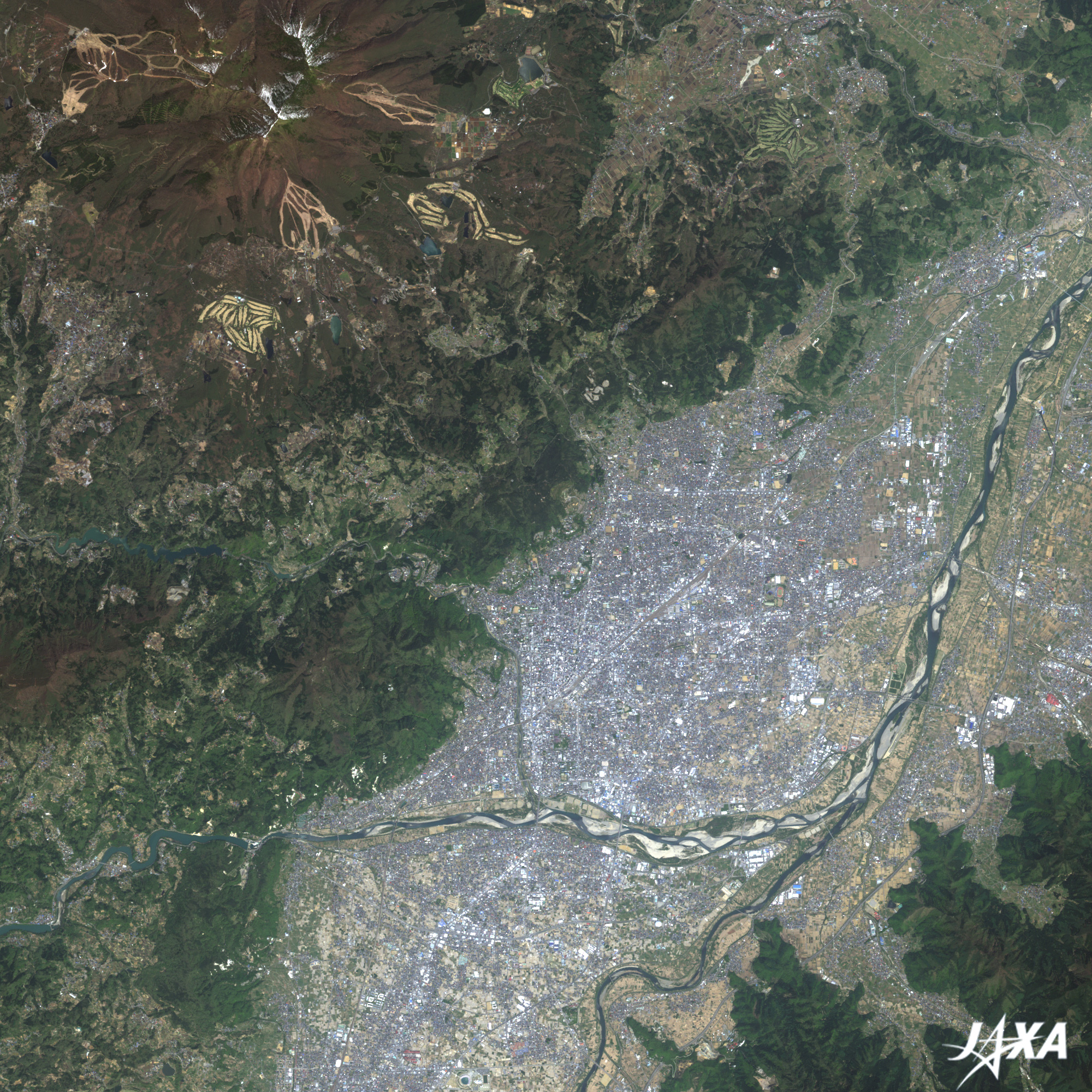 Fig. 2 Vicinity of Nagano
Figure 2 covers the vicinity of Nagano. The Nagano Basin, a brighter area, runs from the right (east) to the bottom (south). Nagono station is seen at the center of the image. The Shinetsu Main Line and the Nagano Shinkansen (bullet train) run through Nagano station. The front approach to Zenkoji runs from the station to the north. There is a famous old story in which a cow led a woman to Zenkoji temple. The Chikuma River, the longest river in Japan, runs from the bottom to the upper-right of the image. At the bottom of the image, you can see the Kawanakajima historic battlefield, where the Feudal Warlords Uesugi Kenshin and Takeda Shingen fought in the sixteenth century. The Iizuna Highlands are seen at the upper left of the image. This is a resort area consisting of Daizaboushi Lake plus campsites, golf courses, and ski slopes. Daizaboushi Lake looks like a foot, and an old story (the Daidara Bocchi legend) says that the lake was formed from a giant’s footprint.
Two legends about Nagano- Led by a cow, I went to Zenkoji In the old days, an impious old woman lived in a village. She had washed her cloth and dried it in the sun. Suddenly a cow appeared and ran away after hooking her dried cloth with its horns. She pursued the cow to take back the cloth. Finally, they arrived at Zenkoji. The cow faded away in Zenkoji, and she found a letter saying “Never see me as just a cow”. Its mind had led her to Buddhism. Her impiety passed away as the emotions welled up, and she sincerely believed the implications of the great Buddhism. - Daidara Bocchi In the old days, the spirit of the mountain Iizuna was boasting proudly to the other mountains that he was the greatest. Suddenly Daidara Bocchi, a giant, came from the sky and tried to pick up the mountain of Iizuna. The spirits of the other mountains interceded with him, and the giant finally released the mountain of Iizuna. The footprint of the giant became a lake. 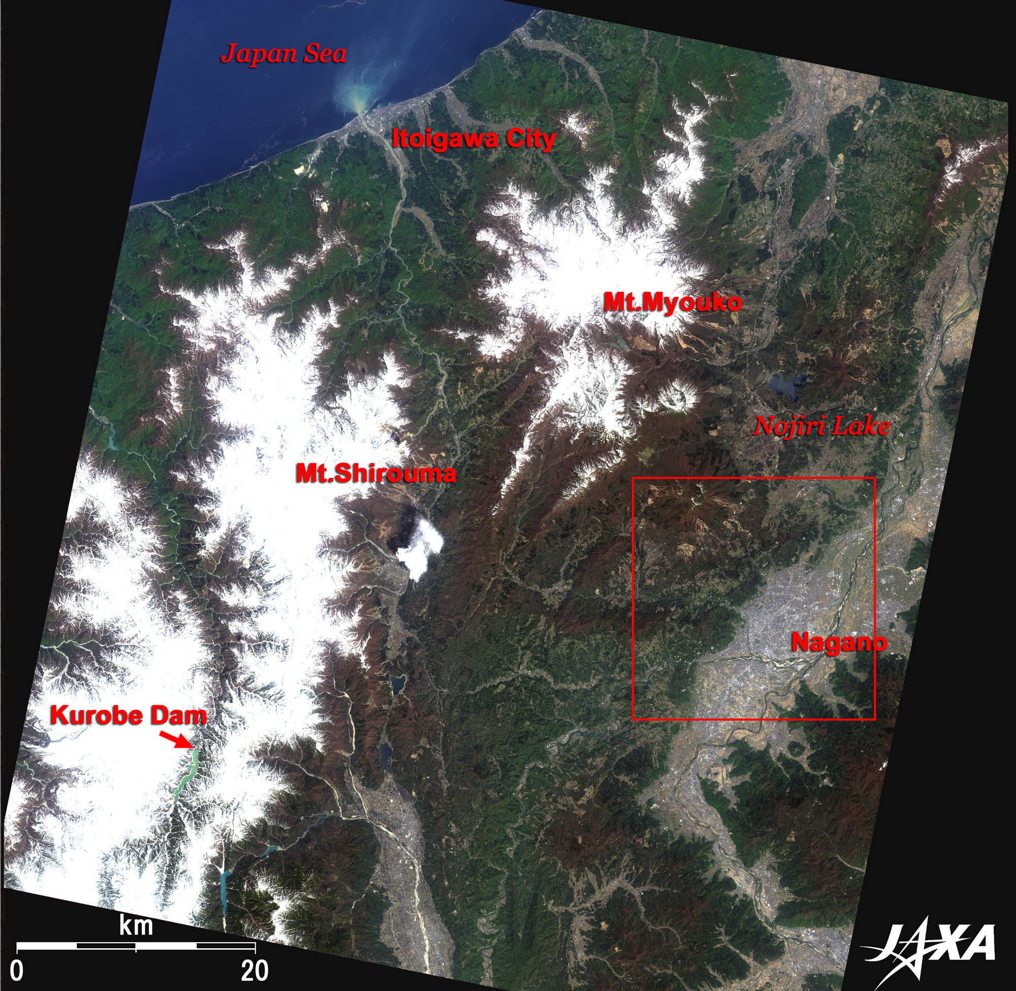 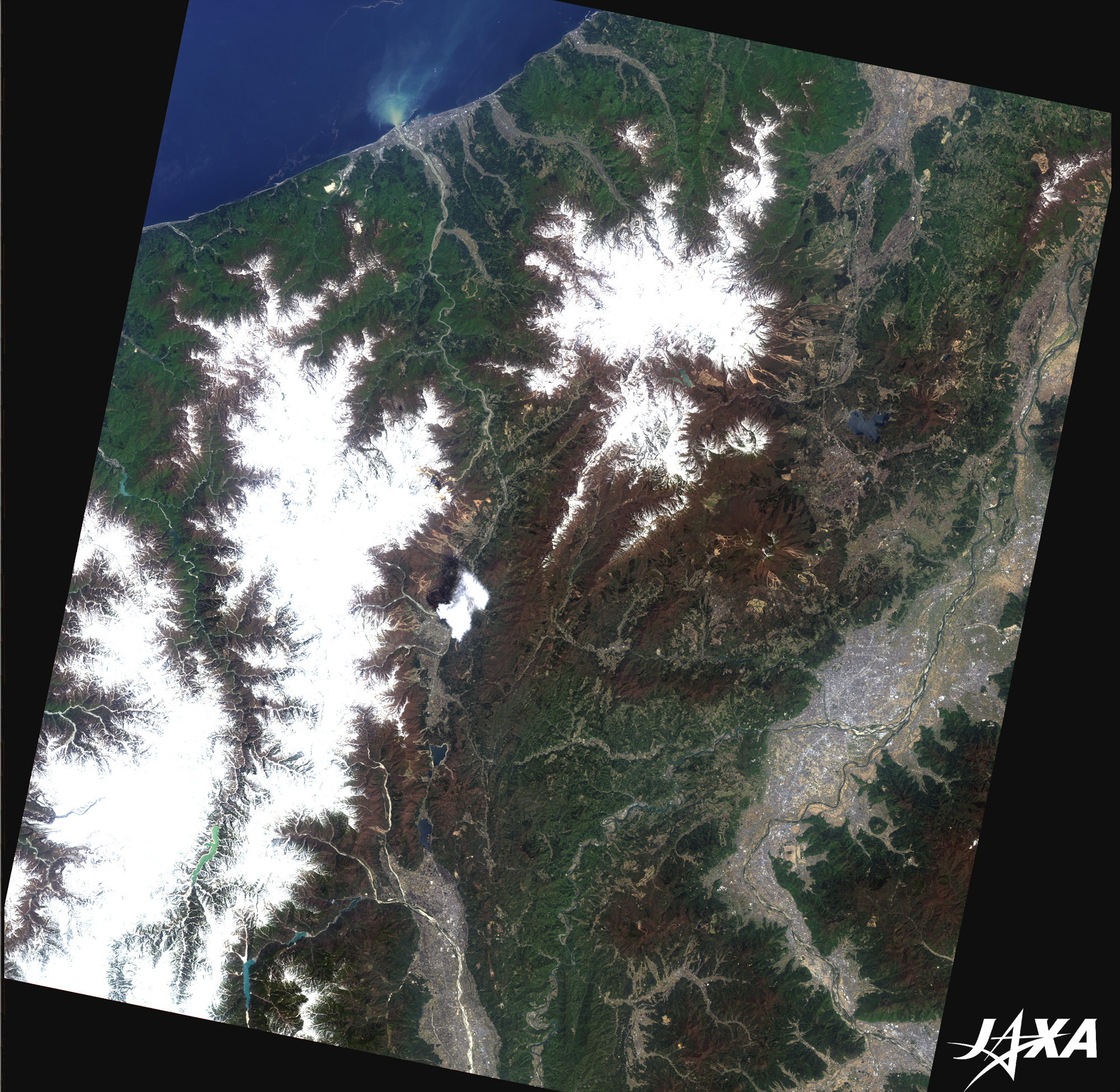 Fig. 3 Northern part of Nagano Prefecture
Figure 3 is an image, taken in May 2007, of the northern part of Nagano Prefecture, including Nagano and Zenkoji. Nagano is located on the right side of the image and is shown in grey. You can see the bluish Nojiri Lake north of Nagano. Nojiri Lake is famous for its fossilized Nauman elephants. The mountains of Myouko and Shirouma are covered by snow and you can see Kurobe dam, the highest in Japan, among them. You can also see a long valley running from north to south in the image. This is part of the Fossa Magna, a great graben running down the center of the Japanese mainland. Explanation of the Images: (Click the images twice to enlarge.)
AVNIR-2 has four observation bands. Composite images are usually produced by assigning red to Band 3 (610 to 690nm), green to Band 2 (520 to 600nm), and blue to Band 1 (420 to 500nm). The resulting images have natural coloring, as if seen by the naked eye. Thus, the following colors designate ground objects.
Fig. 1 |


