Seen from Space 2009
Yakushima and the Total Solar Eclipse on July 22, 2009 |
|
You can see a total solar eclipse at Yakushima, a World Heritage Site, on July 22, 2009. 
Total Solar Eclipse and YakushimaA total solar eclipse will occur on July 22, 2009. We will be able to see a partial solar eclipse across Japan, but a total solar eclipse will be seen only at northern Amami-Oshima, the Tokara Islands, Yakushima, and southern Tanegashima. The last total solar eclipse in Japan took place 46 years ago on July 21, 1963 in eastern Hokkaido and the next total solar eclipse will be on September 2, 2035, 26 years later. Therefore, expectation to observe the rare eclipse in Japan is growing among astronomical fans. The eclipse will start at 9:37 and end at 12:22 at Yakushima; thus, its duration will be 2 hours 45 minutes. The total eclipse, however, will last only 4 minutes. 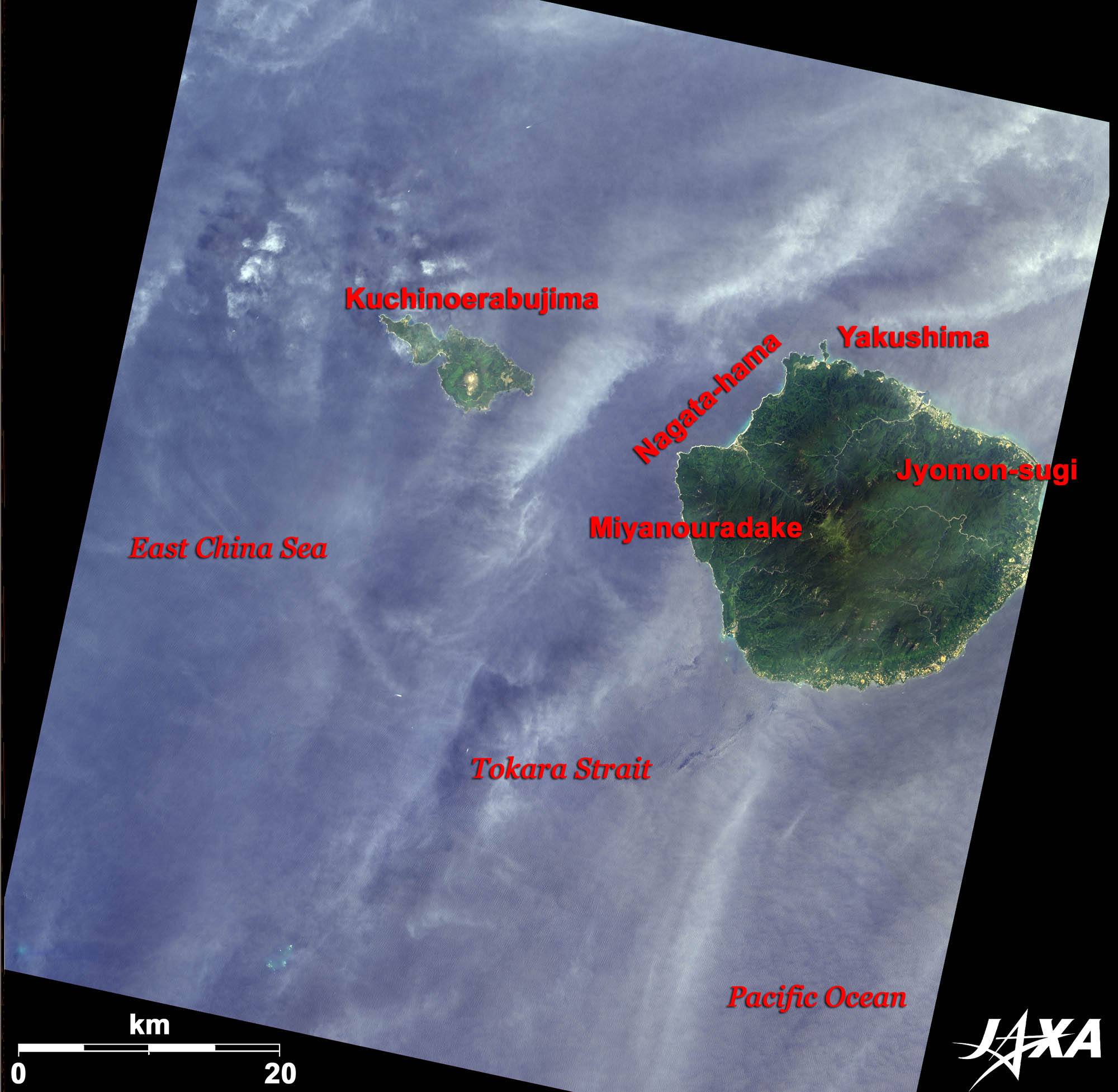 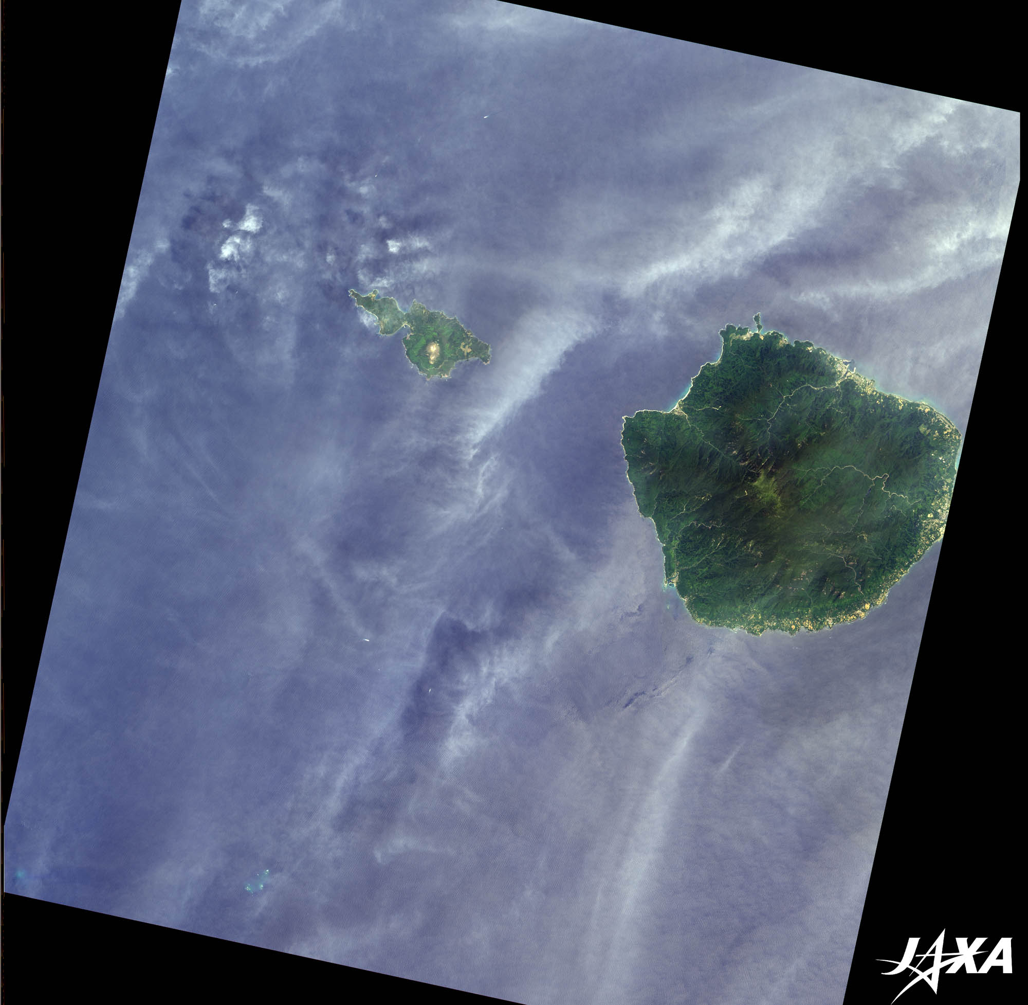 Fig. 1. Yakushima and Kuchinoerabujima
Yakushima(kmz, 3.03MB, Low Resolution) as seen on Google Earth. Figure 1 shows Yakushima and Kuchinoerabujima observed on May 11, 2007. The large island seen on the right of the image is Yakushima and the smaller island on the left is Kuchinoerabujima. The area of Yakushima is 504 square kilometers. The highest point on the island is Miyanouradake at 1,936 meters. There are also some other 1,200-1,800-meter class mountains. Because of this, Yakushima is called “the Alps on the sea”. Moist air from the sea bumps against those high mountains producing heavy precipitation all through the year. Yakushima is visible from the JAXA Tanegashima Space Center, but it is rare to see the whole island due to the clouds covering the island. As seen from the satellite image, the island is covered in deep green, and the inner part has steep geographical features with high mountains and deep valleys. Urban areas and agricultural areas are limited along the coastlines. There are no villages in the inner part, since Yakushima has a severe natural environment. Some rivers run from the central part of the island down to the sea around forming deep valleys. The summit area of Miyanouradake is seen as bright green in contrast with its dark green surroundings. Yakushima is well known as being covered in dense forest and big trees, but has a different vegetation environment around the summit. Yakushima is located in the subtropical zone, but has botanical phases from subtropical to subarctic. Due to this unique feature, Yakushima was registered as a natural World Heritage Site in 1993 together with Shirakami-Sanchi. They were the first sites in Japan registered to the World Heritage. Yakushima also has sand beaches made of weathered granite in the northwest. The beaches are Mae-hama, Inaka-hama, and Yotsuse-hama, and they were registered as a Ramsar Wetland Site under the name of Nagata-hama in 2005. Sea turtles come to the beaches to lay eggs from May to July.
Yakusugi and YakushimaYakushima is the southern limit of Sugi (Japanese cedar; Cryptomeria) growing in Japan. Japanese cedars normally live for 300 years, but at Yakushima some cedars are more than 1,000 years old. Those old cedars are called Yakusugi. The oldest Yakusugi is named “Jyomon-sugi” after the ancient era in Japan. The age of the Jyomon-sugi is estimated to be more than 3,000 years old. The Jyomon-sugi is alive at the middle of the island and it takes around five hours on foot to see it. Visitors are now prohibited from getting access to its base and are allowed to see the tree only from the observation deck nearby. 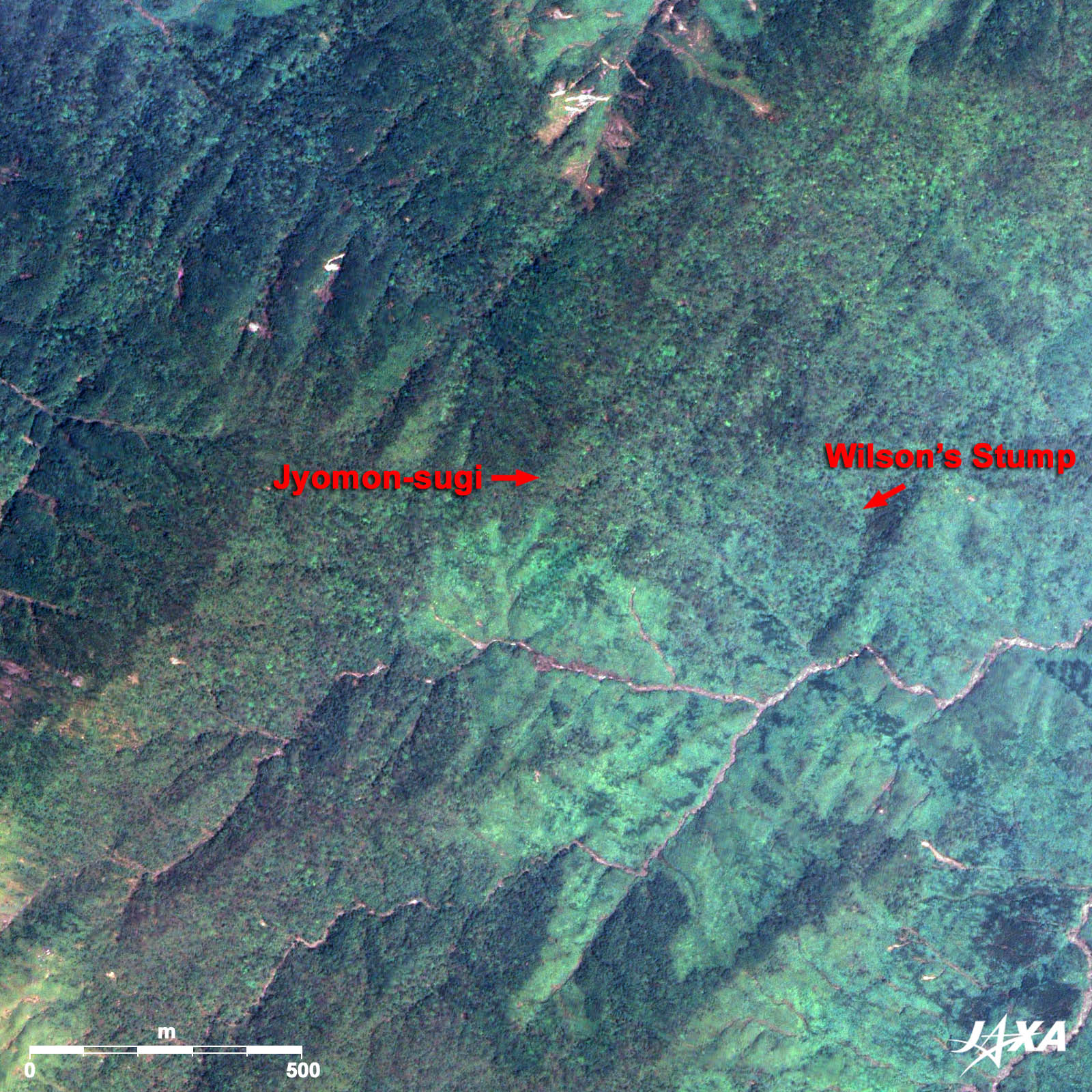
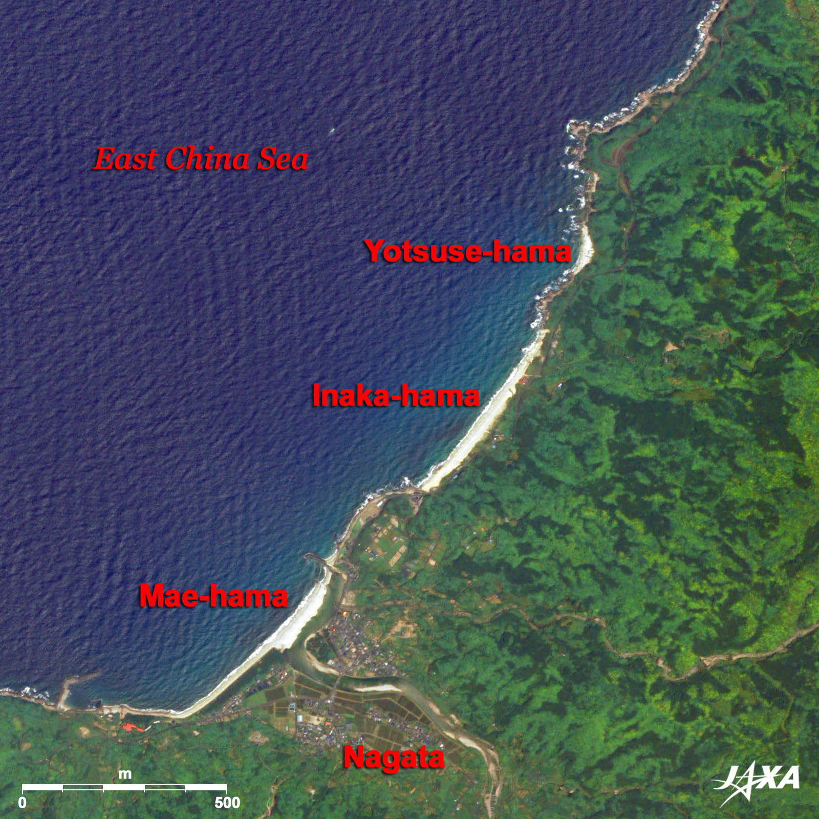 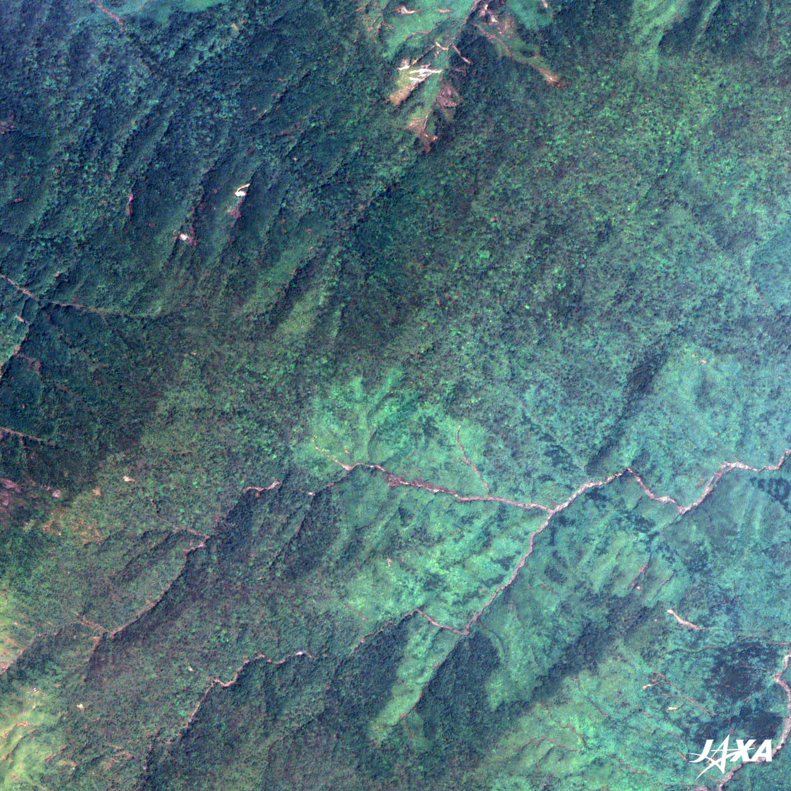
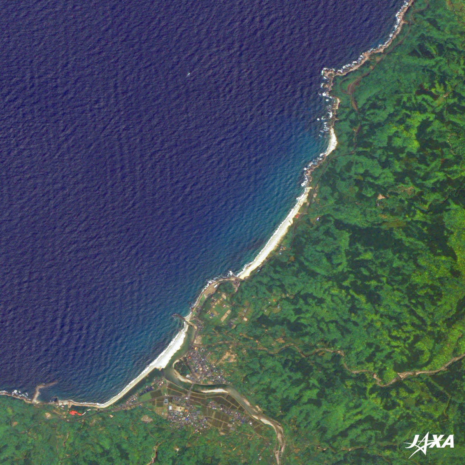
Figure 2 is an enlarged image of the area of Jyomon-sugi. You can see also Wilson’s stump, a remnant of the tree that is said to have been cut by the order of Toyotomi Hideyoshi (Shogun; the ruler of the feudal lords) in the sixteenth century. Figure 3 shows Nagata-hama, registered as a Ramsar Wetland Site. A long bright beach of weathered granite is prominent. Yakushima is an eco-touring site in Japan. People enjoy climbing, trekking, stream climbing, canoeing, scuba diving, and other activities in the fertile and diverse natural environment. A tour to observe the total solar eclipse will be added to the list this year. Explanation of the Images: (Click the images twice to enlarge.)
AVNIR-2 has four observation bands. The composite images are usually produced by assigning red to Band 3 (610 to 690 nm), green to Band 2 (520 to 600 nm), and blue to Band 1 (420 to 500 nm). The resulting images have natural coloring as if seen by the naked eye. Thus, the following colors designate ground objects:
(Figures 2 and 3) |


