| |
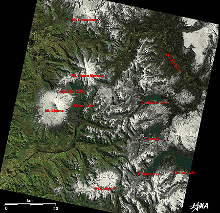 |
Fig. 1. The Andes Mountains in la Araucania Southern Chile
La Araucania (kmz, 4.04 MB, Low Resolution) as seen on Google Earth. |
The Andes Mountain Range lies north and south in an area with the most active volcanoes in the Region of la Araucania, the southern part of the Republic of Chile (Fig. 1). The image was obtained by satellite Daichi (ALOS) on September 17, 2006. White-capped volcanoes with craters filled or surrounded by glaciers range from north to south, in the order of Lonquimay Volcano, Sierra Nevada Volcano, Llaima Volcano, and Sollipulli Volcano.
Lonquimay Volcano (2,865m) is located 630km south of the capital Santiago. It is a stratovolcano shaped as a truncated cone 700m at its top. The latest record of its eruption was in 1990. The 2,554m Sierra Nevada Volcano has not record of last eruption. However, it still has the potential to resume volcanic activity.
A lake region extends north and south in the right of the image. Lake Gallettue, the origin of the Bio Bio River; Lake Icalma, with a city that is the gate to Argentina; Lake Moquehue; and Lake Alumine beyond the border of Argentina are visible.
 |
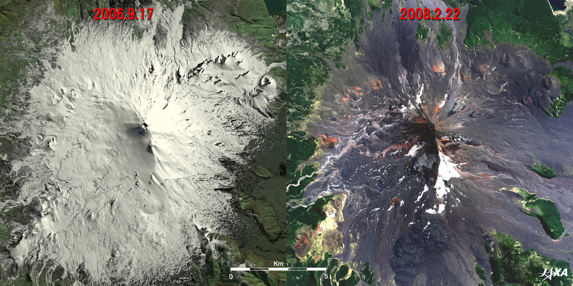
| Fig. 2. Llaima Volcano before and after eruption |
The 3,125-m-high Llaima Volcano, a double-peaked volcano with the higher peak having a 350-m-diameter crater, is depicted in Fig. 2 and is one of the largest and the most active volcanoes in Chile. On New Year's Day 2008, the volcano ended a 13-year dormant period going back to 1994. Seven hundred people were evacuated, and the area was temporarily blocked off. The volcano remained active, and the latest eruption occurred on February 5, 2008. The pair of images in Fig. 2 depicts the volcano before and after the recent volcanic activities. The left image was acquired on September 17, 2006, before the eruptions, and the right image, on February 22, 2008, after numerous eruptions. Llaima Volcano was covered with a white blanket of snow and ice, as it was observed in the winter of the southern hemisphere, and the latter scene was covered with a thin remaining glacier surrounding two peaks and the middle of a mountain. Little glaciers can be seen around the higher peak with a larger crater that had erupted. Patches of glaciers can be seen scattered around the lower peak, which had fumarolic activity.
Here we can find scenic nature around Lake Conguillio and Lake Verde (dark blue in the images) between Llaima Volcano and Sierra Nevada Volcano in Conguillio National Park.
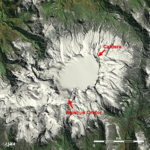 |
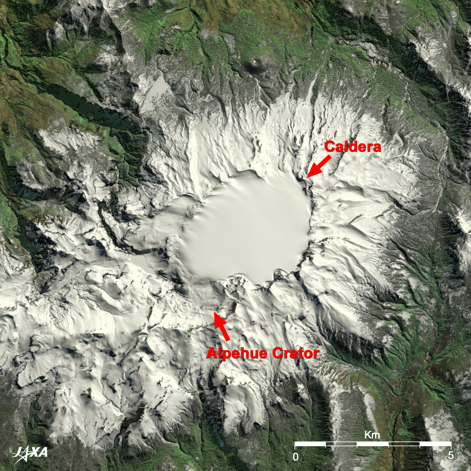
| Fig. 3. Caldera glacier of Sollipulli Volcano |
Sollipulli Volcano is depicted in an enlarged image of Fig. 3; it has a low skyline with a height of 2,283m and is not easily distinguished from the mountains. Its large caldera was filled by a 3.5km by 5km glacier and dominates the view from space. The volcano lies dormant, having last erupted 3,000 years ago. The glacier's maximum estimated thickness is 650m with a volume of 6km3. On the southwest rim of the caldera, a 1-km-wide crater, is seen covered by the glacier.
As these images indicate, the potential for serious disasters around Sollipulli Volcano from outburst floods induced by glacial thawing due to volcanic activity causes great concern for residents, especially when eruptions occur such as in the case of Llaima Volcano.
Explanation of the Images:
Fig. 1 to 3 - Click the images twice to enlarge them.
AVNIR-2 has four observation bands. Figure 1, the left image of Fig. 2, and Fig. 3 were produced by assigning red to Band 3 (610 to 690nm), green to Band 2 (520 to 600nm), and blue to Band 1 (420 to 500nm). The composite image was then transformed into hue, saturation and intensity, and the intensity was replaced by Band 4 (760 to 890nm). As a result, it becomes easy to distinguish snow and ice, which appear pure white. This kind of image has natural coloring as if seen by the naked eye. Thus, the following colors designate ground objects.
| Dark green: |
Forests |
| Bright green: |
Grass fields |
| Dark blue: |
Water surfaces |
| Light brown: |
Open ground |
| White: |
Snow or ice |
| Black: |
Areas with no data |
|
|