Seen from Space 2008
The Eternal Capital with a Long History: Rome
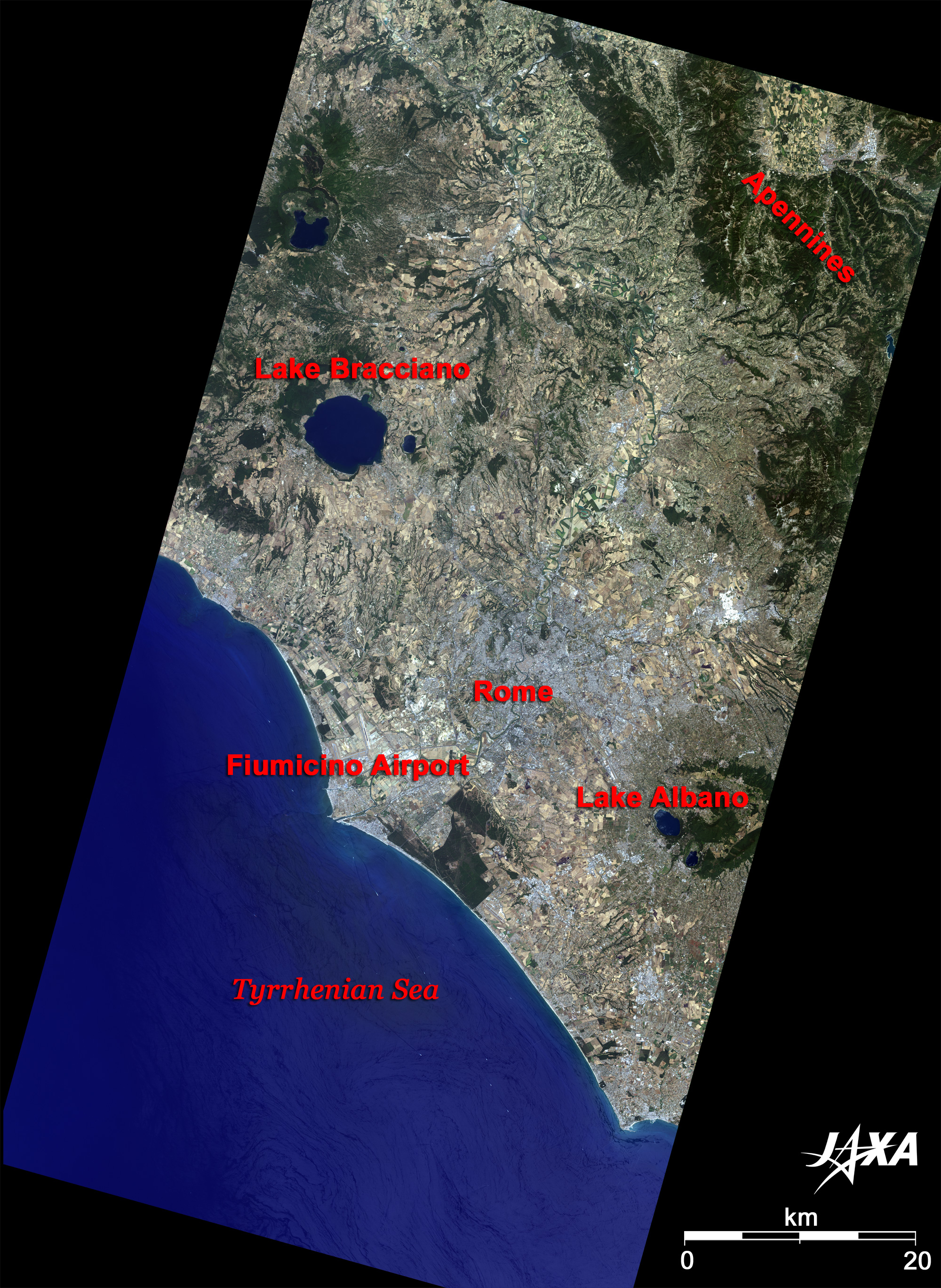
Rome is the center of politics, economy and culture of modern Italy and provides an important transport route. Termini Station is the largest in Rome and serves domestic and international trains that depart and arrive frequently. The Station is a modernistic building using glass and marble and is typical of buildings of 20th century Rome. The Tiber (Italian: Tevere) River flows through the city of Rome from north to south. According to legend, a female wolf saved and nursed twin brothers Romulus and Remus as they floated down the Tiber River in 753 B.C. Romulus became the first king of this town, thus "Rome" came from his name. The red line indicates the walls (13m high, and 3.5m wide) that enclose Rome. The walls were built between 270 and 273 by the Emperor Aurelianus (214-275) in order to protect Rome from the attacks of savage tribes. Most of the ruins in Rome are located in the area enclosed by these walls and the Tiber River. Of all the roads leading to Rome, the road indicated by the green line is commonly called the "queen of the long roads." It is the old Appian Way, which was the most important road of the Roman Empire. Wheel ruts of the carriages and chariots of that age still remain. St. Peter's Basilica (Basilica di San Pietro), a typical building of the Italian baroque style, is located southeast of the Vatican City. It is said that it was built on the grave of the Apostle Peter who died a martyr after persecution by Emperor Nero (37-68) in 64. The old San Pietro church construction started by order of Emperor Constantinus (272-337) in 324, and the church remained until the end of the 15th century. Construction of a new basilica started in 1502. Raphael Santi and Michelangelo became the chief architects in turn during the construction. The new basilica, which is the one seen today, was completed in 1626. The gross area of the basilica is about 22,000m2, and it can accommodate more than 60,000 people. A huge "Cupola" designed by Michelangelo has a height of 132.5m and diameter of 42m.
"Foro Romano" is located between Palatine Hill and Capitoline Hill. This was originally a damp area, but it was developed as a central Foro (public square) of politics, economy, and religion of the Roman Republic after being drained by the Cloaca Maxima (large sewage system) constructed in the 6th century B.C. Foro Romano thrived during the reigns of Caesar (100 B.C.-44 B.C.) and Augustus (63 B.C.-14) in the 1st century B.C., and most of the remaining major ruins were built at this time. However, starting with the imperial age, a cloud began to hang over its role, and it was destroyed by the conflagration in 283 and the invasion of Germanic peoples in the 5th century. The Colosseum (also Coliseum; 527m in circumference and 48.5m in height), where bloody gladiatorial games and public spectacles were performed, was completed by the Emperor Titus (39-81) on Palatine Hill in 80 and was capable of seating around 50,000 spectators. The seats in the Colosseum were divided by status, i.e. the deck seats were for senators, the second deck was for Roman Legionaries, the third deck was for citizens, and the upper deck was for people without citizenship. This was the emperor's skillful way of governing, which made people conscious of the status hierarchy system and maintained imperial order. It was used as an arena until Emperor Honorius (384-423) stopped gladiatorial games and other activities in the first half of the 5th century. The "Circus Maximus" was located between Palatine Hill and Avantine Hill. It was a grand arena built around the 7th century B.C., and largely repaired by Caesar. It could accommodate more than 300,000 people. The most famous event that took place at the Circus Maximus was the chariot race in the epic film of "Ben-Hur," and even now, the relics of the arena remain. Santa Maria in Cosmedin church, famous for "the Mouth of the Truth," is located immediately northwest. A part of the Domus Aurea (Golden House), which was built by the Emperor Nero who lost the royal palace in the disastrous "Great Fire of Rome" in 64, remains on Esquiline Hill and is open to the public. The Baths of Caracalla is a 10-minute walk from Caelian Hill. It was completed by the order of the Emperor Caracalla (186-217) in 217 and was used over 300 years after that. The site is 100,000 meters square, and 1,600 people could bathe there simultaneously. The library of Latin or Greek was located on the site and functioned not only as a mere bathroom but also as Rome's social center and amusement facilities. Powerful Romans maintained mansions with beautiful gardens on Quirinal Hill in ancient times. From the middle of the 20th century, it has been home to the presidential residence (Quirinal Palace (Plazzo del Quirinale)), the administration center of Italy. Viminal Hill is now Viminal Square, and the buildings of the Ministry of Interior are located there. In present Rome, ruins do not remain across the town, but the town exists in ruins. Rome lives and breathes together with the ruins.
|