Seen from Space 2003
AMSR Captures Flooding in Northeast China
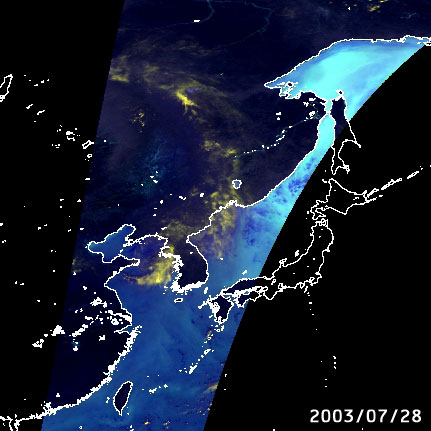
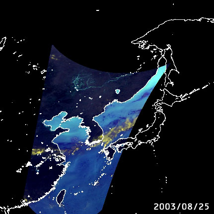
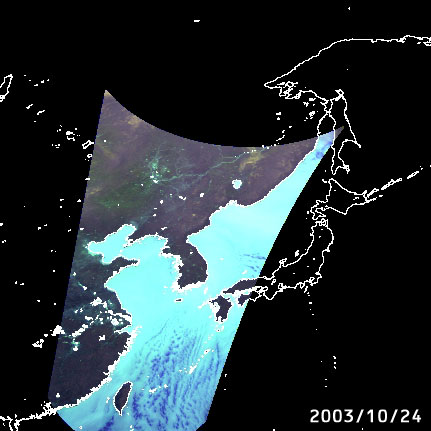
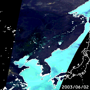
We previously reported the article "Northeastern China Suffers Large-Scale Flooding." However, AMSR also captured continuous images of conditions before and during the flooding without interference from clouds (*1). Figures 1 to 4 are false-color images captured by AMSR (*2). In these images, possible strong precipitation areas or snow-covered land areas in winter are highlighted in bright yellow. Light blue over the land represents water surfaces such as rivers and lakes; colors varying from light blue to dark blue over the ocean correspond to increases of water vapor and clouds. You can hardly find the traces of rivers in Fig. 1 captured on July 28 before the flooding. In Fig. 2, however, the possible strong precipitation area (bright yellow portion) in Northeast China stands out in stark relief from other areas. In subsequent images acquired on August 25 and October 24 (Figs. 3 and 4), you can easily find the Nen River (Nen Jian), Son-hua River (Son-hua Jian) and their tributaries (light blue portion), indicating the rivers continued to be swollen (*3). (*1) A microwave radiometer enables observations under nearly all weather conditions, night or day and even under cloud cover. By making the most of this feature, AMSR-E, a sister sensor of AMSR, is expected to contribute to monitoring large-scale flooding and sea ice. (*2) The above images are false-color images displaying brightness temperature of 89.0-GHz vertical polarization in red, that of 89.0-GHz horizontal polarization in green, and that of 23.8-GHz vertical polarization in blue among eight observation frequencies of the AMSR. (*3) AMSR has a 5km resolution at 89.0-GHz due to its 2 m diameter large aperture antenna that gives it the highest ground resolution among the flight-proven microwave radiometers on board satellites. As a result, AMSR could capture images of several-kilometer-wide swollen rivers that previous microwave radiometers could not detect. |
|||||||||||


