Seen from Space 2003
Northeastern China Suffers Large-Scale Flooding
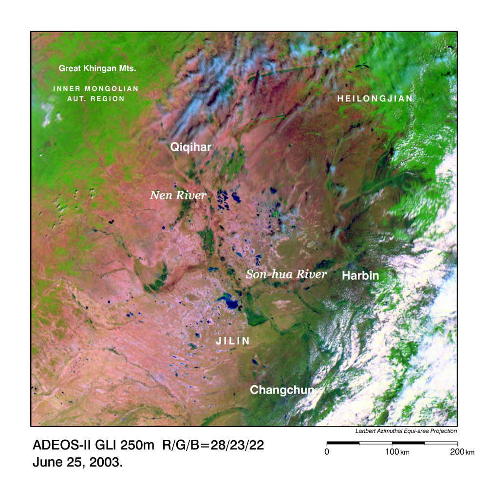
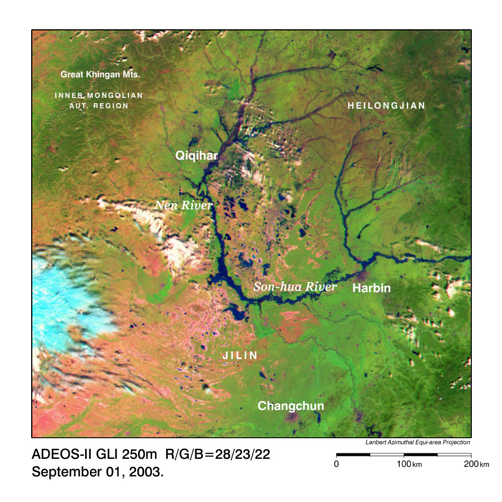
GLI captured the conditions before and during the flooding in Northeastern China that continued from July to October 2003. Figure 1 presents a 250 m resolution false-color image captured by GLI on June 25, 2003, before the flooding. Figure 2 is an image acquired on September 1, 2003, indicating the flooding conditions. Greenish yellow indicates farm or grassland; green and rich green, forest; black and dark blue, water areas such as rivers or lakes; purplish red, non-vegetation areas such as bare land or urban areas; and white and light blue, clouds. You can hardly find the rivers in Fig. 1, but you can clearly see the bold black lines of the swollen rivers in Fig. 2. The Nen River (Nen Jiang) flows north to south in the upper half of the image and flows into Son-hua River (Son-hua Jiang) in the center of the image. The swollen river is more than 10 km wide there. The Son-hua River flows eastward and flows into the Hei-long River (Hei-long Jian) (Amur River in Russian) outside of the image and finally empties into the Mamiya Strait (Tatarskiy Proliv). Most of Fig. 1 is purplish red but most of Fig. 2 is green, indicating that grass and trees grew thickly during the short summer. According to data acquired by Dartmouth Flood Observatory ( http://www.dartmouth.edu/~floods/ ), this flooding continued for 76 days (from July 27, 2003, to October 10, 2003). During this period, 1,000 people were evacuated and water covered 33,000 hectare of farmland. The data also indicate that large-scale flooding has occurred almost biannually in Northeastern China (including Hei-long-jian Province, Jilin Province, Liao-ning Province and the autonomous region of Inner Mongolia) since 1985. |