Seen from Space 2010
Rio de Janeiro: “The Marvelous City” and Main Tourist Destination of Brazil
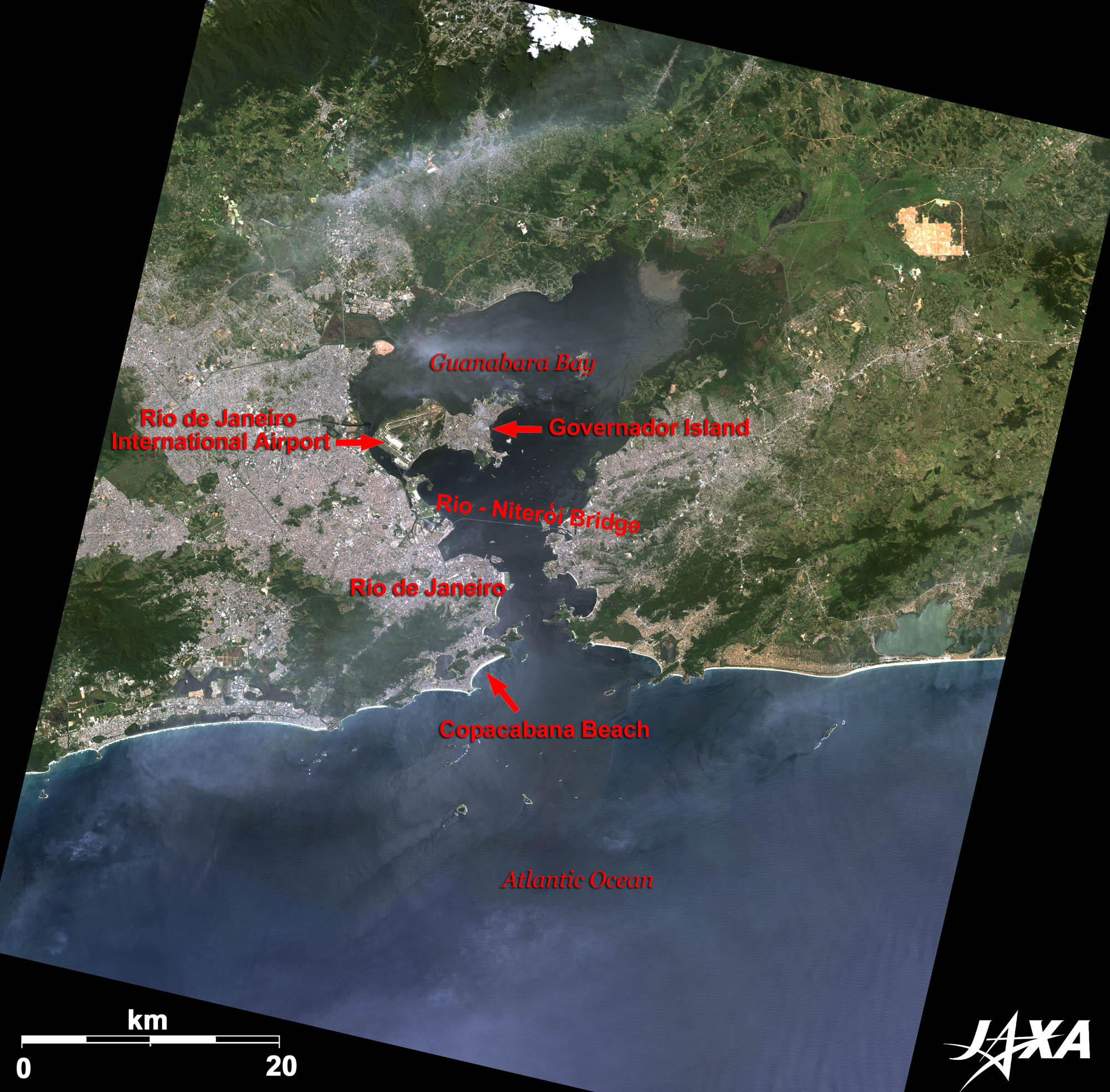 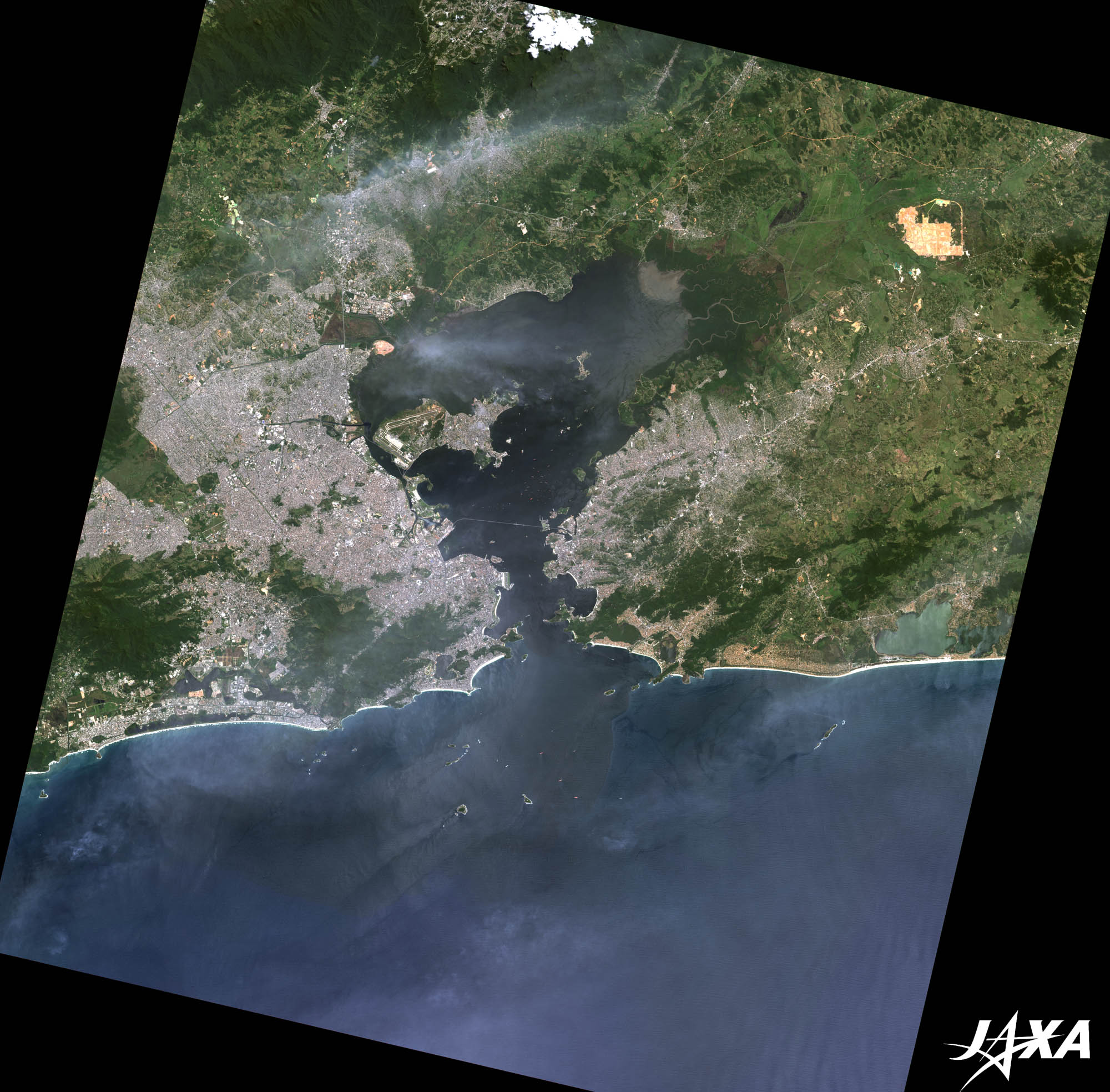 Fig. 1. Rio de Janeiro and Its Vicinity
Rio de Janeiro, or simply called Rio, is a metropolis of Brazil famous for its big Carnival. It has drawn recent attention by winning the bid to host the summer Olympic Games in 2016. Although it is a well-known city, it and Japan are located almost on opposite sides of the globe. Rio de Janeiro, meaning “River of January” in Portuguese, is said to come from a tale that when the explorer Gaspar de Lemos of Portugal visited this area in January 1502, he thought it was a big river. The international airport of Rio de Janeiro (Galeão-Antonio Carlos Jobim International Airport) is located west of large Governador Island in the bay. The straight line that crosses the entrance of the bay is the 14-kilometer-long Rio-Niterói Bridge connecting Niterói on the opposite shore and Rio de Janeiro. 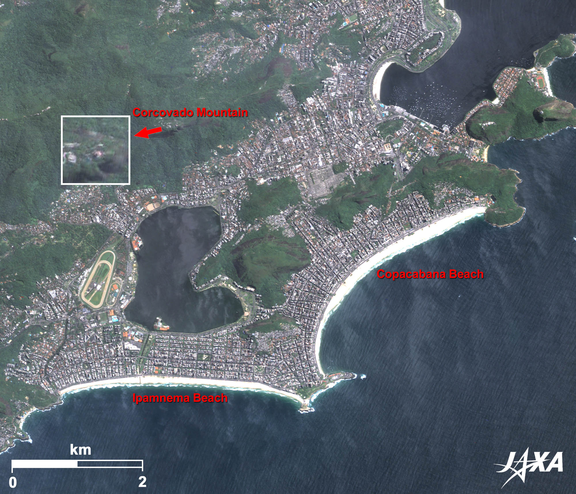 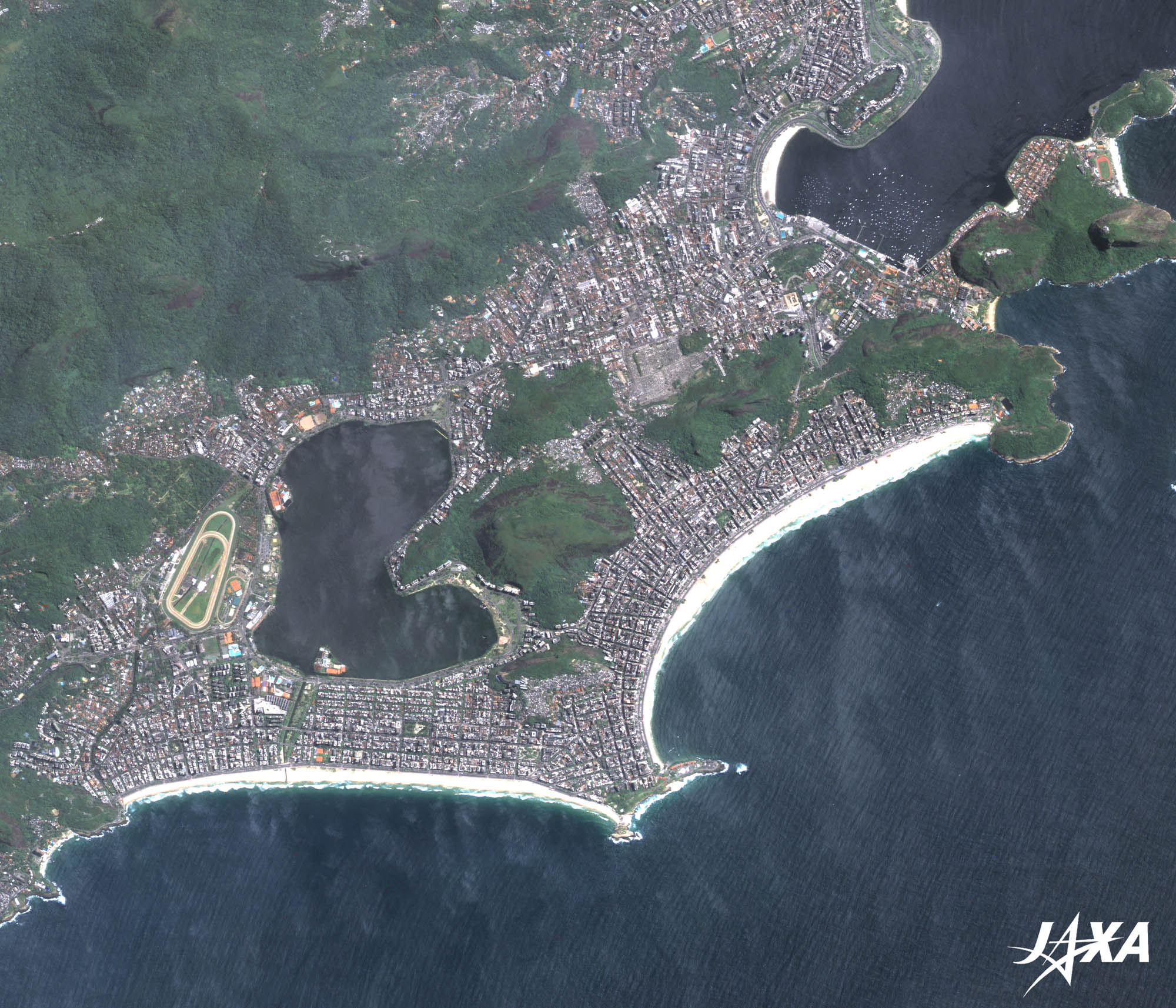 Fig. 2. Enlarged Image of Copacabana Beach and Its Vicinity
Copacabana (kmz, 3.73 MB, Low Resolution) as seen on Google Earth Rio de Janeiro is a prominent tourist city in South America. The resort beach at Copacabana is the most famous among the many well-known tourist spots in the city. The bow-shaped white beach about 4 kilometers long in the east of Figure 1 is Copacabana. Towering hotels, restaurants, etc., stand in rows along the beach. Ipanema to the west of Copacabana is also a 4-kilometer-long beautiful beach. The famous Statue of Jesus (Christ the Redeemer), standing atop Corcovado Mountain with hands spread, is visible to the northwest of Copacabana. 
Corcovado MountainCorcovado Mountain is a 710-meter granite peak. Construction of the Statue of Jesus began in 1924 in commemoration of the centennial anniversary of independence of Brazil and was completed in 1931. This towering statue stands 39.6 meters tall, including its 9.5-meter pedestal, and 30 meters wide. It is visible like a huge cross from anywhere in the city and has become an icon of Rio de Janeiro. This is one of the most famous tourist sites in Rio de Janeiro and is always crowded with visitors. It can be accessed via mountain tram and visitors can enjoy a 360-degree panoramic view of Rio de Janeiro from the top observatory. 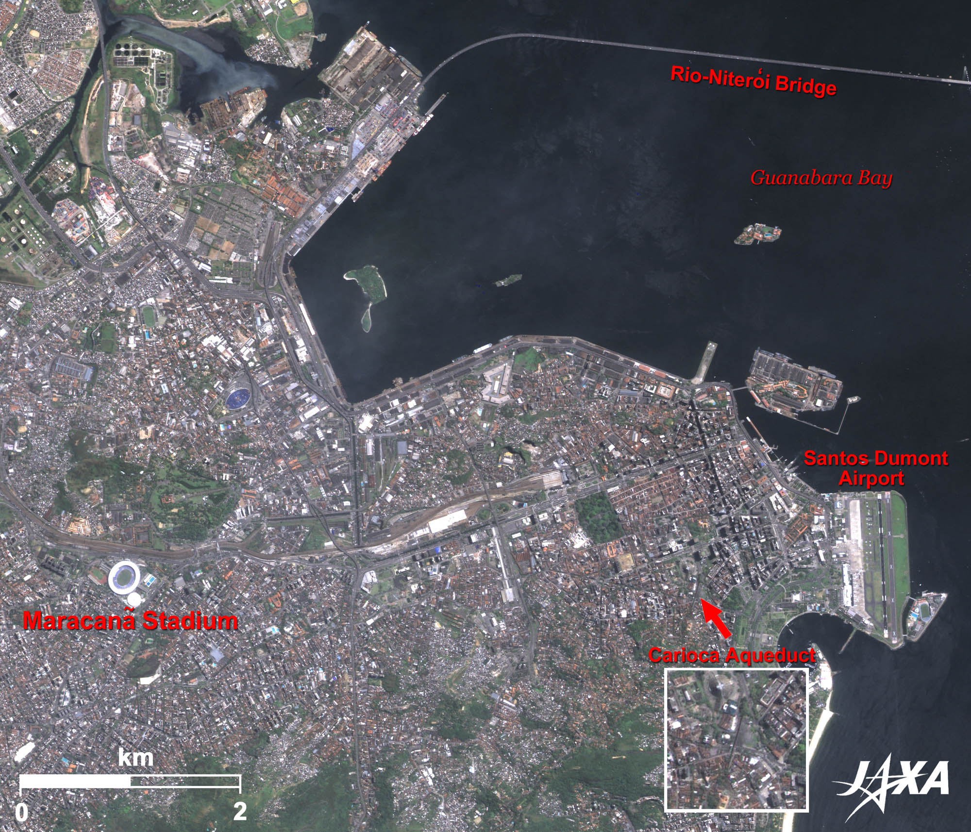 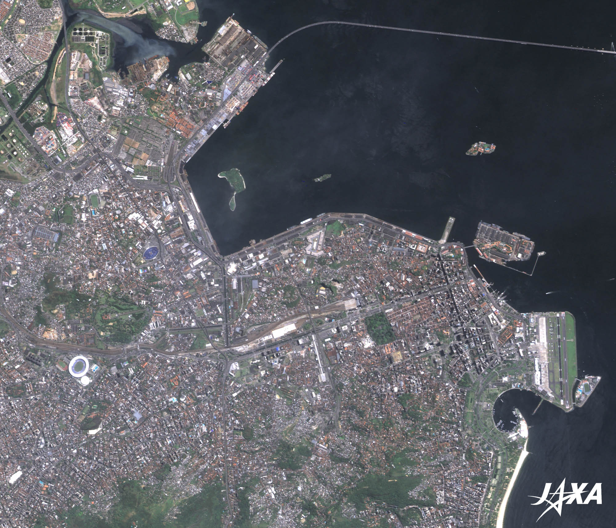 Fig. 3. Enlarged Image of Rio de Janeiro
Rio de Janeiro (kmz, 3.73 MB, Low Resolution) as seen on Google Earth Rio de Janeiro was the capital of Brazil for nearly two centuries until the capital was transferred to Brasilia in 1960. Therefore, traditional buildings can still be found among modernistic high-rise buildings.
Estádio do Maracanã: The World’s Largest Football StadiumEstádio do Maracanã is well known among football fans. It was the world’s largest football stadium when it hosted the final round of the 1950 FIFA World Cup (only this World Cup took league matches instead of a tournament for final games). Brazil was defeated by Uruguay in the final match and lost the championship, thus spawning the name, “The Maracanã Blow” (Maracanazo). Audiences of 200,000 were accommodated in the past but due to an accident in 1992, the stadium was renovated to accommodate about 100,000. It is still a big stadium and is clearly visible in the image. Estádio do Maracanã will be the main stadium of the 2014 FIFA World Cup and the venue for the opening ceremony of the 2016 Olympic Games. Explanation of the Images: (Fig. 1 and 2)
AVNIR-2 has four observation bands. The composite images are usually produced by assigning red to Band 3 (610 to 690 nm), green to Band 2 (520 to 600 nm), and blue to Band 1 (420 to 500 nm). The resulting images have natural coloring as if seen by the naked eye. Thus, the following colors designate ground objects:
PRISM is an optical sensor for observing ground surfaces with visible and near-infrared signals in the 520- to 770-nanometer (one-billionth of a meter) band. The acquired image is monochrome. PRISM has three independent optical systems (telescopes) to acquire images for nadir, forward, and backward views at the same time. Only the nadir image was used in this article. |


